

44.8 Acres Red River County, Texas
$291,200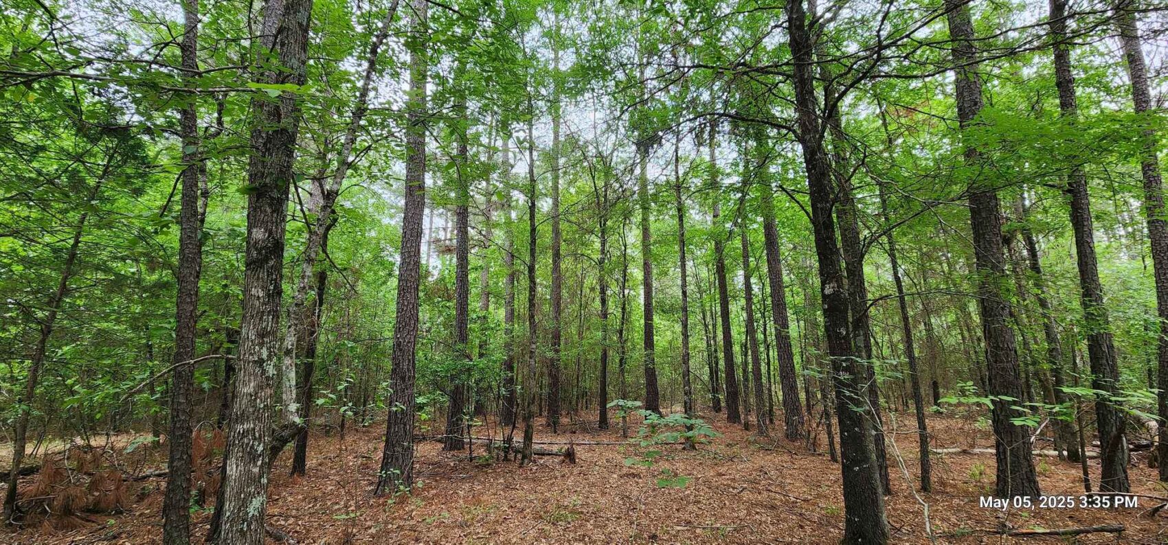
PROPERTY DETAILS
- Price:$291,200
- Type:Recreational Property, Residential Property, Timberland
- Address:County Road 3230
- Acres:45
- County:Red River
- City:Clarksville
- Status:Available
- State:Texas
- Zip:75426
PROPERY DESCRIPTION
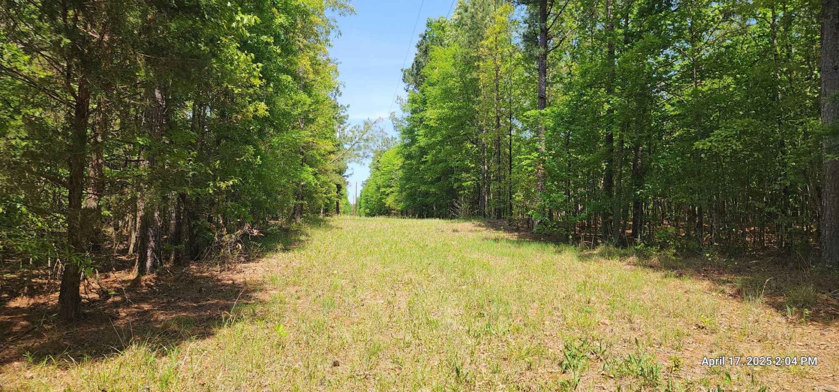
Red River County may be located only an hour and a half from the DFW area or an hour from Texarkana, but the area offers a nice quiet reprieve from the bustle and noise of urban life, almost like stepping back in time. The drive to this offered property from US 82 at Clarksville winds northeast along FM 1159 for ten miles, passing pastures, row crop farms and forests along the way. Five minutes on maintained county roads brings you to the property just north of Pecan Bayou, close to the earliest northeast Texas settlements of Pecan Point, Mound City and Vessey.
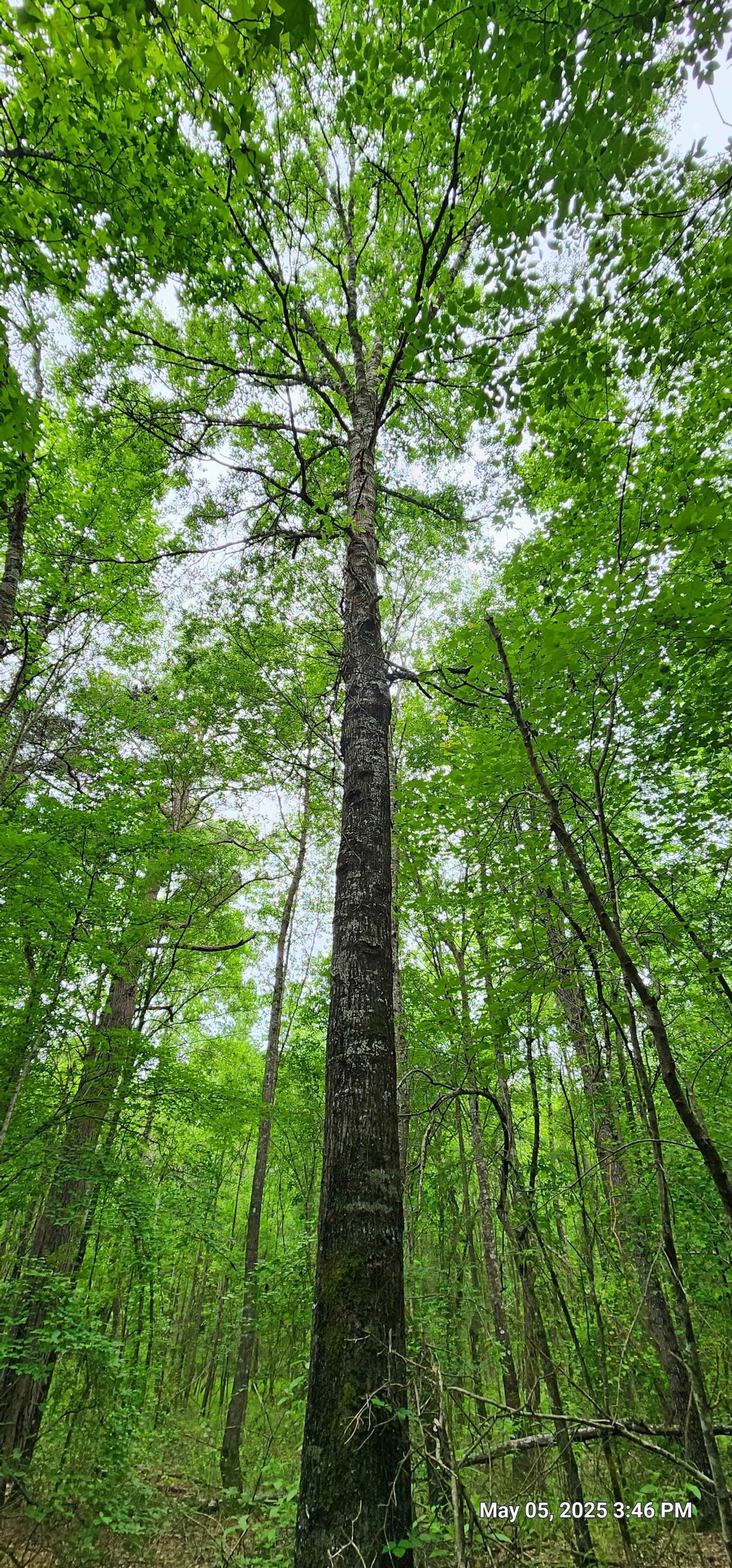
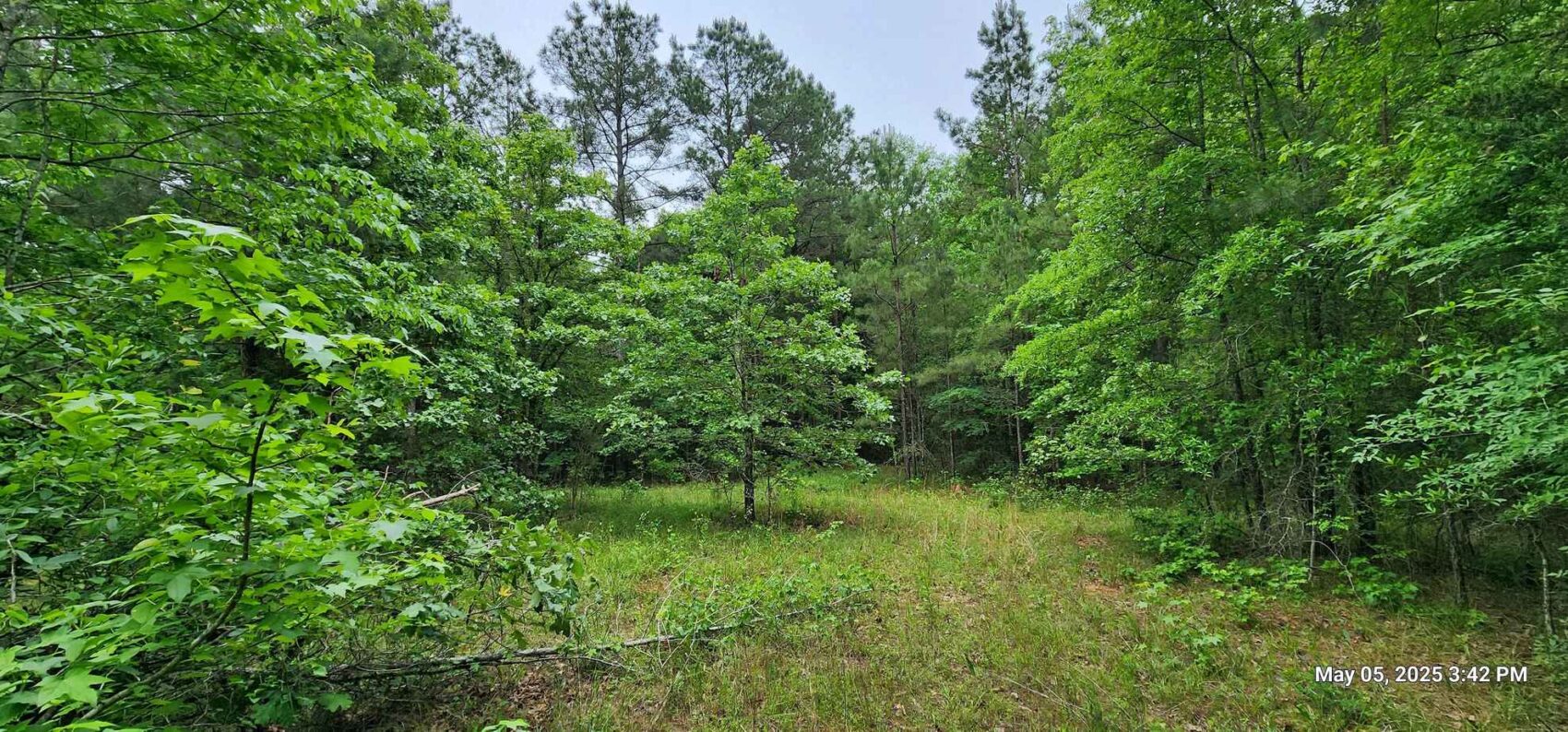
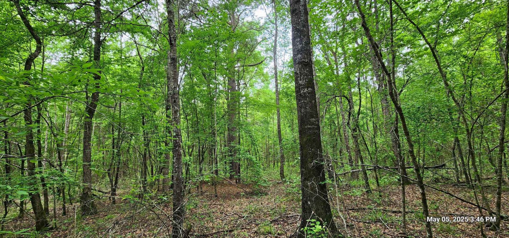
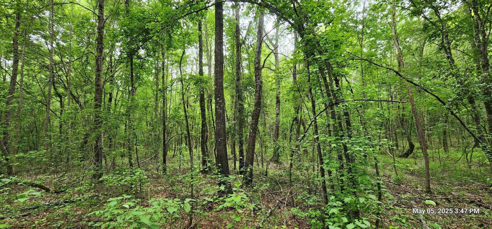
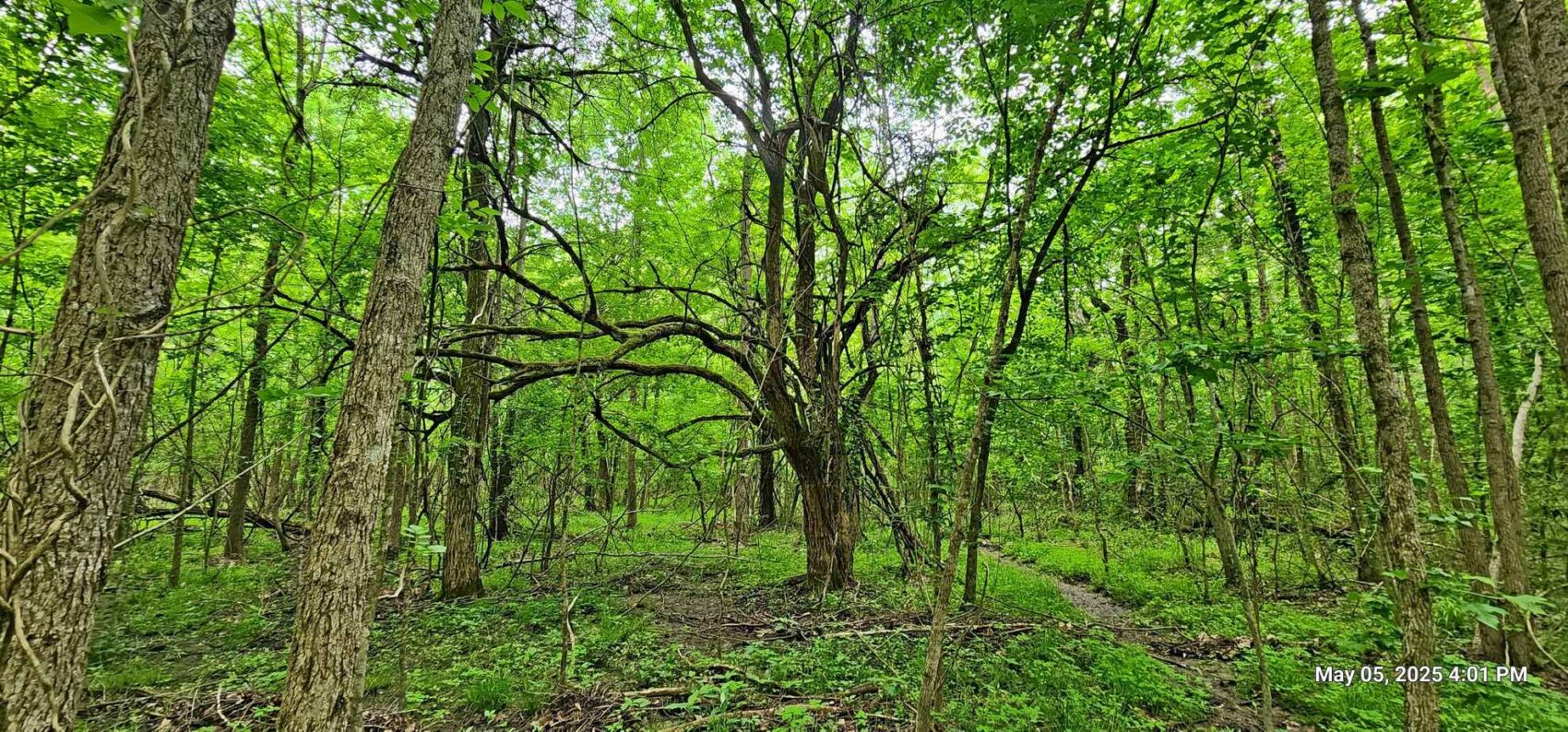
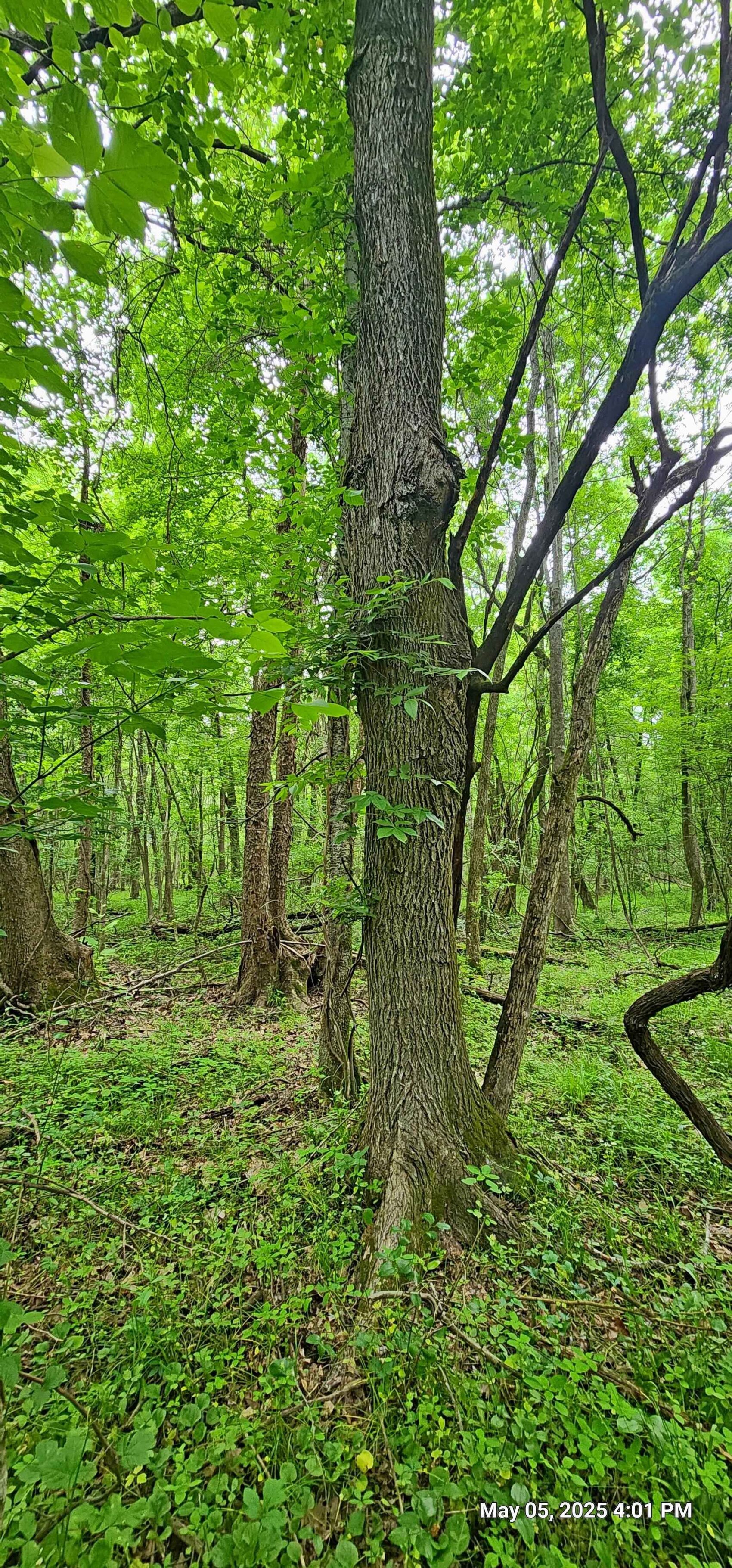
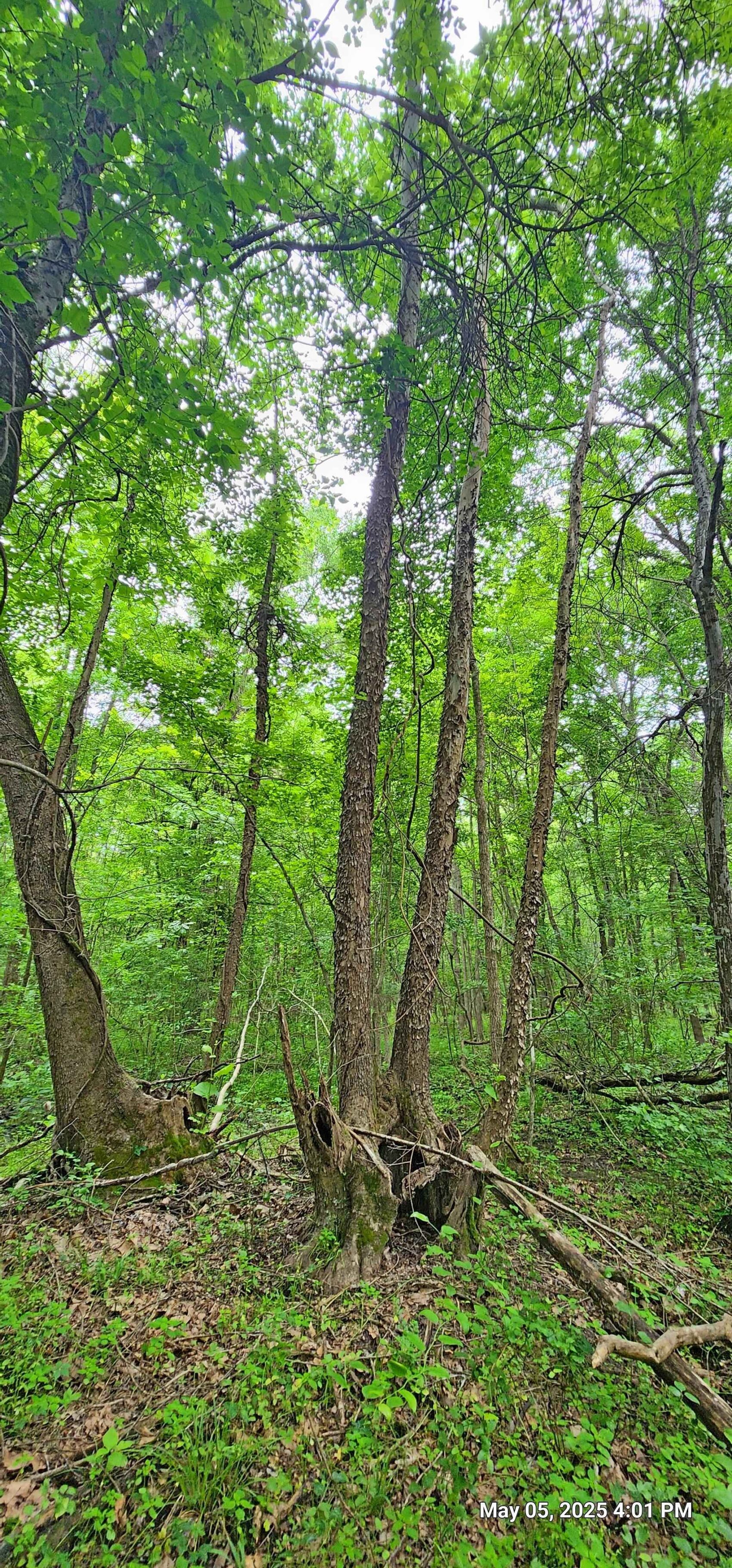
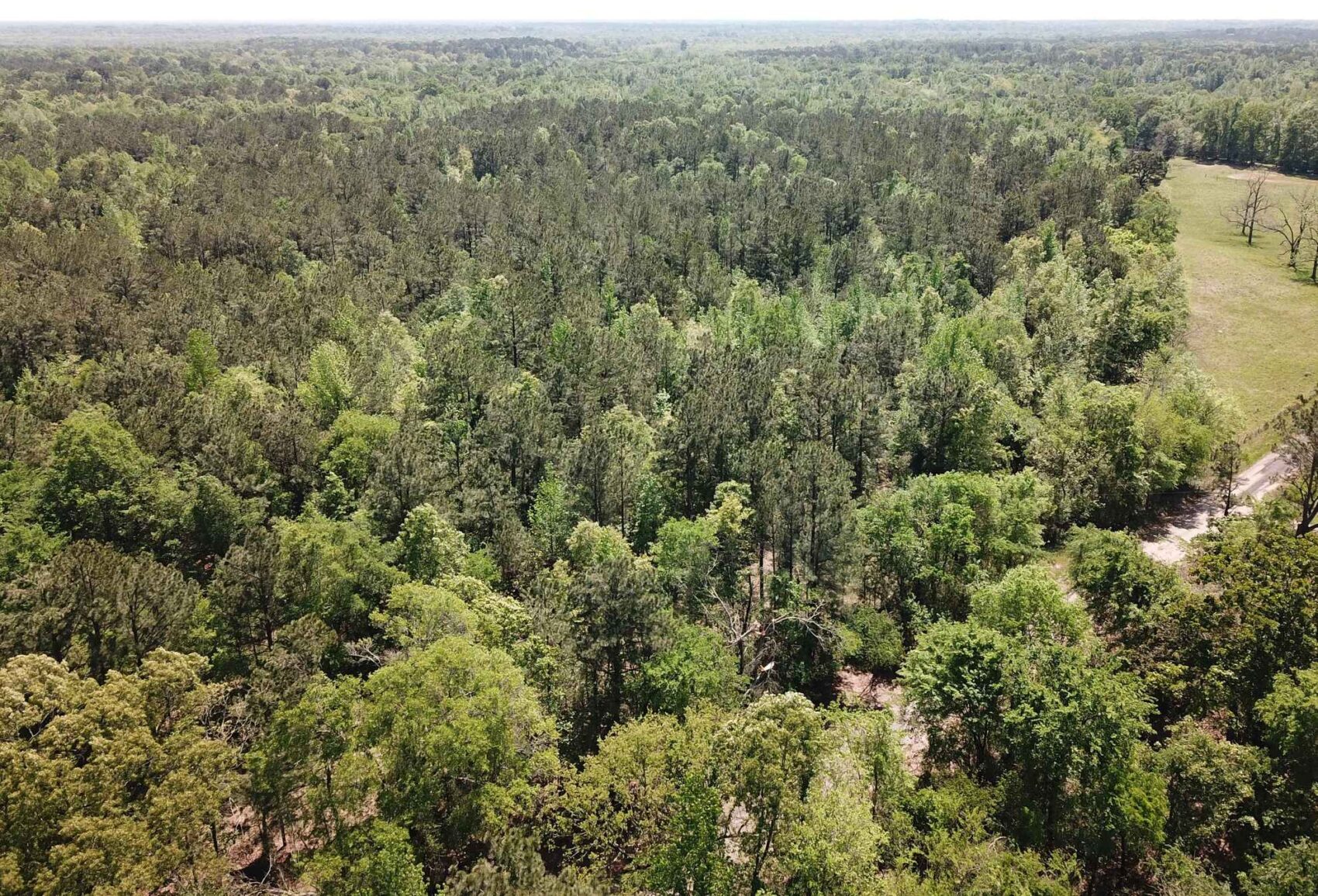
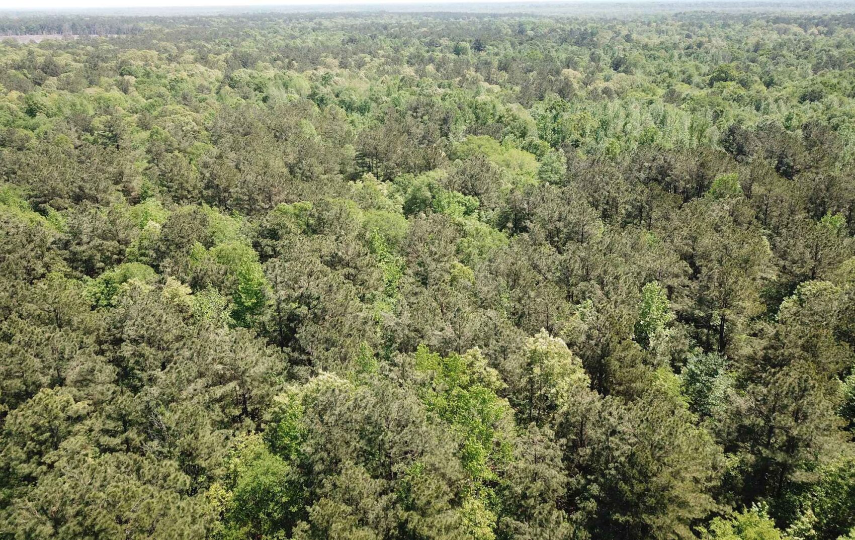
This land is cloaked in native hardwood and pine forests that have taken over the once busy farmsteads. The remnants of these farms are nestled back in the quiet woods now, the hard work of previous generations growing crops and raising livestock now exist as cherished family memories. Row crop furrows are still visible in places on this property, some of the current owners worked on the farm for their grandparents generation during summer breaks. There are very large old post oaks, red oaks, sweetgums and pines that once were scattered about the old fields and around the houses, ponds and barns. These large sprawling trees now stand in contrast to the slender young timber as reminders of what this landscape once was.
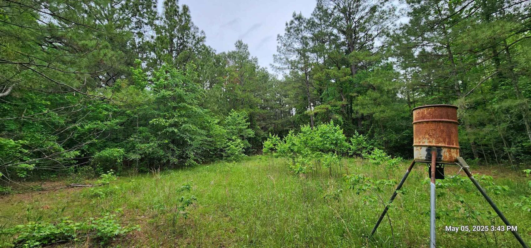
As is happening across much of the rural South, the time has come for passing these legacy farms along to a new set of owners. The soils had been used in the past to grow crops and for pasture which could complement a residential plan. Recreational activities such as hunting, ATV riding or just walking in the woods could work with a residence or weekend getaway. The soils could also once again support grazing if converted back to pasture. The current conditions on the property make it easily suitable for forestry management, with favorable species of hardwood to go along with the loblolly and shortleaf pine. Allowing this forest to grow over time while making use of it recreationally would be a good plan for this acreage.
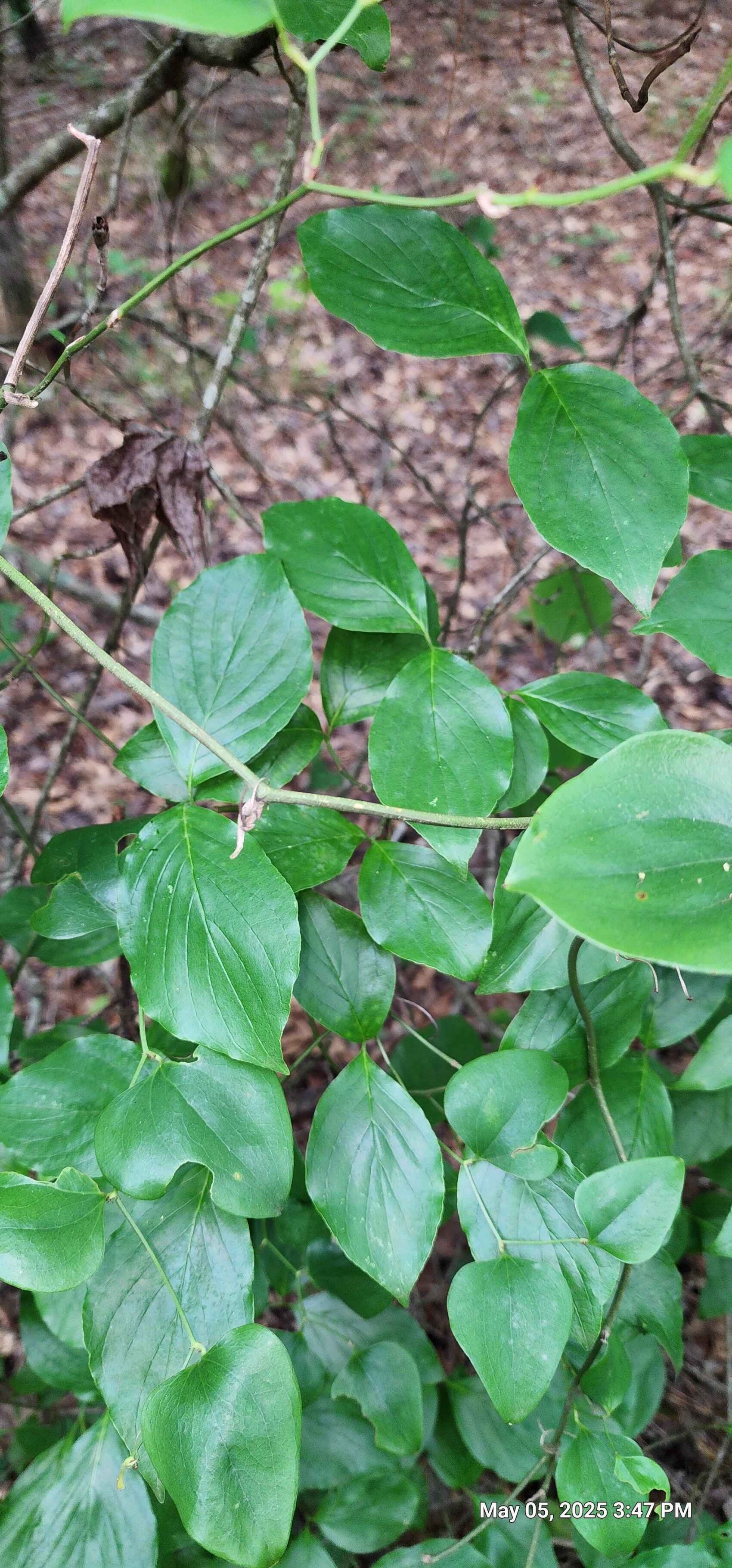
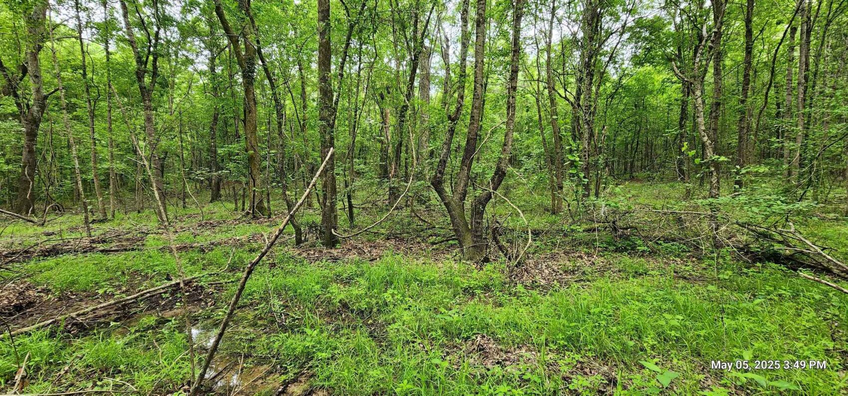
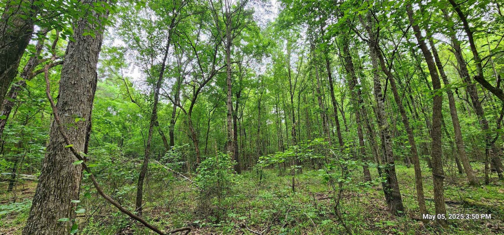
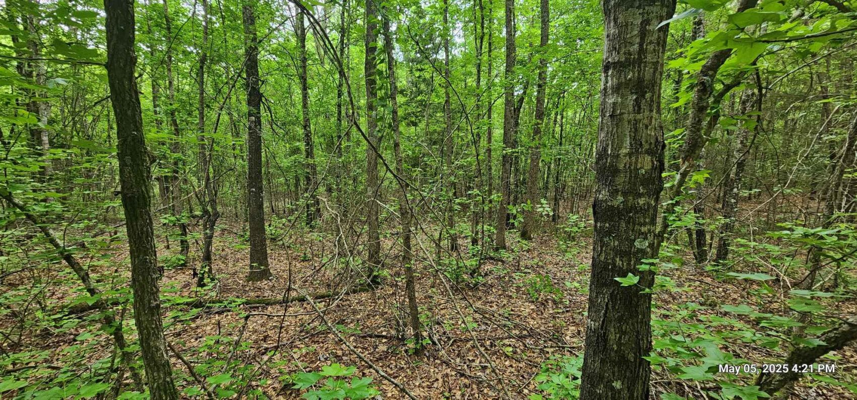
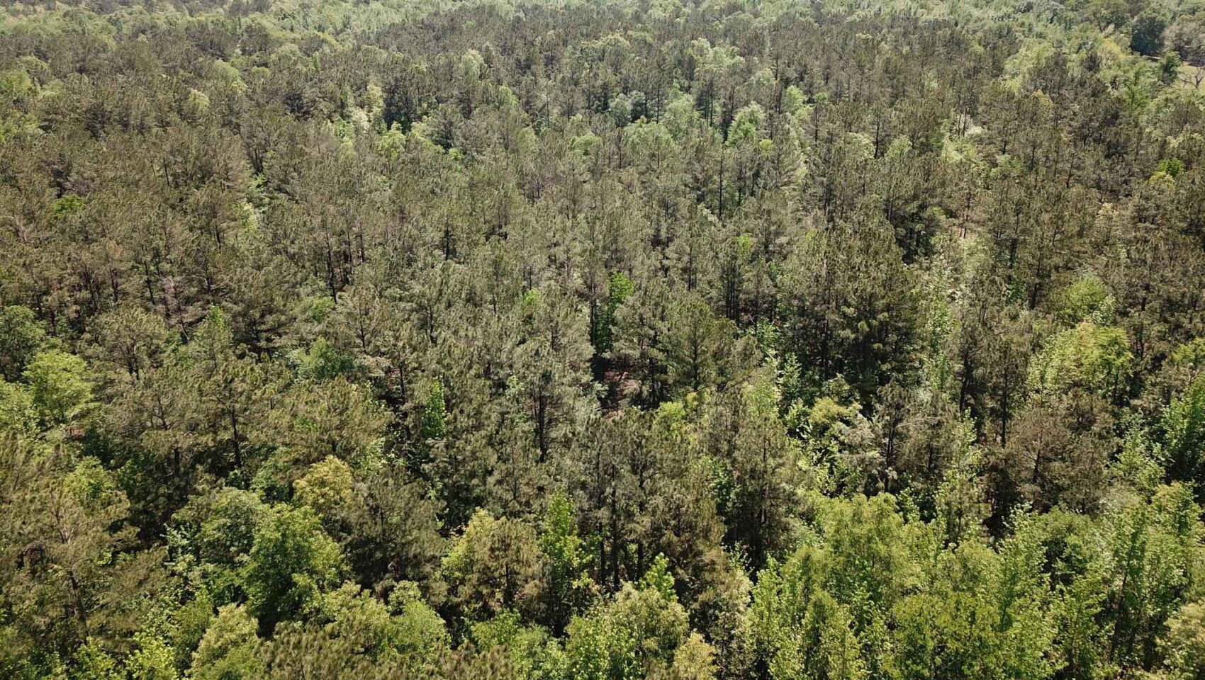
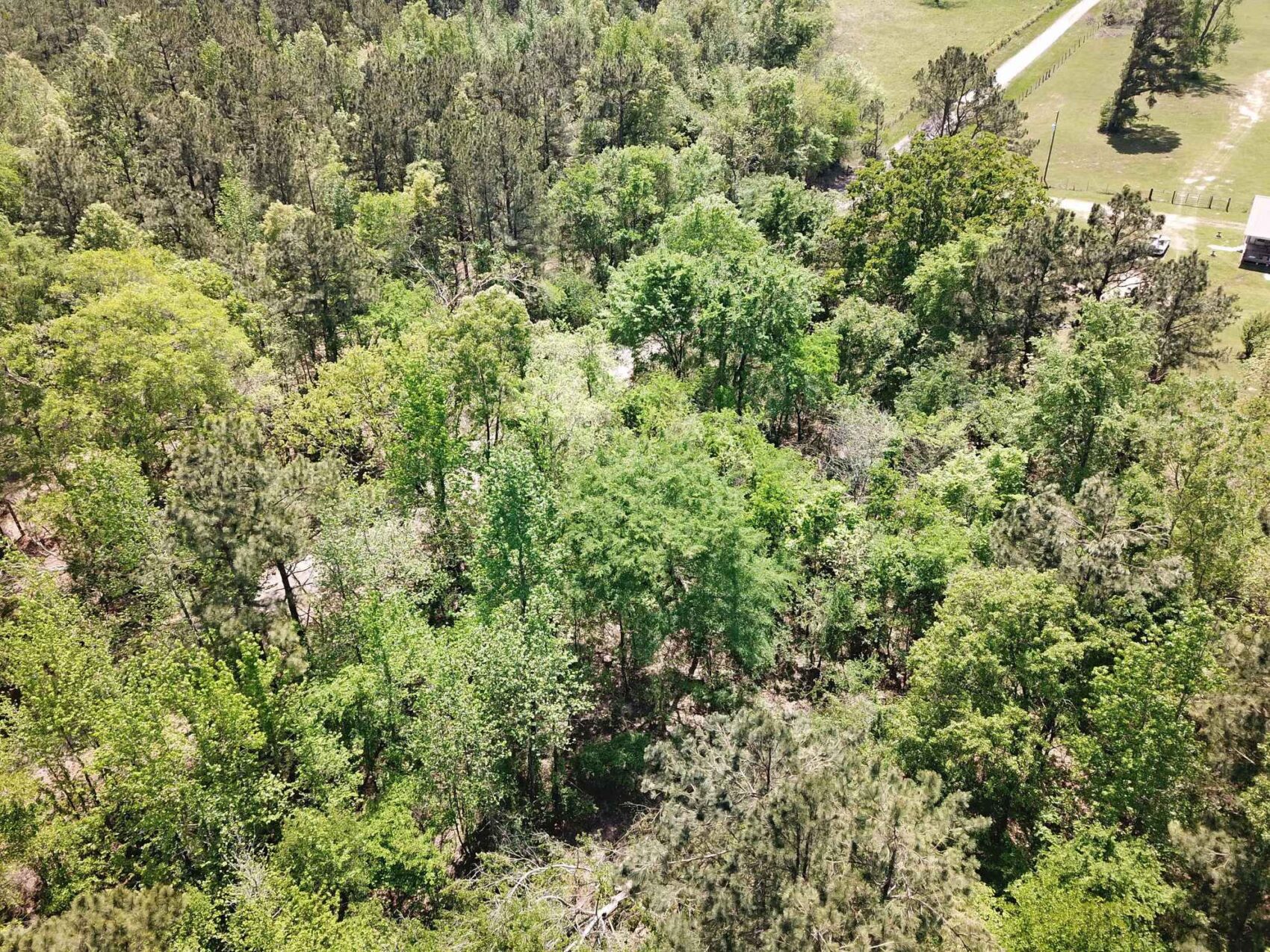
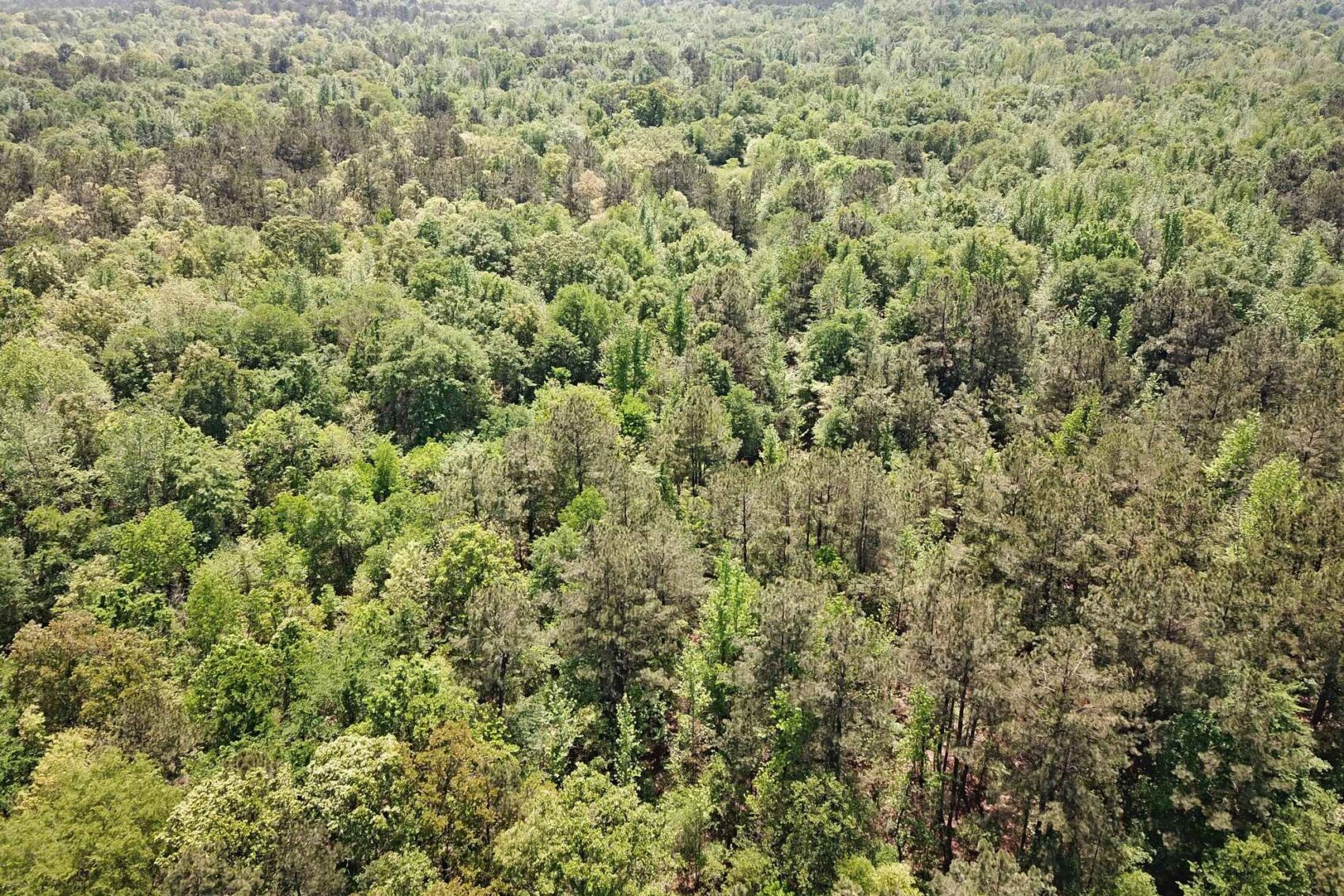
The native forests on this property are young, vigorously growing pine and hardwoods that have naturally reforested the fields. A thinning harvest was last done in 2001, and the regrowth of the last twenty-four seasons has produced another crop of trees. There is a wide assortment of species on the uplands including loblolly pine, post oak, ash, shortleaf pine, water oak, sweetgum, various red oaks, black walnut, American elm, Florida maple, American holly, black cherry, dogwood and hornbeam. In addition, cedar elm, overcup oak, willow oak, sycamore, pignut hickory, bitter pecan, river birch, pawpaw and blackgum are several of the species found in the bottomland areas. The growth stage is to where the understory is beginning to open up as the shade suppresses the brush, revealing a fairly open forest in most places. There is a substantial percentage of oaks, sweetgum and pine that will be contributing greatly to the future economics of this young forest.
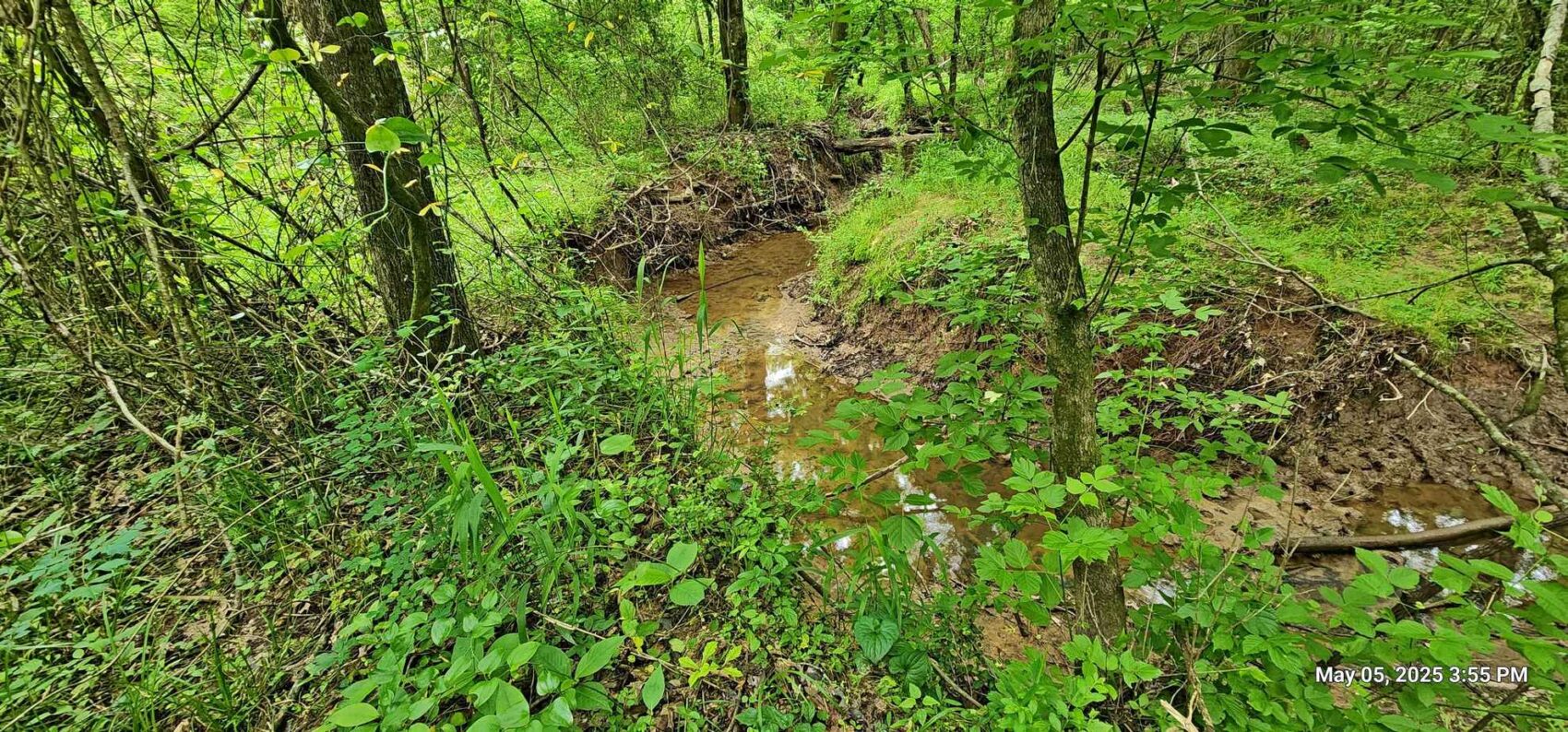
The relatively level uplands on the northern half of this property slope to the south towards the one major perennial stream, Schaffline Creek, which cuts across the southwestern corner of the 44.8 acres. The smaller Tanyard Branch runs easterly along the northeastern boundary of the 12.7 acre parcel. Several wet-weather branches on the 44.8 and 32.8 acre parcels lead into the six or seven total acres of bottomland Thenas fine sandy loam soils associated with Schaffline Creek, which drains into Pecan Bayou to the south of the property.
This farm is offered in seven parcels that will all have county road access. Proposed parcel mapping is found in the downloadable documents. Electric power is present on five of the parcels; a utility right-of-way will be reserved for the other two tracts by utilizing county road access.
This proposed 44.8 acre parcel is being offered for $291,200. See the Parcel Pricing Table in the downloadable document section.
Further details of this offering include:
Sellers are offering the land for sale as individual parcels as shown on the proposed parcel mapping, or a combination of two or more into larger parcels; but the Sellers will not sell subdivided smaller parcels.
Sellers will be requiring a deed restriction that prohibits further subdividing in any subsequent sale that are smaller than the originally-offered parcel.
Land usage will also be restricted to non-commercial activities; acceptable usage would be residential, recreational, agriculture and forestry. See Property Use Restrictions in downloadable documents.
There will be a reservation for a utility right-of-way on County Road 3233 along the boundary between the 12.2 and 14.1 acre parcels to allow utility access to the 16.9 acre and 32.8 acre tracts.
The division lines between parcels have not been surveyed; the mapping is provided as an illustration of the Sellers intent. County roads and/or exterior boundaries define the 20.7, 12.2 and 12.7 acres. The access corridor for the 32.8 acres is intended to be approximately 75 feet wide.
The entire 154.222 acres was surveyed in April 2024, with the plat being available upon request. The acreage figures of the parcels is estimated only, based on Appraisal District information, using GIS and aerial photo interpretation, deed call information and ground checks of corner and line markers.
There are no minerals available, Sellers are reserving all owned mineral rights.
FEMA flood zones are not mapped for Red River County.
Taxes for 2024 were $122.48 on the total of the entire 154 acre block. The property is currently under Ag/Timber Valuation. A New Owner will be responsible to verify tax status, rollback provisions, and/or apply for Ag/Timber Valuation at the Red River County Appraisal District, as the valuations are tied to the landowner, not the land.
State Railroad Commission data shows no pipelines, oil or gas wells on the property.
Property is in the Clarksville Independent School District.
Electric Power - a powerline is along the northern boundary of the 20.7 acre parcel, and along the east side of County Road 3230, running northeast to southwest across the 12.7, 12.2, 14.1 and 44.8 acre parcels. A utility right-of-way will be reserved for the other two tracts by utilizing county road access. Service drops and connections will be the responsibility of the Buyer. Lamar Electric Cooperative 903-784-4303.
Telephone landline is indicated along County Road 3230, it is believed to be Windstream/Kinetic.
Septic system / water well will need to be installed and is responsibility of the buyer. The Red River County Auditor (903-427-2131) oversees the permitting of On Site Sewage Facilities in Red River County. Installers are licensed by the Texas Commission on Environmental Quality. Water well drillers in Texas are licensed by the Texas Department of Licensing & Regulation. Their websites list licensed service providers.
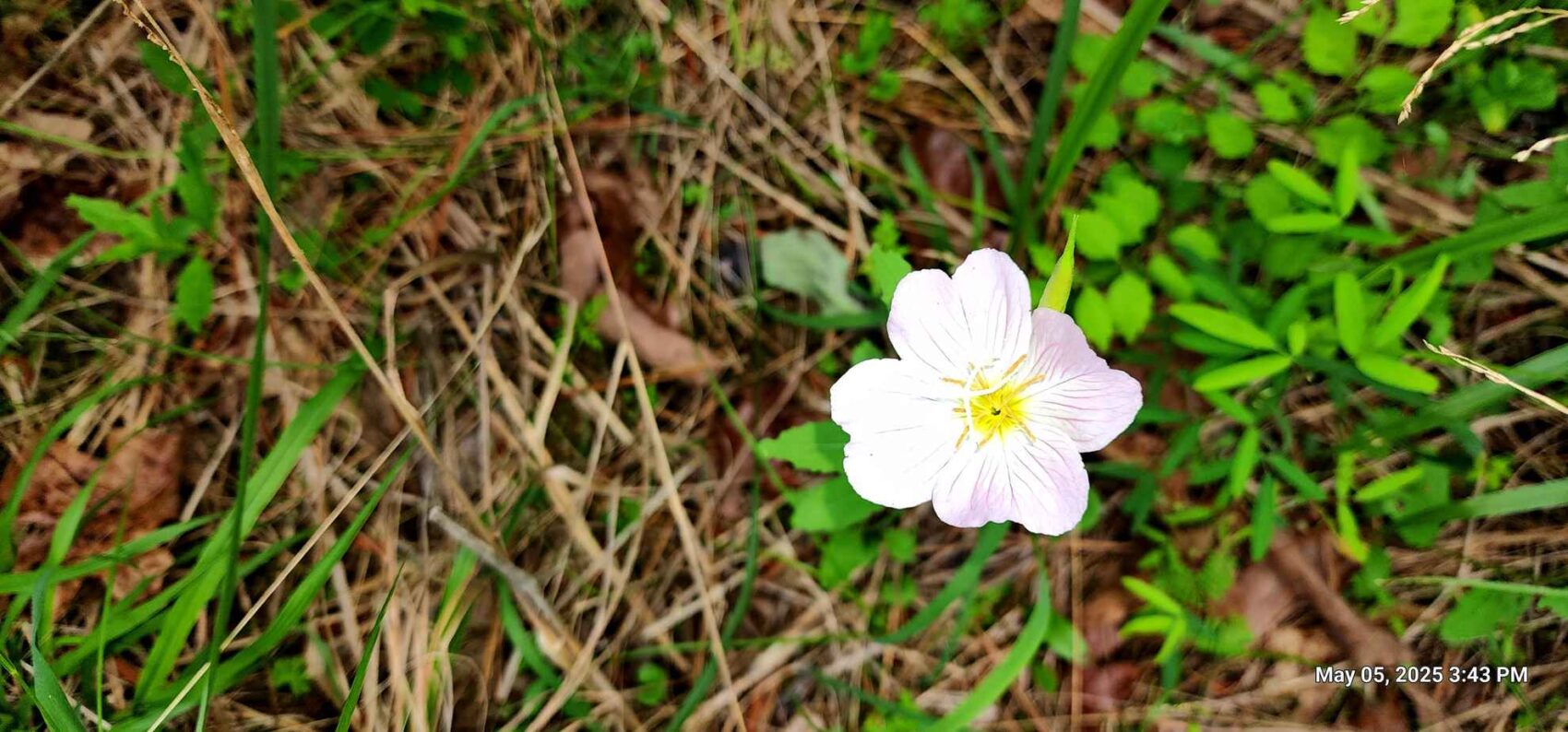
See the ground and drone photos, as well as the downloadable maps and documents, which include a soils map.
To arrange site visits, please contact listing agent Mark Brian at 936-590-0986, or through the TerraStone office at 936-590-4909. Buyers agents are required to contact listing agent to arrange site visits and are required to accompany potential buyers at the time of the first visit. Visitors will be required to execute an Agreement for Land Entry Permit, which is included in the downloadable documents.
Brokers, agents or individuals interested in submitting offers should first contact Listing Agent for details on legal names and other administrative items concerning the Seller information needed for a contract.
TerraStone Land Company strives to gather good information concerning listed properties from reliable sources, but cannot guarantee the accuracy of said data, including but not limited to boundary line locations, acreages, fence lines, tree ages, timber volumes, timber value, legal title, environmental hazards, condition of improvements, legal access, utility services, or site suitability for agricultural or forestry use.
Land taxes may be subject to agricultural or other valuations that may be subject to roll back taxes if the use of the land is changed or a new application for such valuation is not tendered to the appropriate appraisal district by the purchaser. Land use valuation status is tied to the landowner, not to the land. Seller nor TerraStone Land Company can guarantee qualification for any special use valuations.
All maps are provided for illustrative purposes only and are not survey plats. Unless specifically stated, no formal land surveying by a licensed surveyor has been used in determining acreages. Aerial and ground photography may include neighboring properties that are not included in this offering, and such photography is intended for general use only. TLC recommends that potential buyers examine the offered property to their own satisfaction, and are strongly urged to verify all pertinent facts for themselves. TLC is not responsible for errors, omissions, offering withdrawal or price modifications.
USEFUL DOCUMENTS
- FinalListingParcelTable4302025.pdf
- PropertyUseRestrictions.pdf
- AGREEMENTFORLANDENTRY.pdf
- topomap.pdf
- soilsmap.pdf
- ThorntonParcelMapping512025.pdf
- aerialmap-2.pdf
- locationzoommap.pdf
- locationmap-1.pdf
- soilsmap-1.pdf
- detailmapnorth.pdf
- detailmapsouth.pdf
Property Map / Directions
From U.S. 82 on northeast side of Clarksville, take FM 1159 northeast for 10.5 miles to CR 3235 on the right; head east for 1.3 miles to CR 3230, then right (south) on CR 3230 for four-tenths of a mile to the northern boundary of the entire property.
PROPERTY IMAGES


Other Listings
-
 $278,356
+-107.06 Acres - Harrison County, Texas
Acres107.06 CountyHarrison StateTexas -
$1,227,107
1,067 ACRES, McINTOSH COUNTY, OKLAHOMA
Acres1,067.05 CountyMcIntosh StateOklahoma -
$65,000
10.16 ACRES, NACOGDOCHES COUNTY, TEXAS
Acres10.00 CountyNacogdoches StateTexas -
$40,688
10.443 ACRES, SHELBY COUNTY, TEXAS
Acres10.44 CountyShelby StateTexas -
$36,575
10.45 ACRES, NACOGDOCHES COUNTY, TEXAS
Acres10.45 CountyNacogdoches StateTexas -
$30,000
10.928 ACRES, CHEROKEE COUNTY, TEXAS
Acres10.93 CountyCherokee StateTexas -
$429,250
101.0 ACRES, RUSK COUNTY, TEXAS
Acres101.00 CountyRusk StateTexas -
$303,450
101.15 ACRES, HARRISON - PANOLA COUNTY
Acres101.15 CountyPanola StateTexas -
106.0 ACRES, SABINE COUNTY, TEXAS
Acres0.00 County State -
$233,200
106.0 ACRES, SABINE COUNTY, TEXAS
Acres106.00 CountySabine StateTexas -
$231,575
107 ACRES, NACOGDOCHES COUNTY, TEXAS
Acres107.00 CountyNacogdoches StateTexas -
$305,424
113.12 ACRES, SABINE COUNTY, TEXAS
Acres113.12 CountySabine StateTexas -
$295,000
118.0 ACRES, NACOGDOCHES COUNTY, TEXAS
Acres118.00 CountyNacogdoches StateTexas -
$72,000
12.0 ACRES, RUSK COUNTY, TEXAS
Acres12.00 CountyRusk StateTexas -
$146,400
12.2 Acres Red River County, Texas
Acres12.20 CountyRed River StateTexas -
$133,350
12.7 Acres Red River County, Texas
Acres12.70 CountyRed River StateTexas -
$175,000
120 ACRES, CASS COUNTY, TEXAS
Acres120.00 CountyCass StateTexas -
$340,000
132.081 ACRES, SHELBY COUNTY, TEXAS
Acres132.08 CountyShelby StateTexas -
$343,000
133.47 ACRES, PANOLA COUNTY, TEXAS
Acres133.47 CountyPanola StateTexas -
$398,250
135 ACRES, NACOGDOCHES COUNTY, TEXAS
Acres135.00 CountyNacogdoches StateTexas -
$890,500
137.0 ACRES, ANDERSON COUNTY, TEXAS
Acres137.00 CountyAnderson StateTexas -
$148,050
14.1 Acres Red River County, Texas
Acres14.10 CountyRed River StateTexas -
$375,000
140.0 ACRES, SHELBY COUNTY, TEXAS
Acres140.00 CountyShelby StateTexas -
$455,008
154.24 ACRES, RUSK COUNTY, TEXAS
Acres154.24 CountyRusk StateTexas -
$578,380
156 ACRES, NACOGDOCHES COUNTY, TEXAS
Acres156.00 CountyNacogdoches StateTexas -
$99,900
16.0 ACRES NACOGDOCHES COUNTY, TX Lot 5
Acres16.00 CountyNacogdoches StateTexas -
$99,900
16.0 ACRES, NACOGDOCHES COUNTY, TEXAS
Acres16.00 CountyNacogdoches StateTexas -
$143,650
16.9 Acres Red River County, Texas
Acres16.90 CountyRed River StateTexas -
$420,605
162.71 ACRES, ANGELINA COUNTY, TEXAS
Acres162.70 CountyAngelina StateTexas -
$449,500
167.50 ACRES, SHELBY COUNTY, TEXAS
Acres167.50 CountyShelby StateTexas -
$380,250
169.0 ACRES, HARDIN COUNTY, TEXAS
Acres169.00 CountyHardin StateTexas -
$30,600
17.0 ACRES, RUSK COUNTY, TEXAS
Acres17.00 CountyRusk StateTexas -
$317,330
171.53 ACRES, PANOLA COUNTY, TEXAS
Acres171.53 CountyPanola StateTexas -
$689,936
172.7 Acres Nacogdoches County Texas
Acres172.70 CountyNacogdoches StateTexas -
$347,812
178.0 ACRES, SHELBY COUNTY, TX
Acres178.00 CountyShelby StateTexas -
$72,000
18.0 ACRES, TYLER COUNTY, TX
Acres18.00 CountyTyler StateTexas -
$729,000
183 ACRES, UPSHUR COUNTY, TX
Acres183.00 CountyUpshur StateTexas -
$294,006
184.33 ACRES, CADDO PARISH, LOUISIANA
Acres184.33 CountyCaddo StateLouisiana -
$482,250
196 ACRES, BIENVILLE PARISH, LOUISIANA
Acres196.00 CountyBienville StateLouisiana -
$179,000
20.4 ACRES, NACOGDOCHES COUNTY, TEXAS
Acres20.40 CountyNacogdoches StateTexas -
$217,350
20.7 Acres Red River County, Texas
Acres20.70 CountyRed River StateTexas -
$1,063,233
200.61 ACRES, SHELBY COUNTY, TEXAS
Acres200.61 CountyShelby StateTexas -
$155,000
21.4492 Acres, Trinity County, Texas
Acres21.45 CountyTrinity StateTexas -
218 ACRES, CADDO PARISH, LOUISIANA
Acres0.00 County State -
$520,000
218 ACRES, CADDO PARISH, LOUISIANA
Acres218.00 CountyCaddo StateLouisiana -
$135,660
22.61 acres in Rusk County, Texas
Acres22.61 CountyRusk StateTexas -
$314,580
226.6 ACRES, ALLEN PARISH, LOUISIANA
Acres226.60 CountyAllen StateLouisiana -
$599,500
231.87 ACRES, CASS COUNTY, TEXAS
Acres231.87 CountyCass StateTexas -
$120,000
24.86 Acres, Shelby County, TX
Acres24.86 CountyShelby StateTexas -
$1,116,000
248 acres in Nacogdoches County, Texas
Acres248.00 CountyNacogdoches StateTexas -
$91,505
25.070 ACRES, PANOLA COUNTY, TEXAS
Acres25.07 CountyPanola StateTexas -
$396,722
25.595 ACRES, ANGELINA COUNTY, TEXAS
Acres25.60 CountyAngelina StateTexas -
$179,000
26.13 Acres San Augustine County
Acres26.13 CountySan Augustine StateTexas -
$576,555
289.03 ACRES, CHEROKEE COUNTY, TEXAS
Acres289.03 CountyCherokee StateTexas -
$575,000
293.479 ACRES, PANOLA COUNTY, TEXAS
Acres293.47 CountyPanola StateTexas -
$7,900,000
3,160.58 ACRES, AR, LA, OK
Acres3,160.58 CountyUnion StateArkansas -
$55,500
3.48 ACRES, SMITH COUNTY, TX
Acres3.48 CountySmith StateTexas -
$195,000
30 Acres, Nacogdoches County, Texas
Acres30.00 CountyNacogdoches StateTexas -
$258,000
30.0 ACRES, SHELBY COUNTY, TEXAS
Acres30.00 CountyShelby StateTexas -
$102,204
30.06 ACRES, SABINE COUNTY, TEXAS
Acres30.06 CountySabine StateTexas -
$89,900
30.414 Acres, NACOGDOCHES COUNTY, TEXAS
Acres30.41 CountyNacogdoches StateTexas -
$795,000
315.0 ACRES, JEFFERSON COUNTY, TEXAS
Acres315.00 CountyJefferson StateTexas -
$137,600
32 ACRES, RUSK COUNTY, TEXAS
Acres32.00 CountyRusk StateTexas -
$246,000
32.8 Acres Red River County, Texas
Acres32.80 CountyRed River StateTexas -
$1,195,000
340.63 ACRES, PANOLA COUNTY, TEXAS
Acres340.63 CountyPanola StateTexas -
$122,500
35.0 ACRES CHEROKEE COUNTY, TX
Acres35.00 CountyCherokee StateTexas -
$180,025
37.9 ACRES NORTH PARCEL SHELBY COUNTY, TEXAS
Acres37.90 CountyShelby StateTexas -
$175,500
39 ACRES SOUTH PARCEL SHELBY COUNTY, TEXAS
Acres39.00 CountyShelby StateTexas -
$114,811
39.59ac HARRISON COUNTY, TX
Acres39.59 CountyHarrison StateTexas -
$1,160,000
392.68 Acres, Upshur County, Texas
Acres392.68 CountyUpshur StateTexas -
$75,885
40.35 ACRES, PANOLA COUNTY, TEXAS
Acres40.35 CountyPanola StateTexas -
$1,200,000
435 ACRES, BEXAR COUNTY, TEXAS
Acres435.00 CountyBexar StateTexas -
$127,861
44.09 ACRES, NACOGDOCHES COUNTY, TEXAS
Acres44.09 CountyNacogdoches StateTexas -
$291,200
44.8 Acres Red River County, Texas
Acres44.80 CountyRed River StateTexas -
$226,000
46 Acres, Nacogdoches County, Texas
Acres46.00 CountyNacogdoches StateTexas -
$225,500
46.0 ACRES, RUSK COUNTY, TEXAS
Acres46.00 CountyRusk StateTexas -
$117,500
47 ACRES, RUSK COUNTY, TEXAS
Acres47.00 CountyRusk StateTexas -
$289,100
49.0 ACRES, RUSK COUNTY, TEXAS
Acres49.00 CountyRusk StateTexas -
$2,972,730
495.455 Acres, Smith County, Texas
Acres495.45 CountyTexas StateTexas -
$30,000
5.62 ACRES, CHEROKEE COUNTY, TEXAS
Acres5.62 CountyCherokee StateTexas -
$640,000
507 ACRES, YELL COUNTY, ARKANSAS
Acres507.06 CountyYell StateArkansas -
$201,630
51.7 Acres, Rusk County, Texas
Acres51.70 CountyRusk StateTexas -
$1,754,695
527.758 ACRES, SMITH COUNTY, TEXAS
Acres527.75 CountySmith StateTexas -
$202,550
54 ACRES, RUSK COUNTY, TEXAS
Acres54.00 CountyRusk StateTexas -
$170,163
54.02 ACRES, SABINE COUNTY, TEXAS
Acres54.02 CountySabine StateTexas -
$178,230
54.84 ACRES, NACOGDOCHES COUNTY, TEXAS
Acres54.84 CountyNacogdoches StateTexas -
$156,790
55.5 ACRES, HOUSTON COUNTY, TEXAS
Acres55.50 CountyHouston StateTexas -
$156,800
56 ACRES, RUSK COUNTY, TEXAS
Acres56.00 CountyRusk StateTexas -
$131,600
56.0 ACRES, NACOGDOCHES COUNTY, TEXAS
Acres56.00 CountyNacogdoches StateTexas -
Contact for Price
56.889 ACRES, LAFAYETTE COUNTY, ARKANSAS
Acres56.89 CountyLafayette StateArkansas -
$1,562,000
568 ACRES, NACOGDOCHES COUNTY, TEXAS
Acres568.00 CountyNacogdoches StateTexas -
$165,528
58.08 ACRES, SABINE COUNTY, TEXAS
Acres58.08 CountySabine StateTexas -
$194,000
58.6 ACRES CAMP COUNTY, TEXAS
Acres58.60 CountyCamp StateTexas -
$218,230
59.06 ACRES (TR #10), NACOGDOCHES COUNTY, TEXAS
Acres59.06 CountyNacogdoches StateTexas -
$259,000
61.94 ACRES, HARDIN COUNTY, TEXAS
Acres61.94 CountyHardin StateTexas -
$180,648
62.4 Acres, Nacogdoches County, Texas
Acres62.40 CountyNacogdoches StateTexas -
$329,490
62.76 Acres Trawick, Nacogdoches County TX
Acres62.76 CountyNacogdoches StateTexas -
$185,075
67.3 ACRES, PANOLA COUNTY, TEXAS
Acres67.30 CountyPanola StateTexas -
$180,200
68 ACRES, NEWTON COUNTY, TEXAS
Acres68.00 CountyNewton StateTexas -
$239,900
69.358 ACRES PANOLA COUNTY, TX
Acres69.35 CountyPanola StateTexas -
$75,000
7.74 Acres Nacogdoches County, Texas
Acres7.74 CountyNacogdoches StateTexas -
$298,715
70.286 ACRES, PANOLA COUNTY, TEXAS
Acres70.28 CountyPanola StateTexas -
$308,975
72.7 ACRES. RUSK COUNTY, TEXAS
Acres72.70 CountyRusk StateTexas -
$215,000
74.0 ACRES, PANOLA COUNTY, TEXAS
Acres74.00 CountyPanola StateTexas -
$283,513
76.265 ACRES, SHELBY COUNTY, TEXAS
Acres76.27 CountyShelby StateTexas -
$3,995,000
803 ACRES, POLK COUNTY, TEXAS
Acres803.00 CountyPolk StateTexas -
$277,675
81.6 ACRES, DESOTO PARISH, LOUISIANA
Acres81.60 CountyDe Soto StateLouisiana -
$215,200
82.73 ACRES, CASS COUNTY, TEXAS
Acres82.73 CountyCass StateTexas -
$572,000
88.0 ACRES, GREGG COUNTY, TEXAS
Acres88.00 CountyGregg StateTexas -
$220,000
88.0 ACRES, RUSK COUNTY, TEXAS
Acres88.00 CountyRusk StateTexas -
$799,000
88.54 ACRES, BEAUREGARD PARISH, LOUISIANA
Acres88.54 CountyBeauregard StateLouisiana -
$459,000
88.54 ACRES, NACOGDOCHES COUNTY, TEXAS
Acres88.54 CountyNacogdoches StateTexas -
$220,500
90 ACRES, CLAIBORNE PARISH, LOUISIANA
Acres90.00 CountyClaiborne StateLouisiana -
$258,132
92.19 ACRES, RUSK COUNTY, TEXAS
Acres92.19 CountyRusk StateTexas -
$124,371
95.67 ACRES, ALLEN PARISH, LOUISIANA
Acres95.67 CountyAllen StateLouisiana -
$336,000
96.0 ACRES (Tract A&B) NACOGDOCHES COUNTY, TX
Acres96.00 CountyNacogdoches StateTexas -
$496,740
97.4 ACRES, SABINE COUNTY, TEXAS
Acres97.40 CountySabine StateTexas -
$178,200
99 ACRES, TYLER COUNTY, TEXAS
Acres99.00 CountyTyler StateTexas -
$800,000
99.49 ACRES, NACOGDOCHES COUNTY, TEXAS
Acres99.49 CountyNacogdoches StateTexas -
$297,505
99.5 Acres, Panola County, Texas
Acres99.50 CountyPanola StateTexas -
$174,635
CROSSROADS 53 ACRES, NACOGDOCHES COUNTY, TEXAS
Acres53.00 CountyNacogdoches StateTexas -
$535,920
GARRETT WEST 154 ACRES, NACOGDOCHES COUNTY, TEXAS
Acres154.00 CountyNacogdoches StateTexas -
$47,900
PRICE IMPROVEMENT - 6.39 ACRES, RUSK COUNTY, TEXAS
Acres6.39 CountyRusk StateTexas -
$163,845
UPDATED - 64.506 ACRES, CASS COUNTY, TEXAS
Acres64.51 CountyCass StateTexas
Contact Us About This Property
Call us at (936) 590-4909, email us at info@terrastonelandco.com or use the contact form below.