

32 ACRES, RUSK COUNTY, TEXAS
Sold
PROPERTY DETAILS
- Price:$137,600
- Type:Hunting Land, Recreational Property, Timberland
- Address:County Road 3284
- Acres:32
- County:Rusk
- City:Garrison
- Status:Sold
- State:Texas
- Zip:75946
PROPERY DESCRIPTION
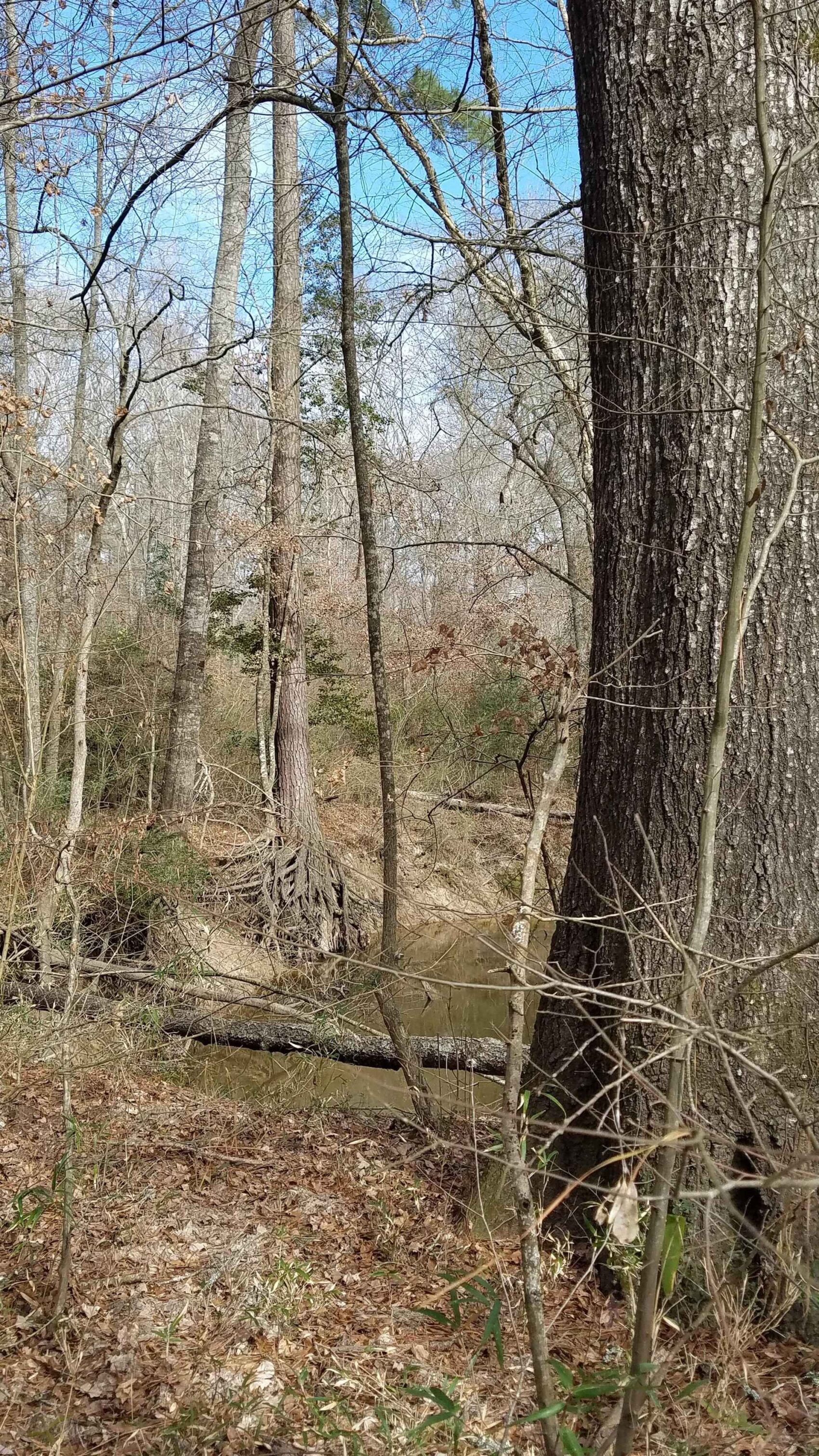
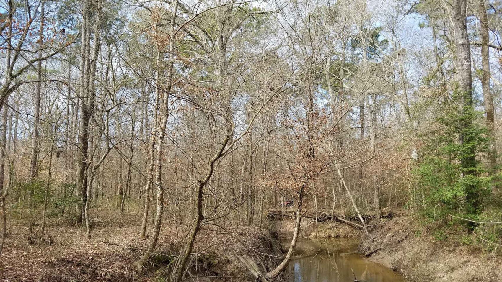
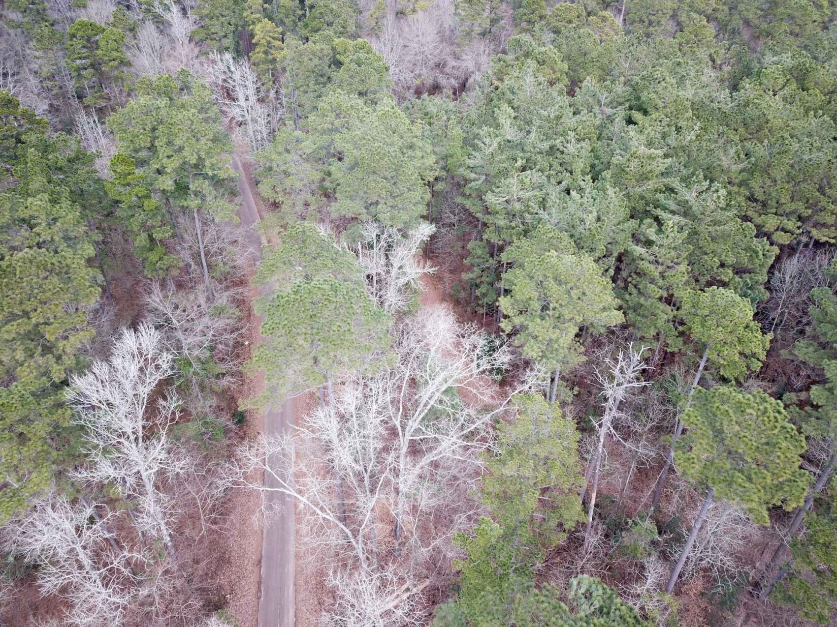
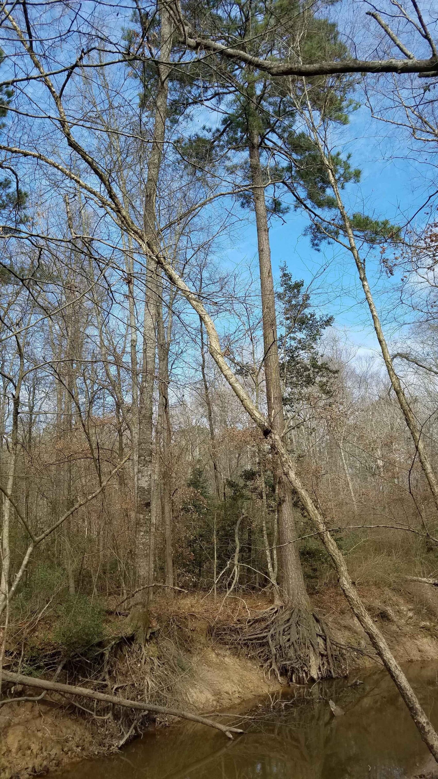
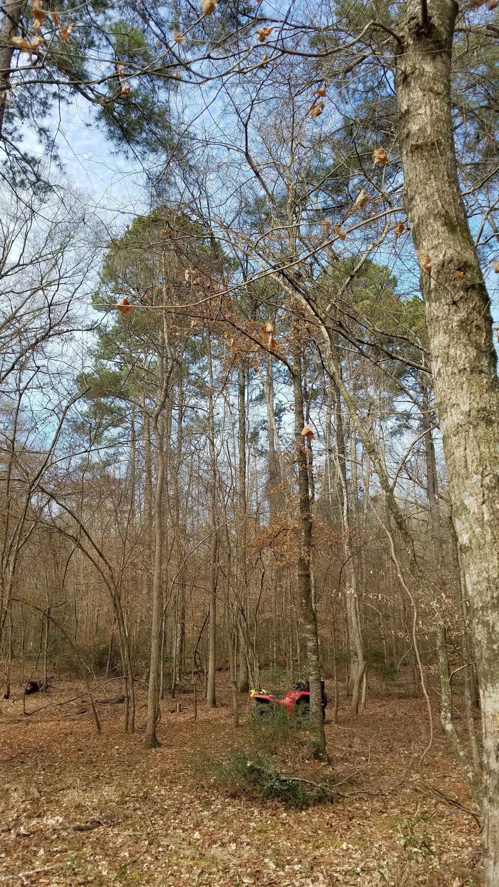
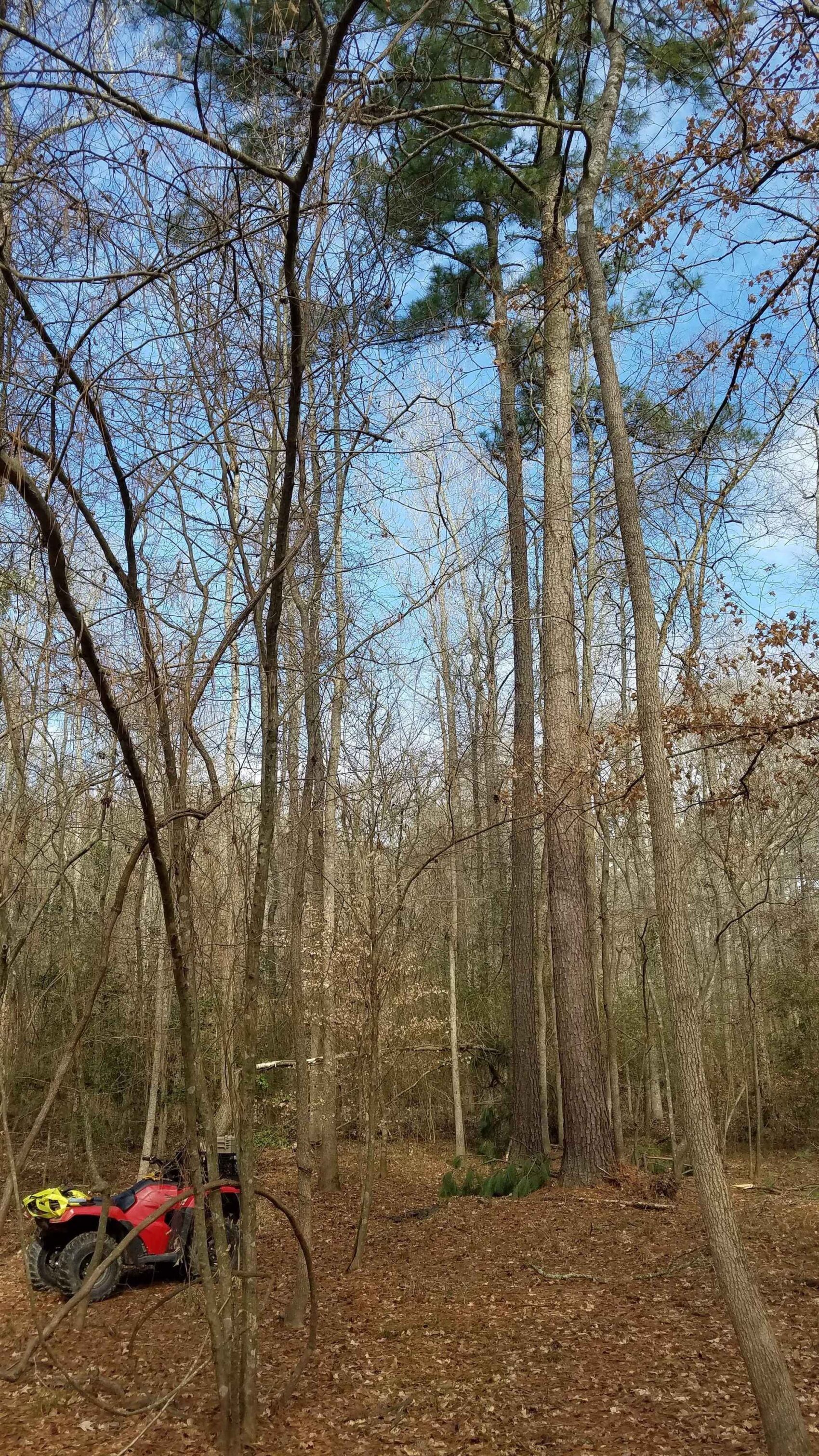
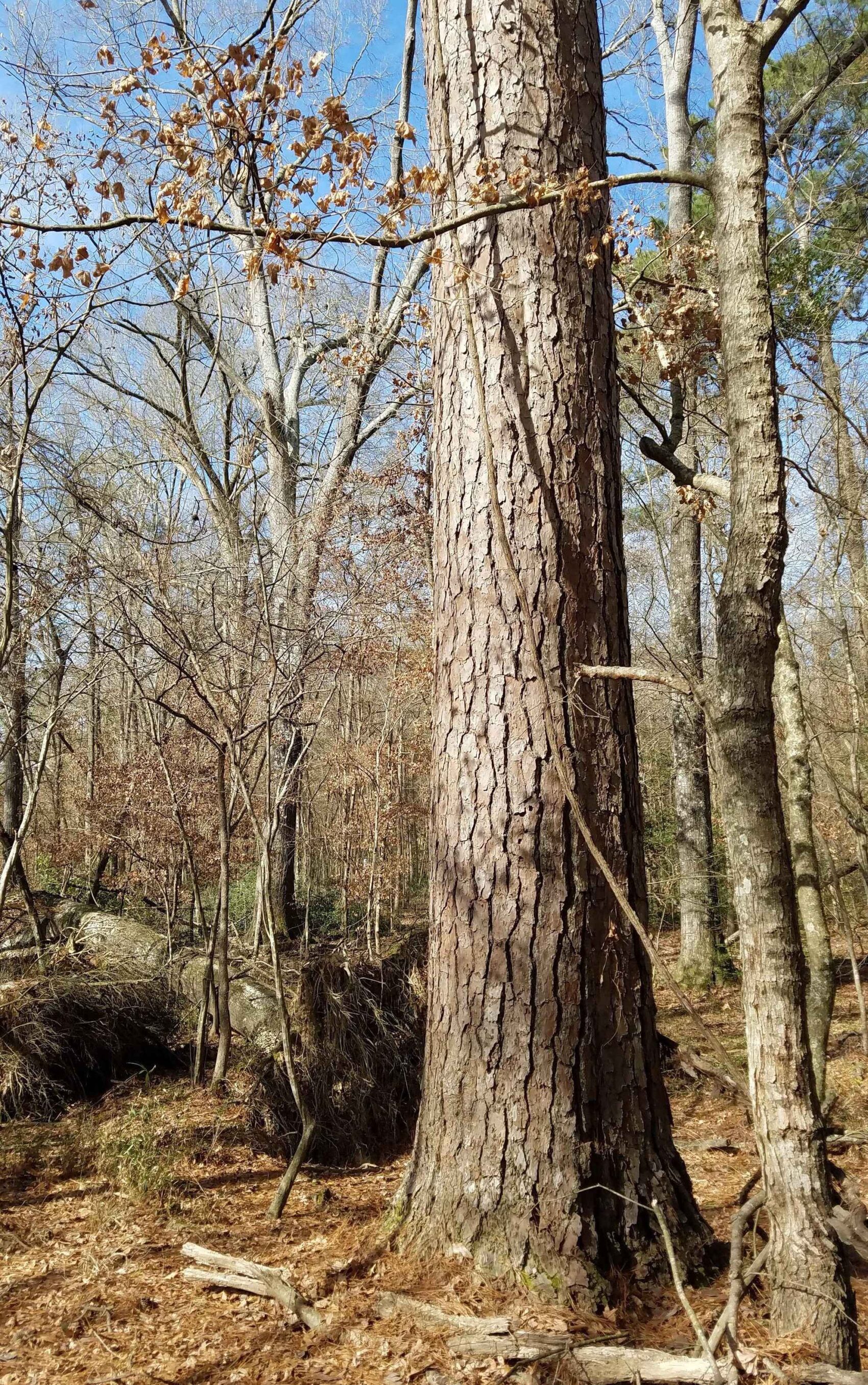
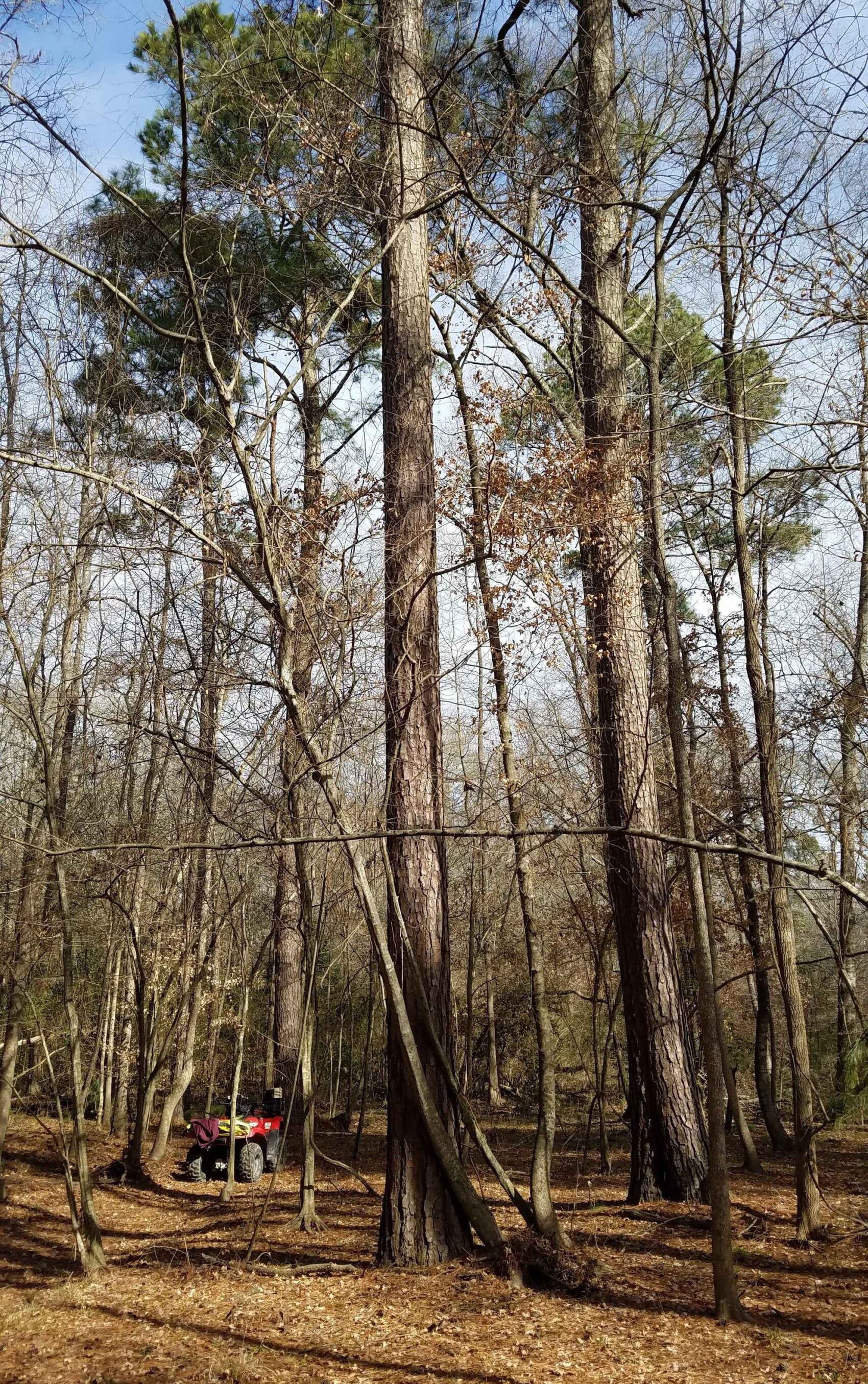
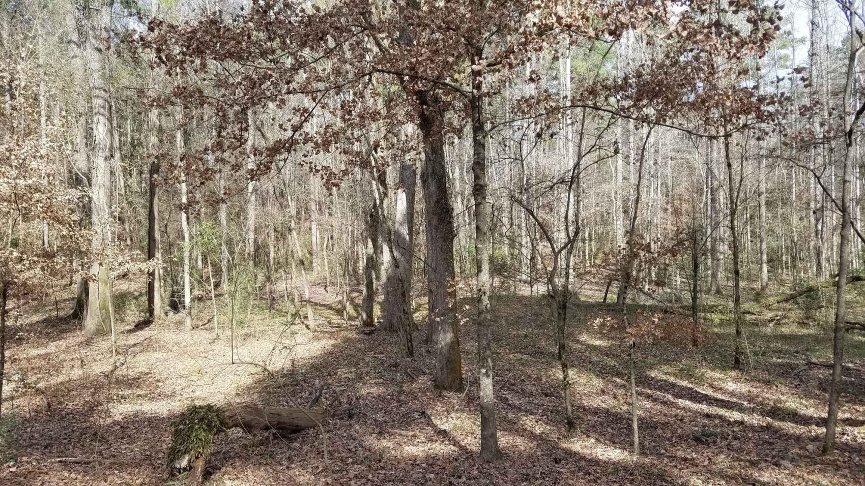
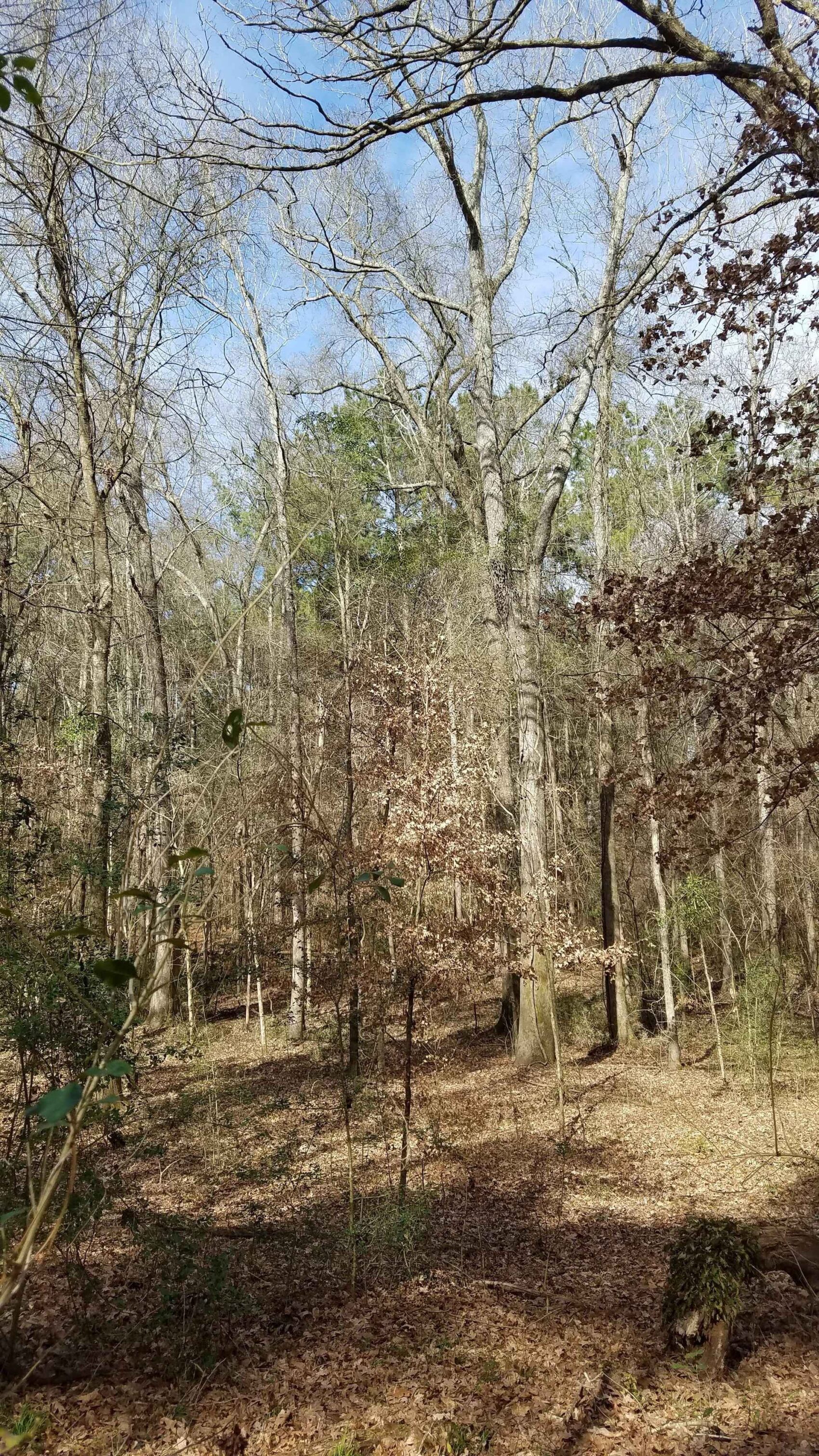
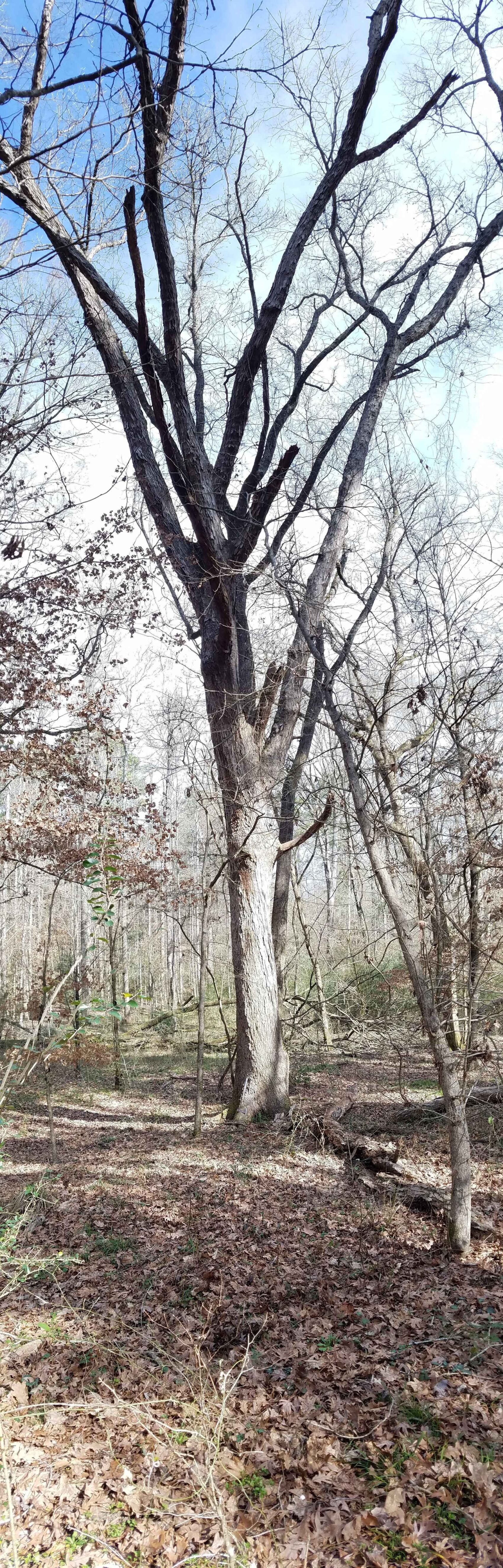
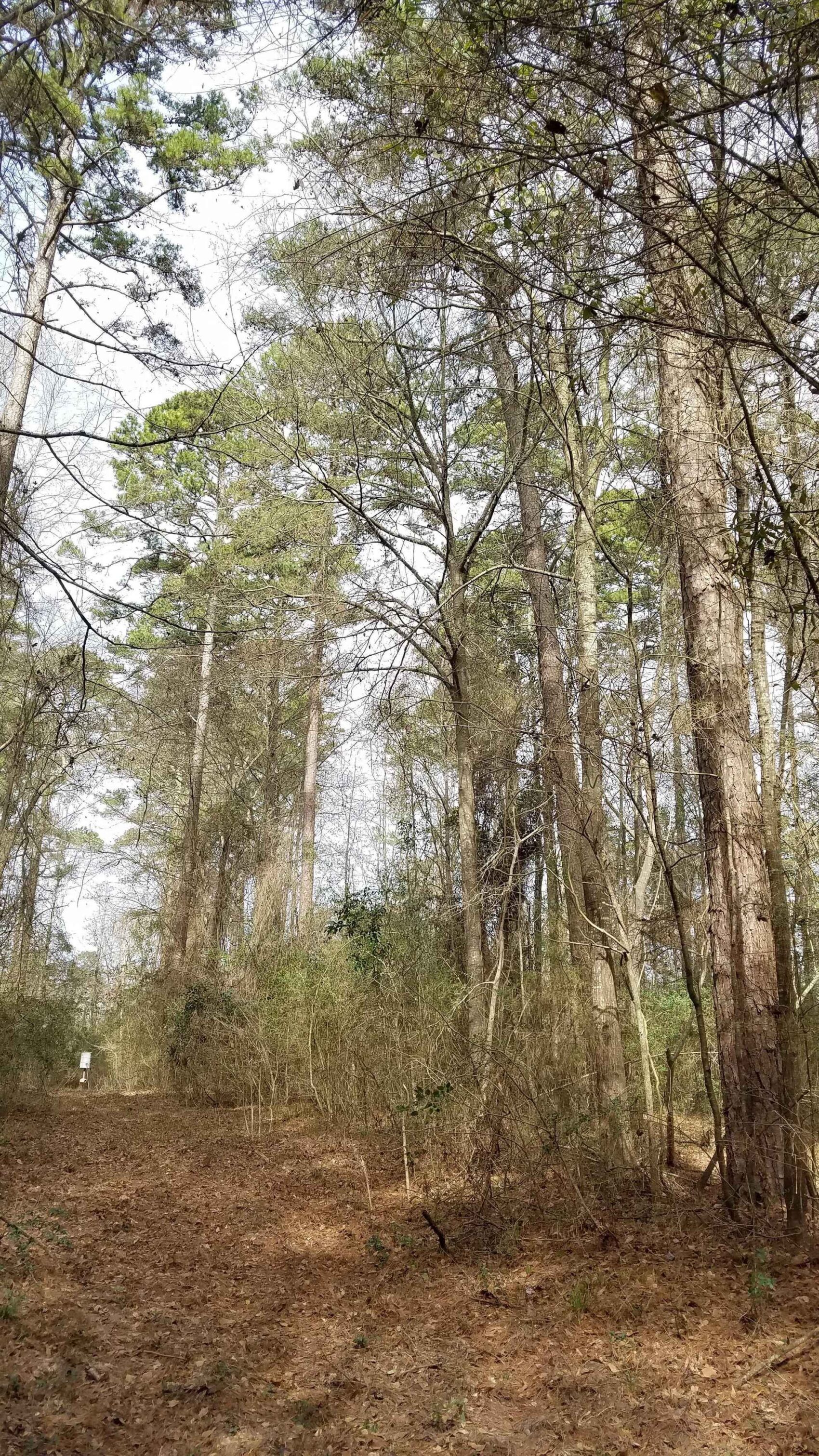
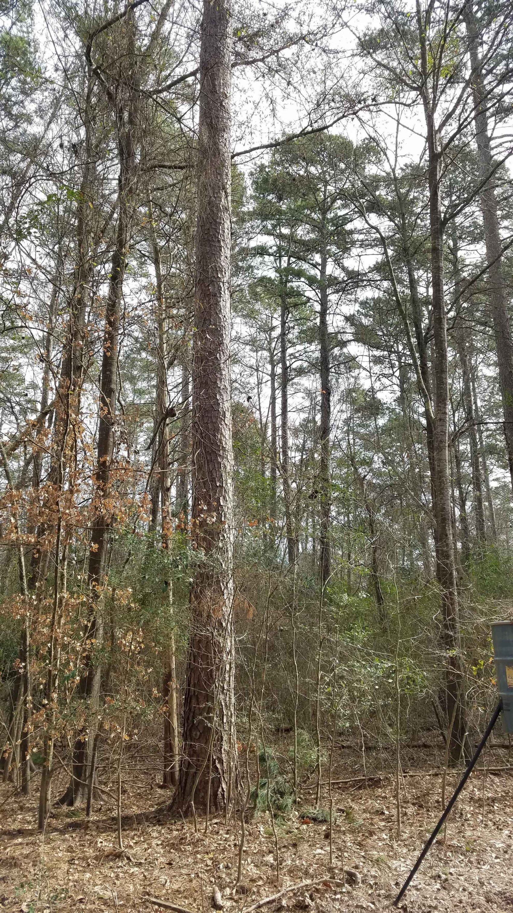
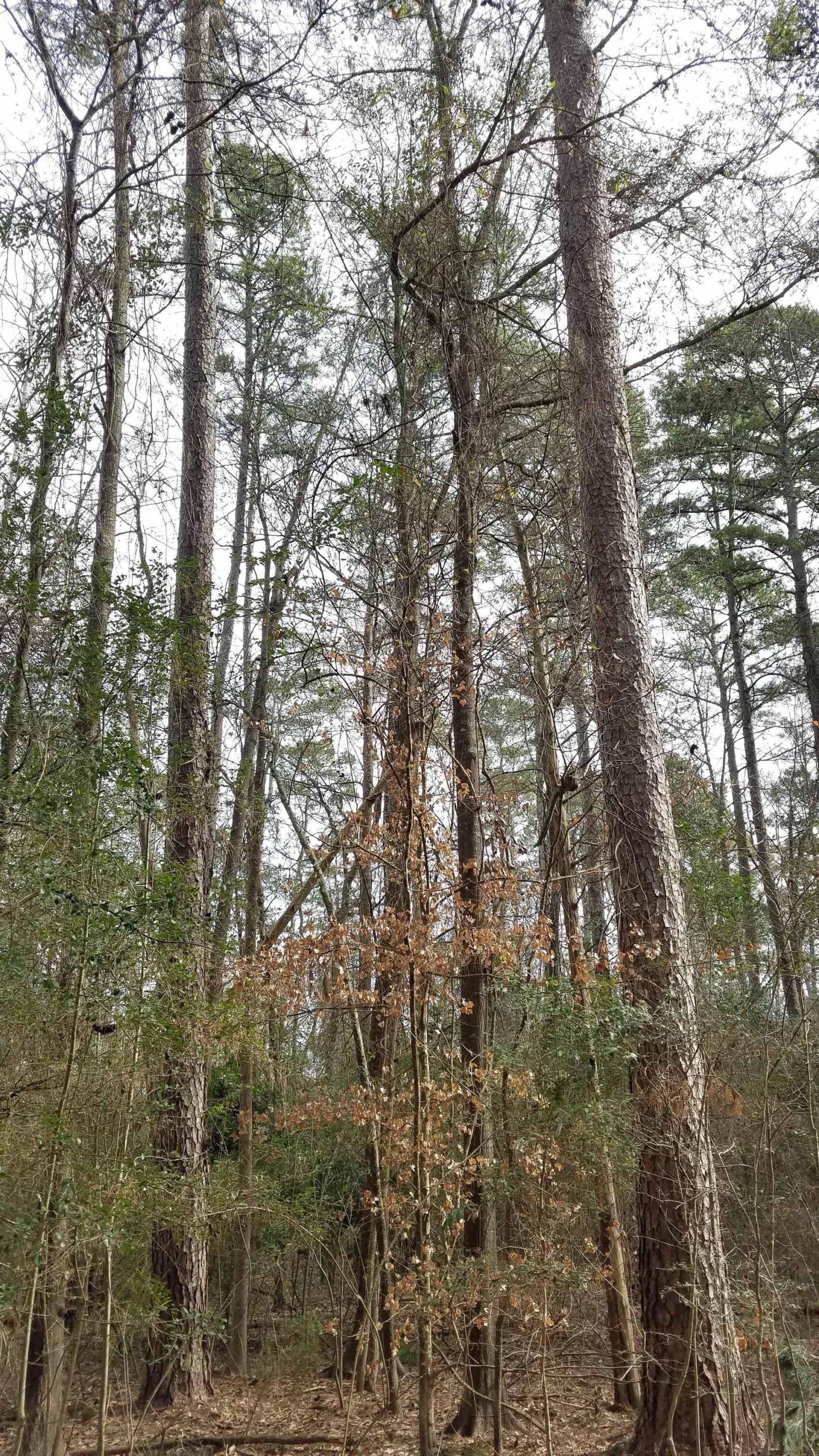
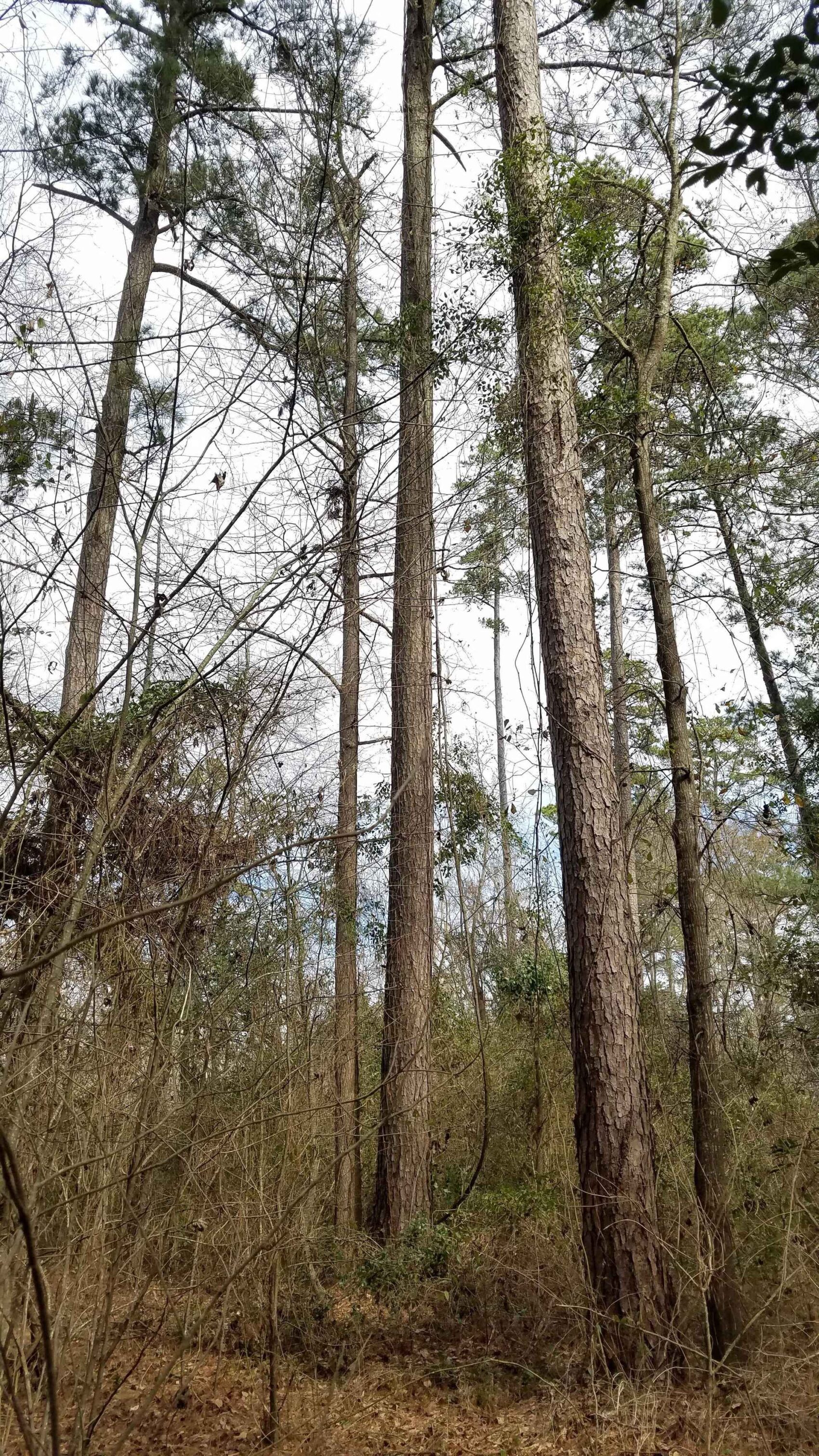
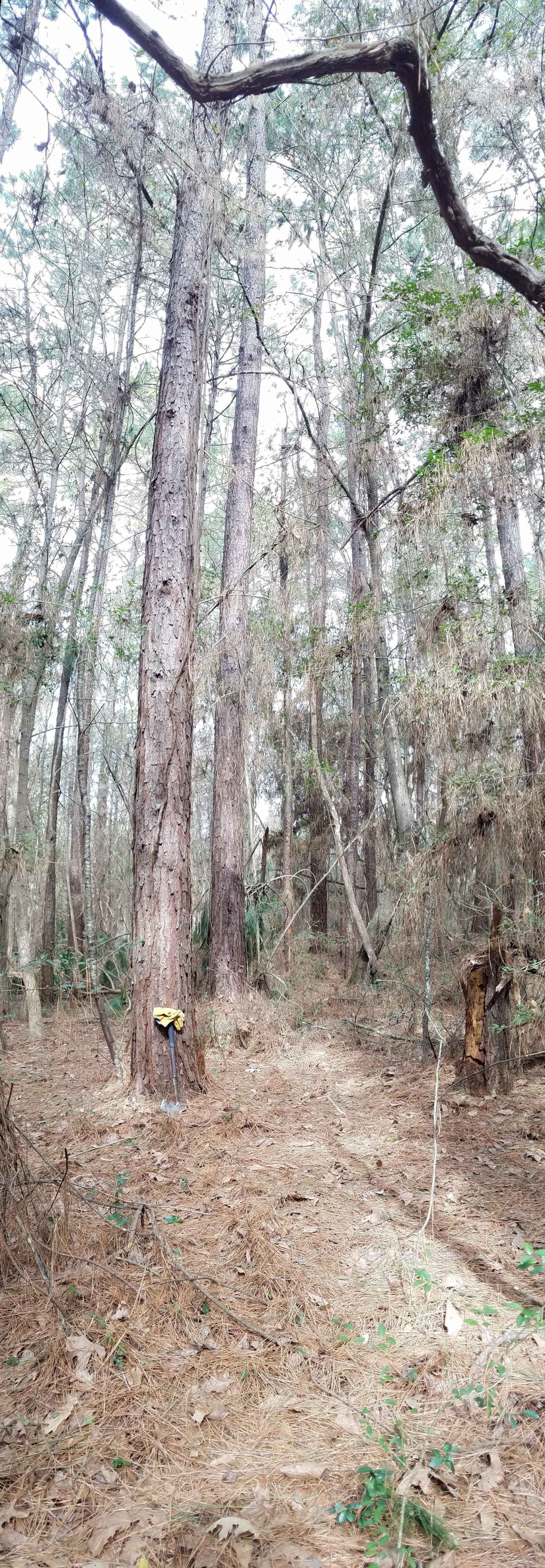
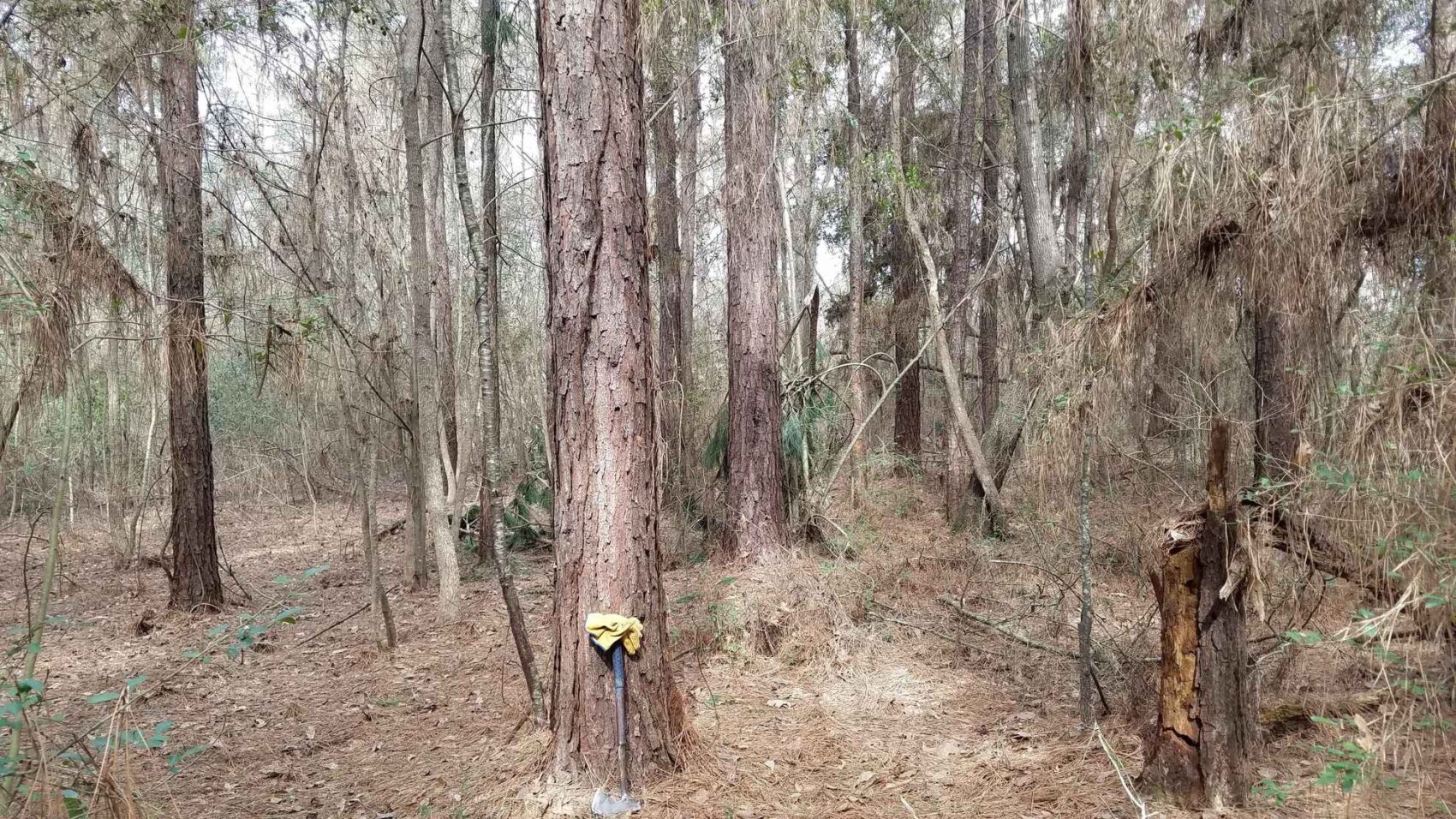
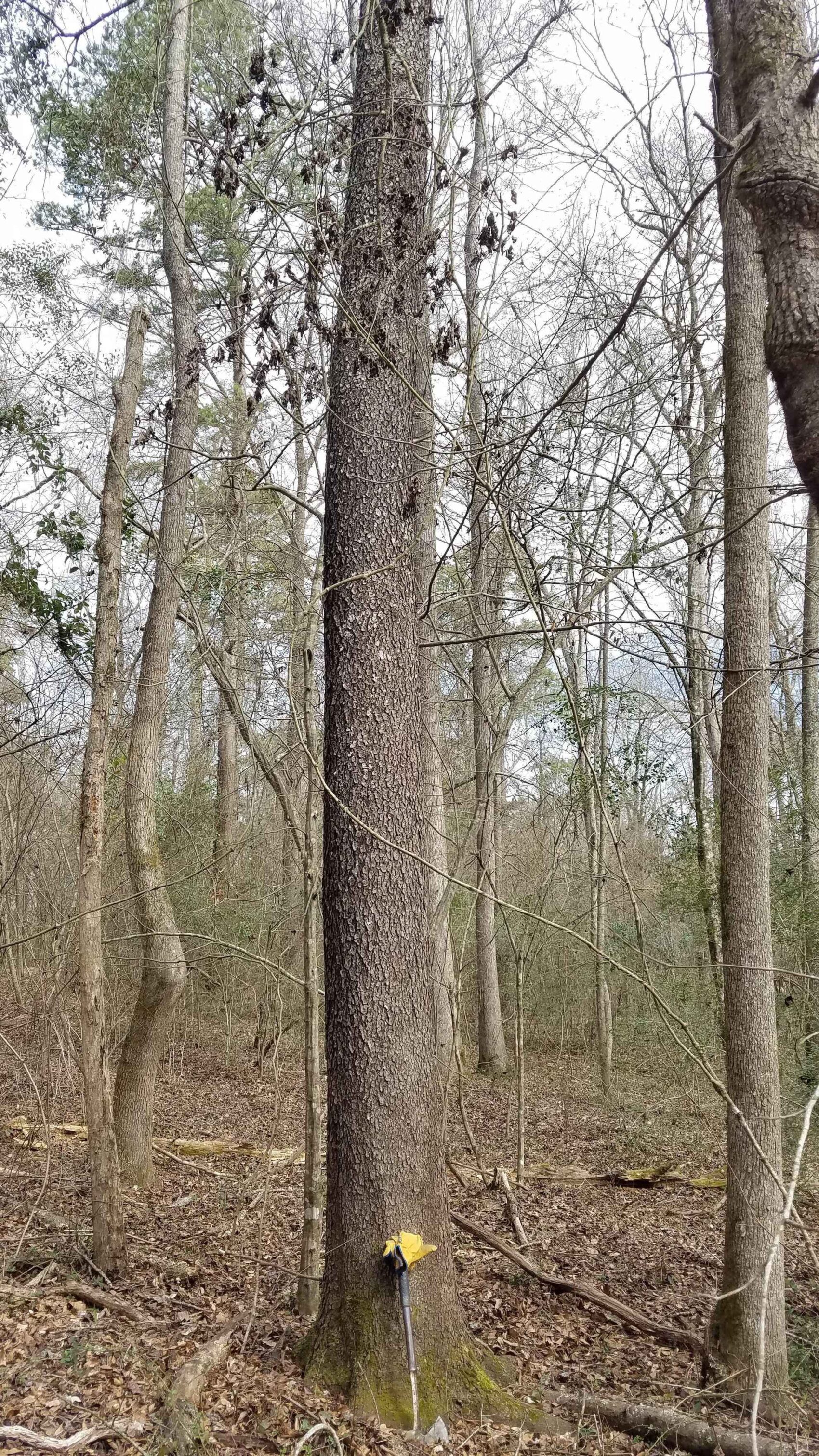
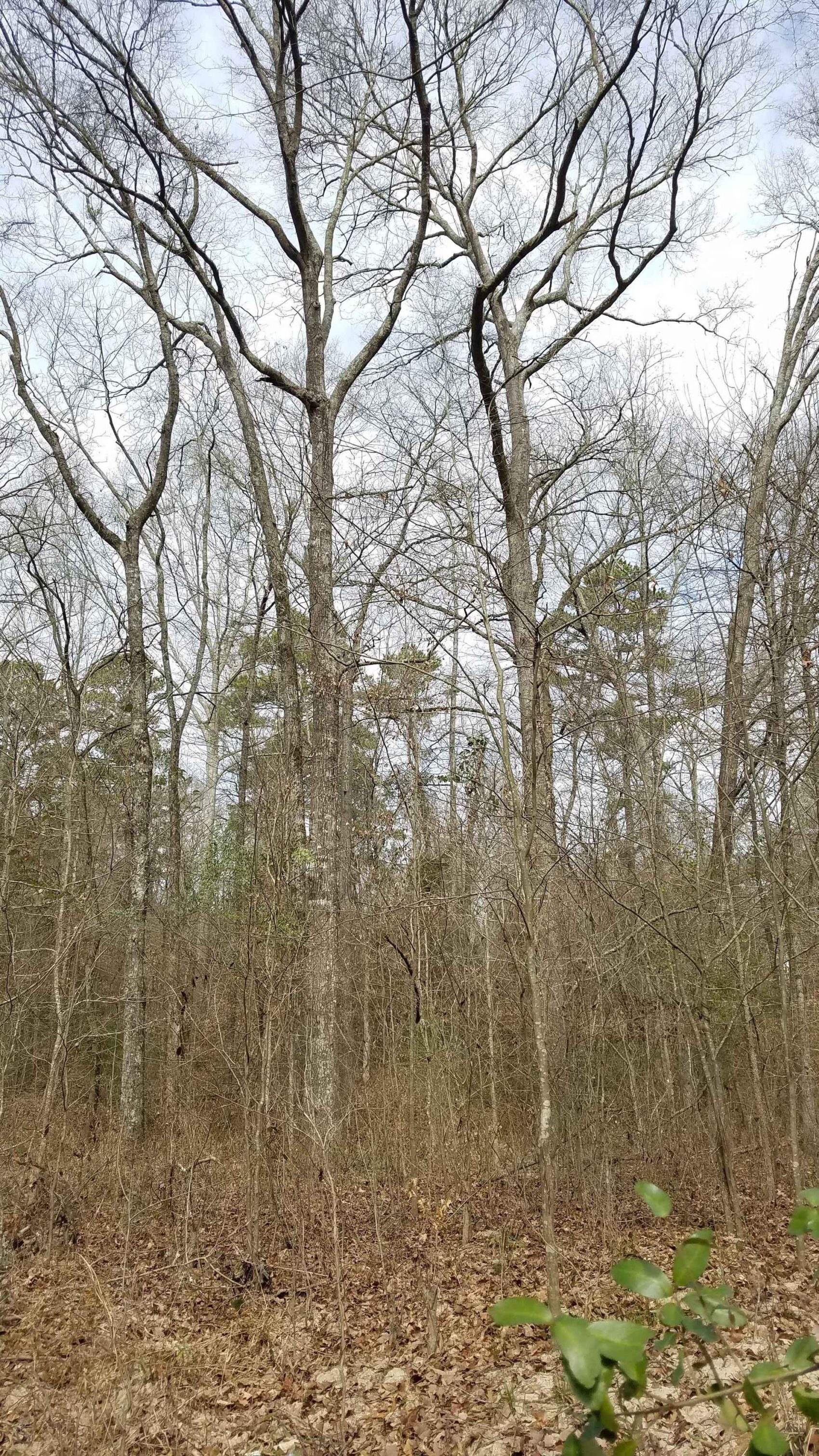
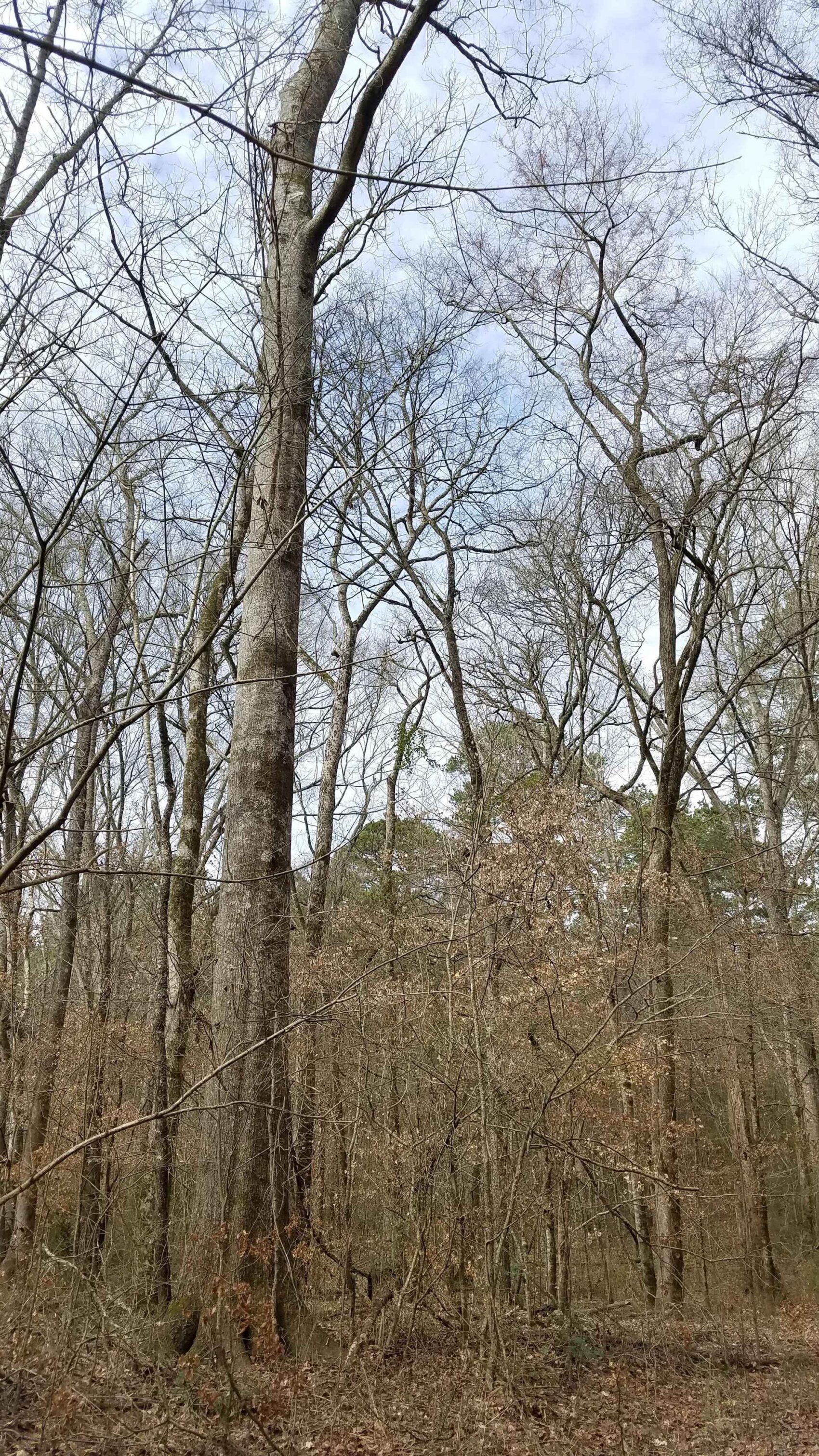
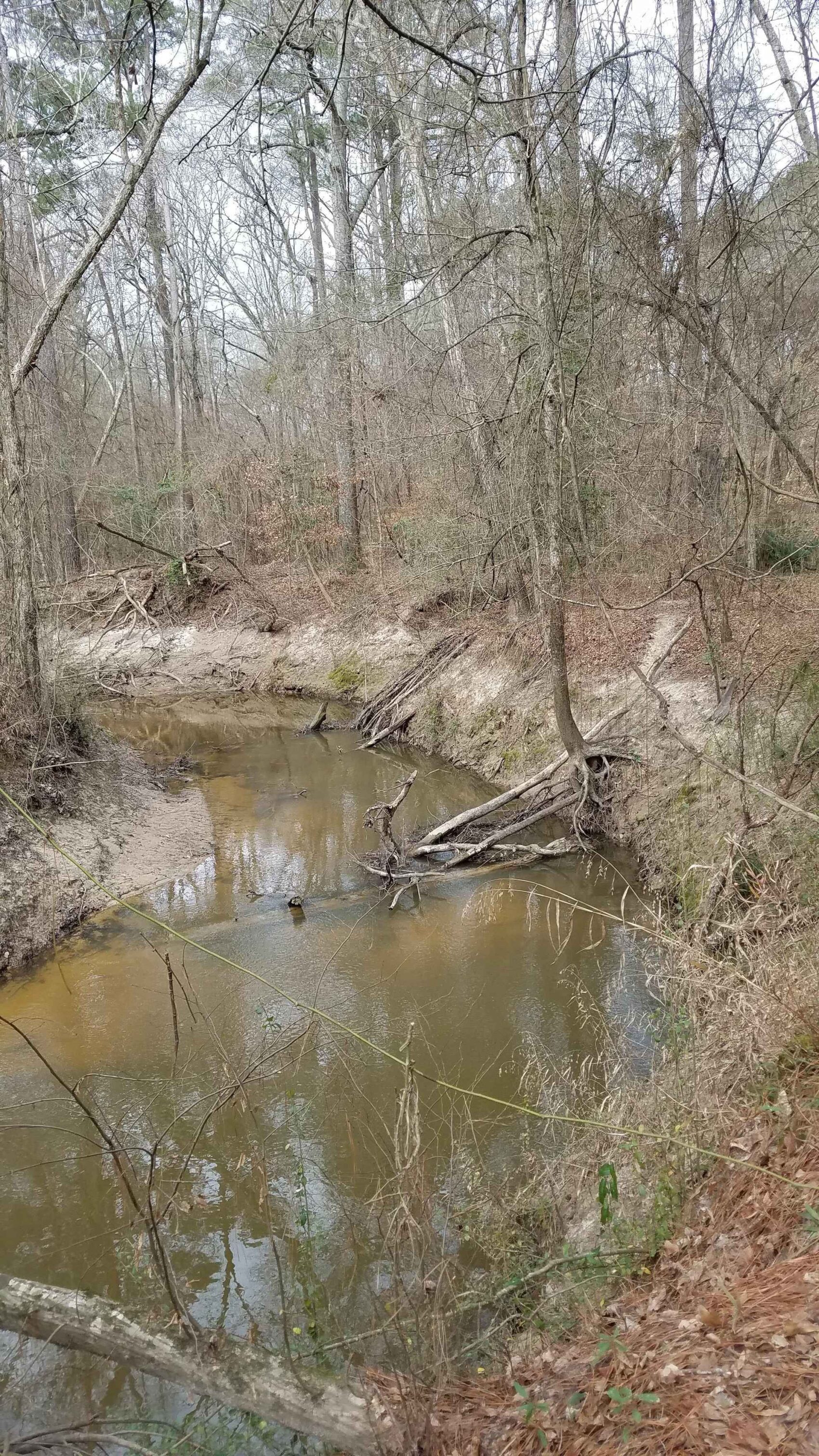
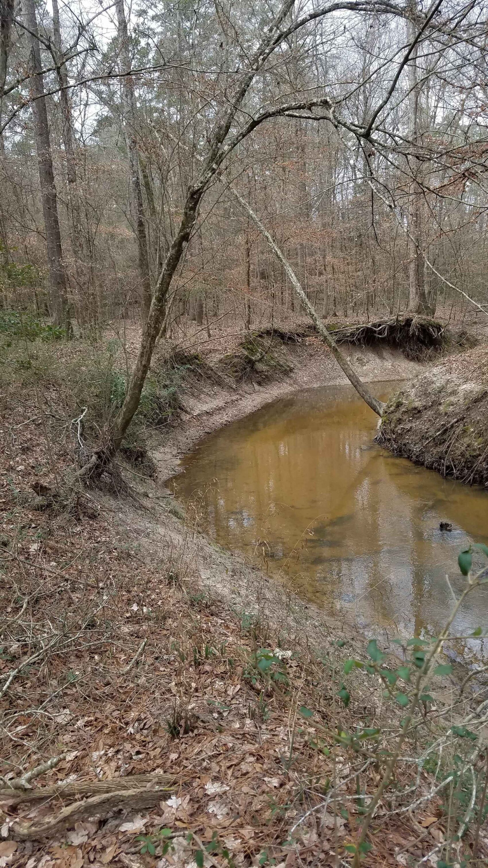
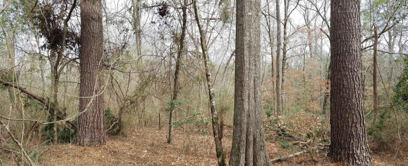
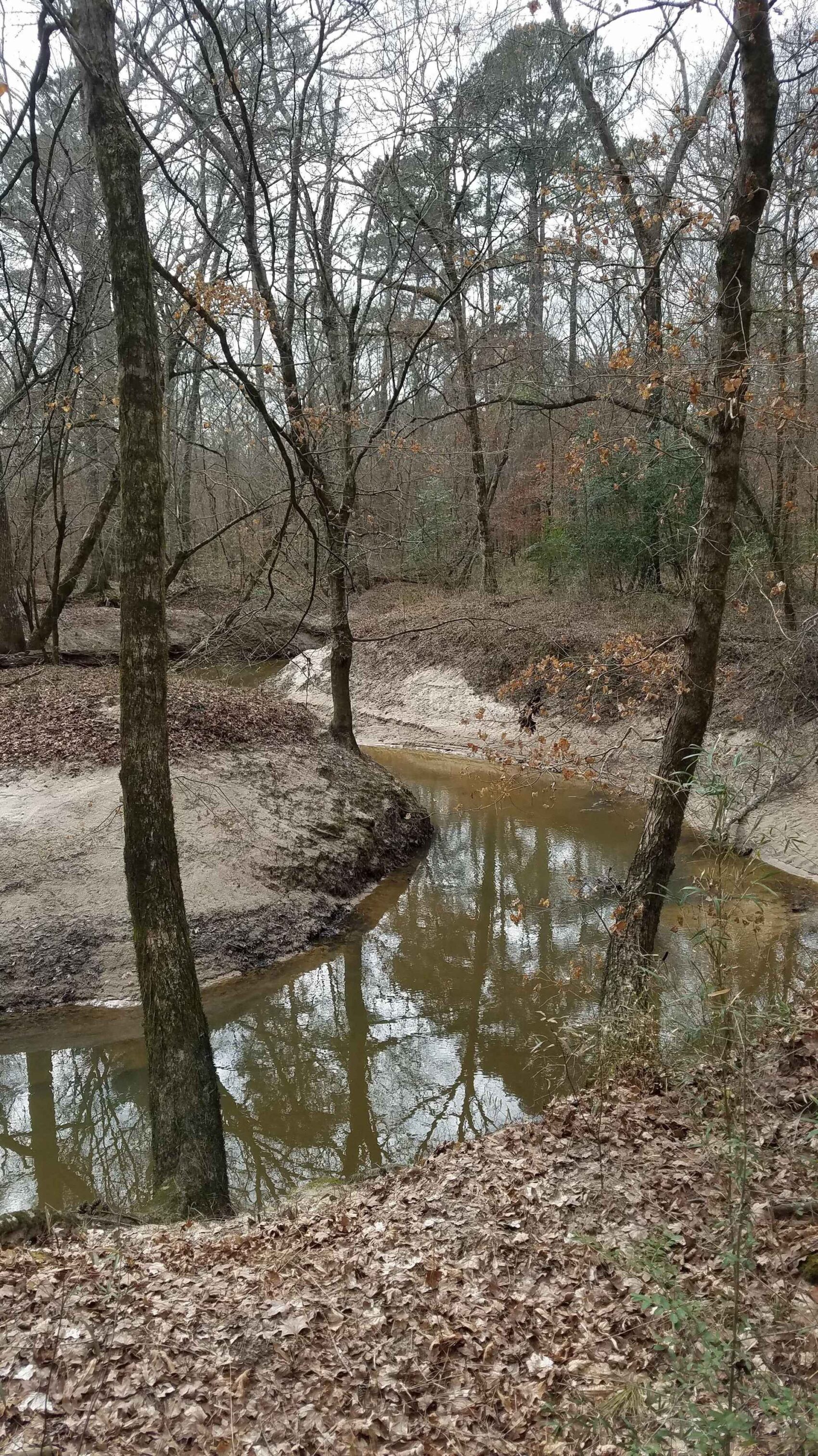
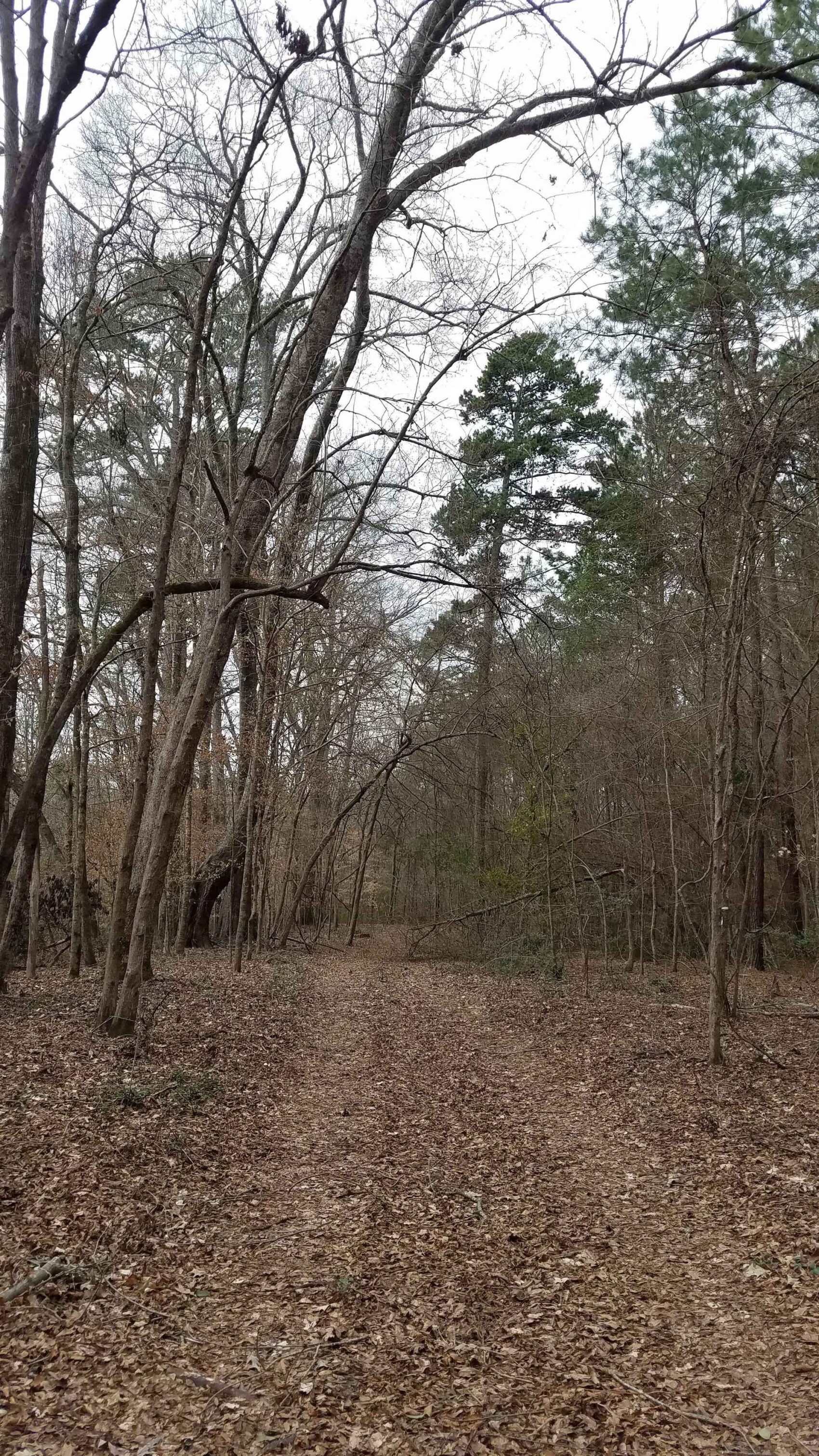
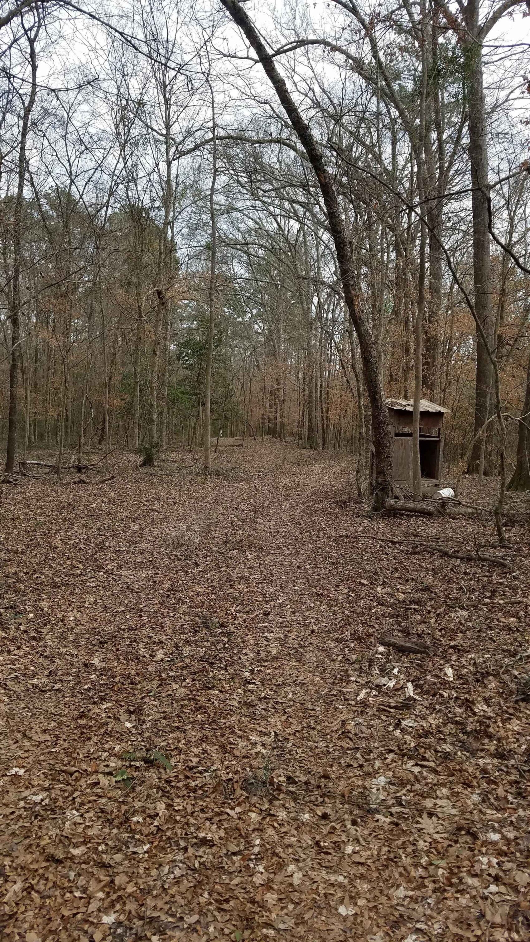
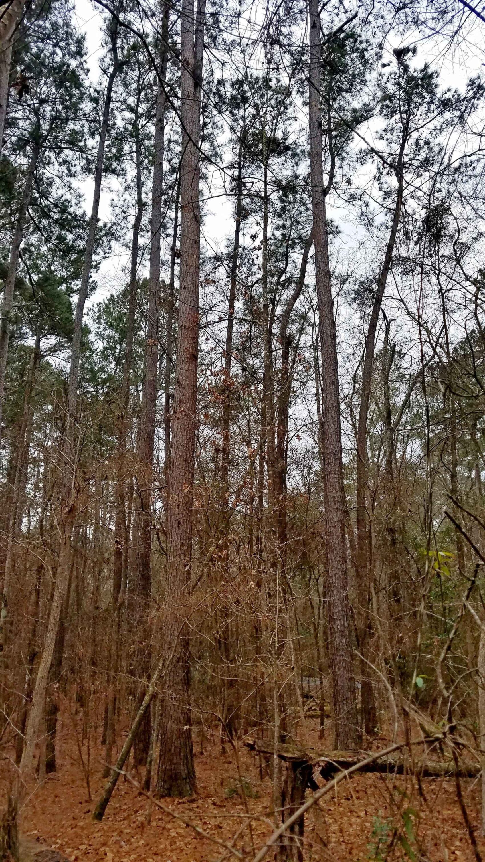
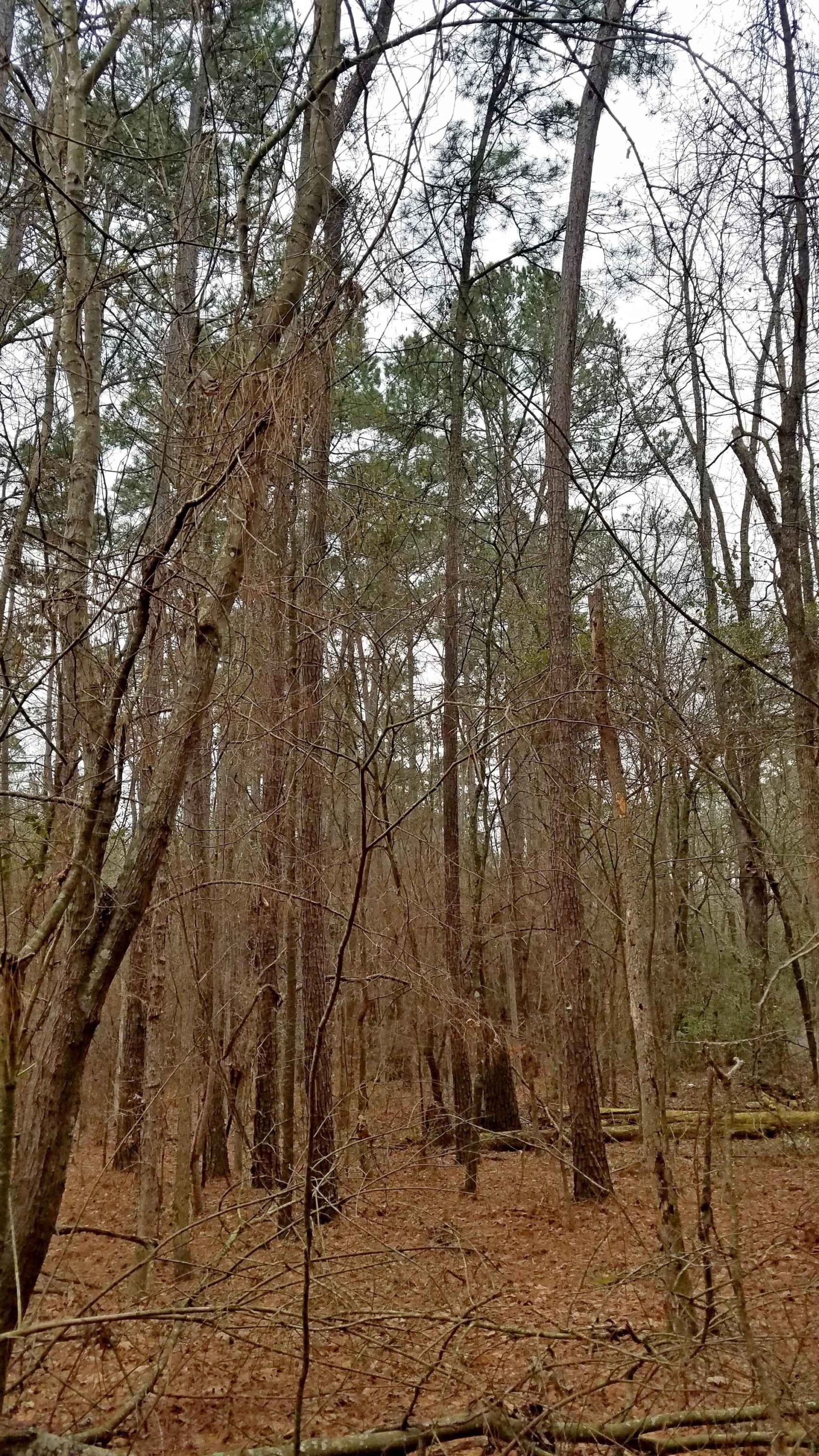
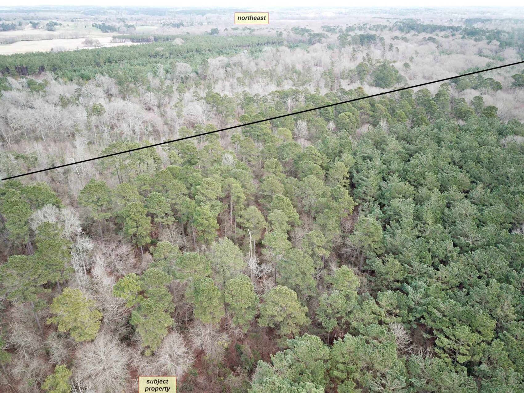
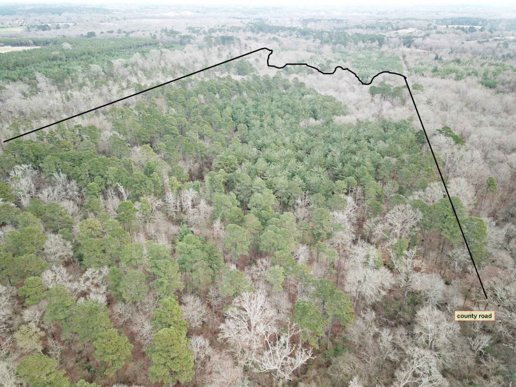
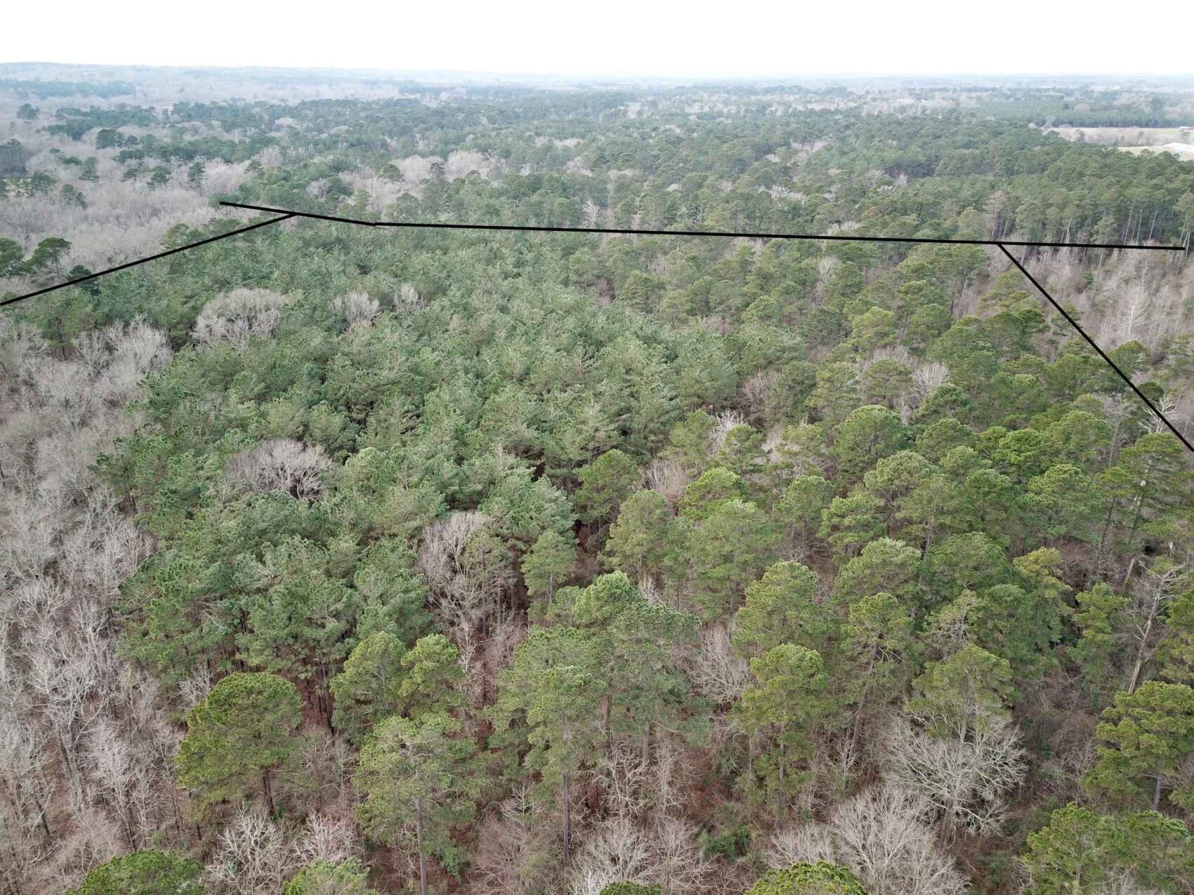
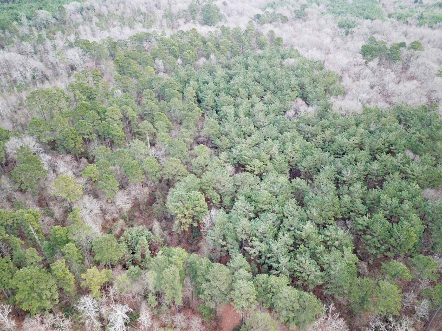
Rarely does timber value, a large perennial stream, all-weather public road access, beautiful scenery, excellent recreational values, and relative remoteness occur within a half-hour drive of Nacogdoches, Carthage, and Henderson. The beauty of this dandy, easily-accessed, well-forested property cannot be overstated. Located a few miles north of Garrison in southern Rusk County, near the Arlam community, this is truly an outstanding parcel of land for a getaway spot to relax and enjoy the forests of East Texas. The secluded bottomlands and upland areas are very suitable for still hunting and archery, with plenty of sign of whitetail deer, feral hogs and squirrels.
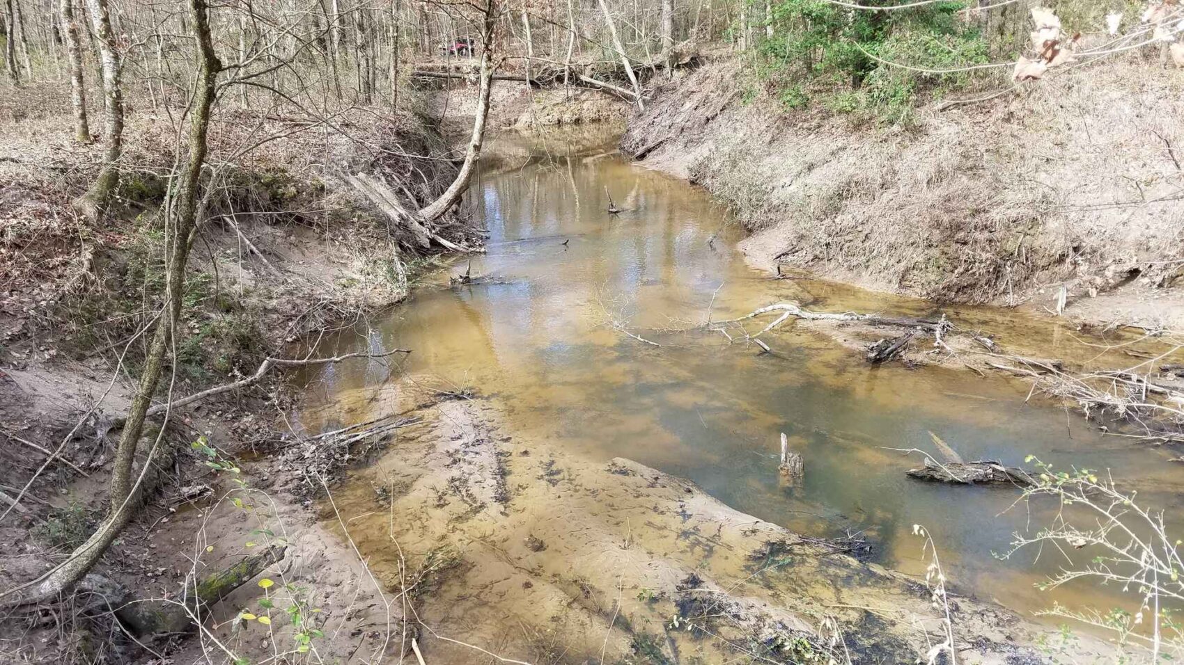
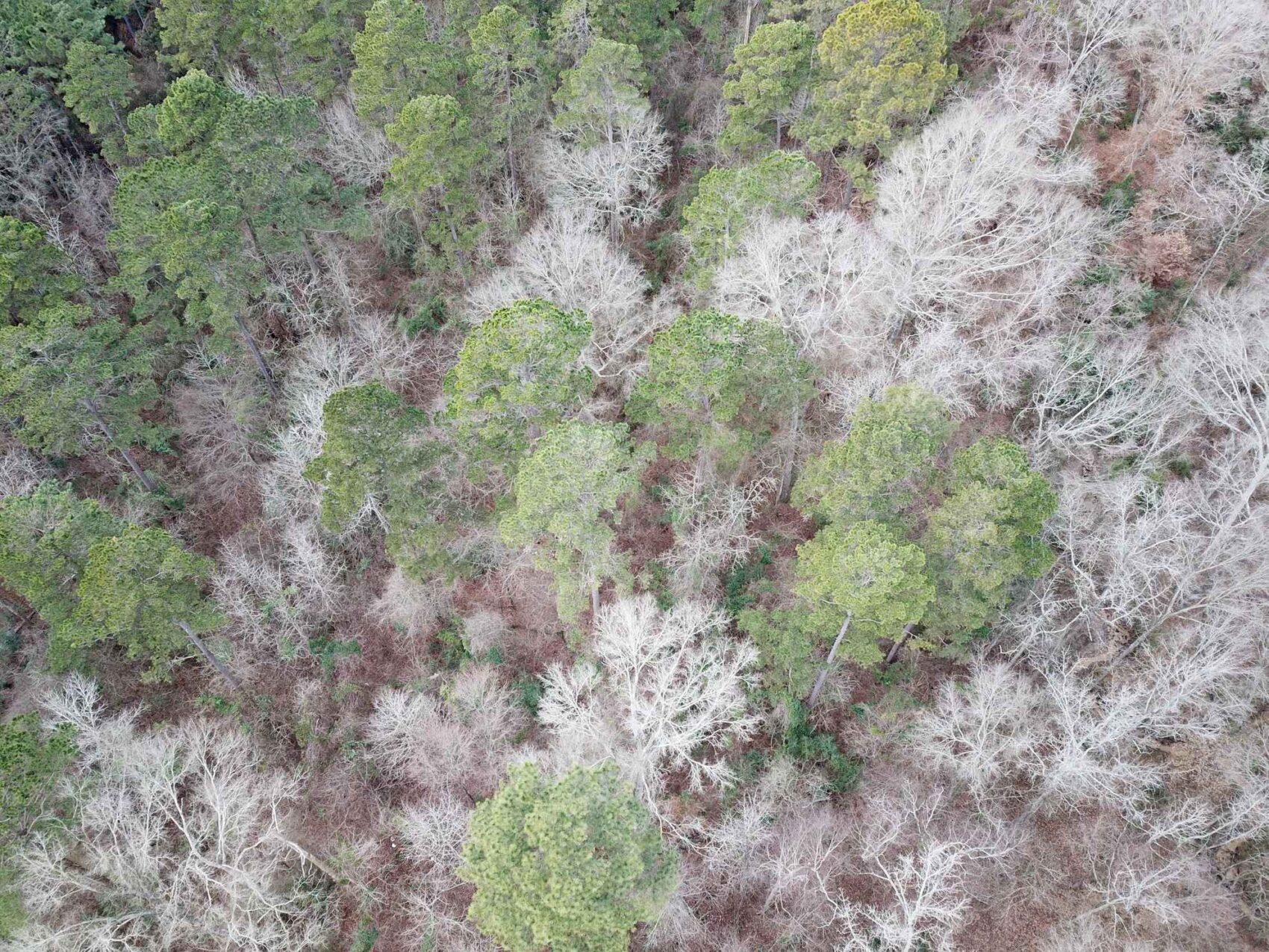
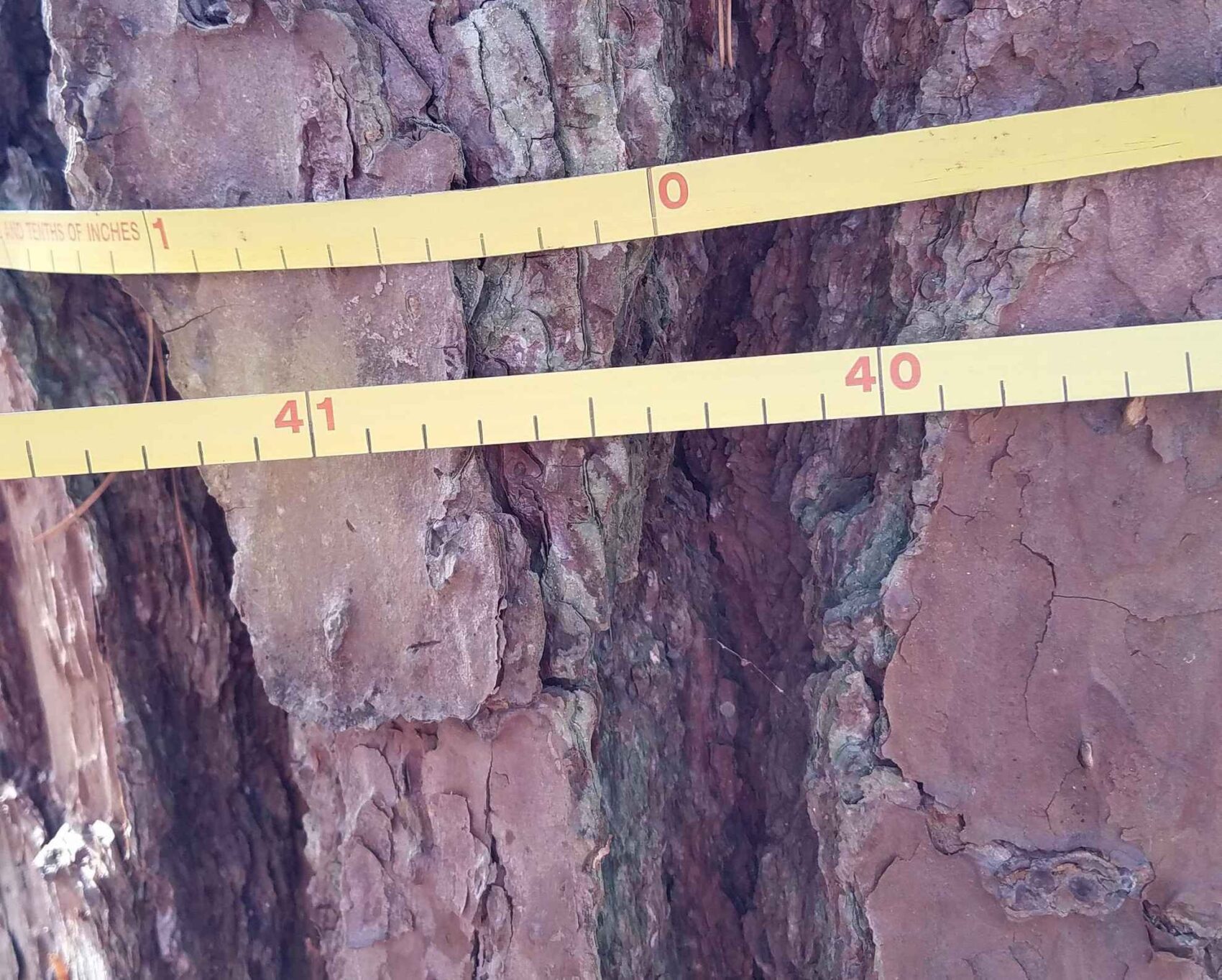
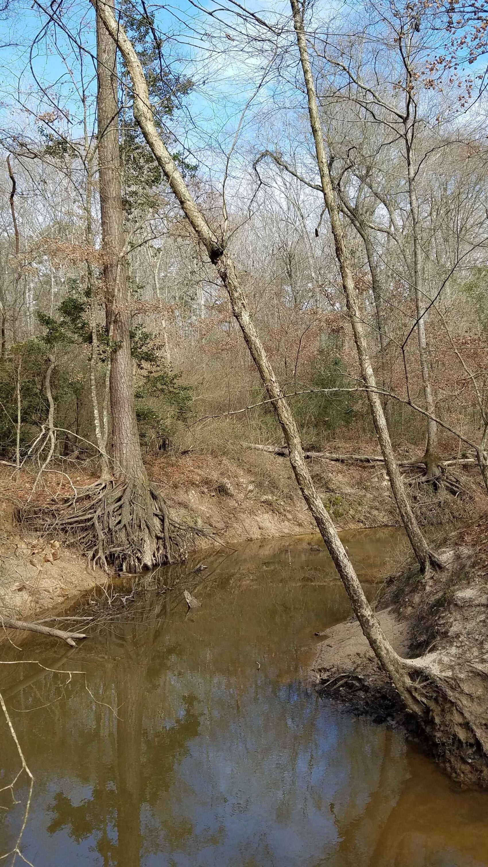
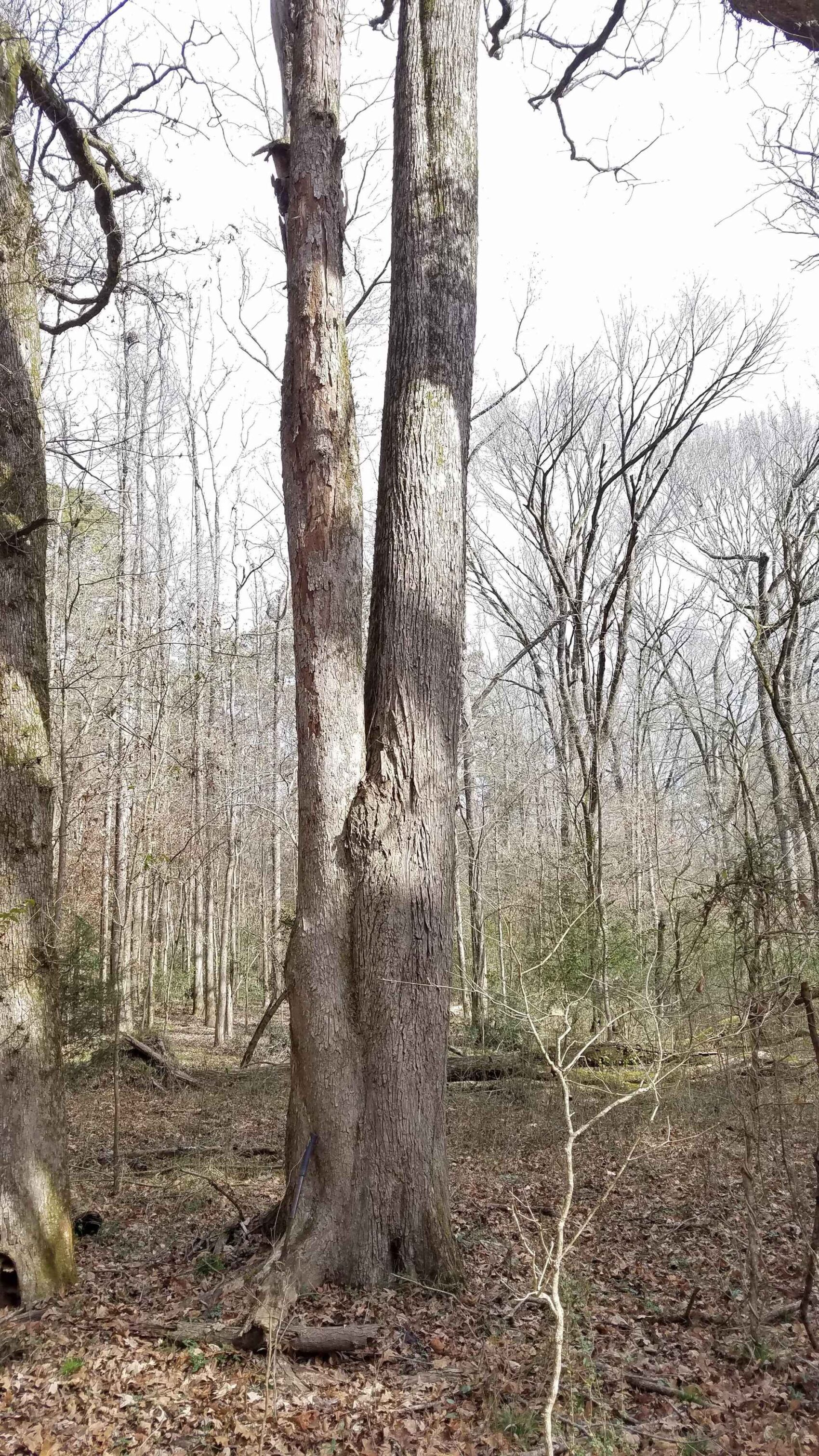
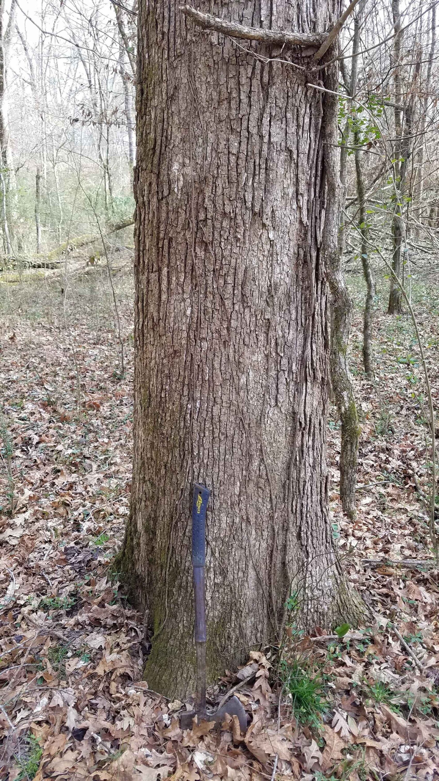
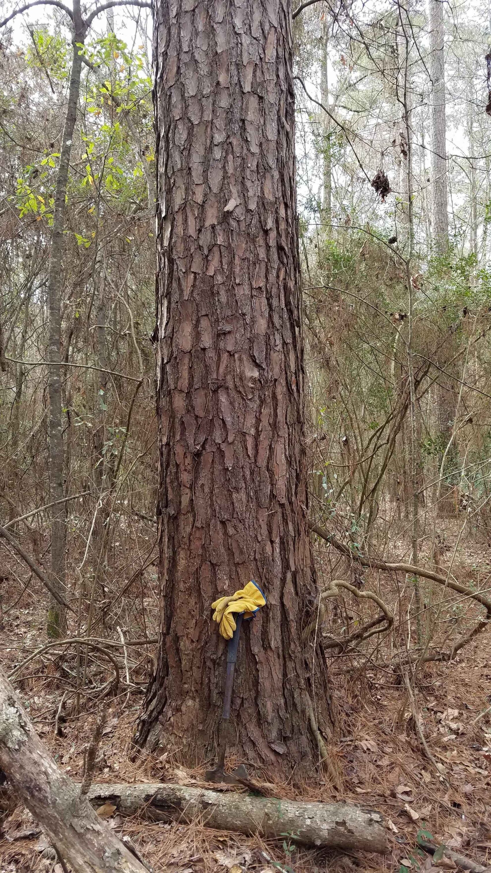
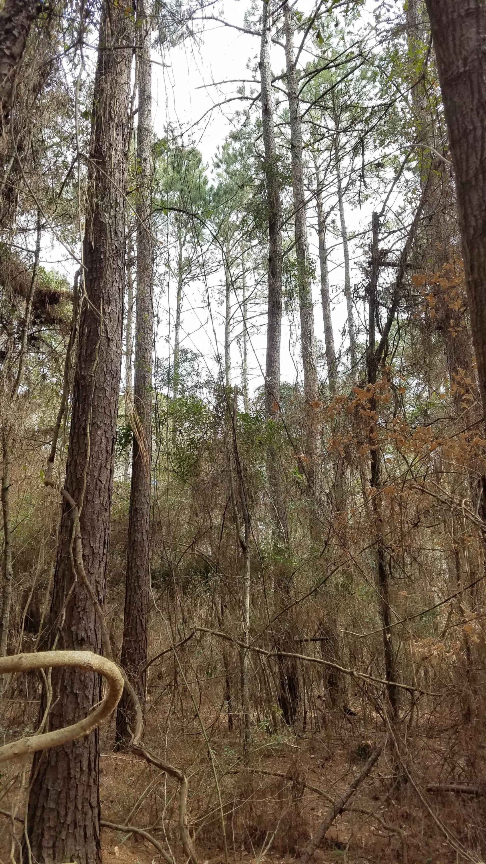
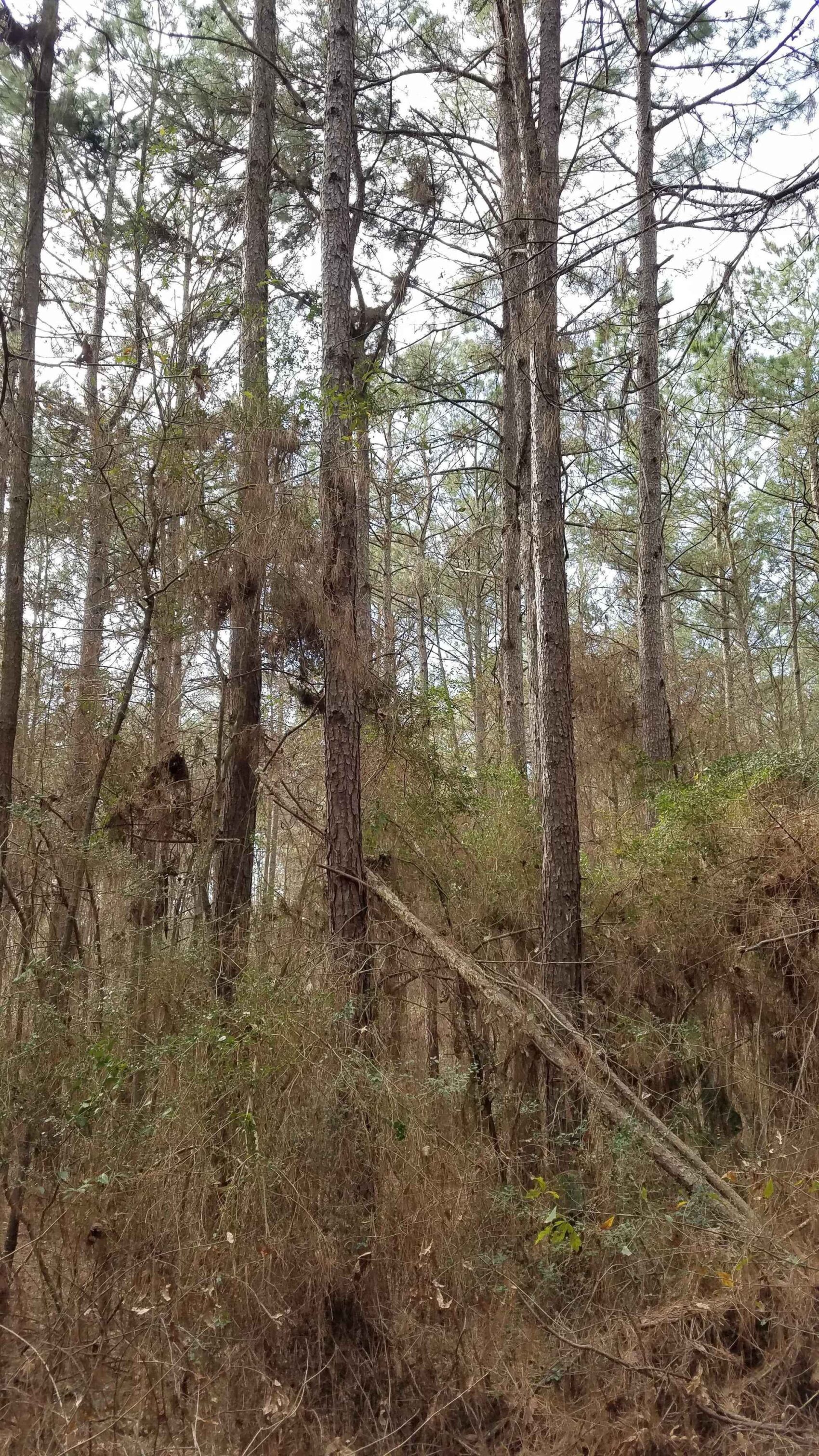
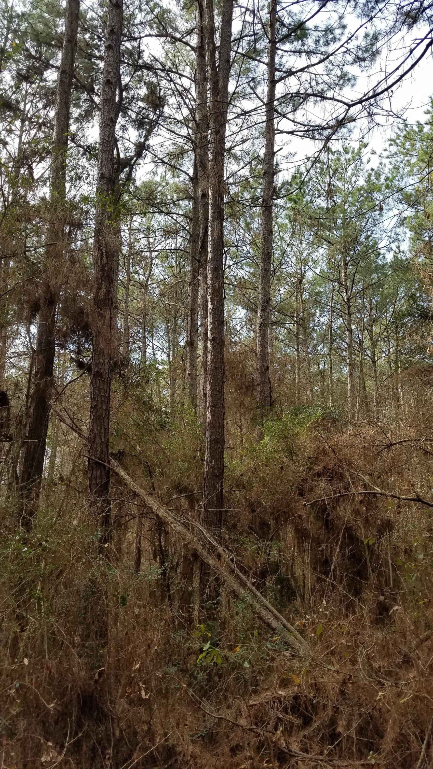
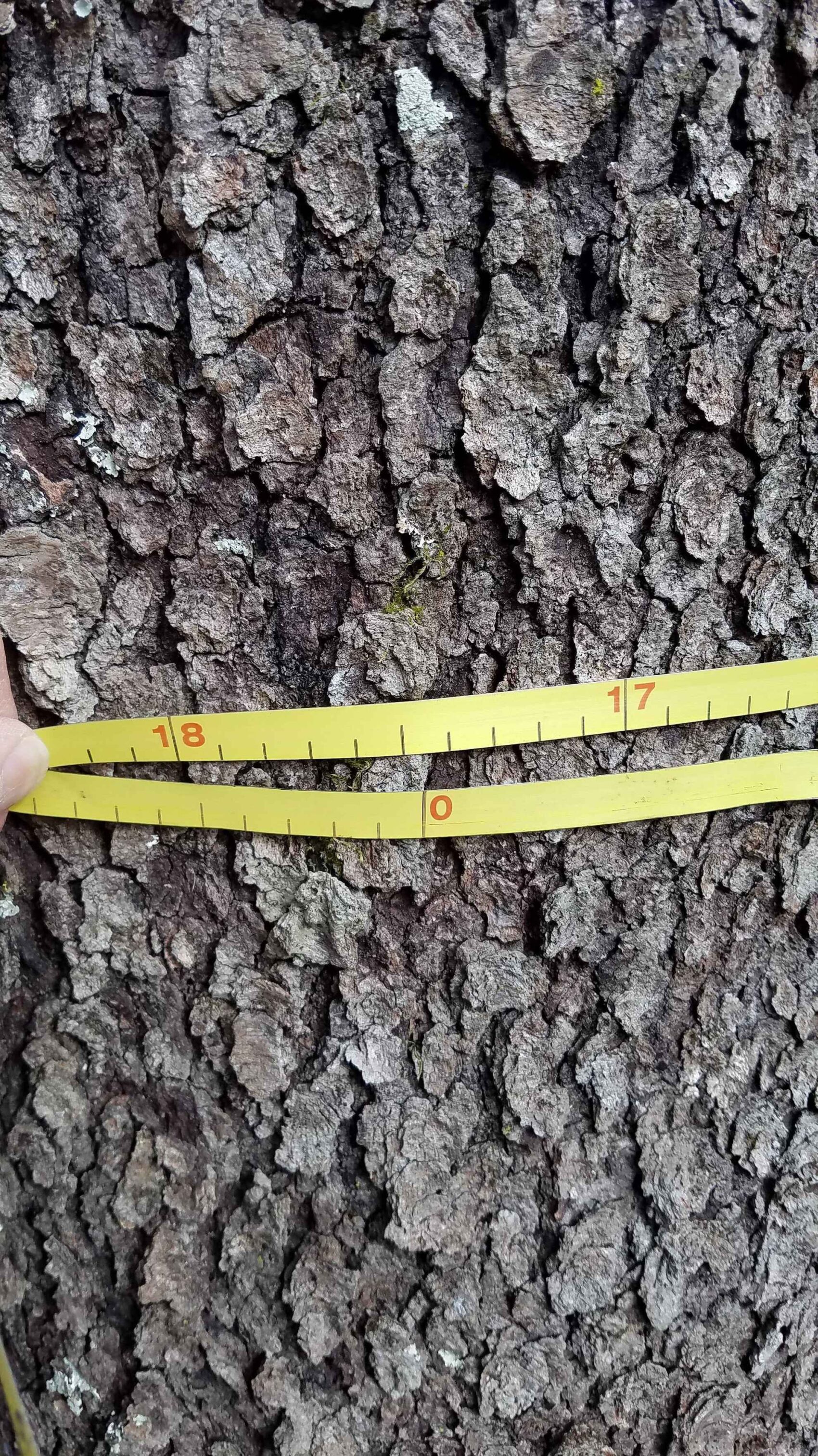
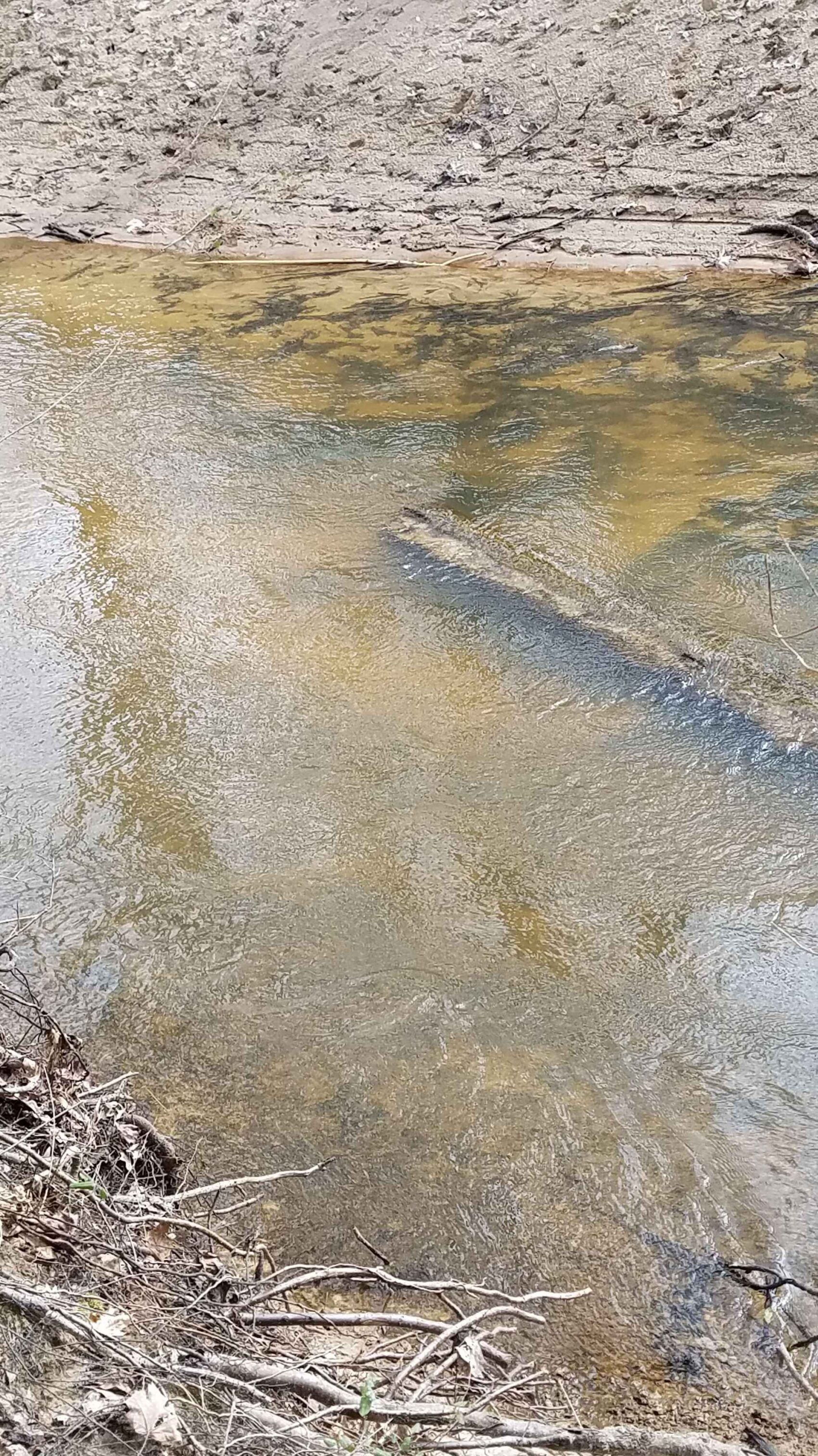
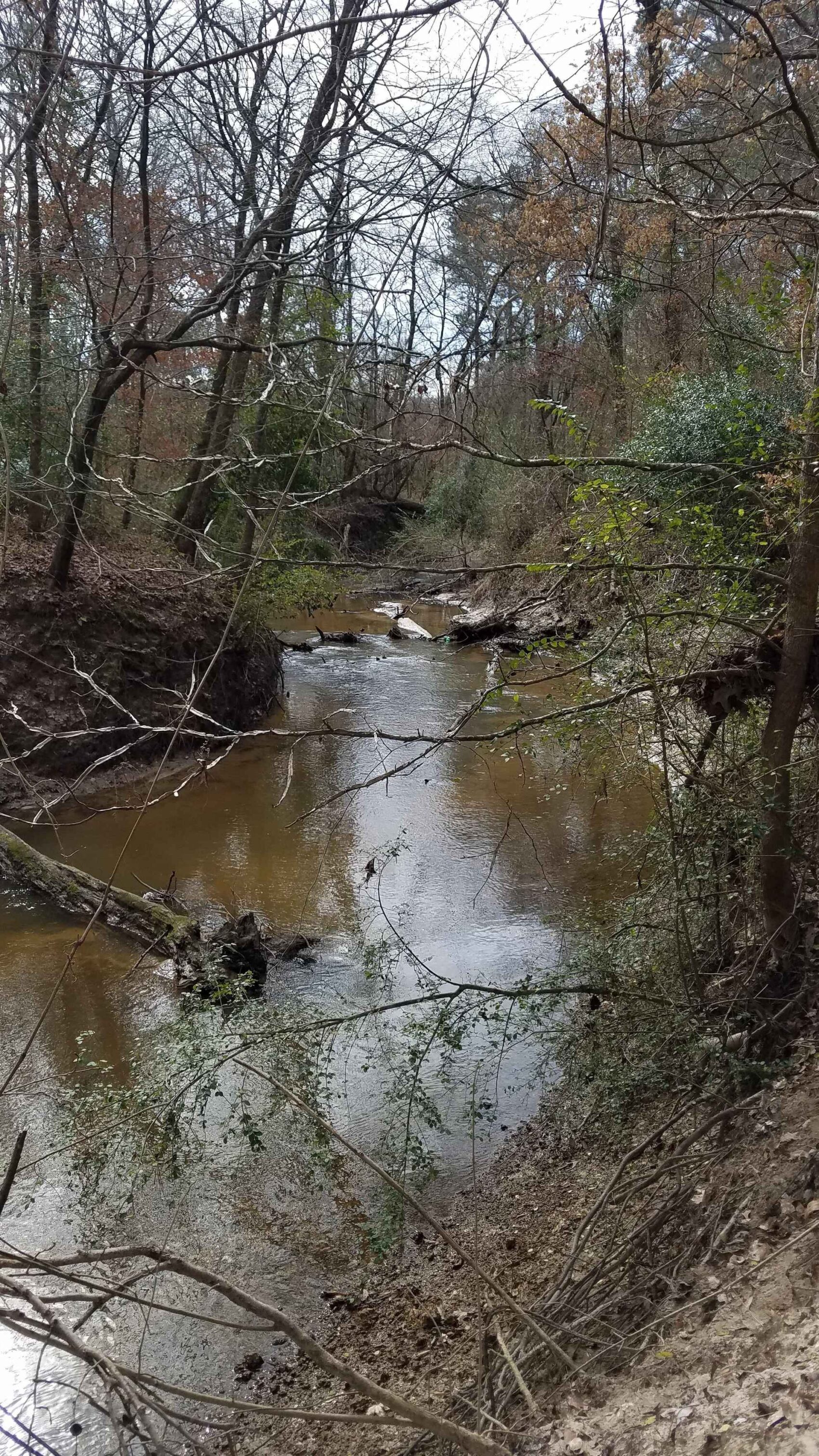
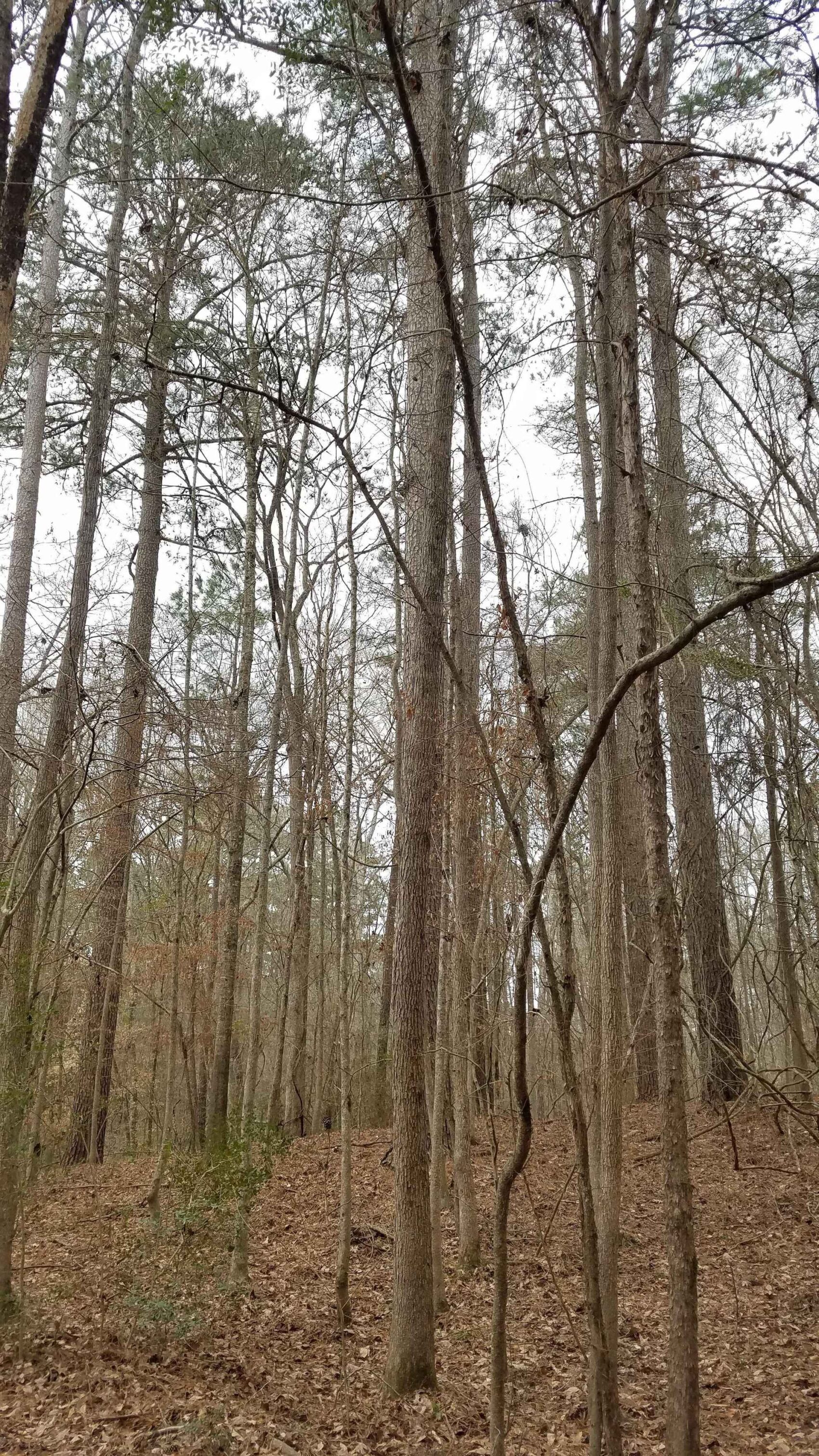
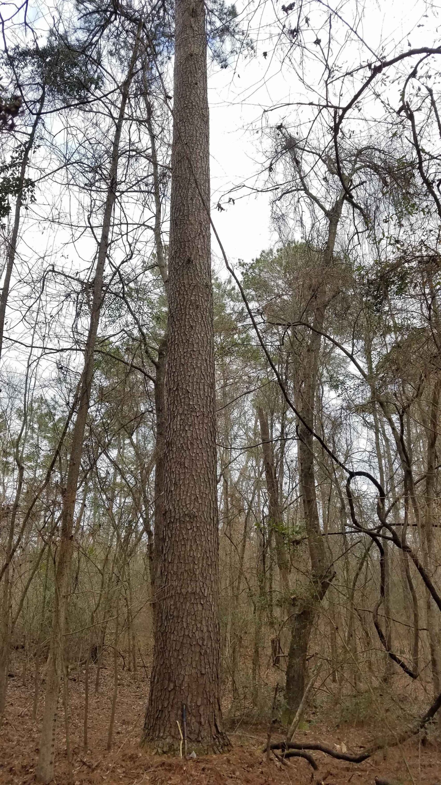
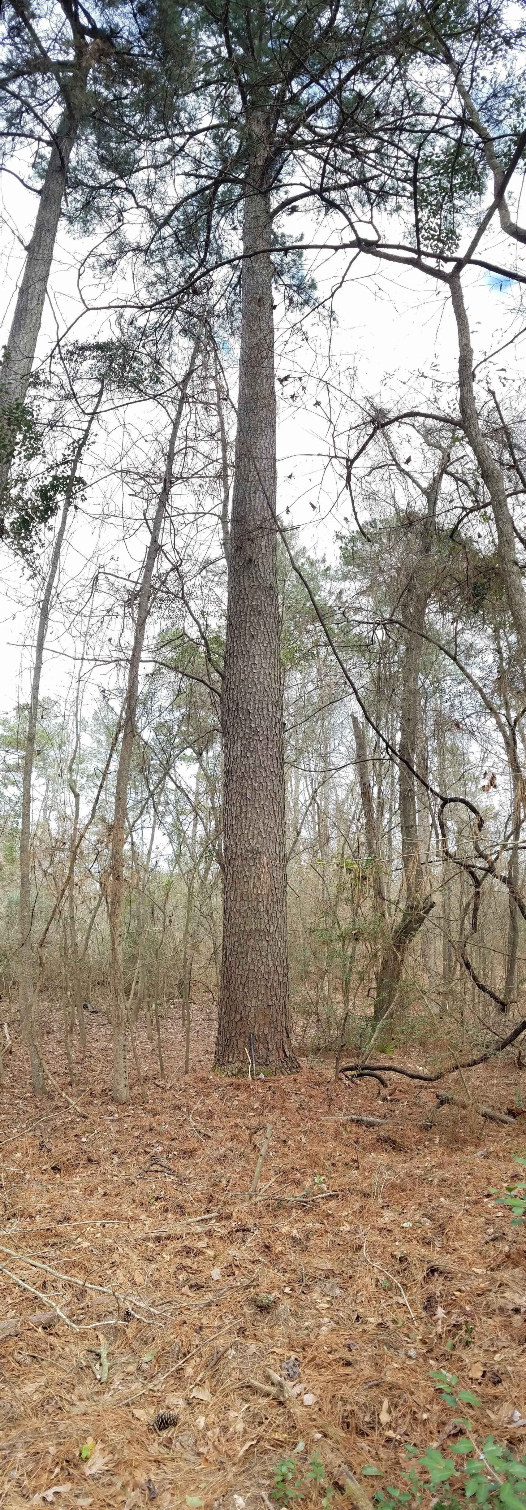
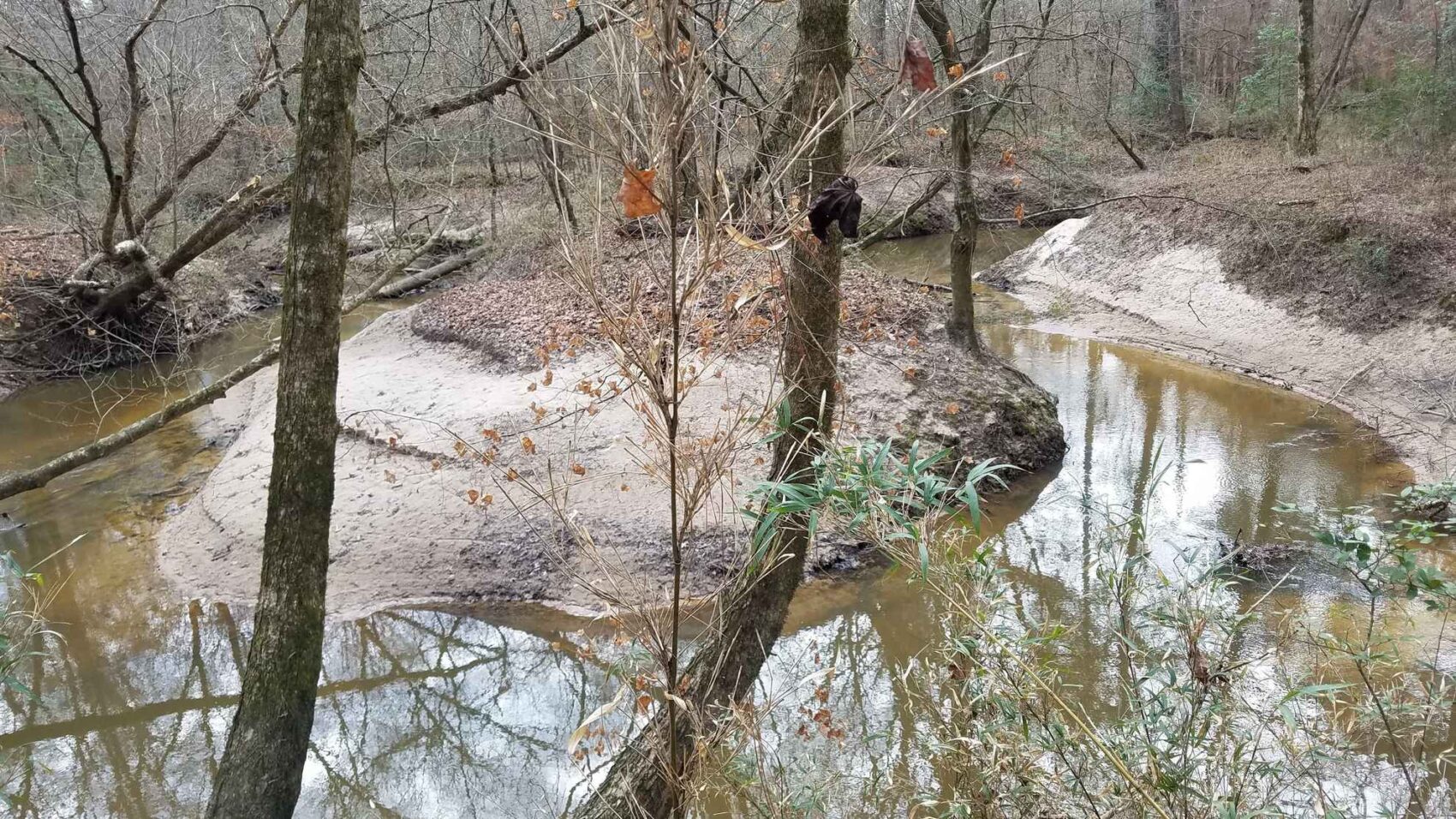
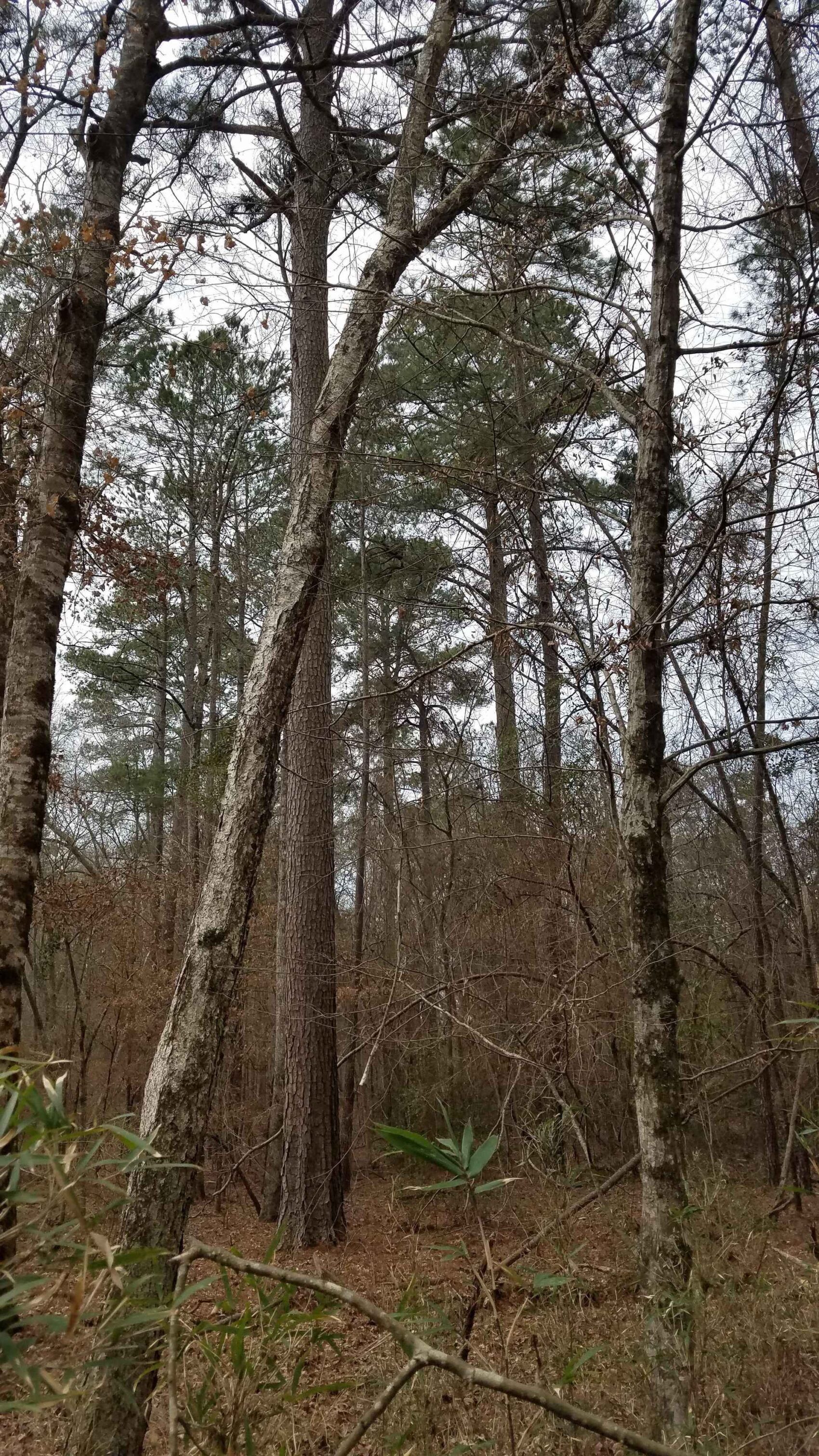
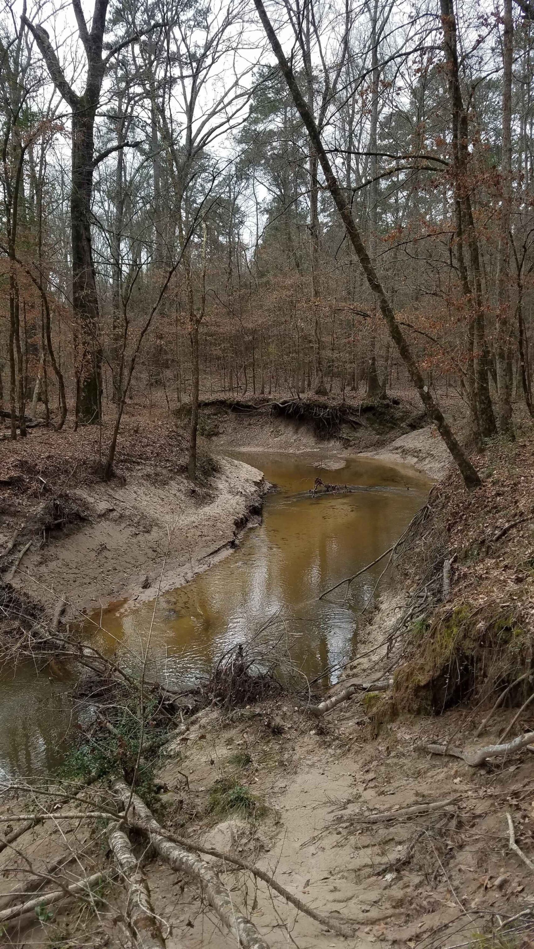
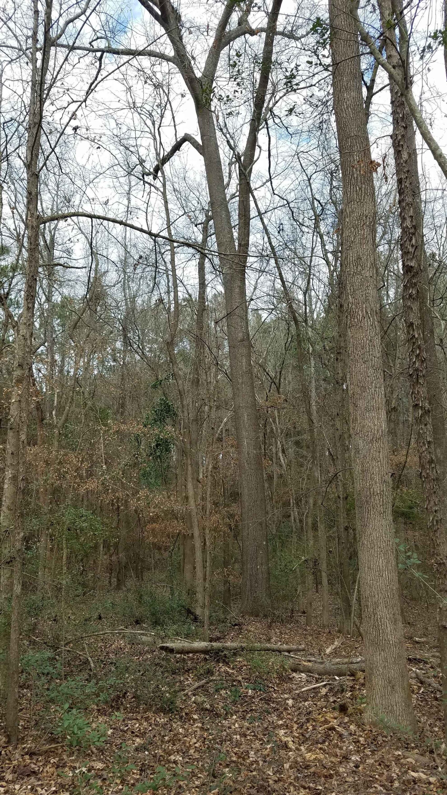
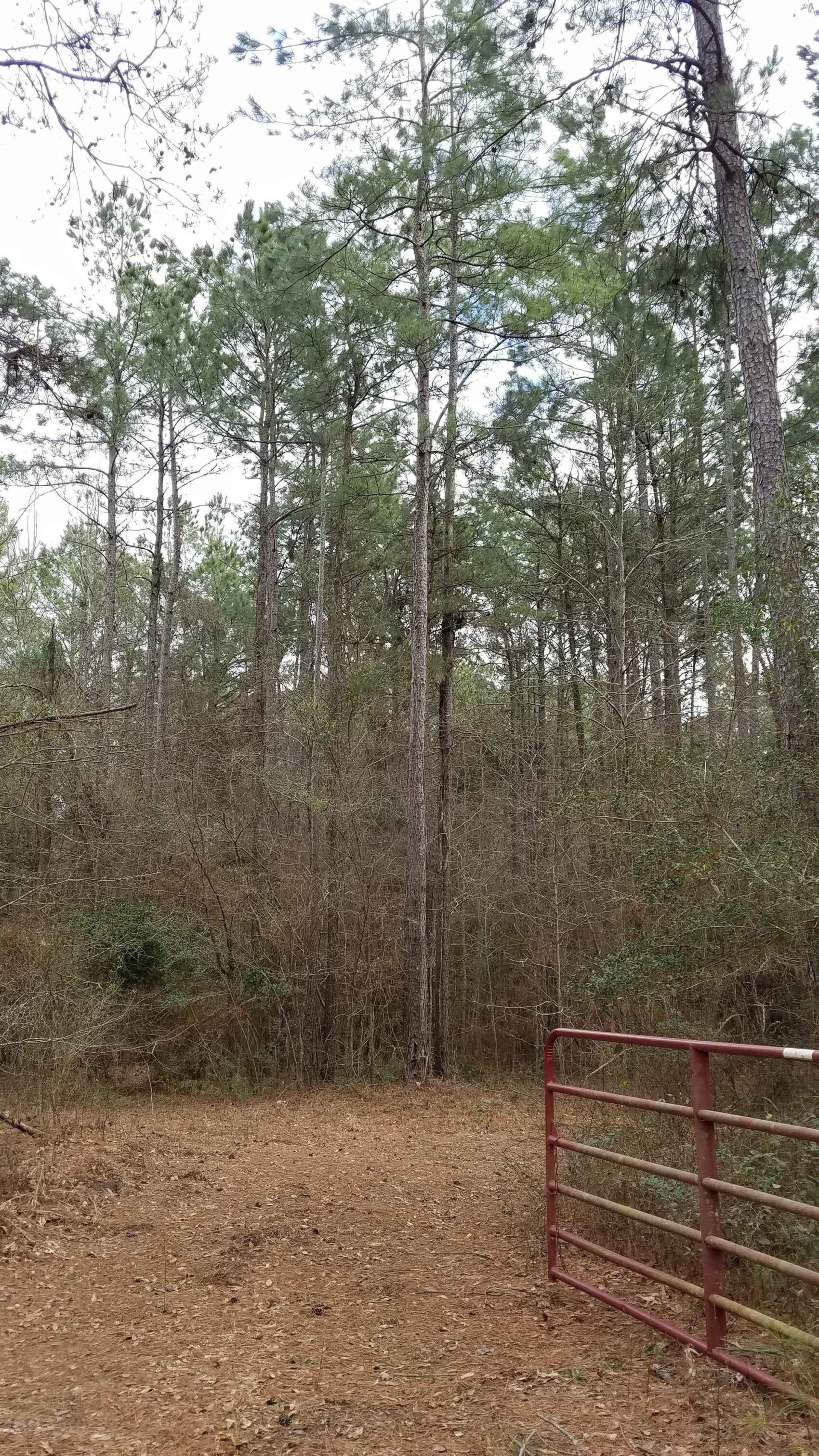
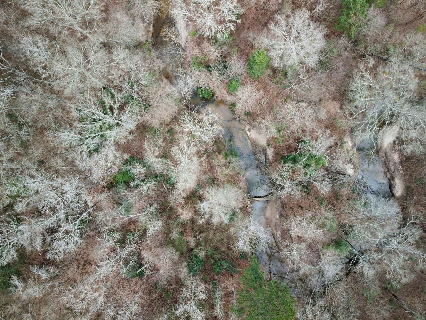
Golondrina Creek is a major perennial stream with beautiful scenery along its banks, and is the eastern boundary of the property. The deed calls for the boundary line to be on the eastern/southern bank of Golondrino the right-bank down-stream, so full access is assured. The extraordinarily attractive pine and hardwood creek bottom forest covers about 15 acres, while the well-drained uplands contain about 17 acres. Some of the loblolly pines in this bottom are truly outstanding specimens, being 30-plus inches in diameter. The uplands include about 7 acres of loblolly pine plantation that was thinned once around 2005; the trees appear to be over 30 years old.
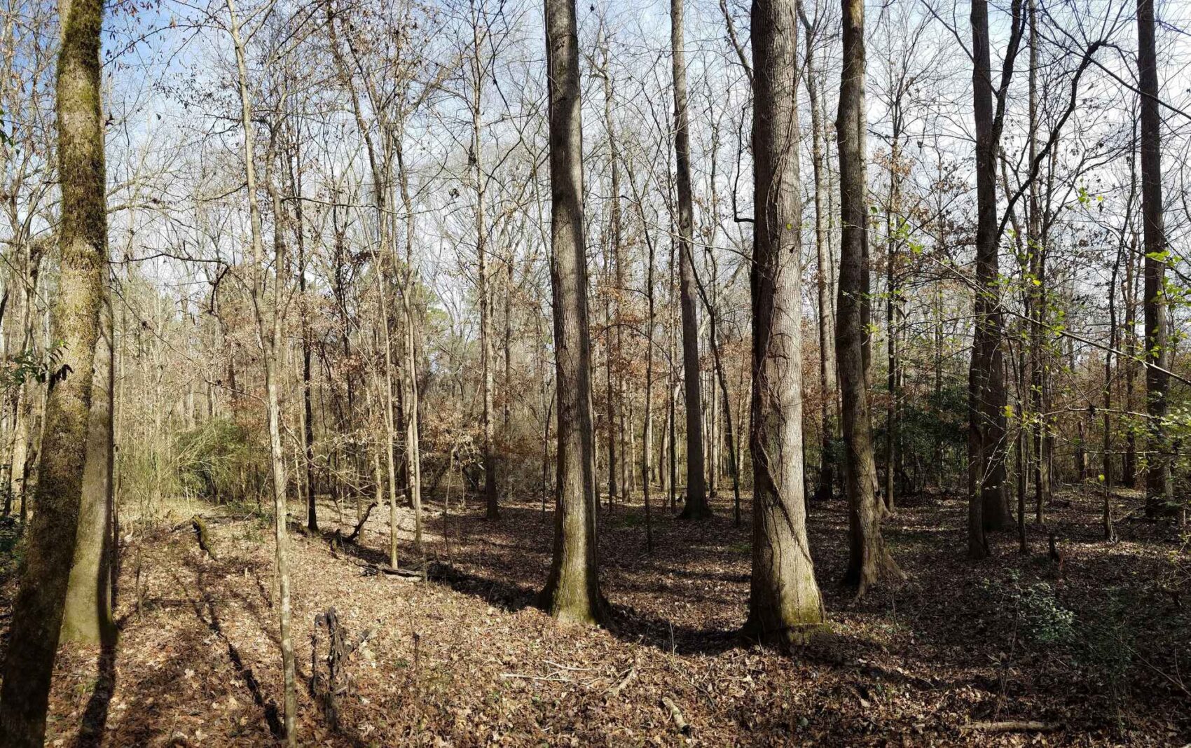
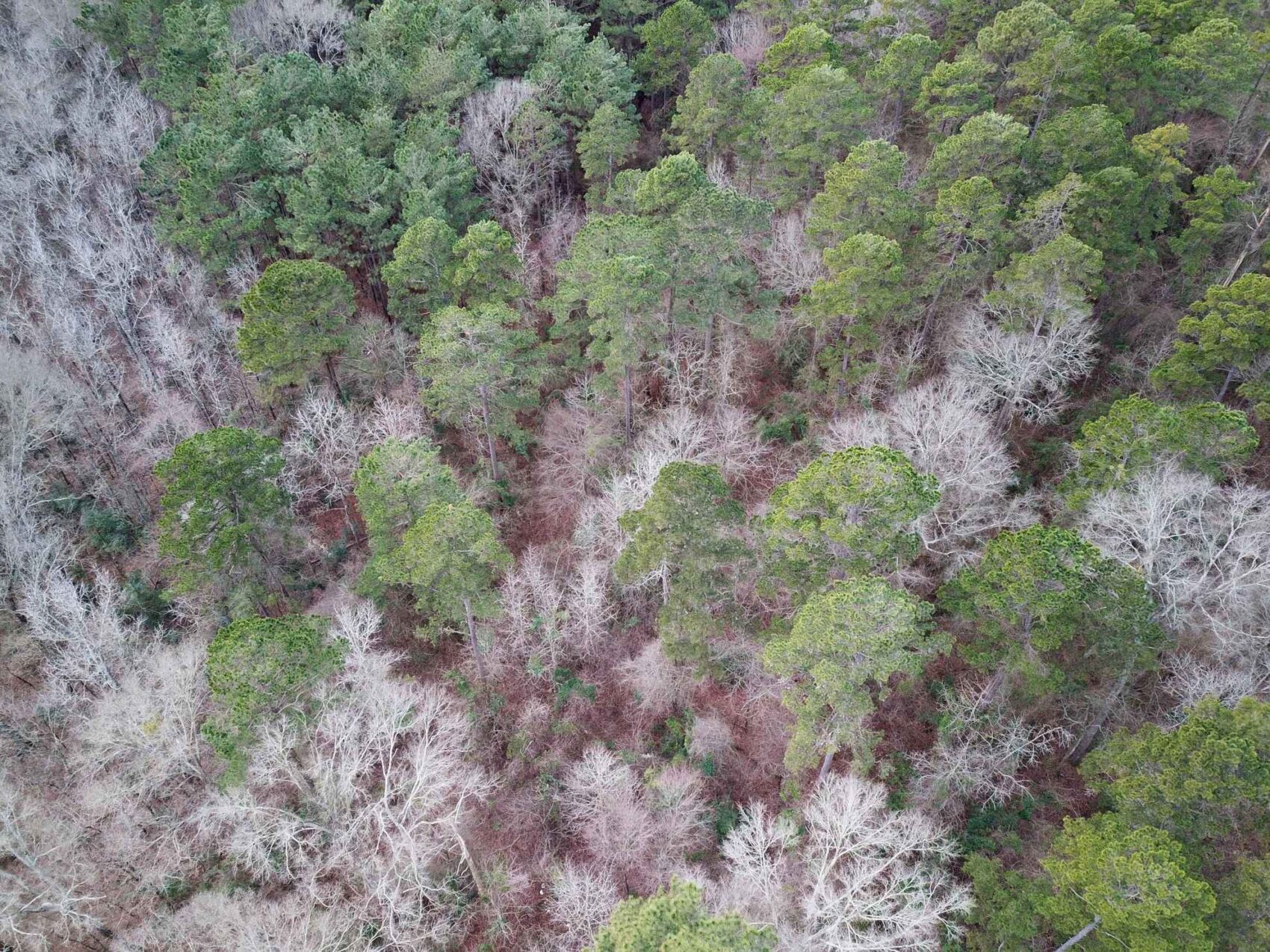
The native forests on this property have a wide assortment of species including loblolly pine, white oak, beech, ash, shortleaf pine, water oak, black oak, sweetgum, southern red oak, American elm, Florida maple, American holly, cherrybark red oak, southern red oak, black cherry, mulberry and hornbeam.
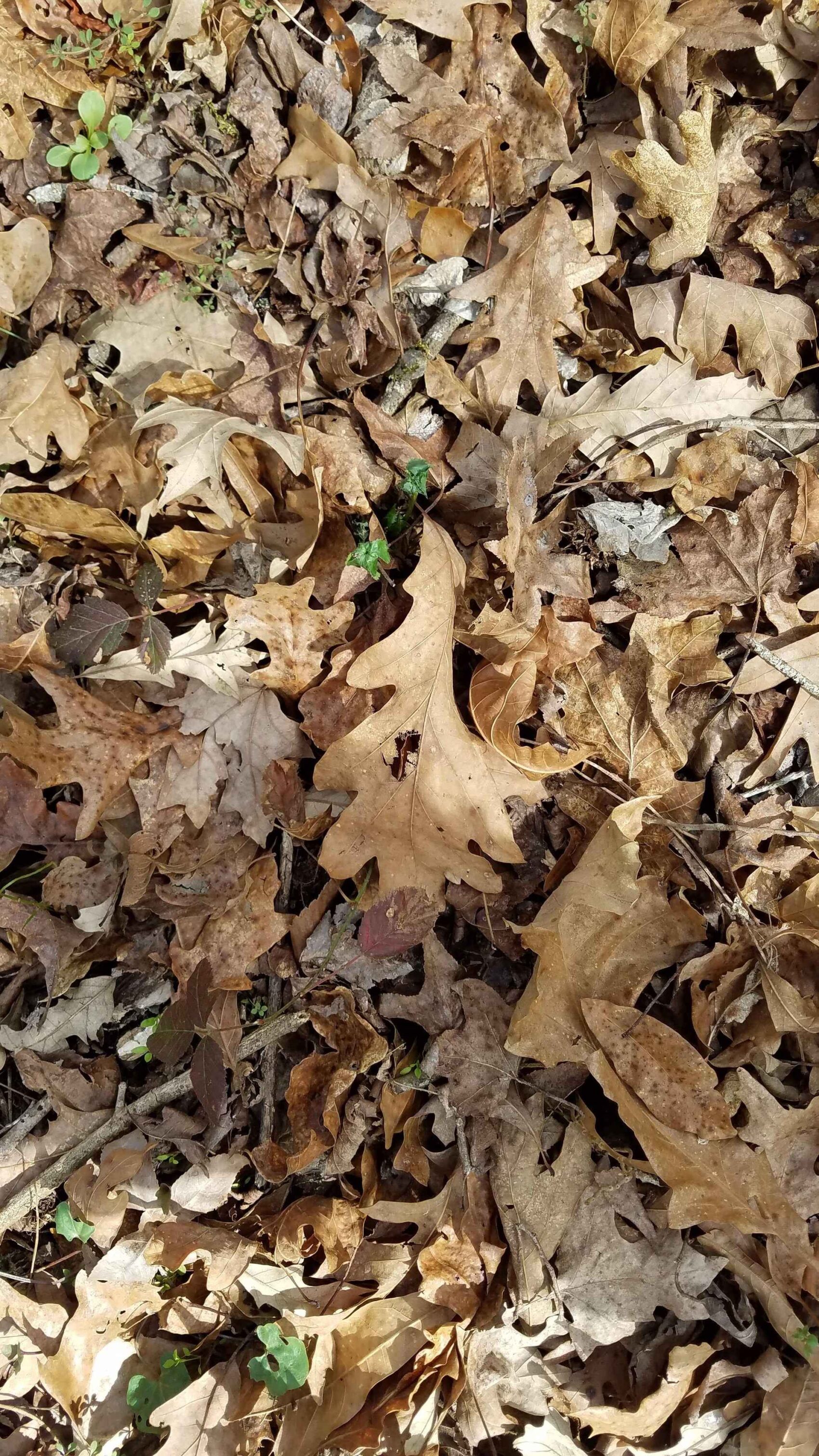
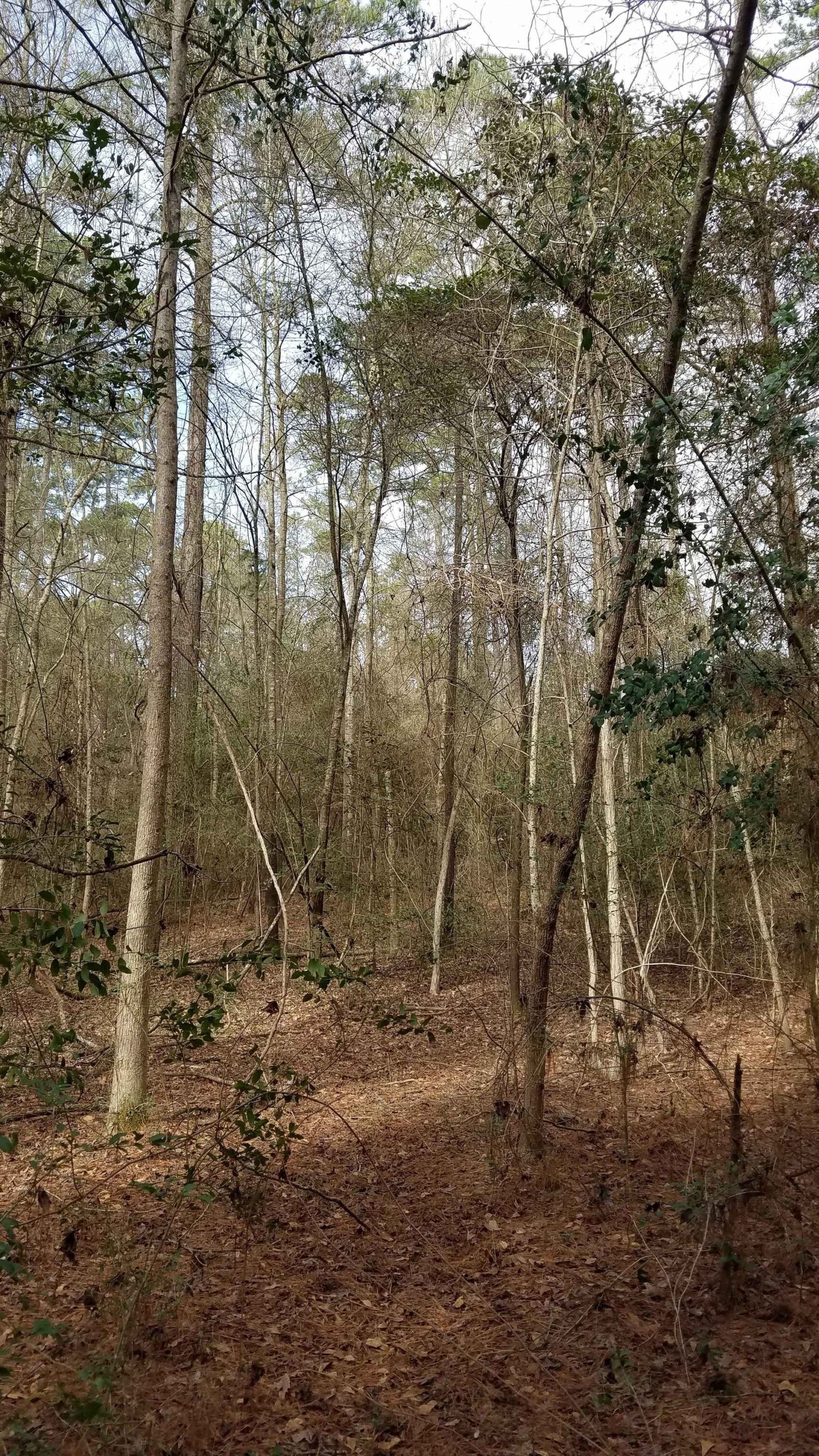
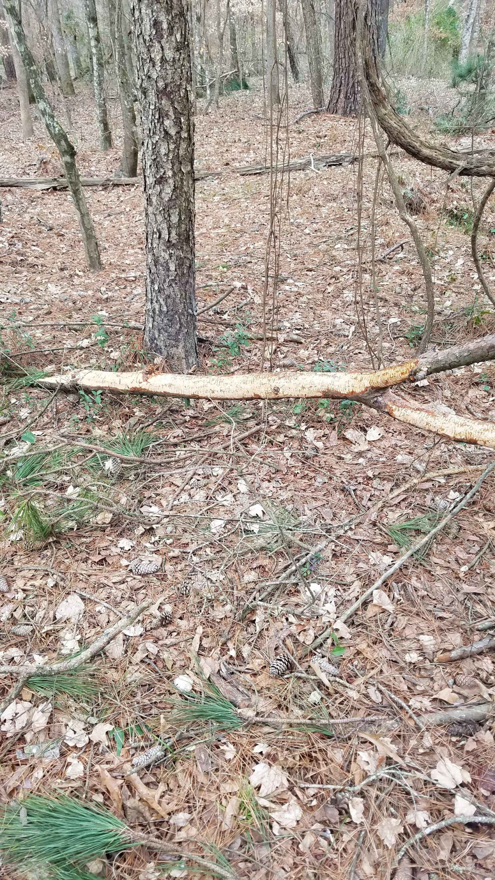
There are small areas holding water on the toe of the hillside that contain blackgum, overcup oak and water hickory. Except in the plantation, the understory is semi- to fully open and is easy to traverse.
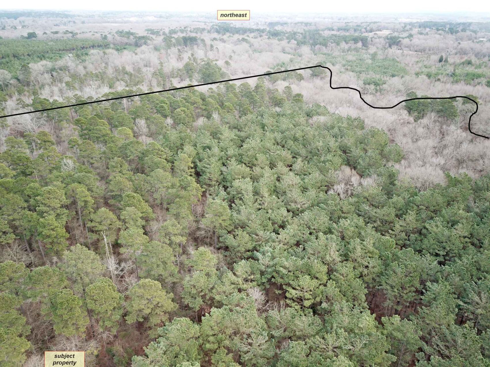
The loamy fine sandy soils are excellent for growing both pine and hardwood. The bottomland Laneville loam soils along Golondrina Creek are supporting an excellent hardwood pine forest. The upland Tenaha loamy fine sand soils appear to have a decent wet-weather timber harvesting capability. The future owner may possibly have several forest management options on this property; an improvement harvest; a total harvest and replant; or allowing the forest to continue to grow for a future timber harvest.
This deed-described 32 acres is offered at $4,300 per acre or $137,600. The boundary lines may possibly require a resurvey for refining the boundary description to modern standards. The Sellers are retaining all owned minerals. No seller financing is available. Hunting equipment such as feeders, trail cameras and blinds are not included in the sale.
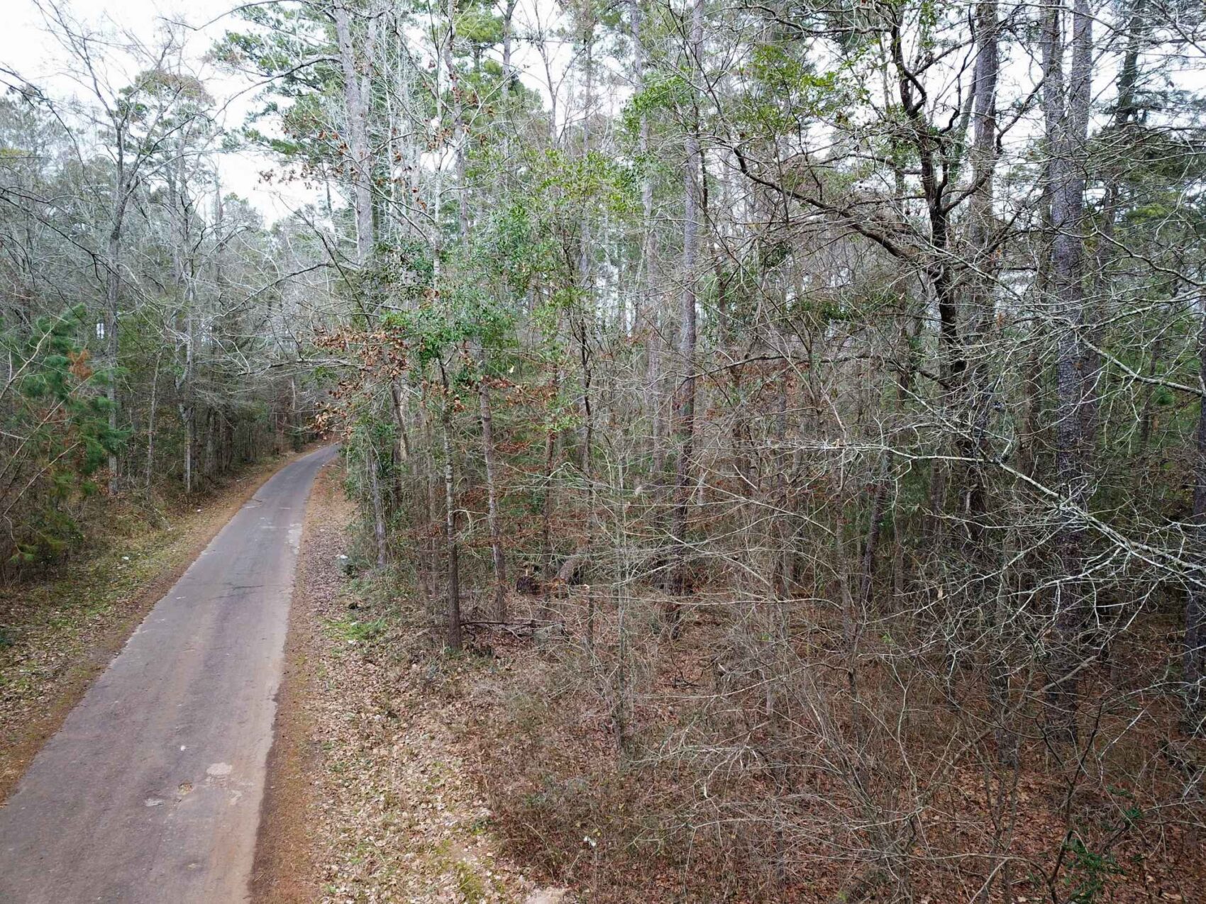
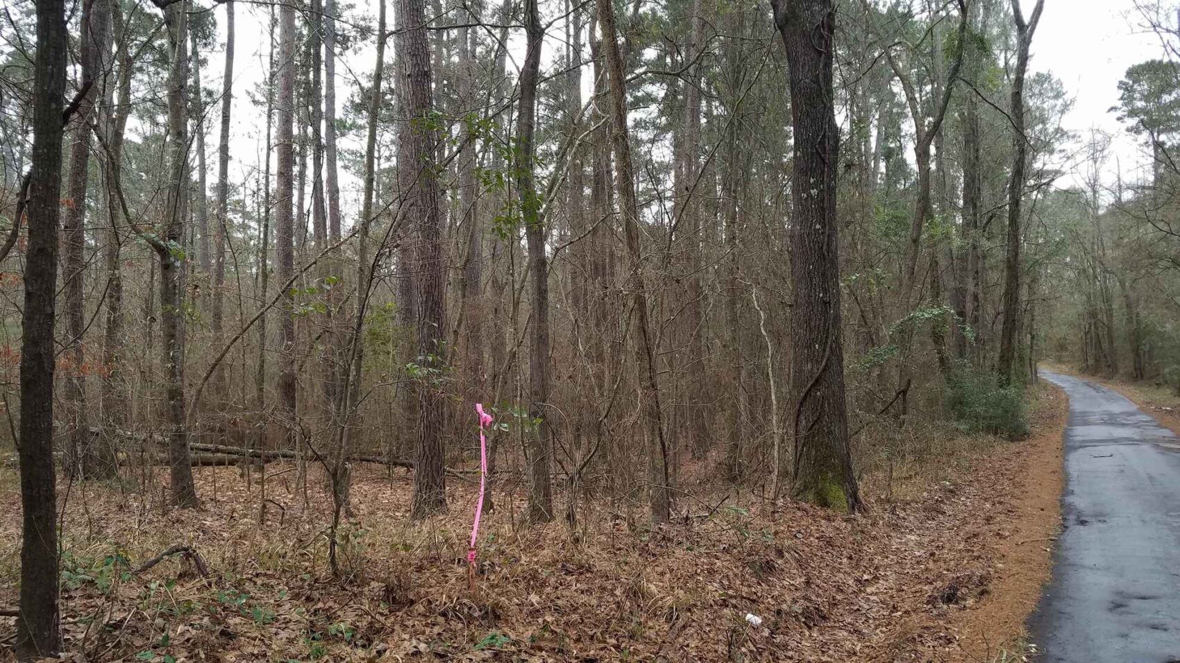
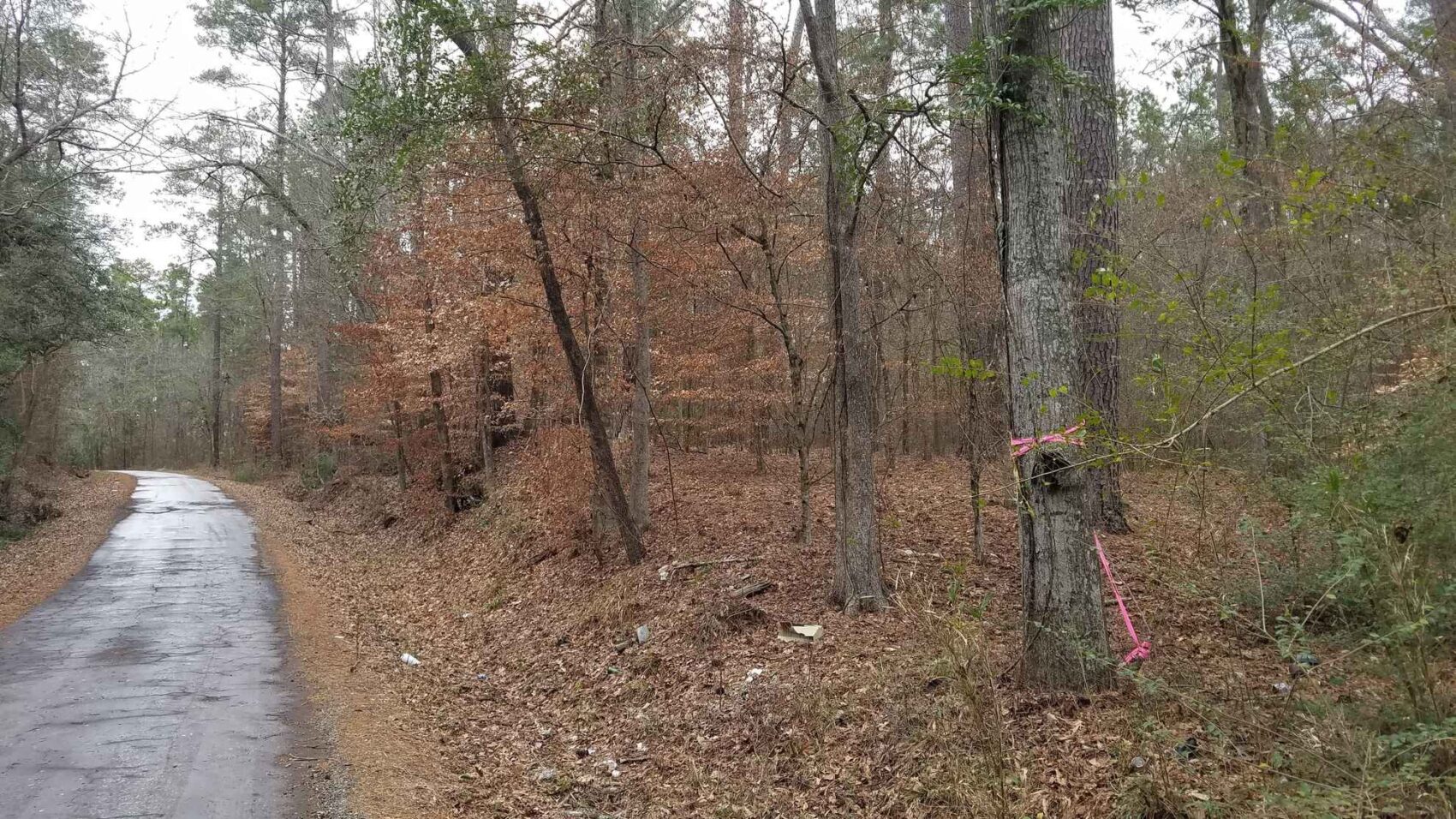
Property boundaries appear to be the county road on the west, old fencing along the south line; it is deed-called to be the eastern bank of Golondrina Creek on the east line, and the north line is old flagging, some old blazes, and a timber type change where the timber on the land to the north was harvested in the past. The apparent northwest and southwest corner markers were located along the eastern side of the county road. No guarantees are made as to the exact location of these boundaries or corners. All provided mapping is based on CAD, GIS aerial photo interpretation using deed call information, and ground checks of Golondrina Creek and the assumed corner and line markers.
This property is currently under Ag/Timber Valuation on the taxes. A rough estimate would be about $125 per year; the appraisal district has inaccurate information concerning this particular parcel.
Electric Power (believed as being Rusk County Electric Coop) is on nearby land to north and south of property.
Approximately 925 feet frontage on east side of County Road 3284.
Residents in the area appear to be on water wells, but land is located within the Arlam Concord Water Supply service area.
Garrison ISD School District.
FEMA floodplain along Golondrina Creek.
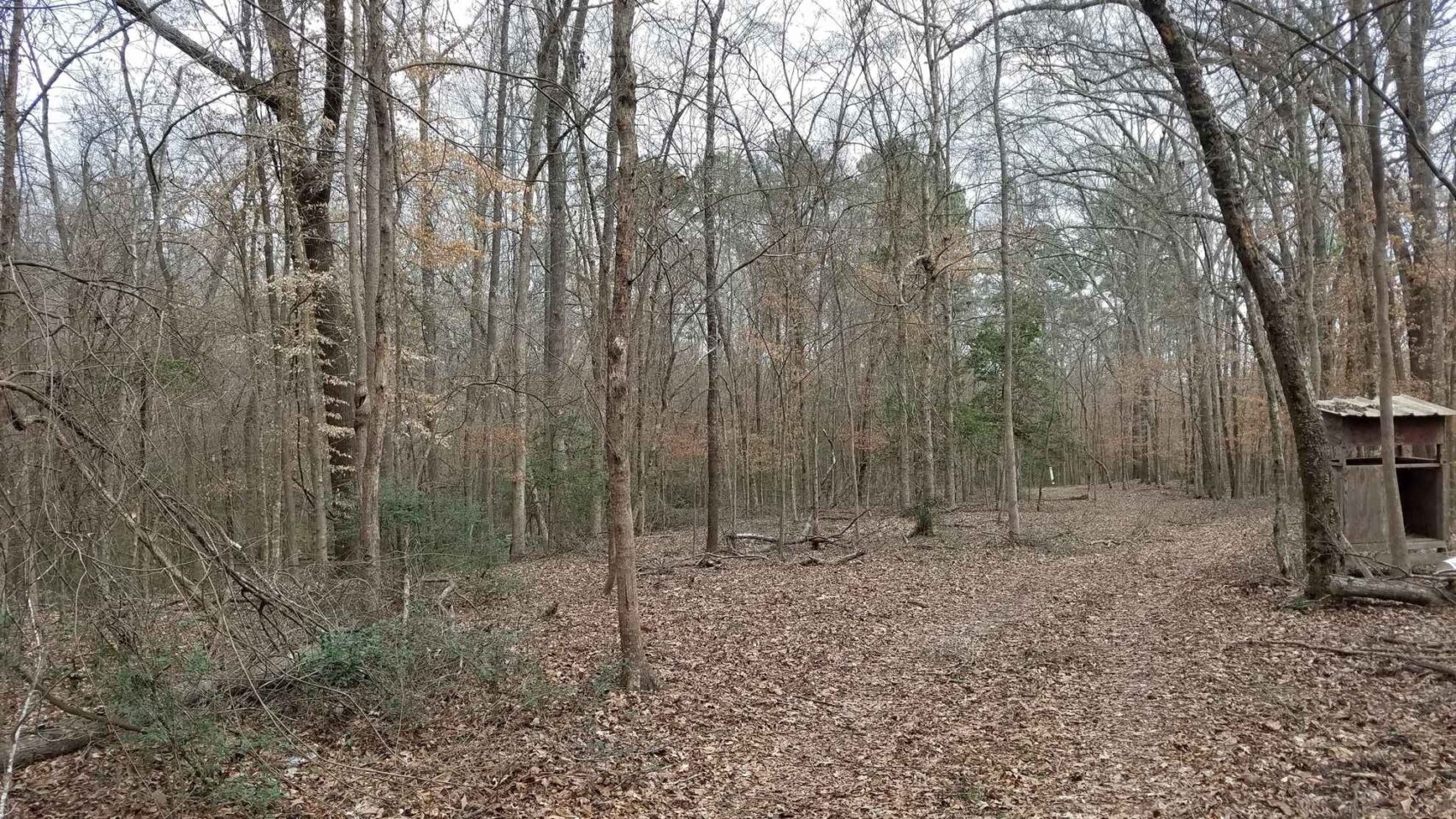
To arrange site visits, please contact listing agent Mark Brian at 936-590-0986, the TerraStone office at 936-590-4909. A registration form will be emailed to you for your review and signing prior to the site visit, and only takes a few minutes on a smart phone or computer. There is a gate into the property on the east side of CR 3284, and access for inspection is available at this location. The lock combination will be provided with the registration. Internal property access is currently one trail/road along the south line to edge of Golondrina Creek, with the remainder being pedestrian.
Buyers agents are required to contact listing agent to arrange site visits and are required to accompany potential buyers at the time of the first visit. Failure to disclose as a buyers agent or lack of presence upon first site visit will result in co-broker compensation being at discretion of listing agent.
TerraStone Land Company strives to gather good information concerning listed properties from reliable sources, but cannot guarantee the accuracy of said data, including but not limited to boundary line locations, acreages, fence lines, tree ages, timber volumes, timber value, legal title, environmental hazards, condition of improvements, legal access, utility services, or site suitability for agricultural or forestry use. All maps are provided for illustrative purposes only and are not survey plats. Unless specifically stated, no formal land surveying by a licensed surveyor has been used in determining acreages. Aerial and ground photography may include neighboring properties that are not included in this offering, and such photography is intended for general use only. TLC recommends that potential buyers examine the offered property to their own satisfaction, and are strongly urged to verify all pertinent facts for themselves. TLC is not responsible for errors, omissions, offering withdrawal or price modifications.
USEFUL DOCUMENTS
Property Map / Directions
From the north, take Hwy 84 east of Mt. Enterprise or west of Timpson: take FM 95 for about 6 miles south off of Hwy 84; turn left (east) on County Road 3282 (a tenth-mile south of the FM 1971 intersection); proceed east 1.4 miles on CR 3282 to its T with CR 3284; then right (south) for .35 miles to the northwest corner of offered parcel on the left (east side). Gate is located about halfway to the southwest corner, also on left (east side) of CR 3284. To access from the south, CR 3282 is located on FM 95 four miles north of Highway 59 in Garrison.
PROPERTY IMAGES

Other Listings
-
 $278,356
+-107.06 Acres - Harrison County, Texas
Acres107.06 CountyHarrison StateTexas -
$1,227,107
1,067 ACRES, McINTOSH COUNTY, OKLAHOMA
Acres1,067.05 CountyMcIntosh StateOklahoma -
$65,000
10.16 ACRES, NACOGDOCHES COUNTY, TEXAS
Acres10.00 CountyNacogdoches StateTexas -
$40,688
10.443 ACRES, SHELBY COUNTY, TEXAS
Acres10.44 CountyShelby StateTexas -
$36,575
10.45 ACRES, NACOGDOCHES COUNTY, TEXAS
Acres10.45 CountyNacogdoches StateTexas -
$30,000
10.928 ACRES, CHEROKEE COUNTY, TEXAS
Acres10.93 CountyCherokee StateTexas -
$429,250
101.0 ACRES, RUSK COUNTY, TEXAS
Acres101.00 CountyRusk StateTexas -
$303,450
101.15 ACRES, HARRISON - PANOLA COUNTY
Acres101.15 CountyPanola StateTexas -
106.0 ACRES, SABINE COUNTY, TEXAS
Acres0.00 County State -
$233,200
106.0 ACRES, SABINE COUNTY, TEXAS
Acres106.00 CountySabine StateTexas -
$231,575
107 ACRES, NACOGDOCHES COUNTY, TEXAS
Acres107.00 CountyNacogdoches StateTexas -
$305,424
113.12 ACRES, SABINE COUNTY, TEXAS
Acres113.12 CountySabine StateTexas -
$295,000
118.0 ACRES, NACOGDOCHES COUNTY, TEXAS
Acres118.00 CountyNacogdoches StateTexas -
$72,000
12.0 ACRES, RUSK COUNTY, TEXAS
Acres12.00 CountyRusk StateTexas -
$146,400
12.2 Acres Red River County, Texas
Acres12.20 CountyRed River StateTexas -
$133,350
12.7 Acres Red River County, Texas
Acres12.70 CountyRed River StateTexas -
$175,000
120 ACRES, CASS COUNTY, TEXAS
Acres120.00 CountyCass StateTexas -
$340,000
132.081 ACRES, SHELBY COUNTY, TEXAS
Acres132.08 CountyShelby StateTexas -
$343,000
133.47 ACRES, PANOLA COUNTY, TEXAS
Acres133.47 CountyPanola StateTexas -
$398,250
135 ACRES, NACOGDOCHES COUNTY, TEXAS
Acres135.00 CountyNacogdoches StateTexas -
$890,500
137.0 ACRES, ANDERSON COUNTY, TEXAS
Acres137.00 CountyAnderson StateTexas -
$148,050
14.1 Acres Red River County, Texas
Acres14.10 CountyRed River StateTexas -
$375,000
140.0 ACRES, SHELBY COUNTY, TEXAS
Acres140.00 CountyShelby StateTexas -
$455,008
154.24 ACRES, RUSK COUNTY, TEXAS
Acres154.24 CountyRusk StateTexas -
$578,380
156 ACRES, NACOGDOCHES COUNTY, TEXAS
Acres156.00 CountyNacogdoches StateTexas -
$99,900
16.0 ACRES NACOGDOCHES COUNTY, TX Lot 5
Acres16.00 CountyNacogdoches StateTexas -
$99,900
16.0 ACRES, NACOGDOCHES COUNTY, TEXAS
Acres16.00 CountyNacogdoches StateTexas -
$143,650
16.9 Acres Red River County, Texas
Acres16.90 CountyRed River StateTexas -
$420,605
162.71 ACRES, ANGELINA COUNTY, TEXAS
Acres162.70 CountyAngelina StateTexas -
$449,500
167.50 ACRES, SHELBY COUNTY, TEXAS
Acres167.50 CountyShelby StateTexas -
$380,250
169.0 ACRES, HARDIN COUNTY, TEXAS
Acres169.00 CountyHardin StateTexas -
$30,600
17.0 ACRES, RUSK COUNTY, TEXAS
Acres17.00 CountyRusk StateTexas -
$317,330
171.53 ACRES, PANOLA COUNTY, TEXAS
Acres171.53 CountyPanola StateTexas -
$689,936
172.7 Acres Nacogdoches County Texas
Acres172.70 CountyNacogdoches StateTexas -
$347,812
178.0 ACRES, SHELBY COUNTY, TX
Acres178.00 CountyShelby StateTexas -
$72,000
18.0 ACRES, TYLER COUNTY, TX
Acres18.00 CountyTyler StateTexas -
$729,000
183 ACRES, UPSHUR COUNTY, TX
Acres183.00 CountyUpshur StateTexas -
$294,006
184.33 ACRES, CADDO PARISH, LOUISIANA
Acres184.33 CountyCaddo StateLouisiana -
$482,250
196 ACRES, BIENVILLE PARISH, LOUISIANA
Acres196.00 CountyBienville StateLouisiana -
$179,000
20.4 ACRES, NACOGDOCHES COUNTY, TEXAS
Acres20.40 CountyNacogdoches StateTexas -
$217,350
20.7 Acres Red River County, Texas
Acres20.70 CountyRed River StateTexas -
$1,063,233
200.61 ACRES, SHELBY COUNTY, TEXAS
Acres200.61 CountyShelby StateTexas -
$155,000
21.4492 Acres, Trinity County, Texas
Acres21.45 CountyTrinity StateTexas -
218 ACRES, CADDO PARISH, LOUISIANA
Acres0.00 County State -
$520,000
218 ACRES, CADDO PARISH, LOUISIANA
Acres218.00 CountyCaddo StateLouisiana -
$135,660
22.61 acres in Rusk County, Texas
Acres22.61 CountyRusk StateTexas -
$314,580
226.6 ACRES, ALLEN PARISH, LOUISIANA
Acres226.60 CountyAllen StateLouisiana -
$599,500
231.87 ACRES, CASS COUNTY, TEXAS
Acres231.87 CountyCass StateTexas -
$120,000
24.86 Acres, Shelby County, TX
Acres24.86 CountyShelby StateTexas -
$1,116,000
248 acres in Nacogdoches County, Texas
Acres248.00 CountyNacogdoches StateTexas -
$91,505
25.070 ACRES, PANOLA COUNTY, TEXAS
Acres25.07 CountyPanola StateTexas -
$332,735
25.595 ACRES, ANGELINA COUNTY, TEXAS
Acres25.60 CountyAngelina StateTexas -
$179,000
26.13 Acres San Augustine County
Acres26.13 CountySan Augustine StateTexas -
$576,555
289.03 ACRES, CHEROKEE COUNTY, TEXAS
Acres289.03 CountyCherokee StateTexas -
$575,000
293.479 ACRES, PANOLA COUNTY, TEXAS
Acres293.47 CountyPanola StateTexas -
$7,900,000
3,160.58 ACRES, AR, LA, OK
Acres3,160.58 CountyUnion StateArkansas -
$55,500
3.48 ACRES, SMITH COUNTY, TX
Acres3.48 CountySmith StateTexas -
$195,000
30 Acres, Nacogdoches County, Texas
Acres30.00 CountyNacogdoches StateTexas -
$258,000
30.0 ACRES, SHELBY COUNTY, TEXAS
Acres30.00 CountyShelby StateTexas -
$102,204
30.06 ACRES, SABINE COUNTY, TEXAS
Acres30.06 CountySabine StateTexas -
$89,900
30.414 Acres, NACOGDOCHES COUNTY, TEXAS
Acres30.41 CountyNacogdoches StateTexas -
$795,000
315.0 ACRES, JEFFERSON COUNTY, TEXAS
Acres315.00 CountyJefferson StateTexas -
$137,600
32 ACRES, RUSK COUNTY, TEXAS
Acres32.00 CountyRusk StateTexas -
$246,000
32.8 Acres Red River County, Texas
Acres32.80 CountyRed River StateTexas -
$1,195,000
340.63 ACRES, PANOLA COUNTY, TEXAS
Acres340.63 CountyPanola StateTexas -
$122,500
35.0 ACRES CHEROKEE COUNTY, TX
Acres35.00 CountyCherokee StateTexas -
$180,025
37.9 ACRES NORTH PARCEL SHELBY COUNTY, TEXAS
Acres37.90 CountyShelby StateTexas -
$175,500
39 ACRES SOUTH PARCEL SHELBY COUNTY, TEXAS
Acres39.00 CountyShelby StateTexas -
$114,811
39.59ac HARRISON COUNTY, TX
Acres39.59 CountyHarrison StateTexas -
$1,160,000
392.68 Acres, Upshur County, Texas
Acres392.68 CountyUpshur StateTexas -
$75,885
40.35 ACRES, PANOLA COUNTY, TEXAS
Acres40.35 CountyPanola StateTexas -
$1,200,000
435 ACRES, BEXAR COUNTY, TEXAS
Acres435.00 CountyBexar StateTexas -
$127,861
44.09 ACRES, NACOGDOCHES COUNTY, TEXAS
Acres44.09 CountyNacogdoches StateTexas -
$291,200
44.8 Acres Red River County, Texas
Acres44.80 CountyRed River StateTexas -
$226,000
46 Acres, Nacogdoches County, Texas
Acres46.00 CountyNacogdoches StateTexas -
$225,500
46.0 ACRES, RUSK COUNTY, TEXAS
Acres46.00 CountyRusk StateTexas -
$117,500
47 ACRES, RUSK COUNTY, TEXAS
Acres47.00 CountyRusk StateTexas -
$289,100
49.0 ACRES, RUSK COUNTY, TEXAS
Acres49.00 CountyRusk StateTexas -
$2,972,730
495.455 Acres, Smith County, Texas
Acres495.45 CountyTexas StateTexas -
$30,000
5.62 ACRES, CHEROKEE COUNTY, TEXAS
Acres5.62 CountyCherokee StateTexas -
$640,000
507 ACRES, YELL COUNTY, ARKANSAS
Acres507.06 CountyYell StateArkansas -
$201,630
51.7 Acres, Rusk County, Texas
Acres51.70 CountyRusk StateTexas -
$1,754,695
527.758 ACRES, SMITH COUNTY, TEXAS
Acres527.75 CountySmith StateTexas -
$202,550
54 ACRES, RUSK COUNTY, TEXAS
Acres54.00 CountyRusk StateTexas -
$170,163
54.02 ACRES, SABINE COUNTY, TEXAS
Acres54.02 CountySabine StateTexas -
$178,230
54.84 ACRES, NACOGDOCHES COUNTY, TEXAS
Acres54.84 CountyNacogdoches StateTexas -
$156,790
55.5 ACRES, HOUSTON COUNTY, TEXAS
Acres55.50 CountyHouston StateTexas -
$156,800
56 ACRES, RUSK COUNTY, TEXAS
Acres56.00 CountyRusk StateTexas -
$131,600
56.0 ACRES, NACOGDOCHES COUNTY, TEXAS
Acres56.00 CountyNacogdoches StateTexas -
Contact for Price
56.889 ACRES, LAFAYETTE COUNTY, ARKANSAS
Acres56.89 CountyLafayette StateArkansas -
$1,562,000
568 ACRES, NACOGDOCHES COUNTY, TEXAS
Acres568.00 CountyNacogdoches StateTexas -
$165,528
58.08 ACRES, SABINE COUNTY, TEXAS
Acres58.08 CountySabine StateTexas -
$194,000
58.6 ACRES CAMP COUNTY, TEXAS
Acres58.60 CountyCamp StateTexas -
$218,230
59.06 ACRES (TR #10), NACOGDOCHES COUNTY, TEXAS
Acres59.06 CountyNacogdoches StateTexas -
$259,000
61.94 ACRES, HARDIN COUNTY, TEXAS
Acres61.94 CountyHardin StateTexas -
$180,648
62.4 Acres, Nacogdoches County, Texas
Acres62.40 CountyNacogdoches StateTexas -
$329,490
62.76 Acres Trawick, Nacogdoches County TX
Acres62.76 CountyNacogdoches StateTexas -
$185,075
67.3 ACRES, PANOLA COUNTY, TEXAS
Acres67.30 CountyPanola StateTexas -
$180,200
68 ACRES, NEWTON COUNTY, TEXAS
Acres68.00 CountyNewton StateTexas -
$239,900
69.358 ACRES PANOLA COUNTY, TX
Acres69.35 CountyPanola StateTexas -
$75,000
7.74 Acres Nacogdoches County, Texas
Acres7.74 CountyNacogdoches StateTexas -
$298,715
70.286 ACRES, PANOLA COUNTY, TEXAS
Acres70.28 CountyPanola StateTexas -
$308,975
72.7 ACRES. RUSK COUNTY, TEXAS
Acres72.70 CountyRusk StateTexas -
$215,000
74.0 ACRES, PANOLA COUNTY, TEXAS
Acres74.00 CountyPanola StateTexas -
$283,513
76.265 ACRES, SHELBY COUNTY, TEXAS
Acres76.27 CountyShelby StateTexas -
$3,995,000
803 ACRES, POLK COUNTY, TEXAS
Acres803.00 CountyPolk StateTexas -
$277,675
81.6 ACRES, DESOTO PARISH, LOUISIANA
Acres81.60 CountyDe Soto StateLouisiana -
$215,200
82.73 ACRES, CASS COUNTY, TEXAS
Acres82.73 CountyCass StateTexas -
$572,000
88.0 ACRES, GREGG COUNTY, TEXAS
Acres88.00 CountyGregg StateTexas -
$220,000
88.0 ACRES, RUSK COUNTY, TEXAS
Acres88.00 CountyRusk StateTexas -
$799,000
88.54 ACRES, BEAUREGARD PARISH, LOUISIANA
Acres88.54 CountyBeauregard StateLouisiana -
$459,000
88.54 ACRES, NACOGDOCHES COUNTY, TEXAS
Acres88.54 CountyNacogdoches StateTexas -
$220,500
90 ACRES, CLAIBORNE PARISH, LOUISIANA
Acres90.00 CountyClaiborne StateLouisiana -
$258,132
92.19 ACRES, RUSK COUNTY, TEXAS
Acres92.19 CountyRusk StateTexas -
$124,371
95.67 ACRES, ALLEN PARISH, LOUISIANA
Acres95.67 CountyAllen StateLouisiana -
$336,000
96.0 ACRES (Tract A&B) NACOGDOCHES COUNTY, TX
Acres96.00 CountyNacogdoches StateTexas -
$496,740
97.4 ACRES, SABINE COUNTY, TEXAS
Acres97.40 CountySabine StateTexas -
$178,200
99 ACRES, TYLER COUNTY, TEXAS
Acres99.00 CountyTyler StateTexas -
$800,000
99.49 ACRES, NACOGDOCHES COUNTY, TEXAS
Acres99.49 CountyNacogdoches StateTexas -
$297,505
99.5 Acres, Panola County, Texas
Acres99.50 CountyPanola StateTexas -
$174,635
CROSSROADS 53 ACRES, NACOGDOCHES COUNTY, TEXAS
Acres53.00 CountyNacogdoches StateTexas -
$535,920
GARRETT WEST 154 ACRES, NACOGDOCHES COUNTY, TEXAS
Acres154.00 CountyNacogdoches StateTexas -
$47,900
PRICE IMPROVEMENT - 6.39 ACRES, RUSK COUNTY, TEXAS
Acres6.39 CountyRusk StateTexas -
$163,845
UPDATED - 64.506 ACRES, CASS COUNTY, TEXAS
Acres64.51 CountyCass StateTexas
Contact Us About This Property
Call us at (936) 590-4909, email us at info@terrastonelandco.com or use the contact form below.