

172.7 Acres Nacogdoches County Texas
Sold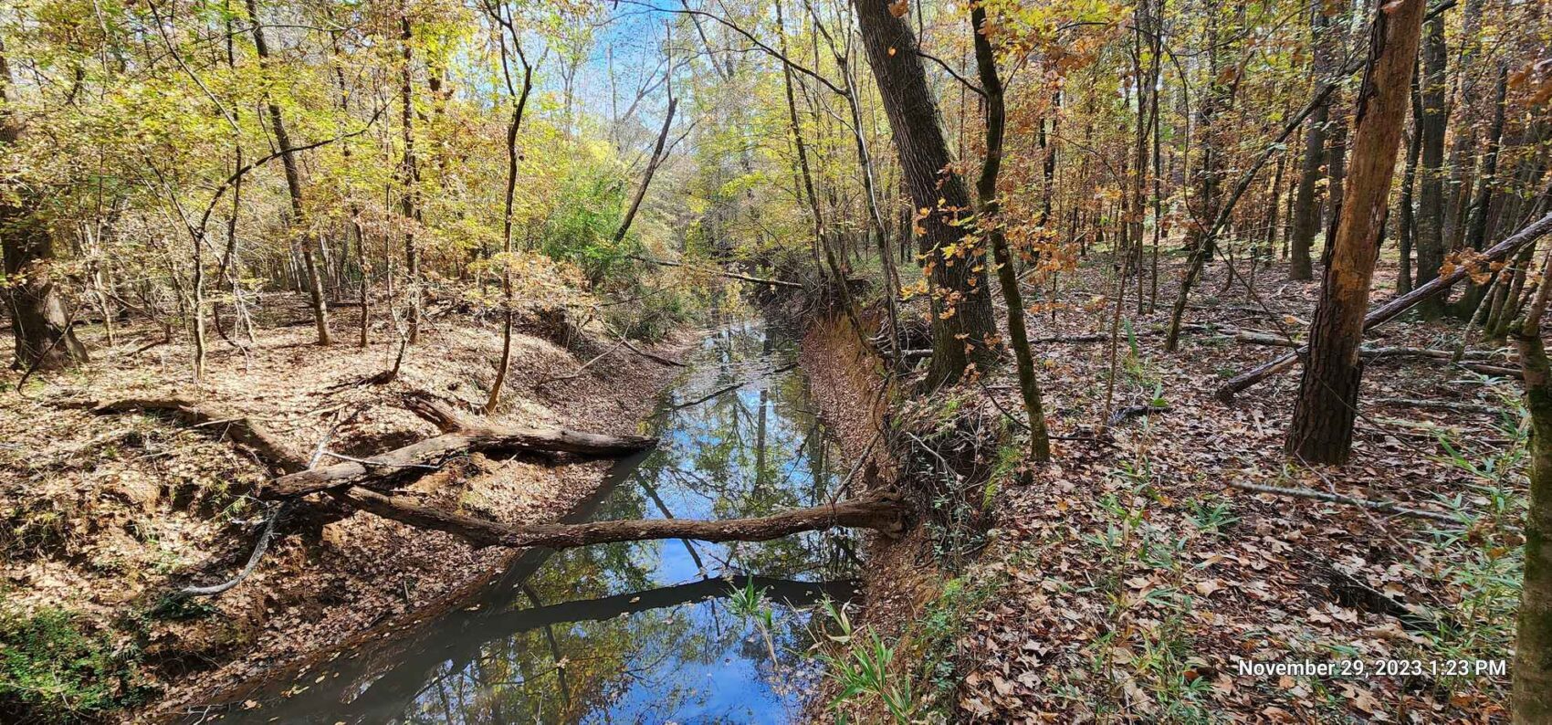
PROPERTY DETAILS
- Price:$689,936
- Type:Hunting Land, Recreational Property, Timberland
- Address:County Road 841
- Acres:173
- County:Nacogdoches
- City:Nacogdoches
- Status:Sold
- State:Texas
- Zip:75961
PROPERY DESCRIPTION
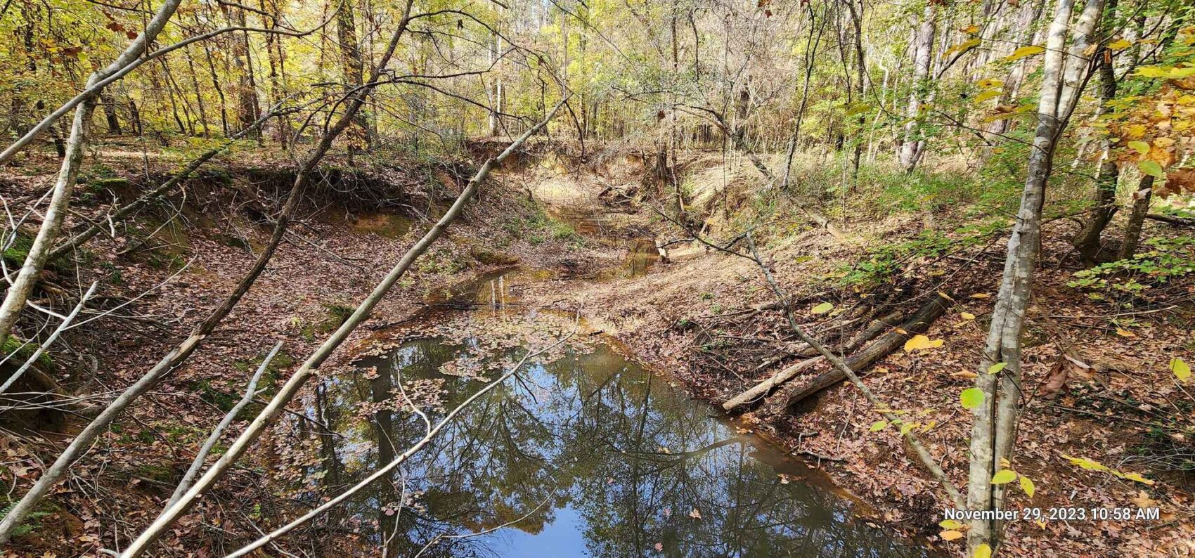
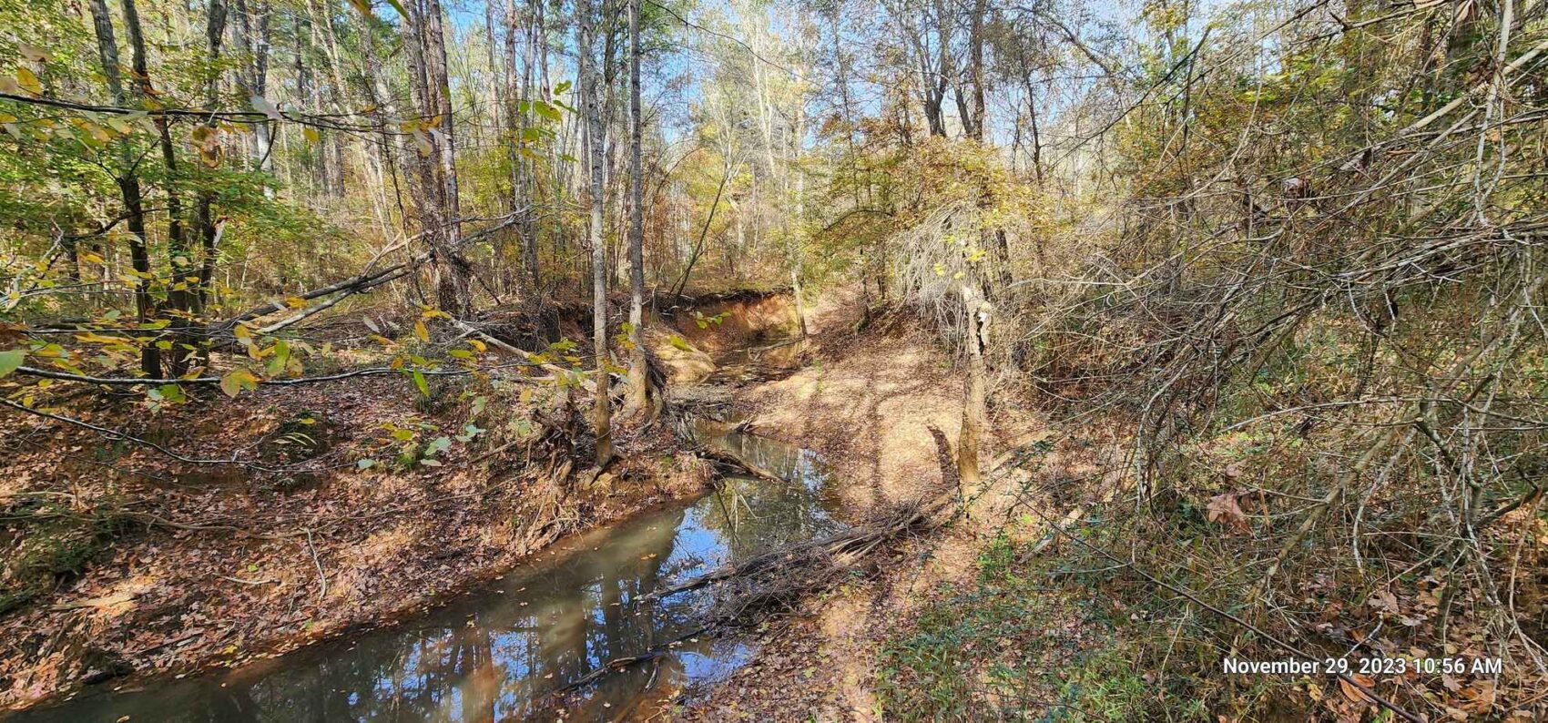
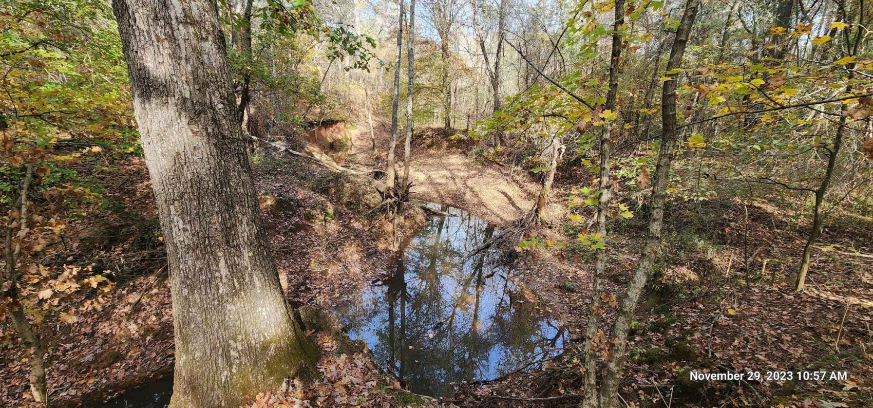
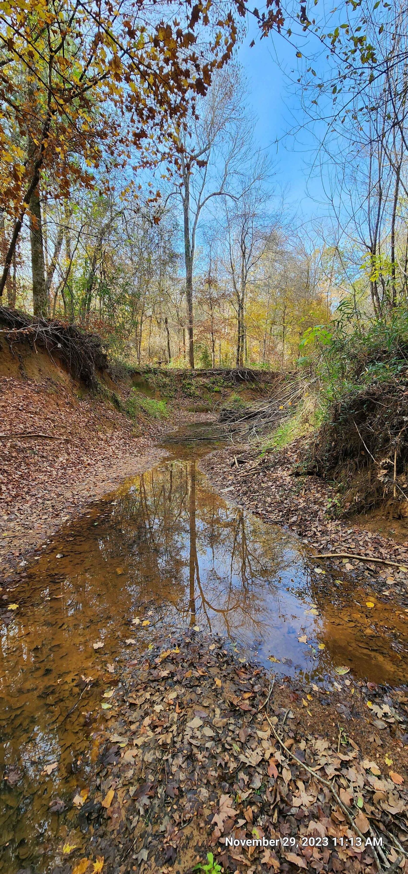
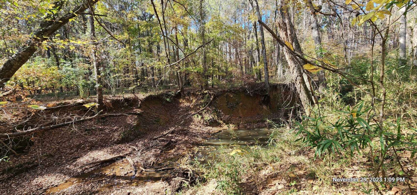
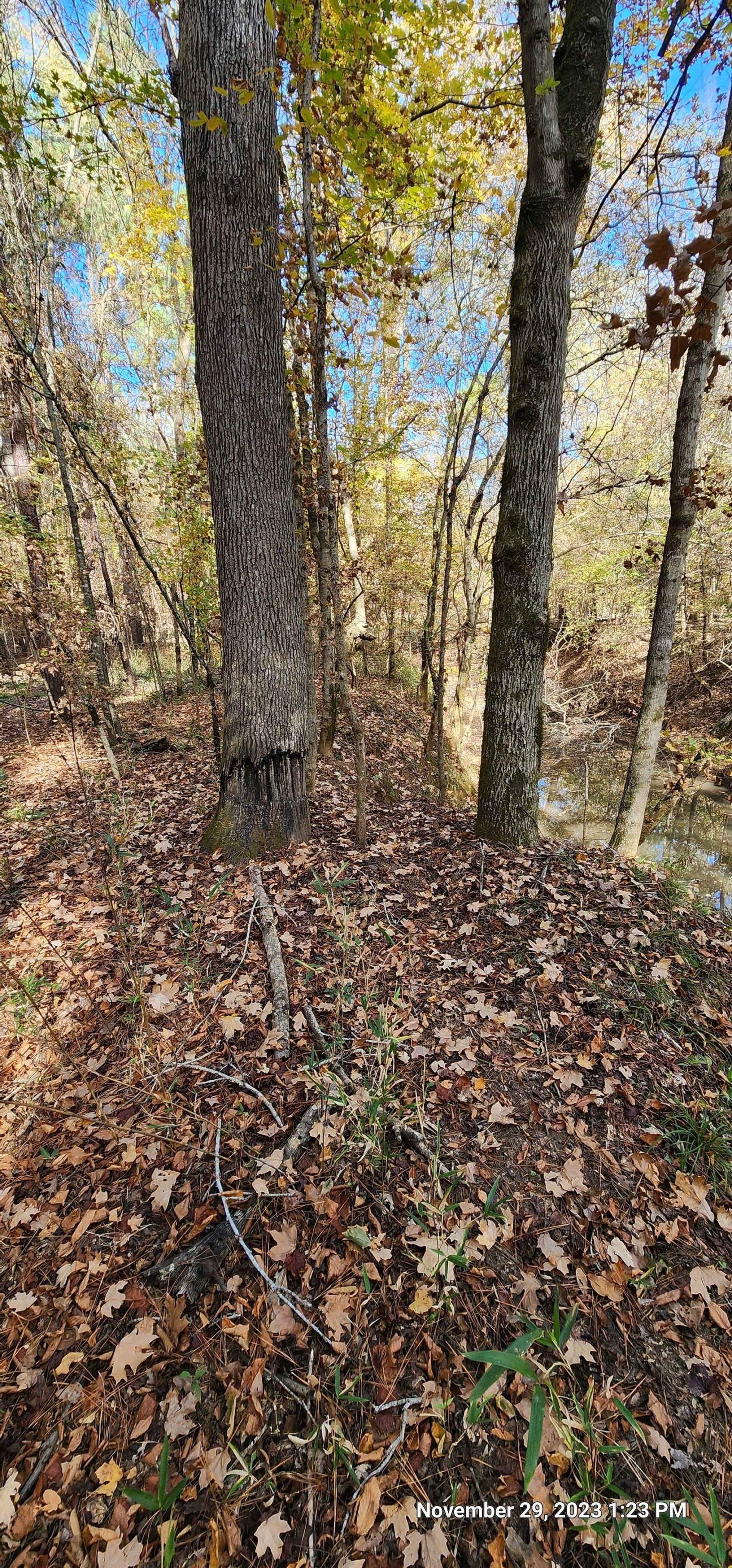
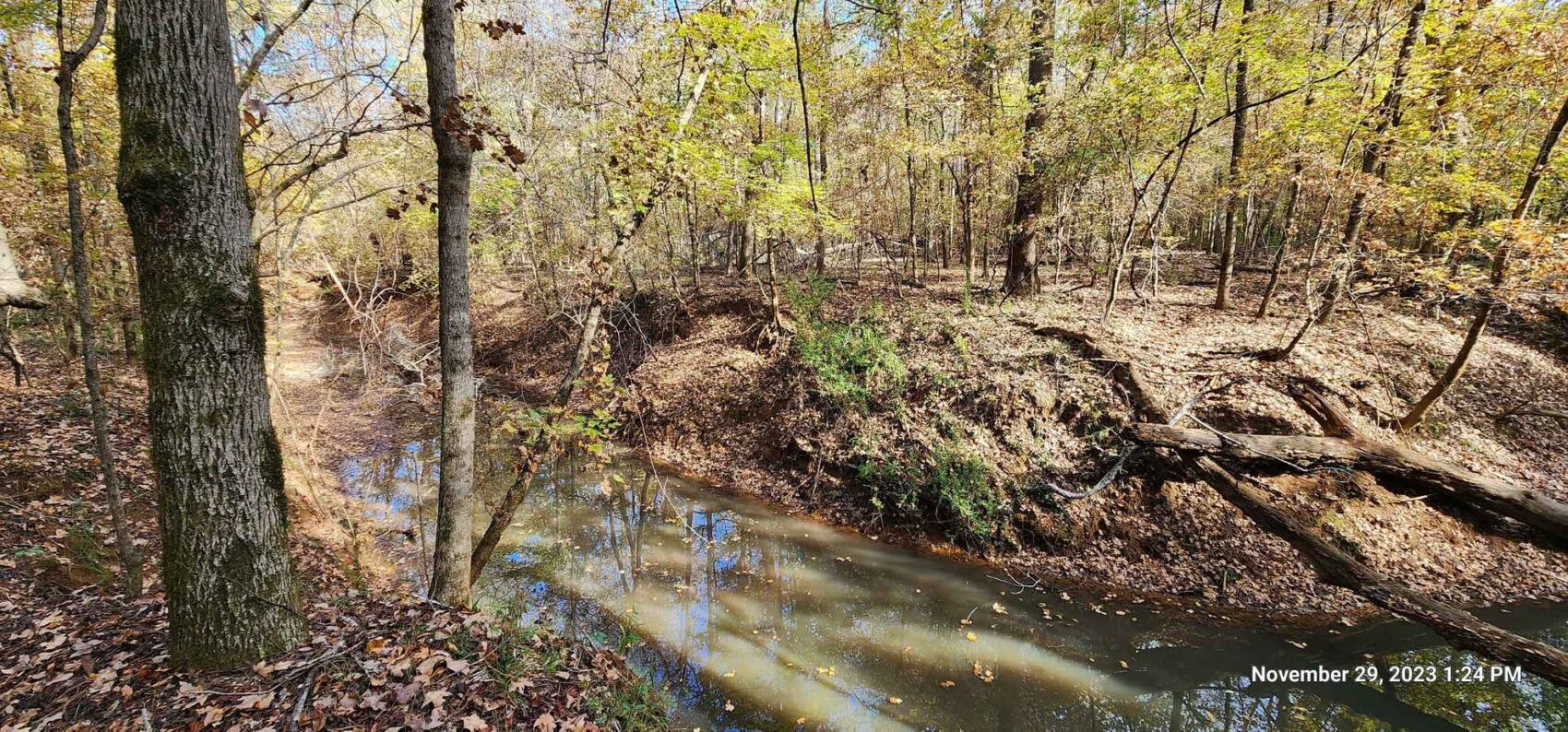
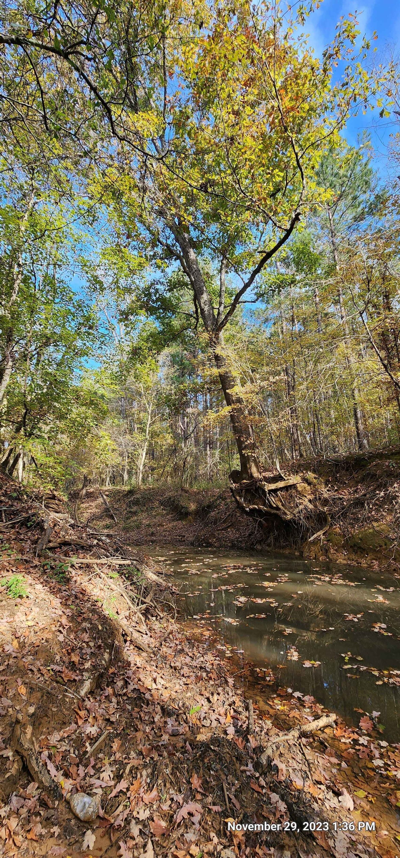
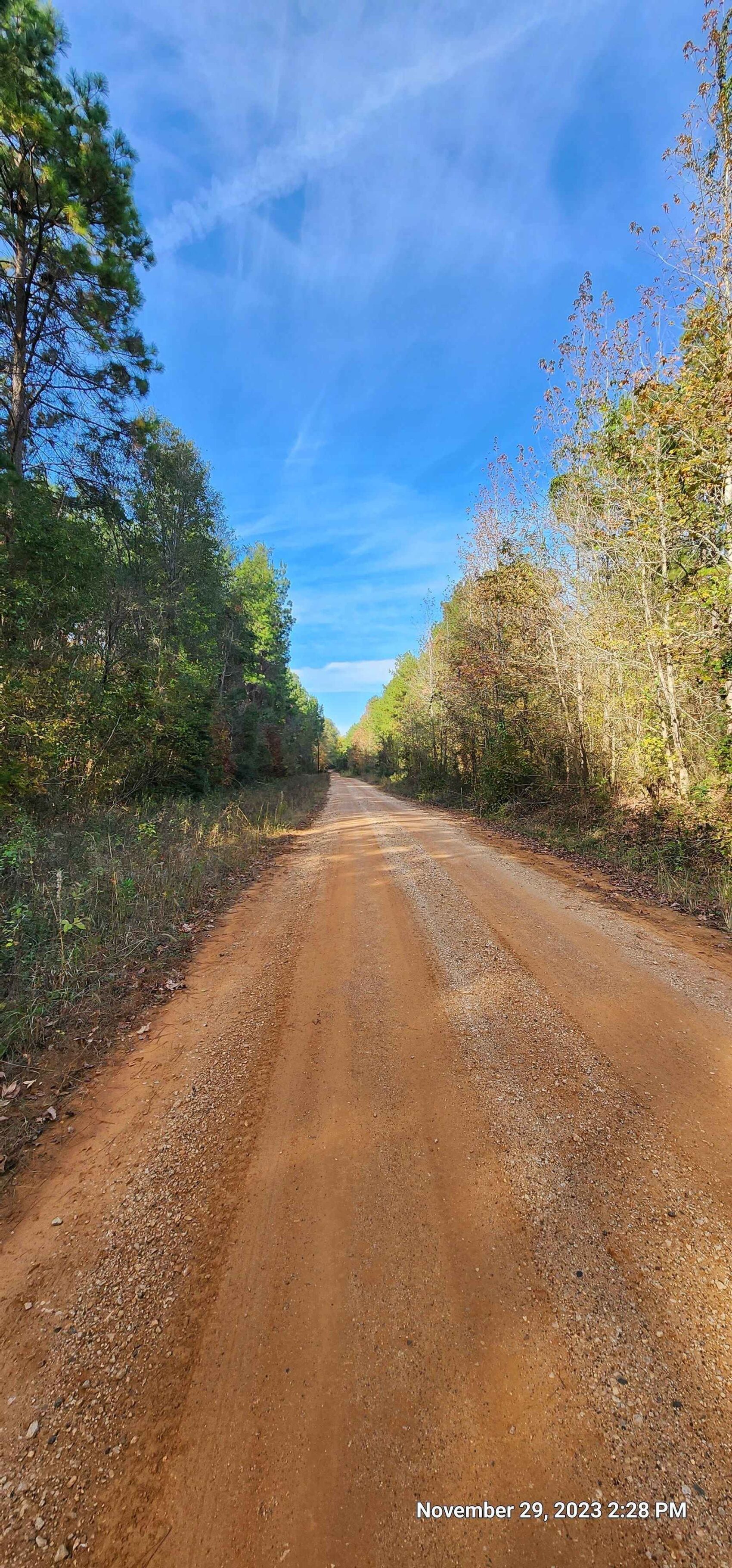
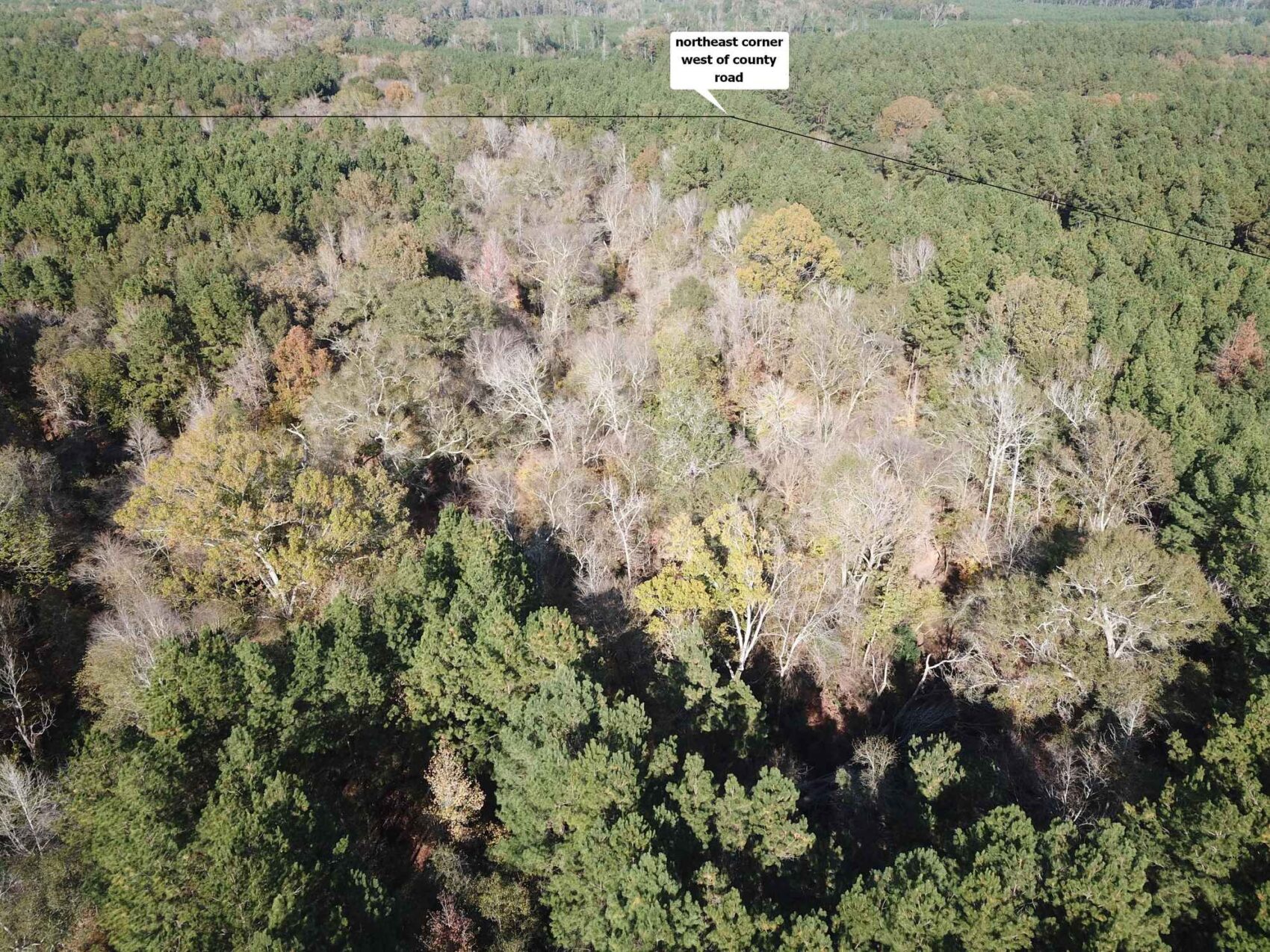
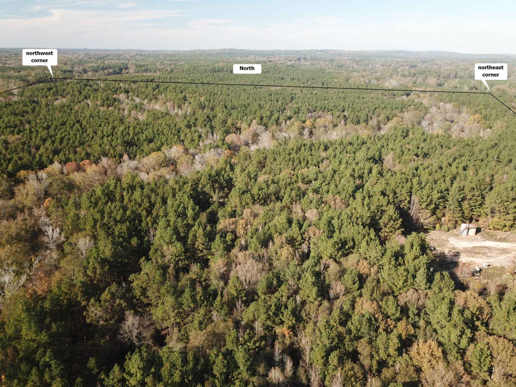
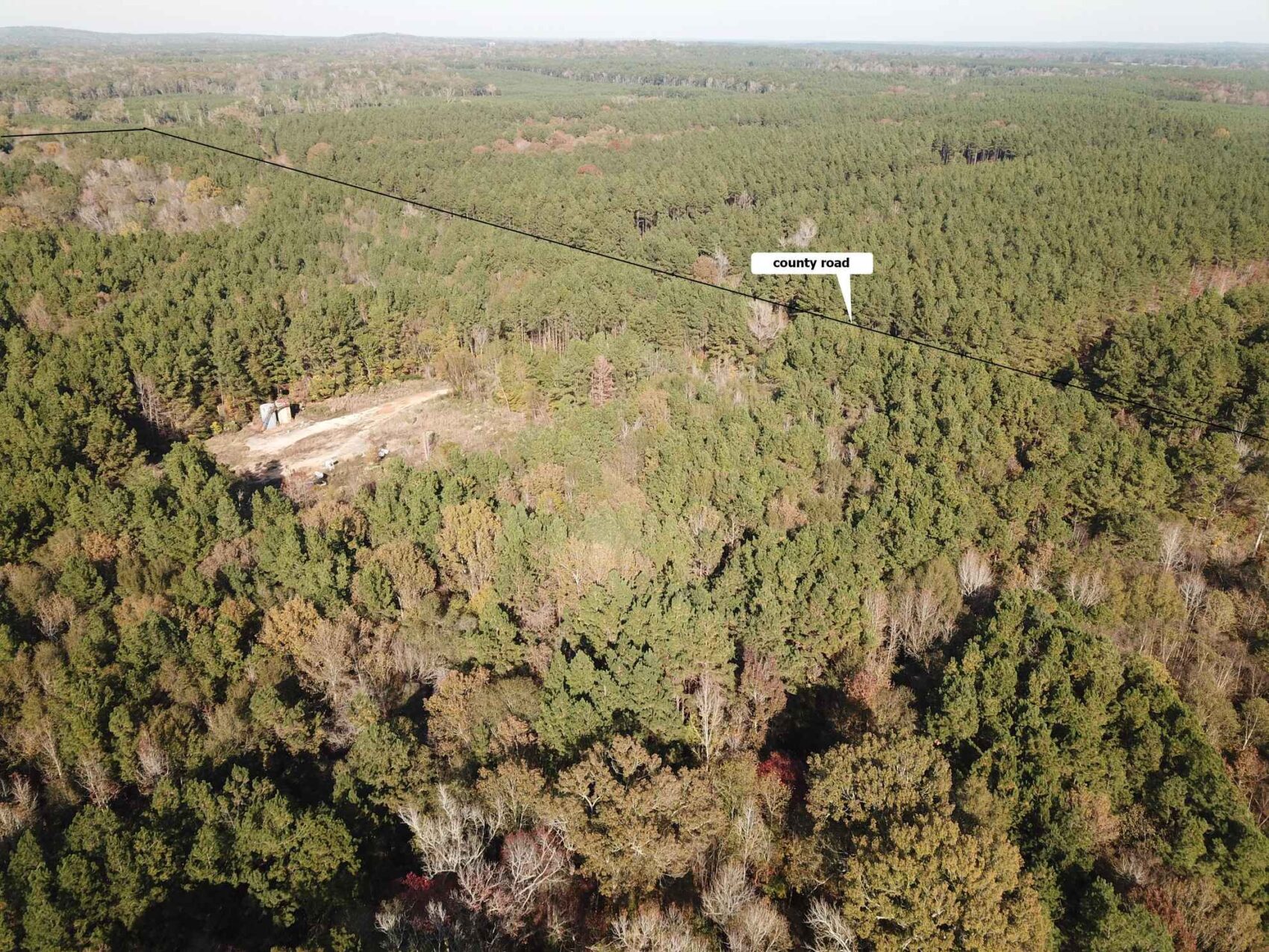
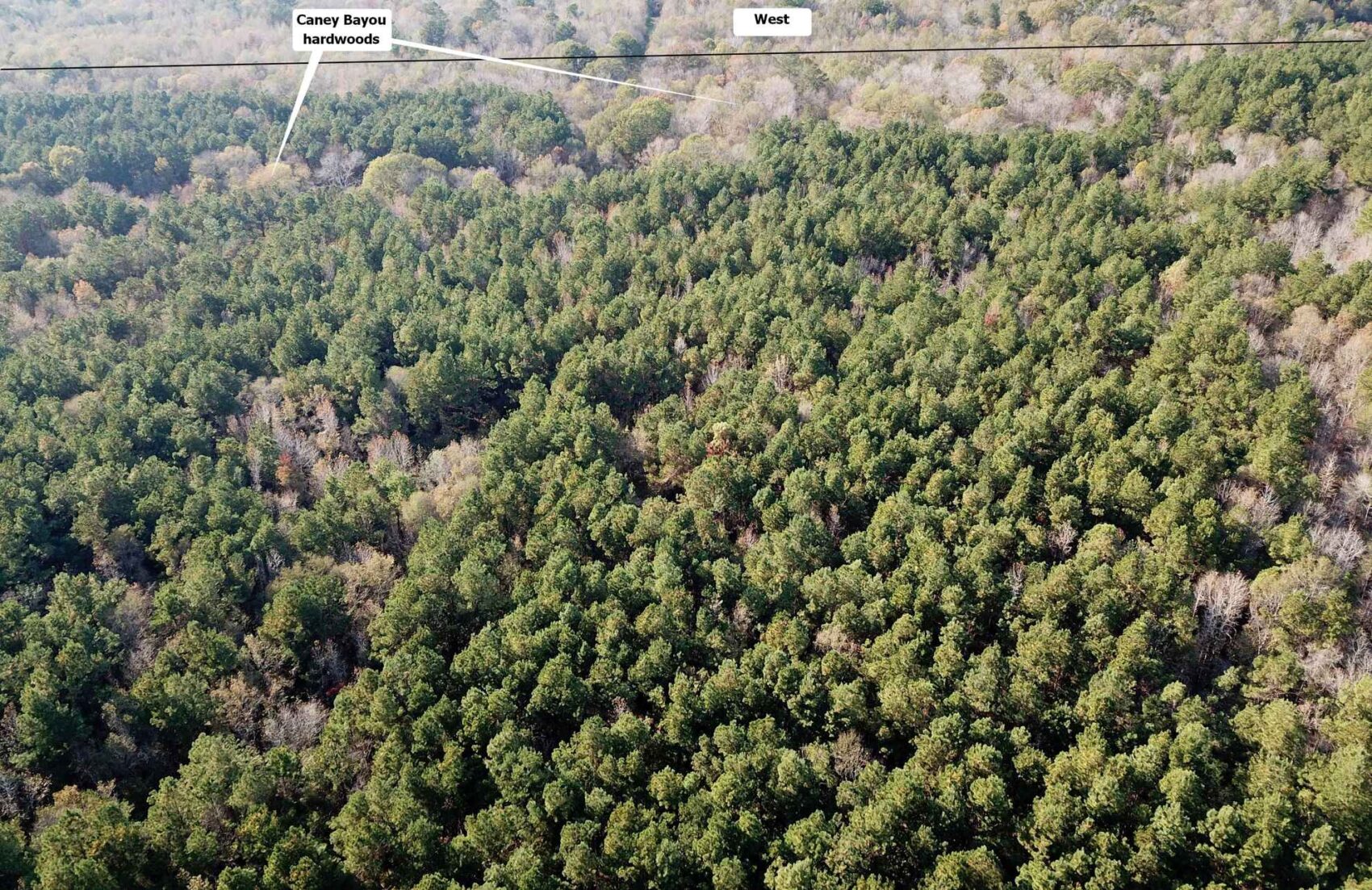
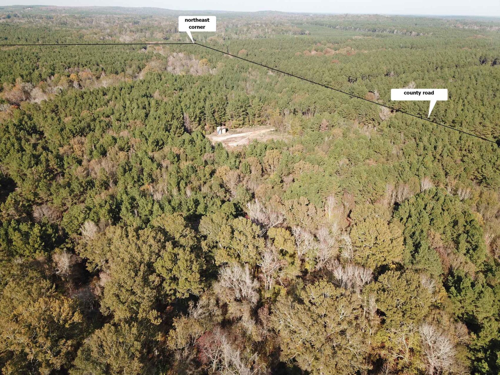
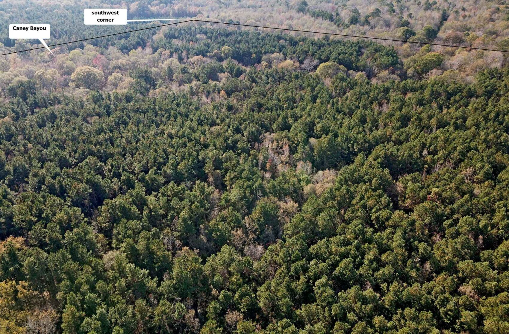
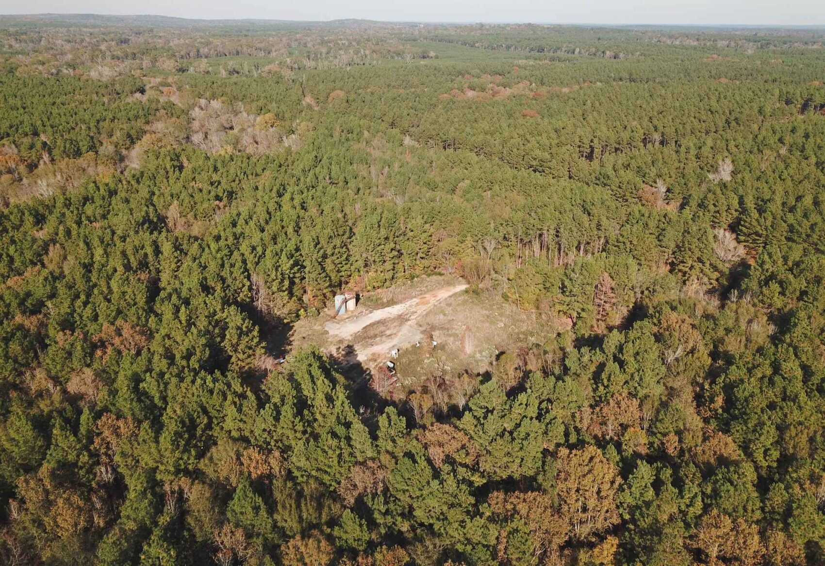
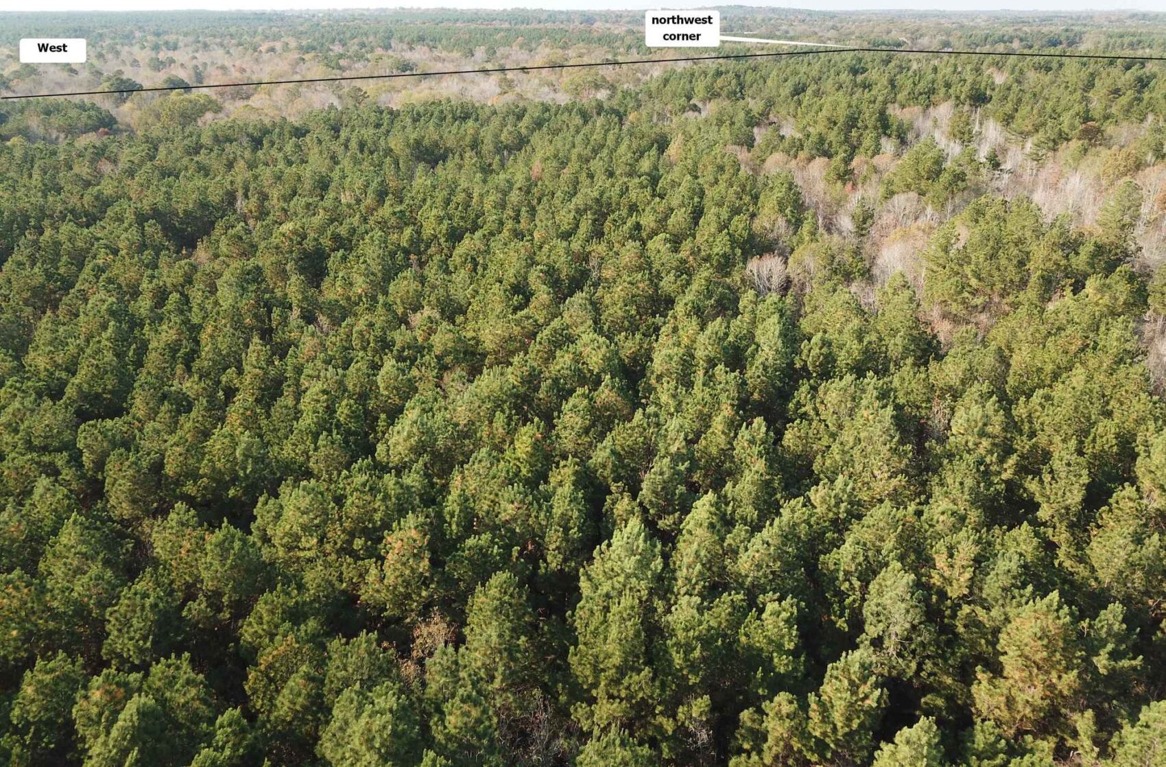
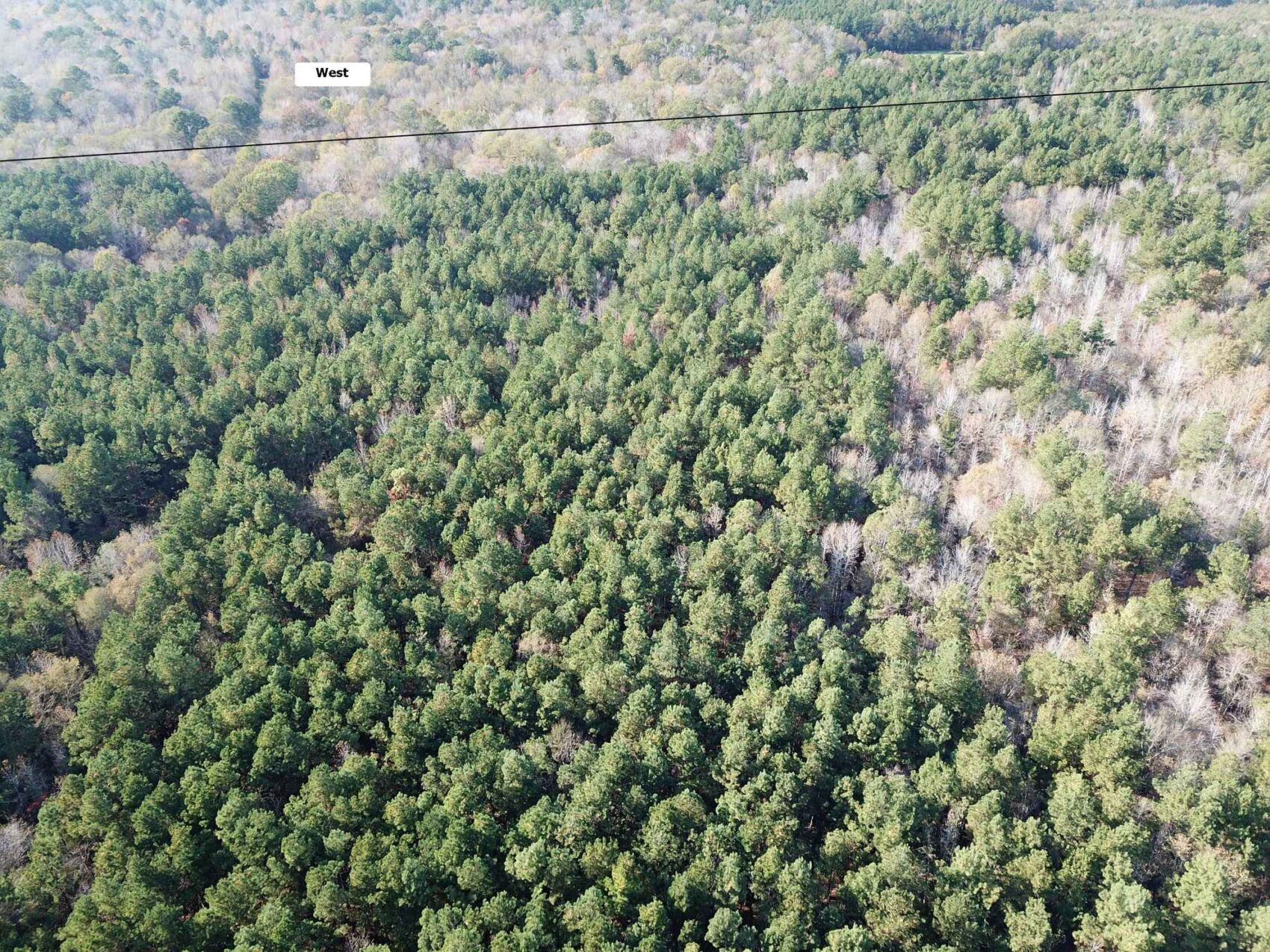
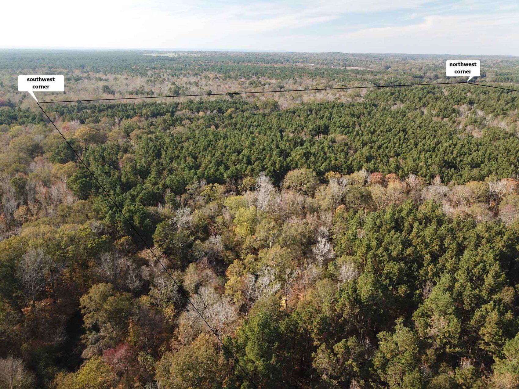
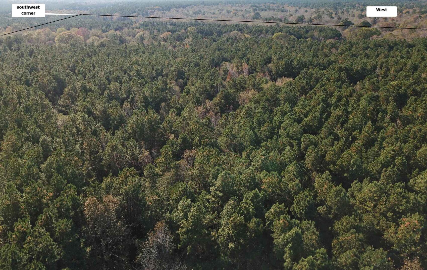
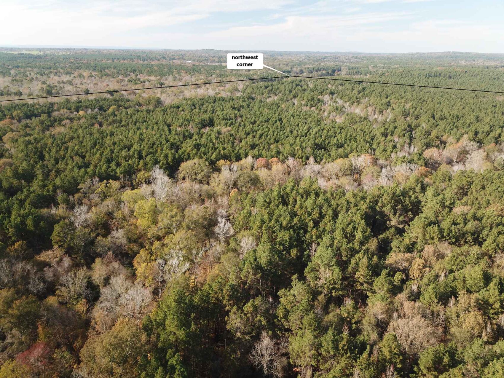
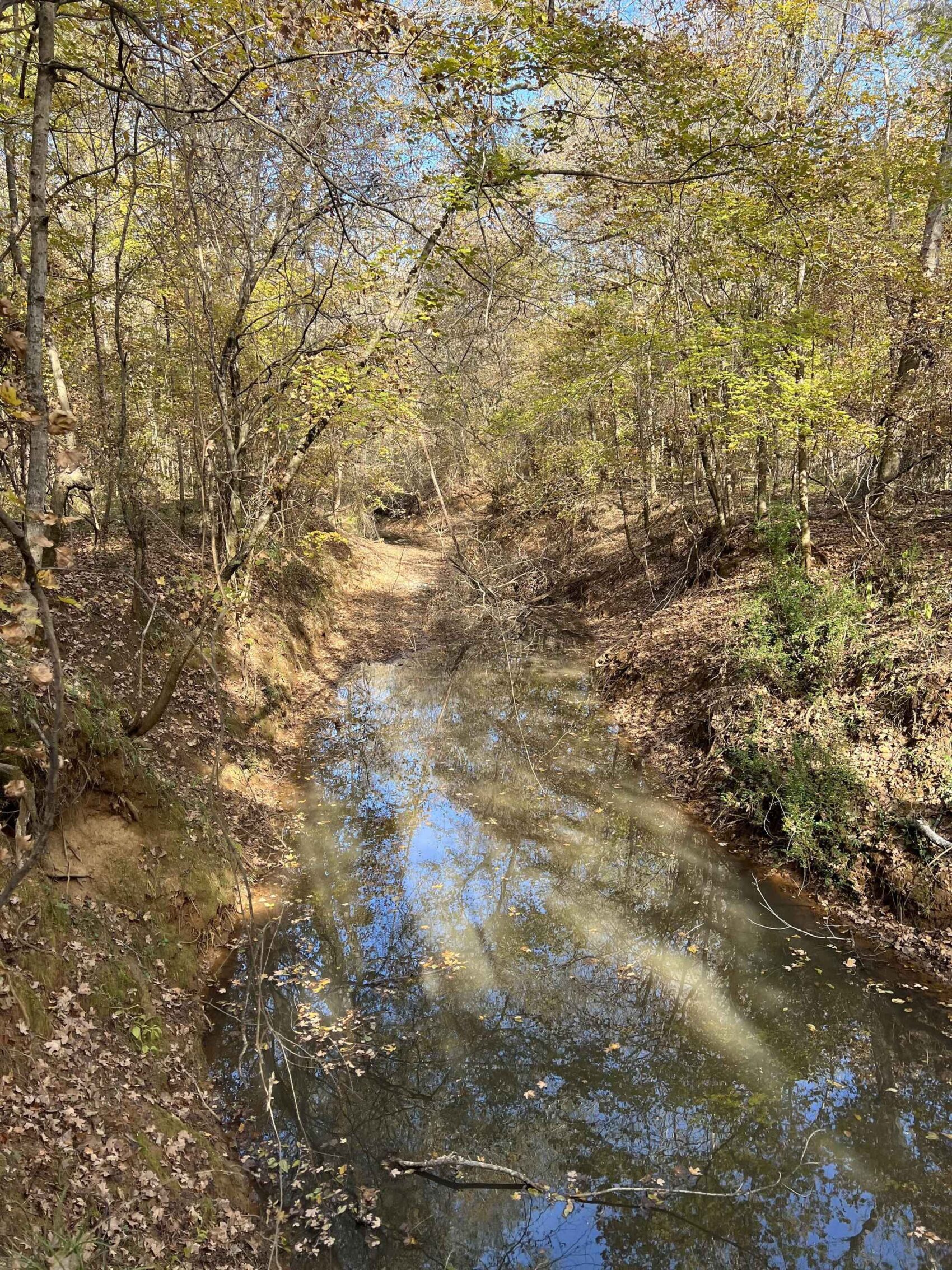
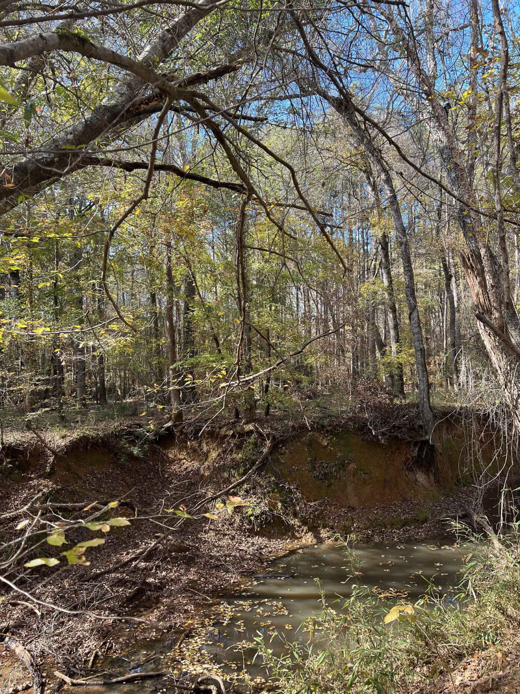
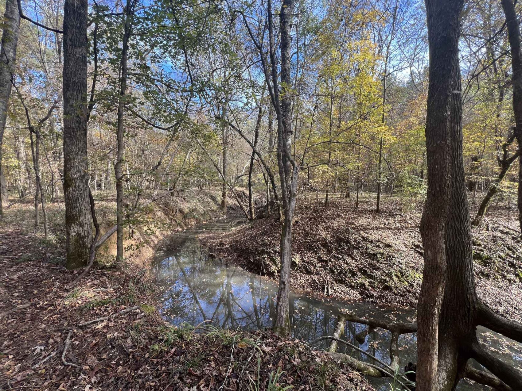
This impressive legacy property from a family that has been in Nacogdoches County since the mid-1800s has a great mix of rich creek bottoms and uplands forested with pine plantations and native hardwoods. Two major perennial streams are the centerpiece of this land, with Little Loco Bayou flowing the length of the property north to south, and with Caney Bayou cutting across the southwest corner. The eastern boundary is along County Road 841 (Red Wilson Road) with an electric power line along the west side of the road. This property is located a fifteen-minute drive to supplies, shopping and health care in Nacogdoches, being west of town off of Highway 21.
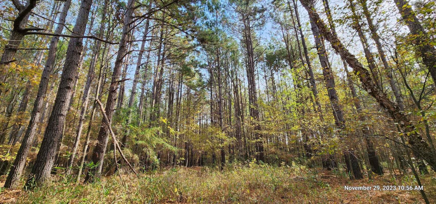
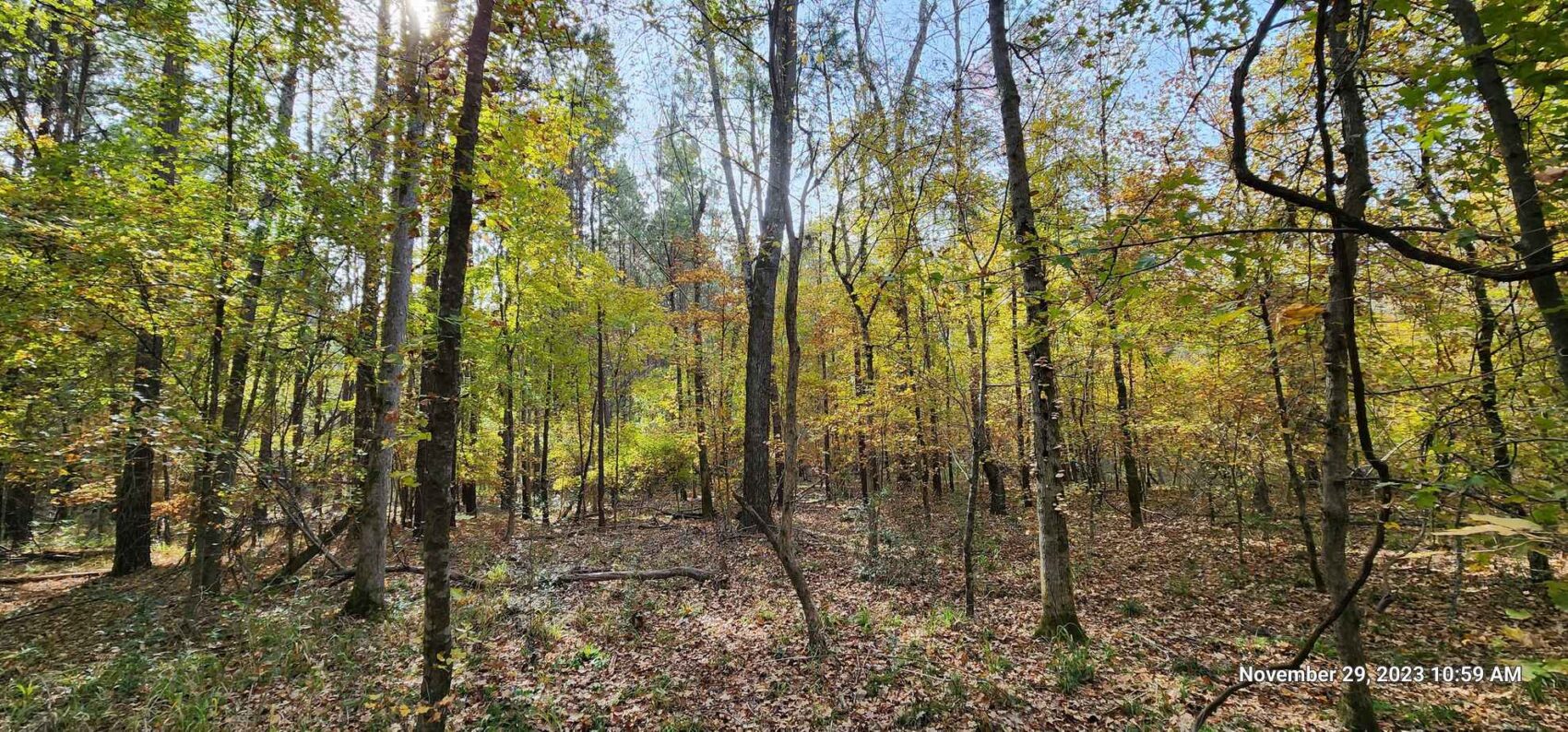
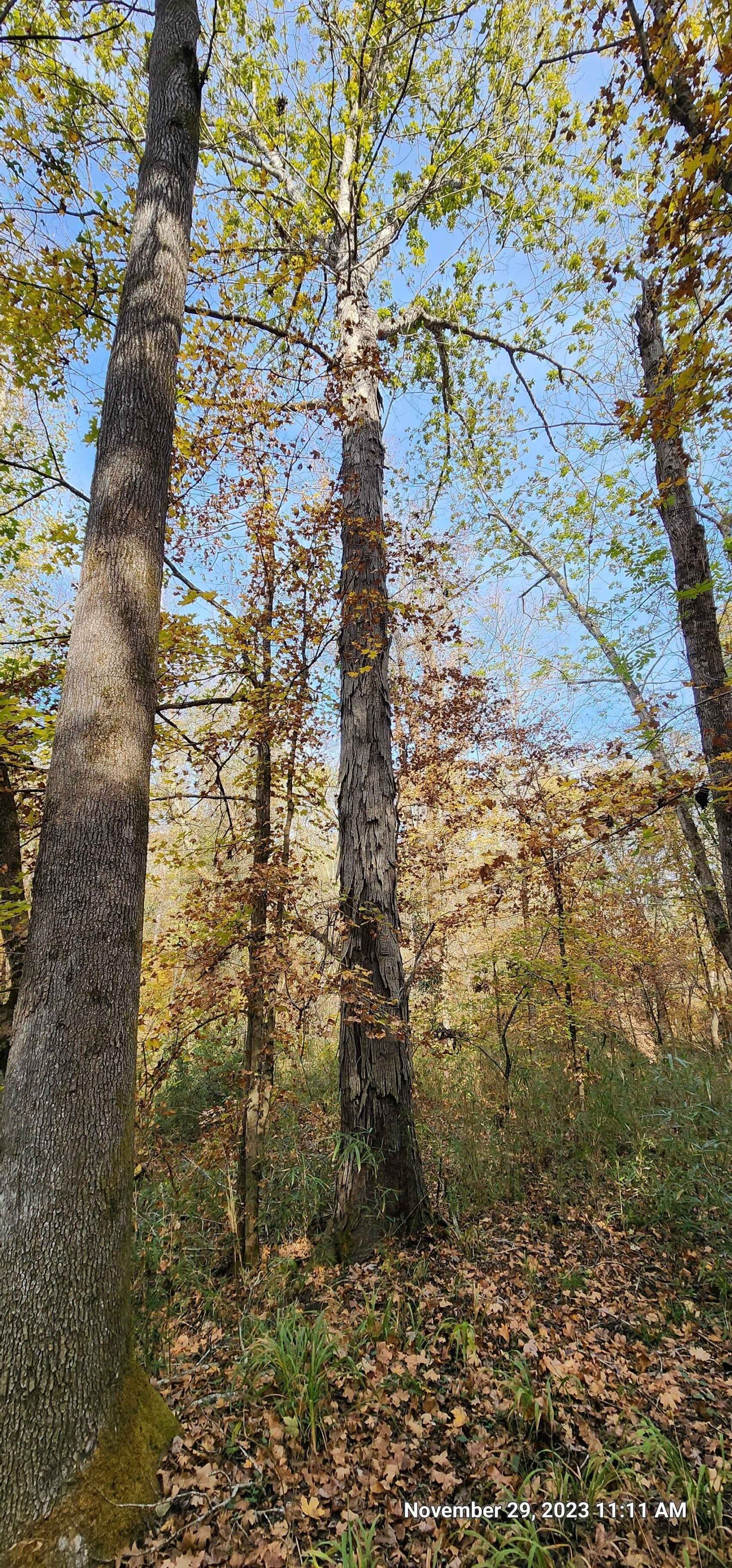
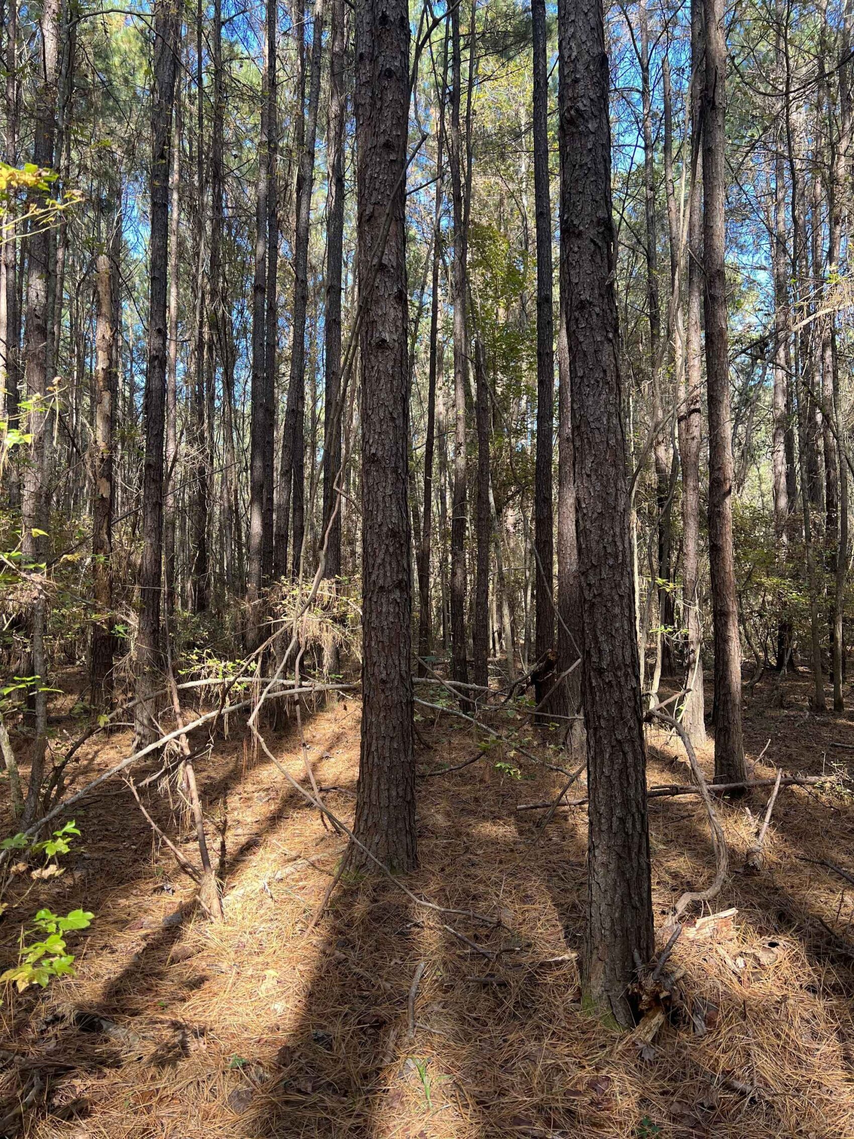
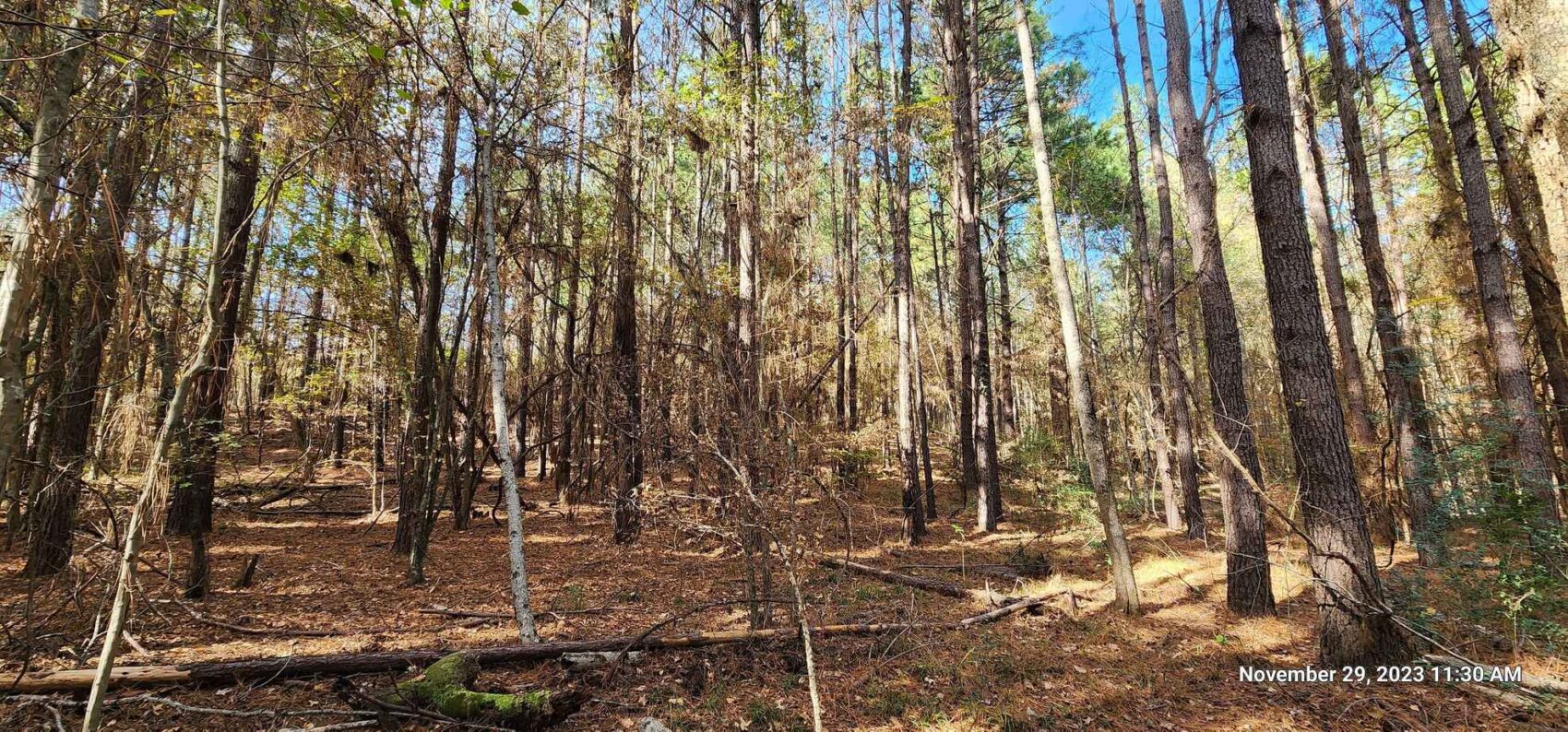
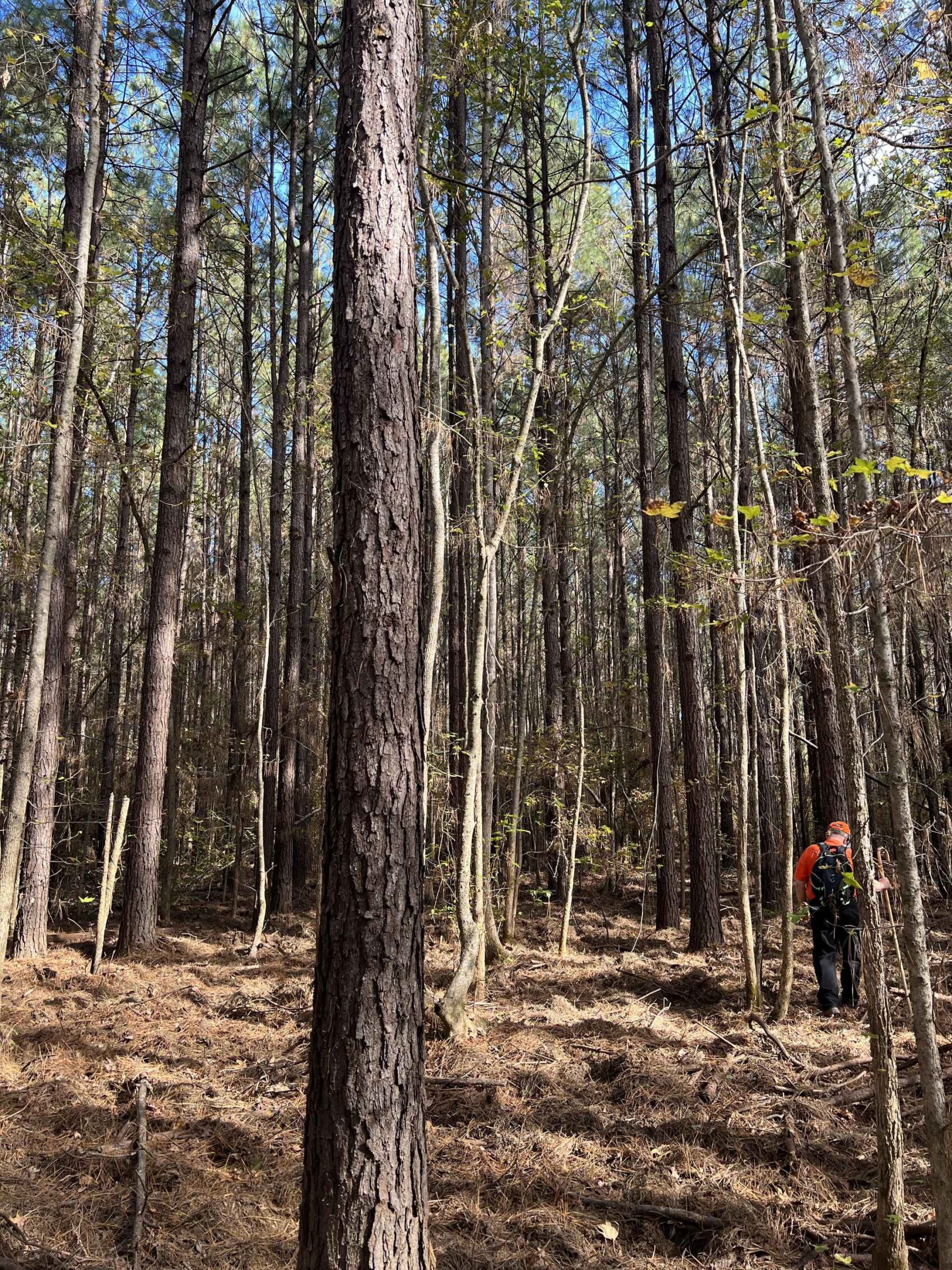
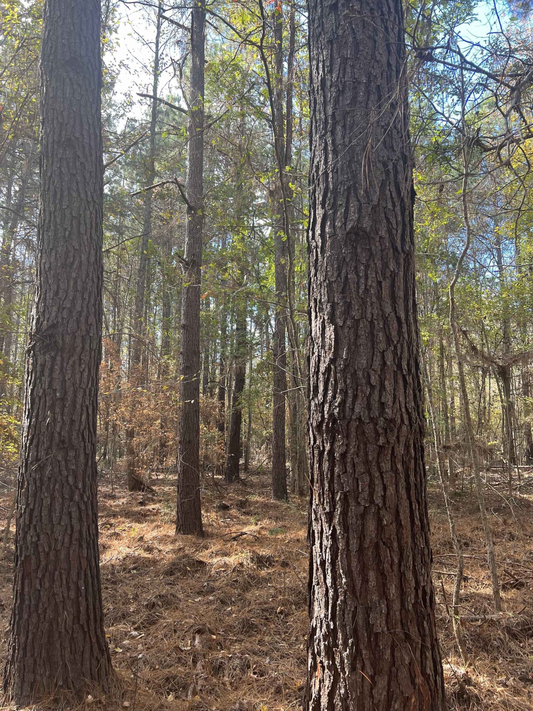
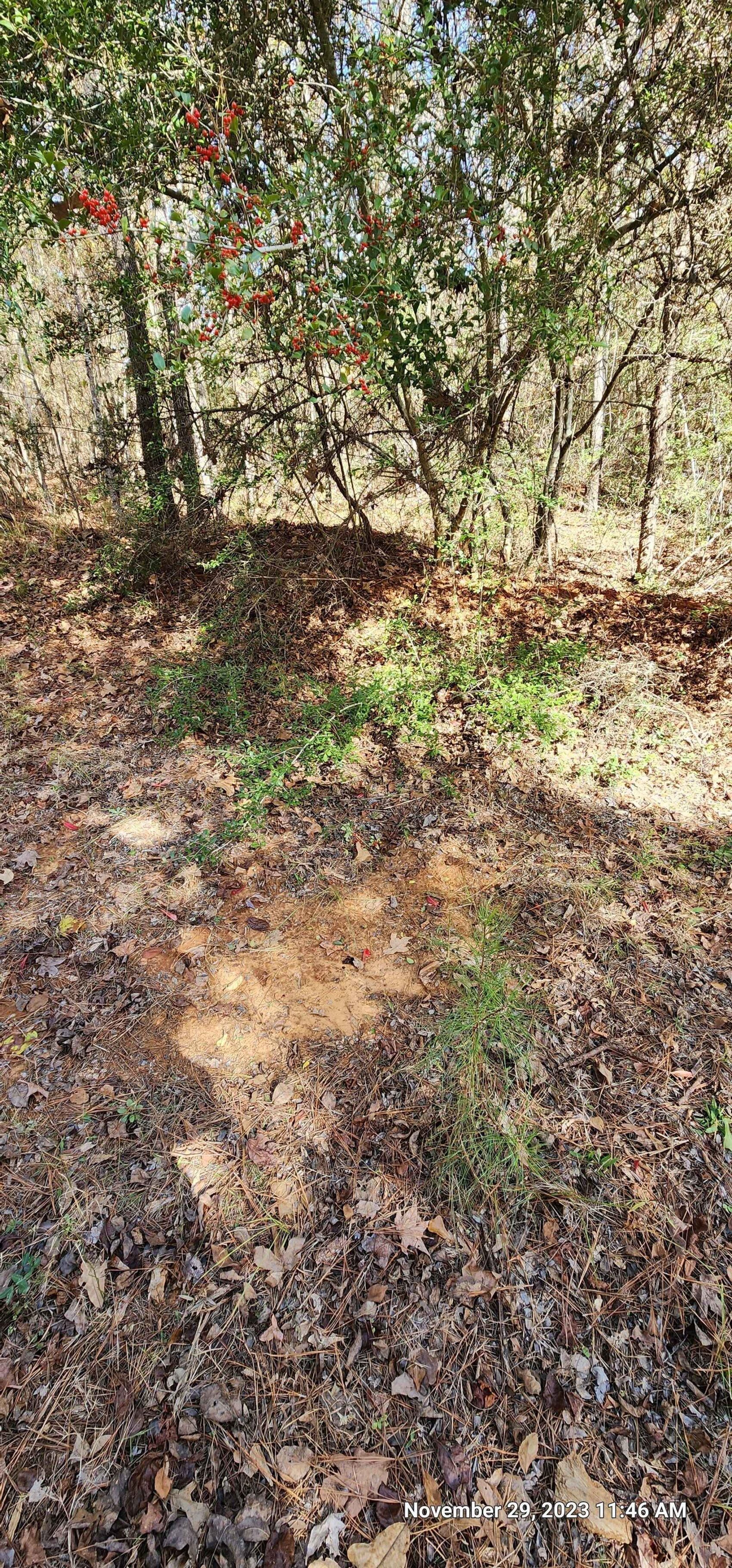
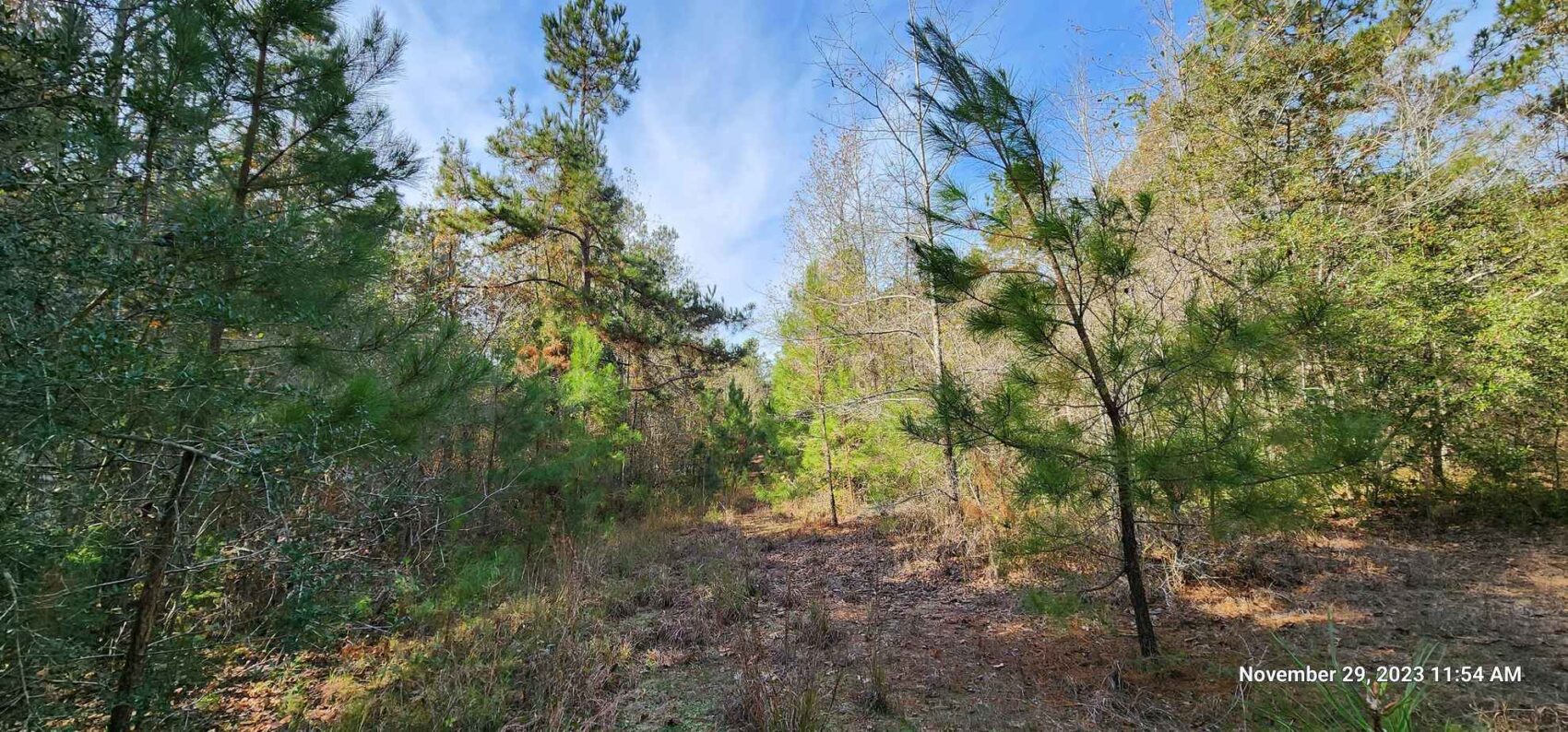
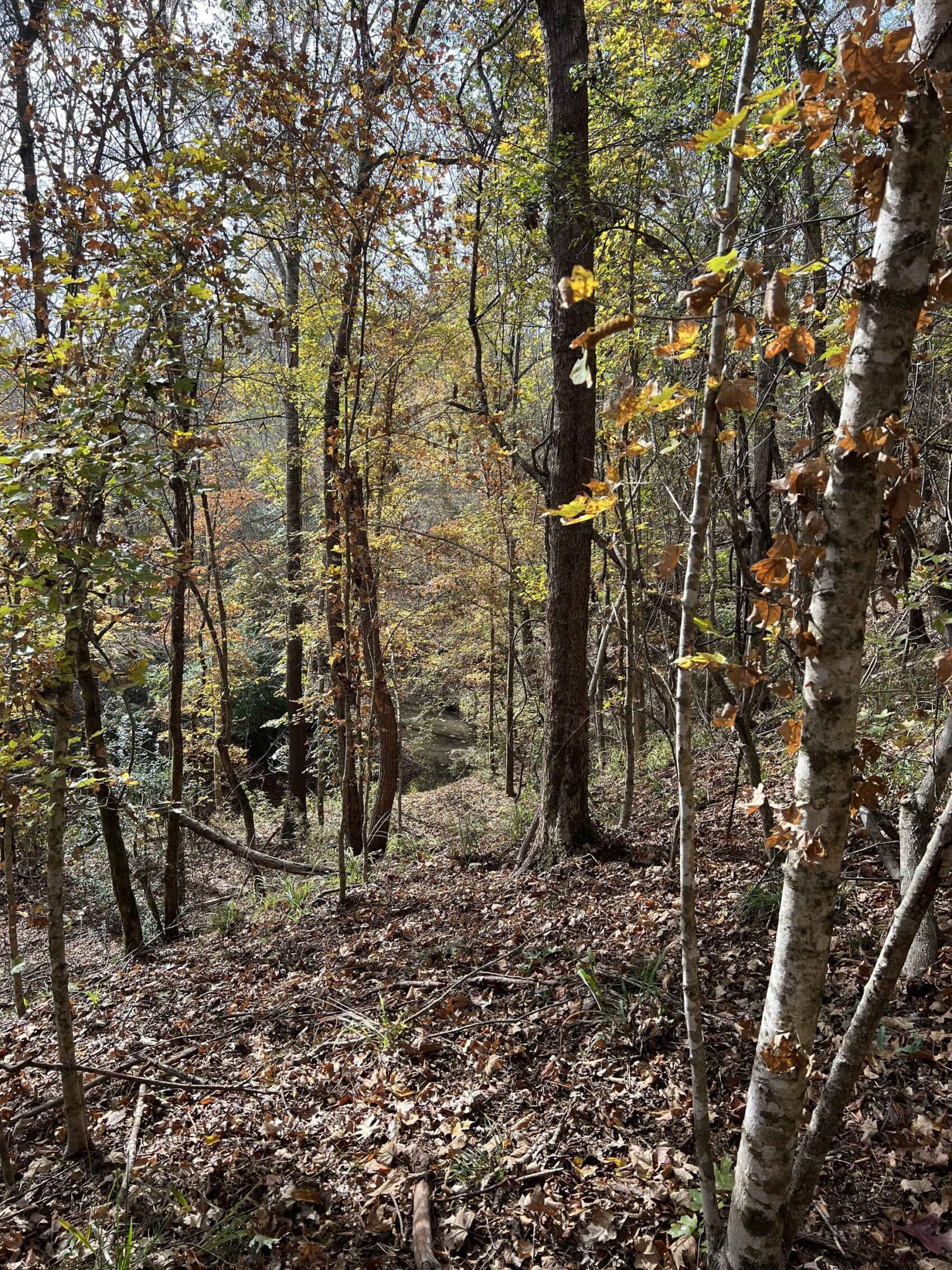
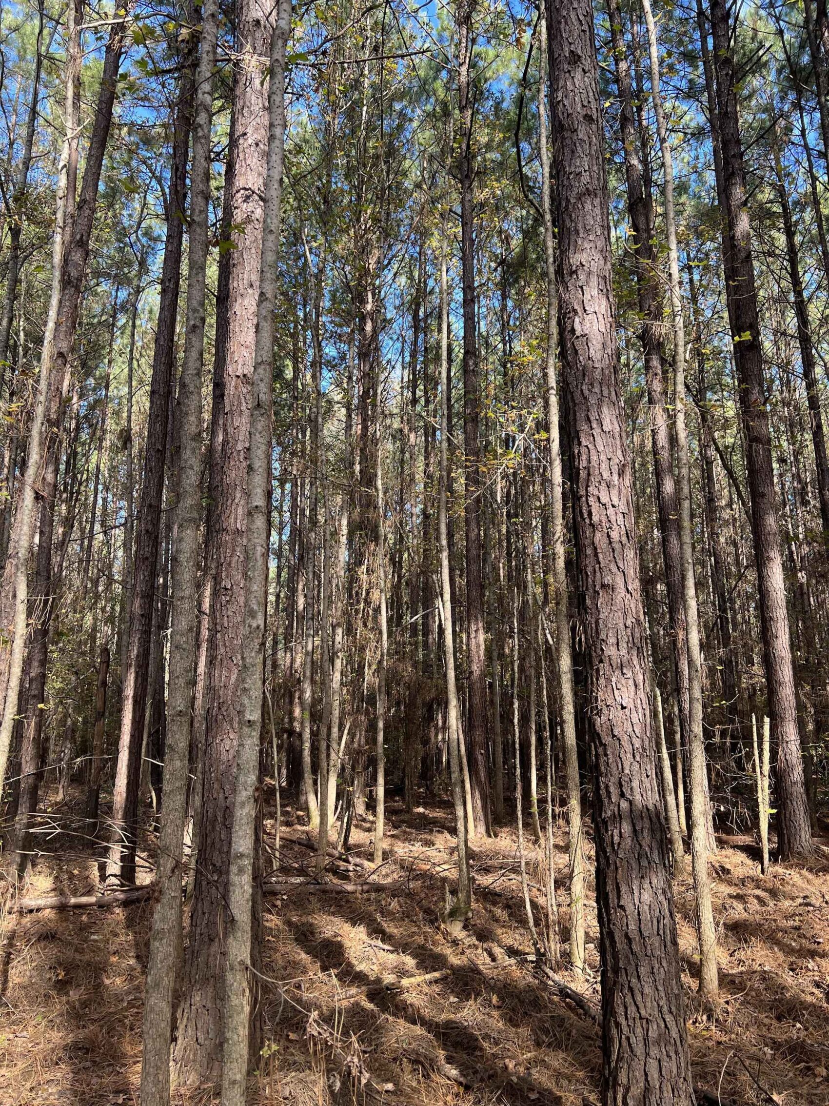
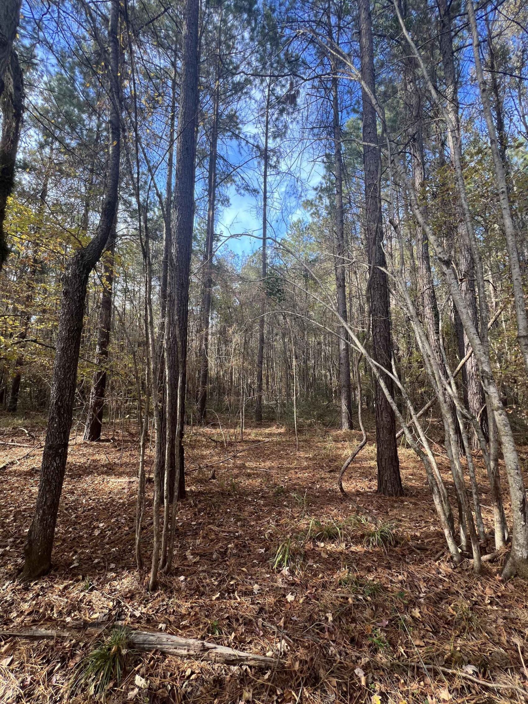
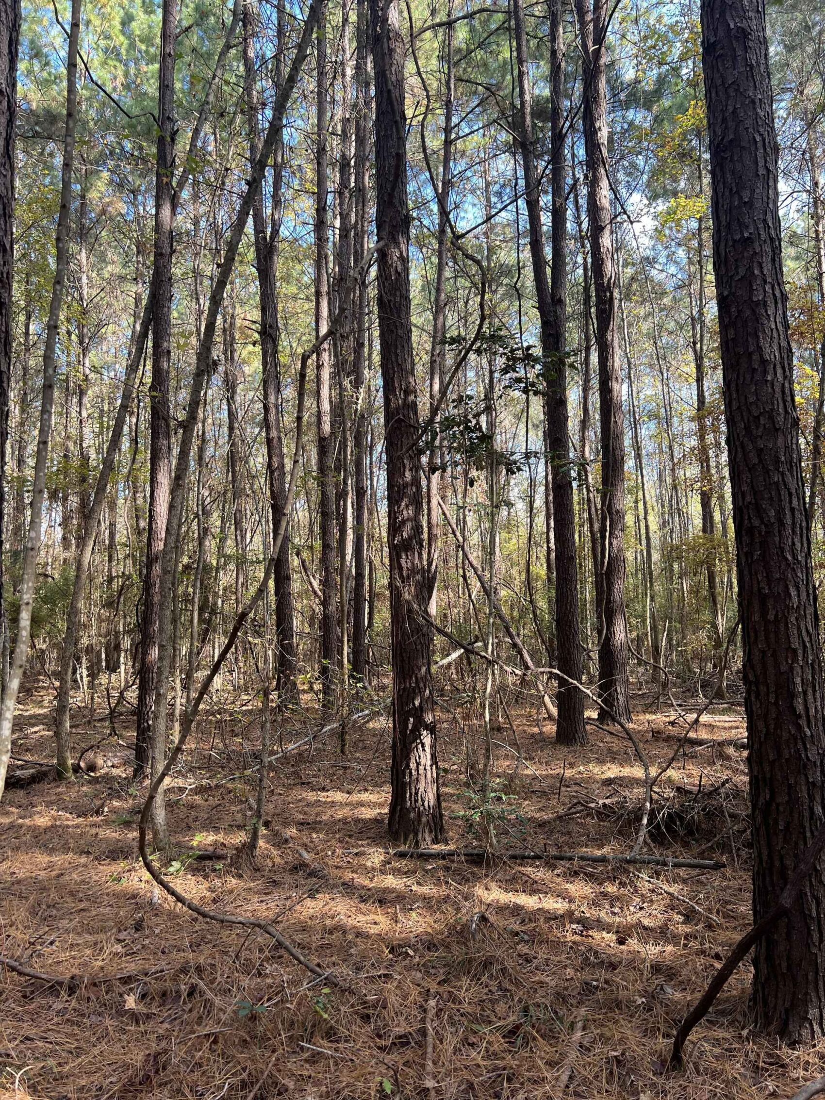
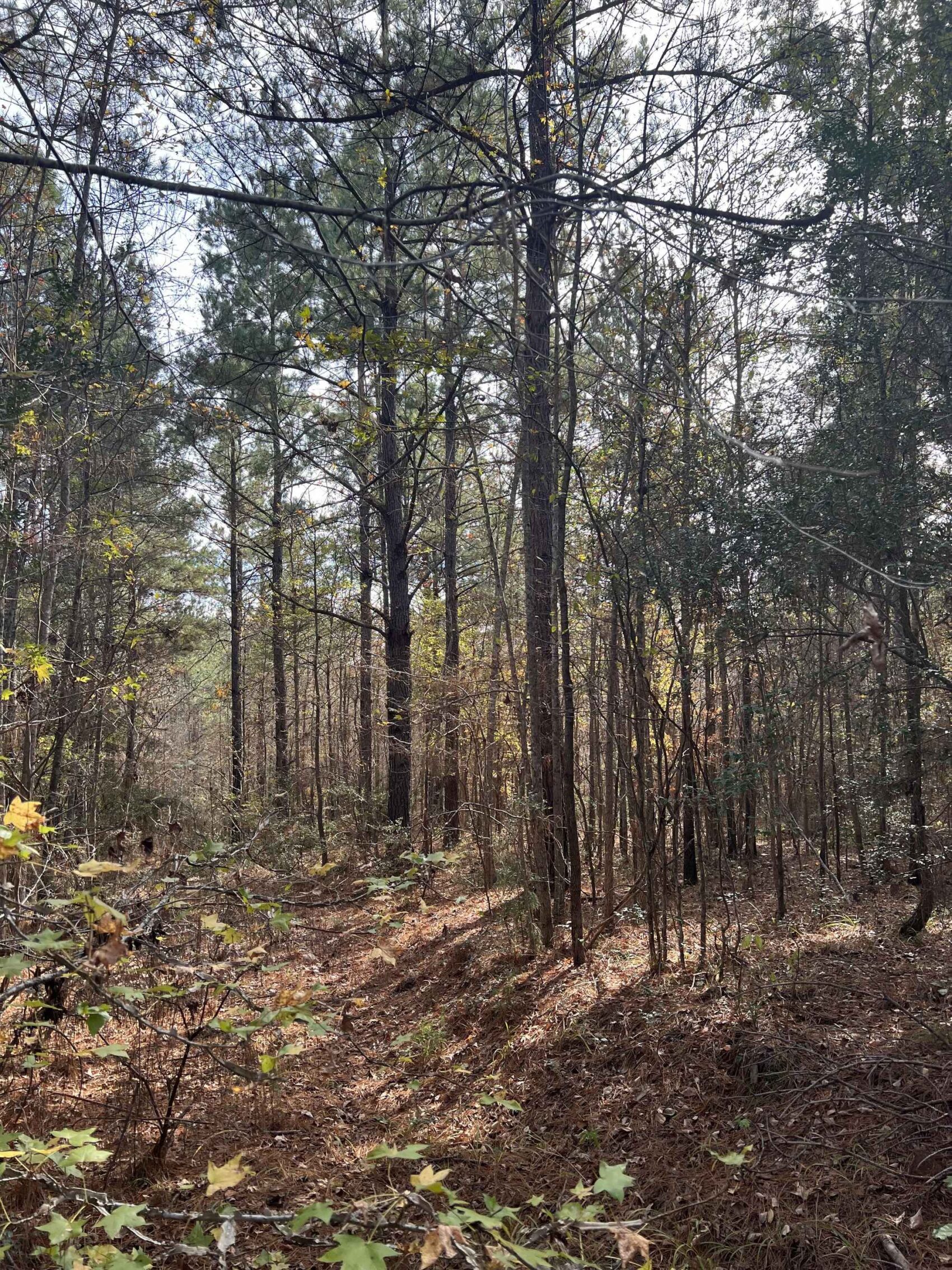
For hunters and naturalists this is a remarkable woodland with a nice diversity of towering trees with an open understory that is easy to traverse on foot contrasted by areas of dense shrub habitat. There are good opportunities for hunting or just observing wildlife in the uncommonly tall and dense pine plantations and bottomland hardwoods along the creeks.
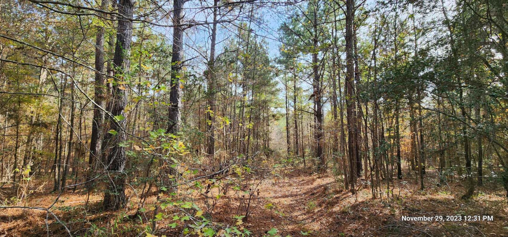
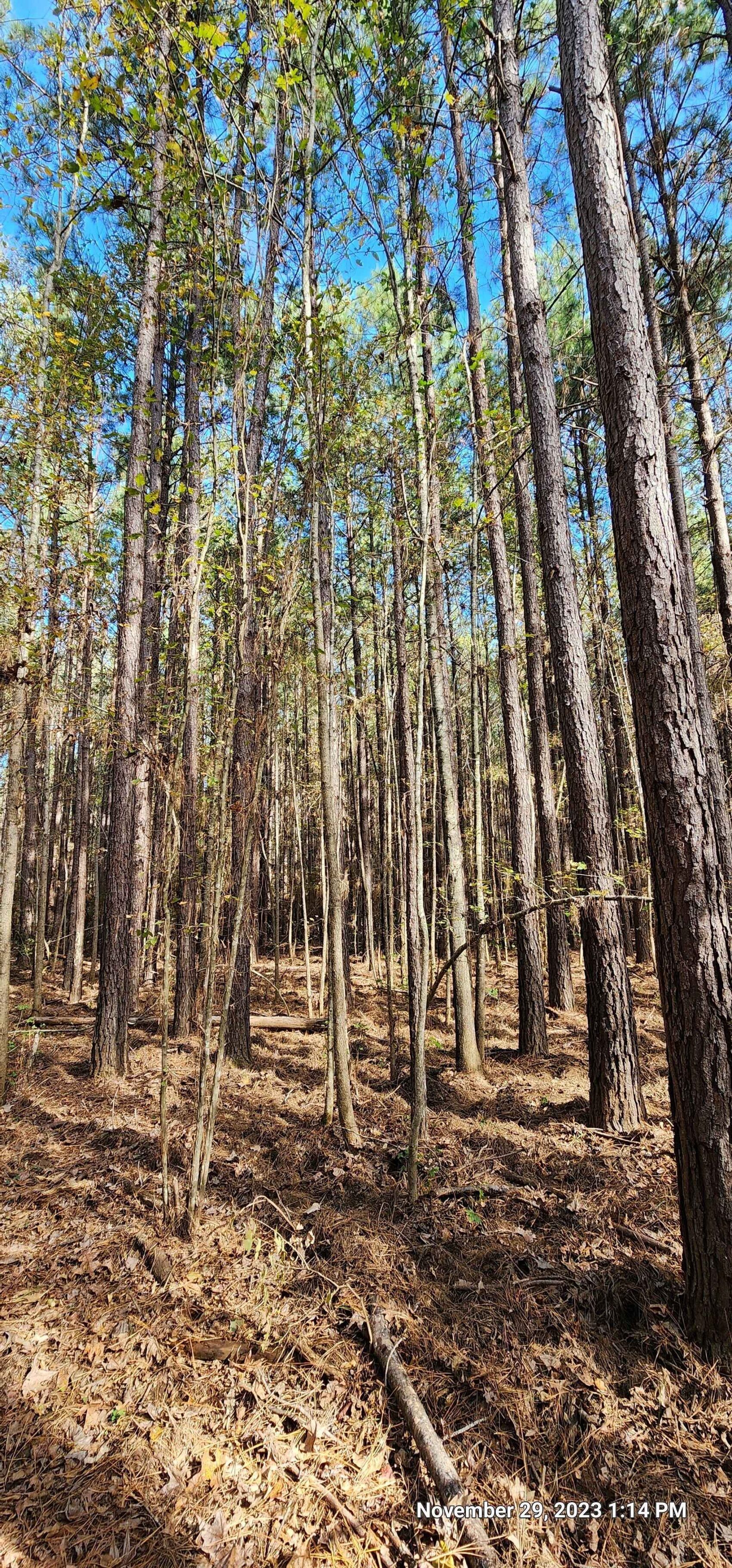
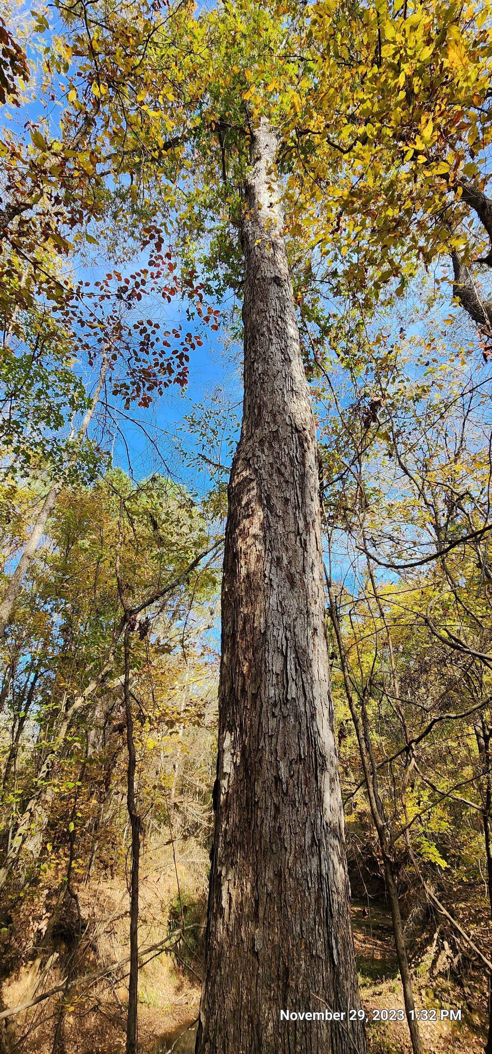
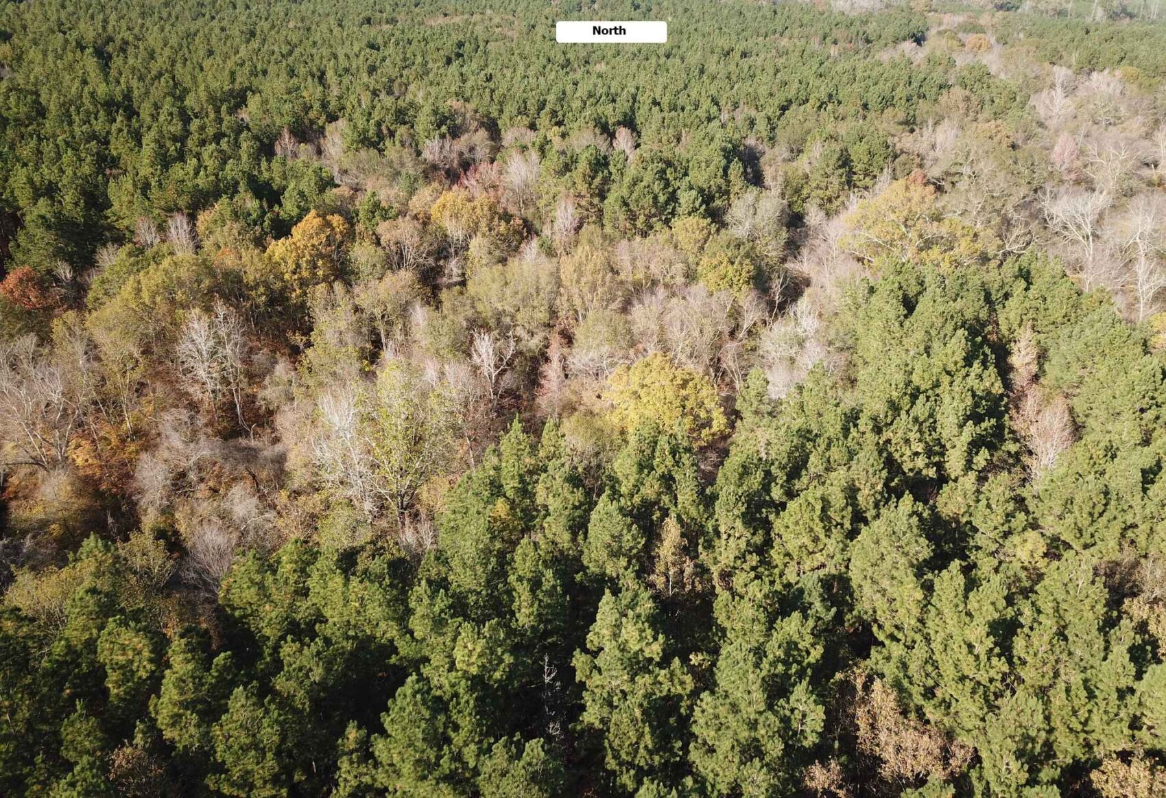
The creek bottom areas have outstanding unthinned pine plantation around 25 to 27 years old, with extraordinary heights in the high site index soils. A rough guesstimate of total pine volume in these good pine stands suggests a potential of four or more loads of pine timber per acre. Some of the pine trees growing in these deep, well-drained soils appear to possibly be powerline-pole quality. These plantations are definitely ready for a first thinning harvest and offer the prospect of near-term cash flow as well as future timber growth prospects. The bottomland Hannahatchee soils make up over half of the Property along Little Loco and Caney Bayous, with a small section of Tuscosso clay in the southwestern corner along Caney Bayou.
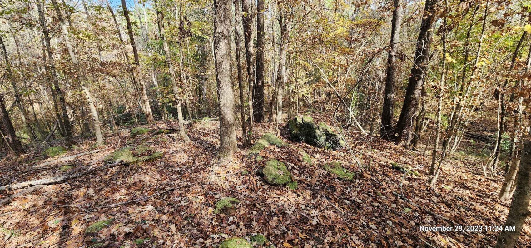
The uplands are the fine sandy loams in the Cuthbert, Alto, Sacul and Kirvin series. These are good, well-drained upland soils for growing both hardwood and pine. The planted pines are more scattered and in pockets in the uplands, with hardwoods and shrubs intermixed, affording a diverse wildlife habitat that is favorable for whitetail deer.
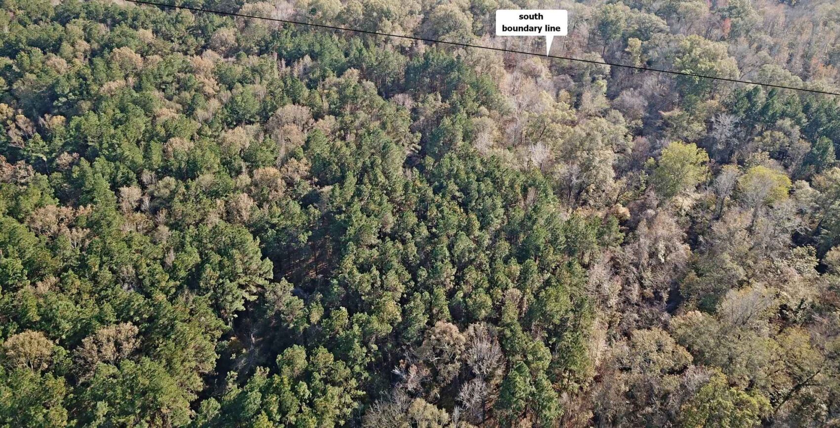
A previously-unknown easement not referenced in the Sellers 1972 deed is described in an adjacent-property deed as being located 900 feet north of the south boundary line of the 172.2 acre tract. The Aerial Photo Creek Easement map in the download document section shows the approximate location as described. Note that this is an illustration only, it is not guaranteed in any manner. The easement appears at this point to have not been developed or used based on aerial photographs and a lack of known evidence on the ground. The describing deed is also included in the download document section.
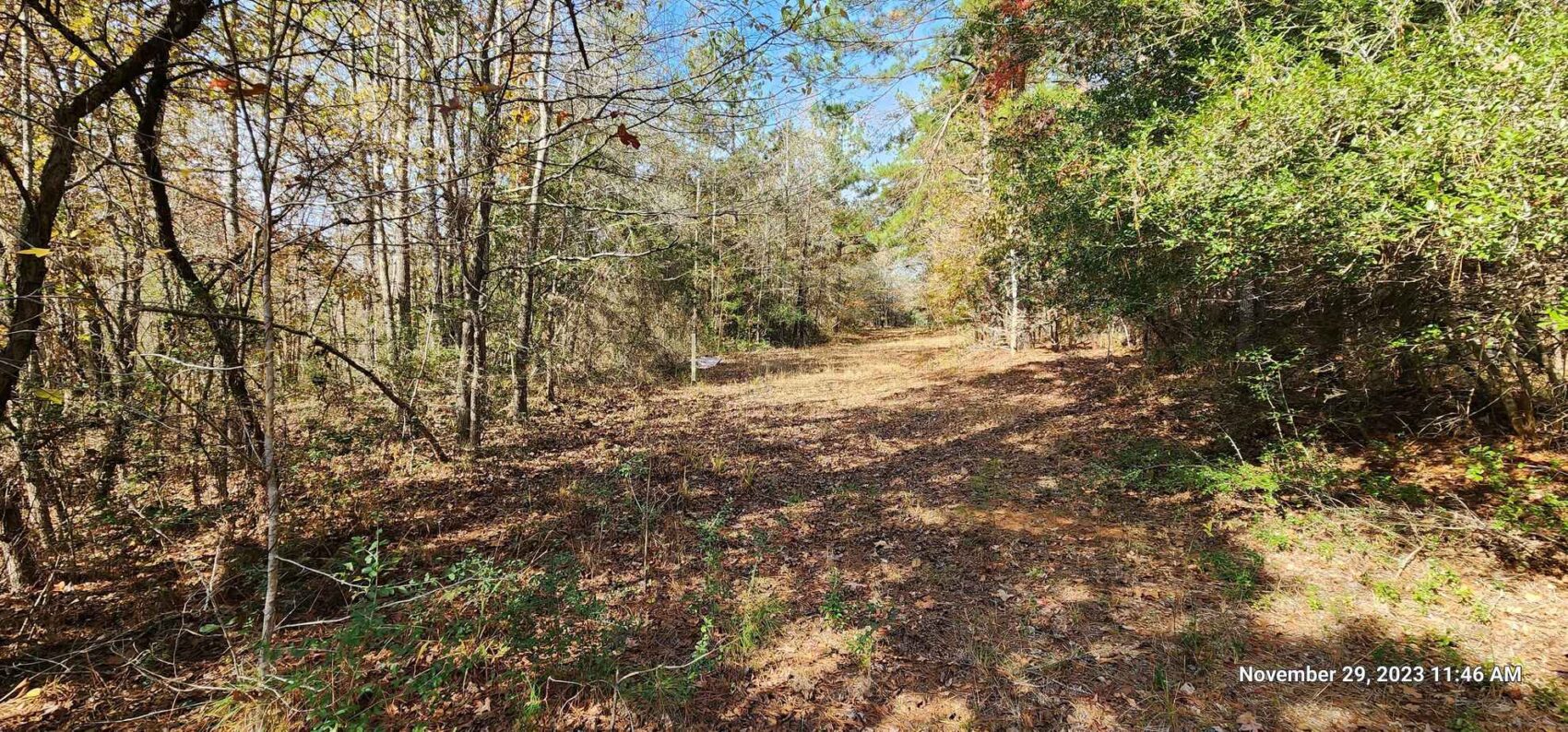
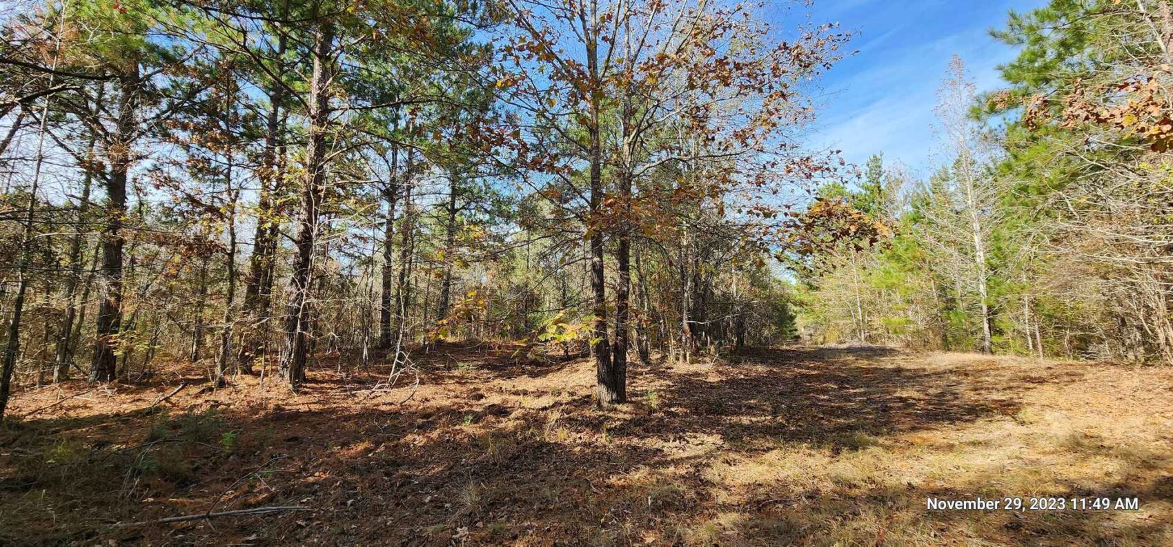
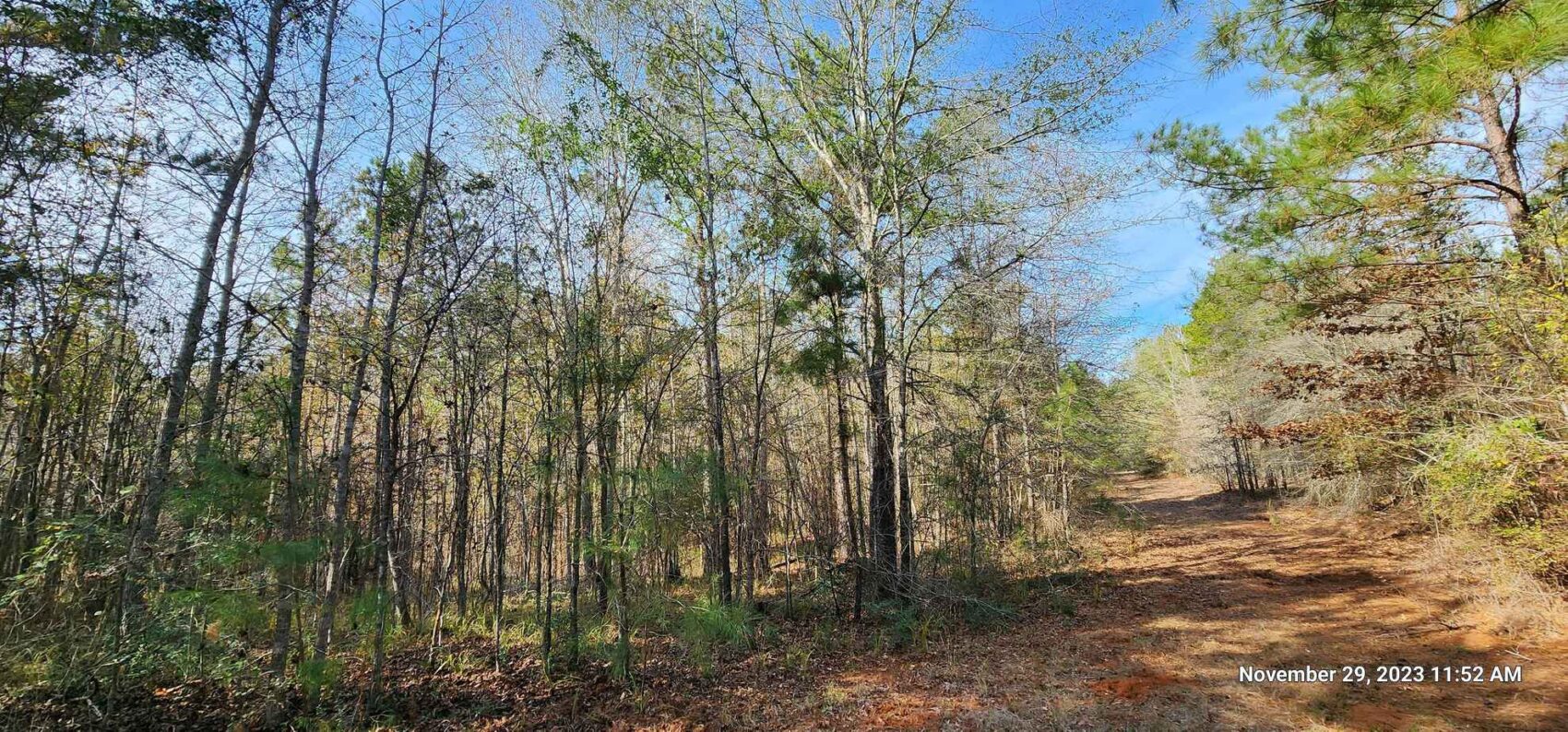
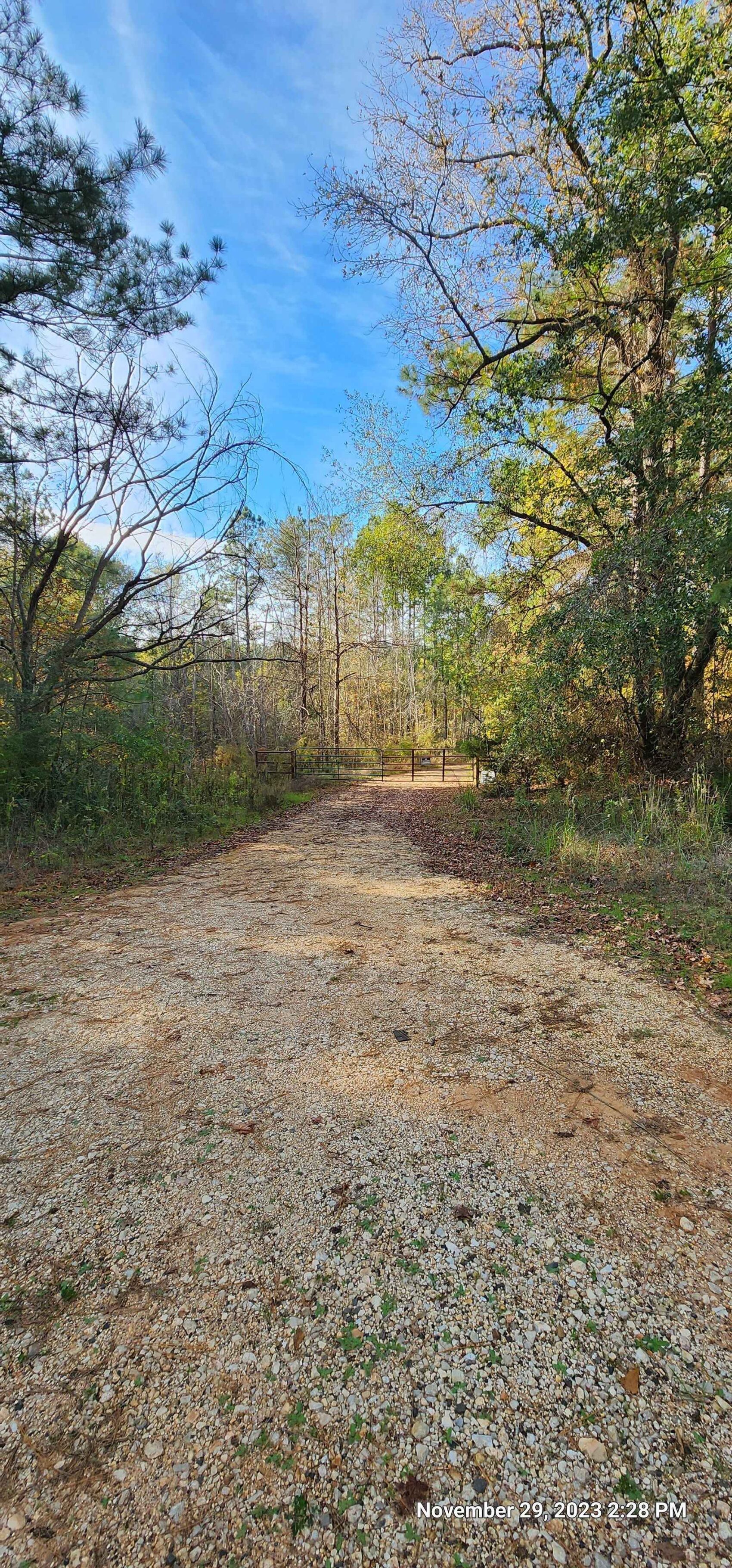
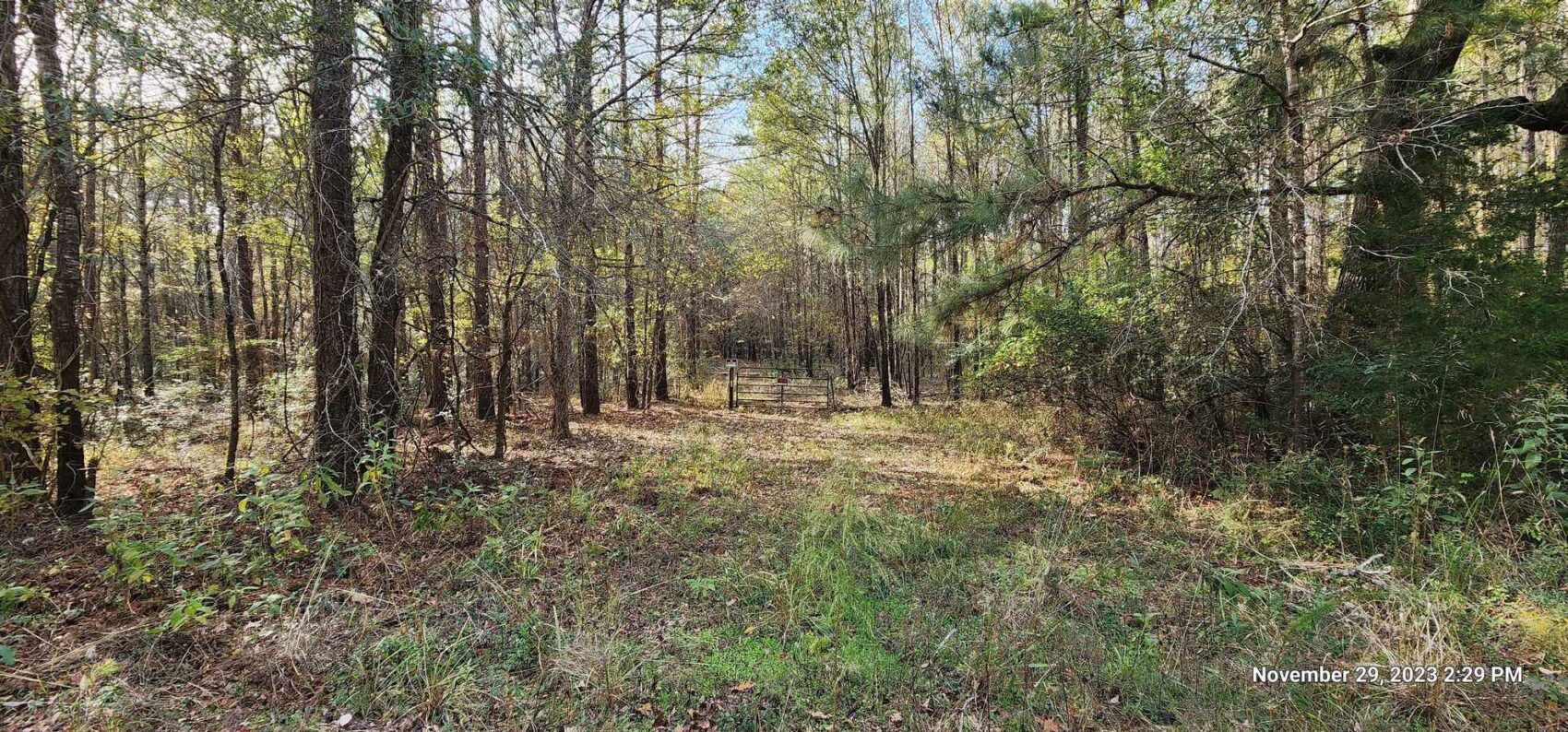
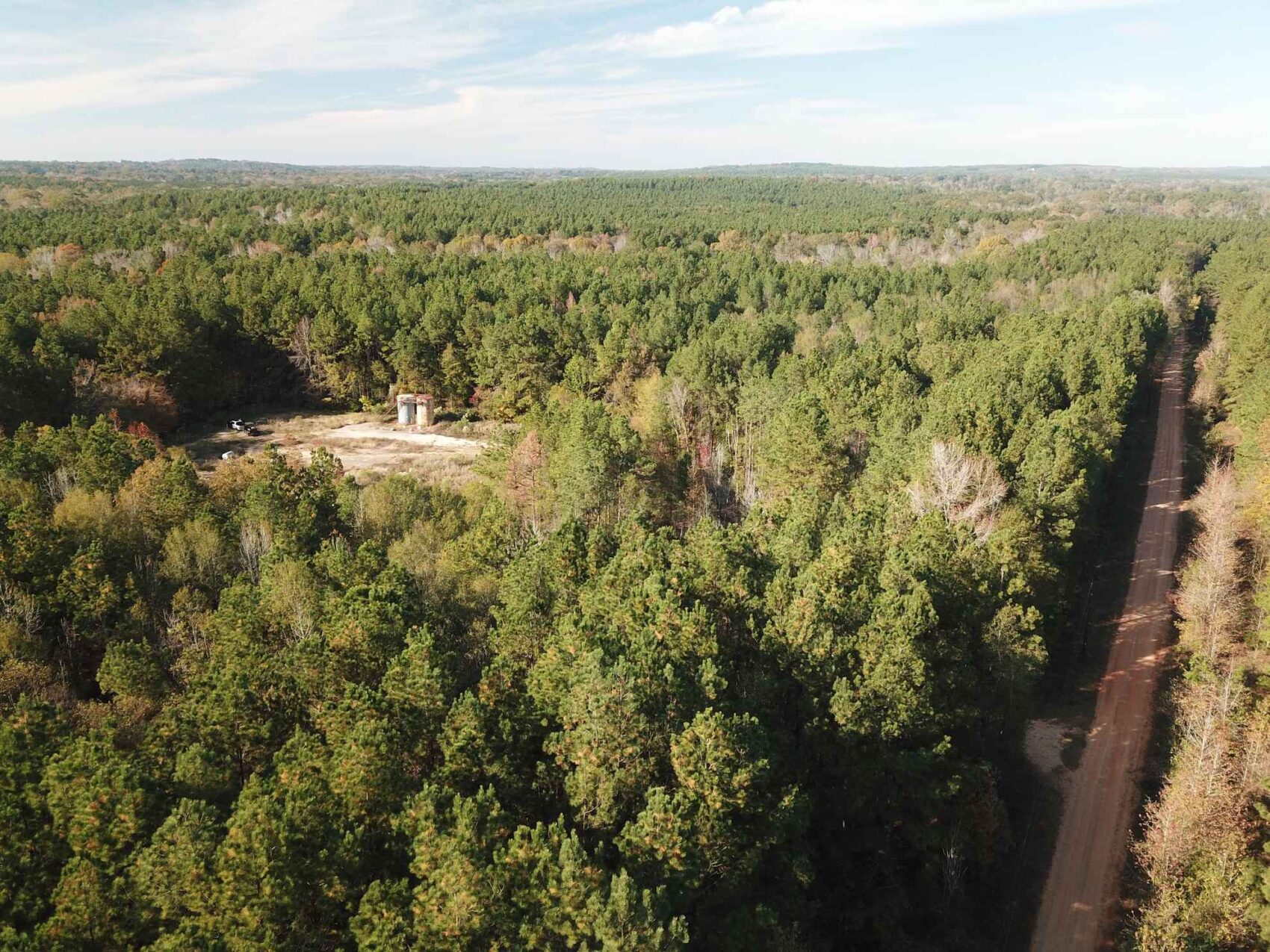
The internal woods road system starts at a gate near the center of the east boundary at the county road and leads to Little Loco Bayou. Currently there is not a stream crossing for vehicles, but the woods road system continues on the west side of the property. These roads need some cleaning out of deadfalls and underbrush where the small trees have taken root, but in general they appear in good shape. The need for the first thinning of the pine plantation offers a source of income for reestablishing a vehicular crossing on Little Loco if so desired. I was able to easily cross the creek and walk the property.
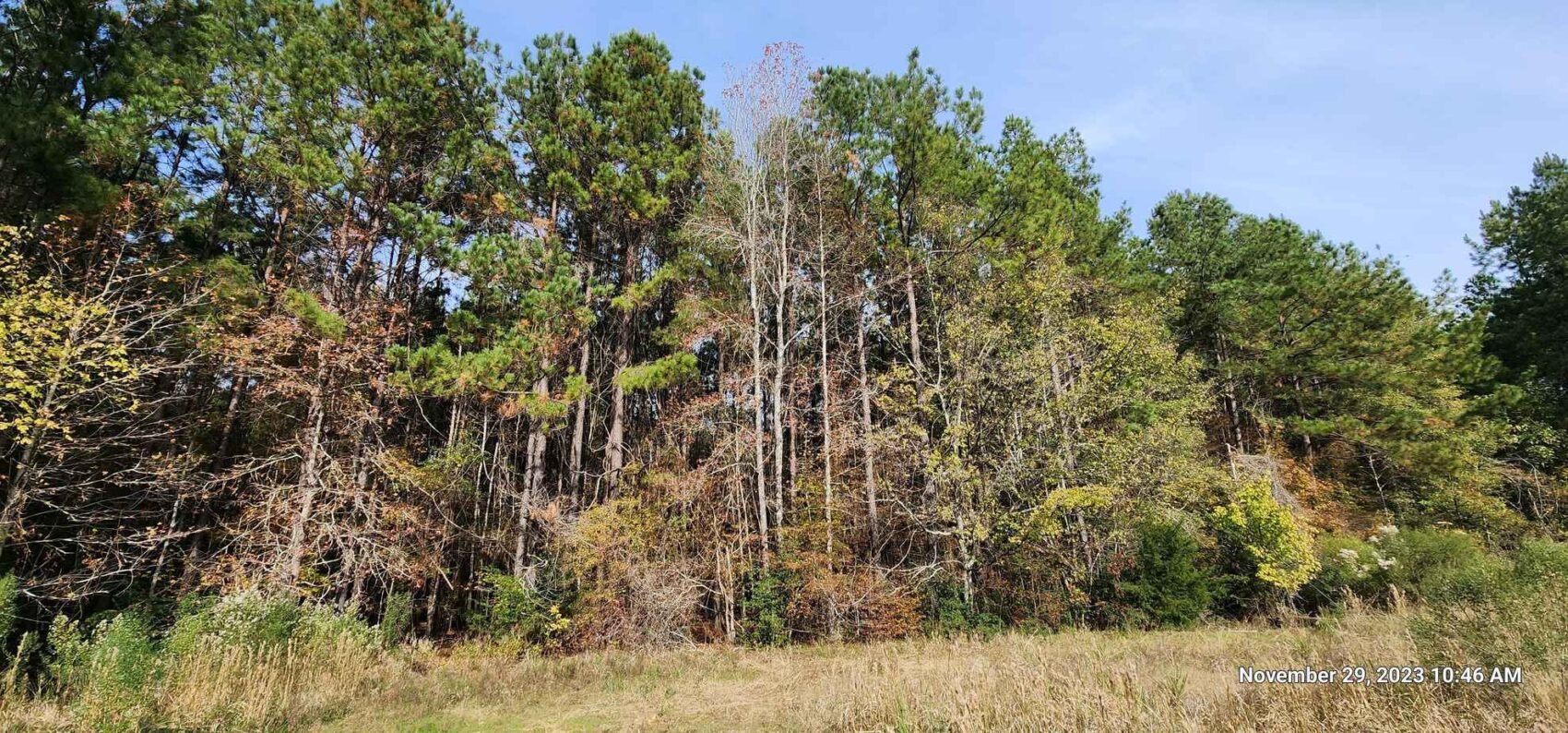
The forests on this property make up 96% of the land and have a wide assortment of species including loblolly pine, white oak, American beech, white ash, shortleaf pine, water oak, black oak, sweetgum, southern red oak, American elm, Florida maple, American holly, cherrybark red oak, shagbark hickory, blackgum, pawpaw, black walnut, southern red oak, black cherry, mulberry and hornbeam.
The timber asset is a combination of planted loblolly pine and native bottomland hardwood timber. The chart in the download documents is an estimate of the various acreages in several timber types. The Good Pine areas are primarily the bottomland pine plantation. The Pine Hardwood areas are on upland sites with a mix of planted and native pine and hardwood. The Hardwood areas include the bottomlands along the two streams. A small section of the land is in the county road with a small strip east of the road. The gas well site rounds out this table. These timber types are shown on the mapping on the Timber Type and Woods Road map.
The mapping is offered as a general guide as to the location and nature of the property, but no guarantee is made as to the exact location of boundaries or features, timber type or any acreage estimates.
This property of approximately 172.7 acres is offered at $3,995 per acre or $689,936.
The Sellers are retaining all owned oil & gas minerals.
No owner financing is available.
This property is currently under Ag/Timber Valuation. According to the Nacogdoches Appraisal District 2023 Tax records, the taxes are estimated at $405 with timber/ag exemptions, and at $10,273 without timber/ag exemptions. Buyers should be aware of roll-back provisions if land use is changed, or the new owner fails to apply and/or qualify for ag/timber exemption.
The current appraisal district mapping appears to be incorrect, as the deed description and in-field evidence shows the southeastern corner of the property to be east of the county road. The northeast corner is west of the county road. This is not a legal or recent survey-derived statement, but an observation of the on-the-ground evidence and interpretation of the deed calls and is not guaranteed.
Electric Power (believed to be Oncor) is present on the Property along the west side of CR 841.
No improvements, buildings, or deer blinds are included in the offering other than the existing gate on the woods road entrance.
Approximately 2,300 feet of frontage along CR 841 along its eastern boundary.
Most residents in the area are believed to be on septic systems.
Community water service area boundary is indicated about 500 feet to the south on CR 841 and is shown to be D & M Water Supply Corporation (936) 559-9900 PO Box 9, 111 Buck Alley, Douglass, TX 75943. The Lilly Grove Special Utility District boundary is indicated to be about a half mile north of the Property on CR 841. 7435 FM 1638 Nacogdoches, TX 75964, (936)-569-9292 See the Water Service Boundary map.
All of Nacogdoches County groundwater is subject to the rules of the Pineywoods Groundwater Conservation District. Information concerning water well drilling can be found at: pgcd.org
Douglass ISD School District.
The Soil Map shows the FEMA floodplain along Little Loco Bayou and Caney Bayou.
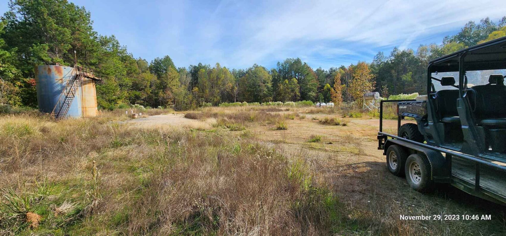
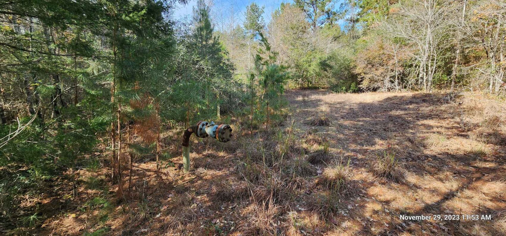
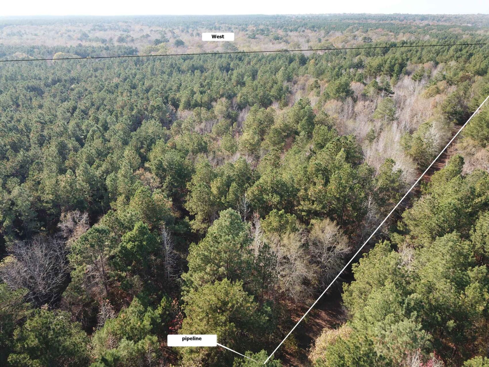
There is one known gas gathering pipeline on this Property running from the active well in the southeastern corner to the northwest corner, as shown on the mapping. It is believed to have been bored underneath the Little Loco stream and bottomland and does not show above-ground location.
There is one active gas well on the Property, and one permitted location approved in 2008, as shown on the mapping. No activity is evident at the permitted location.
To arrange site visits, please contact listing agent Mark Brian at 936-590-0986, or the TerraStone office at 936-590-4909. Buyers Agents are required to contact listing agent to arrange site visits and are required to accompany potential buyers at the time of the first visit. Failure to disclose as a Buyers Agent or lack of presence upon first site visit will result in co-broker compensation being at discretion of listing agent. A 2% co-broker fee is offered on this property. The listing agent is willing to accompany Buyers Agents as a guide if requested and given sufficient notice.
TerraStone Land Company strives to gather good information concerning listed properties from reliable sources, but cannot guarantee the accuracy of said data, including but not limited to boundary line locations, acreages, fence lines, tree ages, timber volumes, timber value, legal title, environmental hazards, condition of improvements, legal access, utility services, or site suitability for agricultural or forestry use. All maps are provided for illustrative purposes only and are not survey plats. Unless specifically stated, no formal land surveying by a licensed surveyor has been used in determining acreages. Aerial and ground photography may include neighboring properties that are not included in this offering, and such photography is intended for general use only. TLC recommends that potential buyers examine the offered property to their own satisfaction and are strongly urged to verify all pertinent facts for themselves. TLC is not responsible for errors, omissions, offering withdrawal or price modifications.
USEFUL DOCUMENTS
- countylevellocationmap.pdf
- StandAcreagesChart.pdf
- Nacogdoches_1972-04-07_N_00001707_V_DR_00374_P_0041.pdf
- timbertypeandwoodsroadsmap.pdf
- aerialmap-1.pdf
- topomap-1.pdf
- zoomedoutlocationmap.pdf
- contourlineswellsandpipelinemap.pdf
- timbertypeandwoodsroadsmap-1.pdf
- topolocation.pdf
- soilmap.pdf
- aerialmap.pdf
- contourlineswellsandpipelinemap-1.pdf
- topomap-2.pdf
- zoomedoutlocationmap-1.pdf
- Nacogdoches_1972-04-07_N_00001706_V_DR_00374_P_0037g.pdf
Property Map / Directions
From Nacogdoches on Highway 21, from the West Loop at Hwy 59 & Hwy 21 go west 8.5 miles on Hwy 21 to County Road 841 (sign for Turnip Seed Cemetery) then right (north) for 1.6 miles to the property on the left (west side of CR 841). The property is 1.8 miles south of FM 343 at the Salem Church turnoff, which is 4.7 miles south of Looneyville and FM 225, or 9.6 miles west of the West Loop Hwy 59 at Nacogdoches. From Douglass, CR 841 is 5 miles east on Hwy 21 on the left.
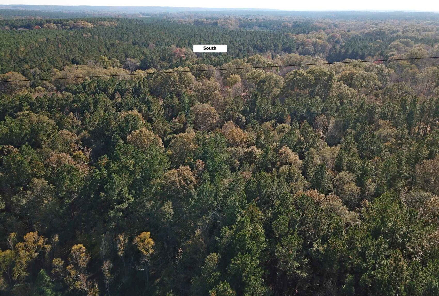
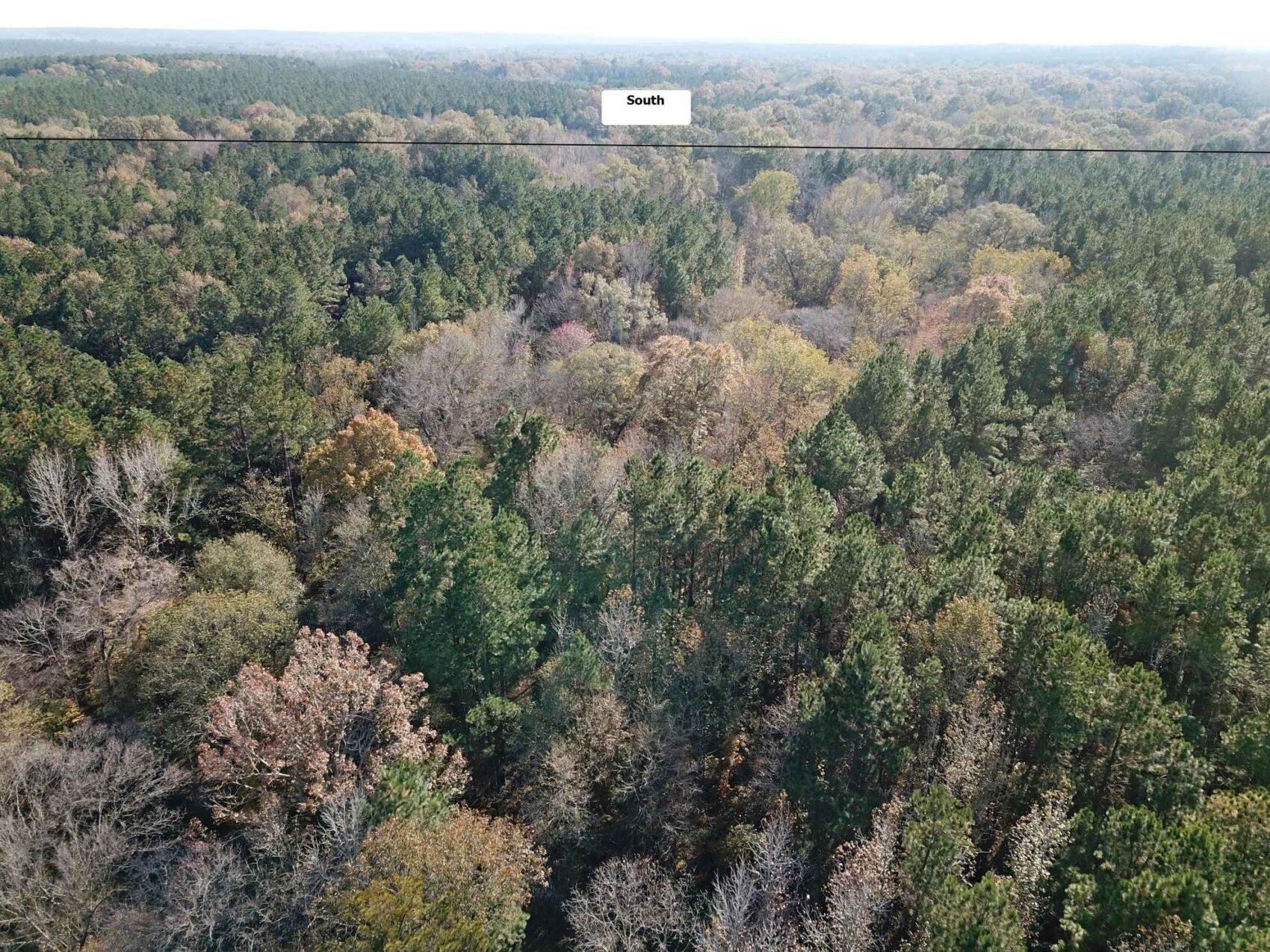
PROPERTY IMAGES


Other Listings
-
 $278,356
+-107.06 Acres - Harrison County, Texas
Acres107.06 CountyHarrison StateTexas -
$1,227,107
1,067 ACRES, McINTOSH COUNTY, OKLAHOMA
Acres1,067.05 CountyMcIntosh StateOklahoma -
$65,000
10.16 ACRES, NACOGDOCHES COUNTY, TEXAS
Acres10.00 CountyNacogdoches StateTexas -
$40,688
10.443 ACRES, SHELBY COUNTY, TEXAS
Acres10.44 CountyShelby StateTexas -
$36,575
10.45 ACRES, NACOGDOCHES COUNTY, TEXAS
Acres10.45 CountyNacogdoches StateTexas -
$30,000
10.928 ACRES, CHEROKEE COUNTY, TEXAS
Acres10.93 CountyCherokee StateTexas -
$429,250
101.0 ACRES, RUSK COUNTY, TEXAS
Acres101.00 CountyRusk StateTexas -
$303,450
101.15 ACRES, HARRISON - PANOLA COUNTY
Acres101.15 CountyPanola StateTexas -
106.0 ACRES, SABINE COUNTY, TEXAS
Acres0.00 County State -
$233,200
106.0 ACRES, SABINE COUNTY, TEXAS
Acres106.00 CountySabine StateTexas -
$231,575
107 ACRES, NACOGDOCHES COUNTY, TEXAS
Acres107.00 CountyNacogdoches StateTexas -
$305,424
113.12 ACRES, SABINE COUNTY, TEXAS
Acres113.12 CountySabine StateTexas -
$295,000
118.0 ACRES, NACOGDOCHES COUNTY, TEXAS
Acres118.00 CountyNacogdoches StateTexas -
$72,000
12.0 ACRES, RUSK COUNTY, TEXAS
Acres12.00 CountyRusk StateTexas -
$146,400
12.2 Acres Red River County, Texas
Acres12.20 CountyRed River StateTexas -
$133,350
12.7 Acres Red River County, Texas
Acres12.70 CountyRed River StateTexas -
$175,000
120 ACRES, CASS COUNTY, TEXAS
Acres120.00 CountyCass StateTexas -
$340,000
132.081 ACRES, SHELBY COUNTY, TEXAS
Acres132.08 CountyShelby StateTexas -
$343,000
133.47 ACRES, PANOLA COUNTY, TEXAS
Acres133.47 CountyPanola StateTexas -
$398,250
135 ACRES, NACOGDOCHES COUNTY, TEXAS
Acres135.00 CountyNacogdoches StateTexas -
$890,500
137.0 ACRES, ANDERSON COUNTY, TEXAS
Acres137.00 CountyAnderson StateTexas -
$148,050
14.1 Acres Red River County, Texas
Acres14.10 CountyRed River StateTexas -
$375,000
140.0 ACRES, SHELBY COUNTY, TEXAS
Acres140.00 CountyShelby StateTexas -
$455,008
154.24 ACRES, RUSK COUNTY, TEXAS
Acres154.24 CountyRusk StateTexas -
$578,380
156 ACRES, NACOGDOCHES COUNTY, TEXAS
Acres156.00 CountyNacogdoches StateTexas -
$99,900
16.0 ACRES NACOGDOCHES COUNTY, TX Lot 5
Acres16.00 CountyNacogdoches StateTexas -
$99,900
16.0 ACRES, NACOGDOCHES COUNTY, TEXAS
Acres16.00 CountyNacogdoches StateTexas -
$143,650
16.9 Acres Red River County, Texas
Acres16.90 CountyRed River StateTexas -
$420,605
162.71 ACRES, ANGELINA COUNTY, TEXAS
Acres162.70 CountyAngelina StateTexas -
$449,500
167.50 ACRES, SHELBY COUNTY, TEXAS
Acres167.50 CountyShelby StateTexas -
$380,250
169.0 ACRES, HARDIN COUNTY, TEXAS
Acres169.00 CountyHardin StateTexas -
$30,600
17.0 ACRES, RUSK COUNTY, TEXAS
Acres17.00 CountyRusk StateTexas -
$317,330
171.53 ACRES, PANOLA COUNTY, TEXAS
Acres171.53 CountyPanola StateTexas -
$689,936
172.7 Acres Nacogdoches County Texas
Acres172.70 CountyNacogdoches StateTexas -
$347,812
178.0 ACRES, SHELBY COUNTY, TX
Acres178.00 CountyShelby StateTexas -
$72,000
18.0 ACRES, TYLER COUNTY, TX
Acres18.00 CountyTyler StateTexas -
$729,000
183 ACRES, UPSHUR COUNTY, TX
Acres183.00 CountyUpshur StateTexas -
$294,006
184.33 ACRES, CADDO PARISH, LOUISIANA
Acres184.33 CountyCaddo StateLouisiana -
$482,250
196 ACRES, BIENVILLE PARISH, LOUISIANA
Acres196.00 CountyBienville StateLouisiana -
$179,000
20.4 ACRES, NACOGDOCHES COUNTY, TEXAS
Acres20.40 CountyNacogdoches StateTexas -
$217,350
20.7 Acres Red River County, Texas
Acres20.70 CountyRed River StateTexas -
$1,063,233
200.61 ACRES, SHELBY COUNTY, TEXAS
Acres200.61 CountyShelby StateTexas -
$155,000
21.4492 Acres, Trinity County, Texas
Acres21.45 CountyTrinity StateTexas -
218 ACRES, CADDO PARISH, LOUISIANA
Acres0.00 County State -
$520,000
218 ACRES, CADDO PARISH, LOUISIANA
Acres218.00 CountyCaddo StateLouisiana -
$135,660
22.61 acres in Rusk County, Texas
Acres22.61 CountyRusk StateTexas -
$314,580
226.6 ACRES, ALLEN PARISH, LOUISIANA
Acres226.60 CountyAllen StateLouisiana -
$599,500
231.87 ACRES, CASS COUNTY, TEXAS
Acres231.87 CountyCass StateTexas -
$120,000
24.86 Acres, Shelby County, TX
Acres24.86 CountyShelby StateTexas -
$1,116,000
248 acres in Nacogdoches County, Texas
Acres248.00 CountyNacogdoches StateTexas -
$91,505
25.070 ACRES, PANOLA COUNTY, TEXAS
Acres25.07 CountyPanola StateTexas -
$332,735
25.595 ACRES, ANGELINA COUNTY, TEXAS
Acres25.60 CountyAngelina StateTexas -
$179,000
26.13 Acres San Augustine County
Acres26.13 CountySan Augustine StateTexas -
$576,555
289.03 ACRES, CHEROKEE COUNTY, TEXAS
Acres289.03 CountyCherokee StateTexas -
$575,000
293.479 ACRES, PANOLA COUNTY, TEXAS
Acres293.47 CountyPanola StateTexas -
$7,900,000
3,160.58 ACRES, AR, LA, OK
Acres3,160.58 CountyUnion StateArkansas -
$55,500
3.48 ACRES, SMITH COUNTY, TX
Acres3.48 CountySmith StateTexas -
$195,000
30 Acres, Nacogdoches County, Texas
Acres30.00 CountyNacogdoches StateTexas -
$258,000
30.0 ACRES, SHELBY COUNTY, TEXAS
Acres30.00 CountyShelby StateTexas -
$102,204
30.06 ACRES, SABINE COUNTY, TEXAS
Acres30.06 CountySabine StateTexas -
$89,900
30.414 Acres, NACOGDOCHES COUNTY, TEXAS
Acres30.41 CountyNacogdoches StateTexas -
$795,000
315.0 ACRES, JEFFERSON COUNTY, TEXAS
Acres315.00 CountyJefferson StateTexas -
$137,600
32 ACRES, RUSK COUNTY, TEXAS
Acres32.00 CountyRusk StateTexas -
$246,000
32.8 Acres Red River County, Texas
Acres32.80 CountyRed River StateTexas -
$1,195,000
340.63 ACRES, PANOLA COUNTY, TEXAS
Acres340.63 CountyPanola StateTexas -
$122,500
35.0 ACRES CHEROKEE COUNTY, TX
Acres35.00 CountyCherokee StateTexas -
$180,025
37.9 ACRES NORTH PARCEL SHELBY COUNTY, TEXAS
Acres37.90 CountyShelby StateTexas -
$175,500
39 ACRES SOUTH PARCEL SHELBY COUNTY, TEXAS
Acres39.00 CountyShelby StateTexas -
$114,811
39.59ac HARRISON COUNTY, TX
Acres39.59 CountyHarrison StateTexas -
$1,160,000
392.68 Acres, Upshur County, Texas
Acres392.68 CountyUpshur StateTexas -
$75,885
40.35 ACRES, PANOLA COUNTY, TEXAS
Acres40.35 CountyPanola StateTexas -
$1,200,000
435 ACRES, BEXAR COUNTY, TEXAS
Acres435.00 CountyBexar StateTexas -
$127,861
44.09 ACRES, NACOGDOCHES COUNTY, TEXAS
Acres44.09 CountyNacogdoches StateTexas -
$291,200
44.8 Acres Red River County, Texas
Acres44.80 CountyRed River StateTexas -
$226,000
46 Acres, Nacogdoches County, Texas
Acres46.00 CountyNacogdoches StateTexas -
$225,500
46.0 ACRES, RUSK COUNTY, TEXAS
Acres46.00 CountyRusk StateTexas -
$117,500
47 ACRES, RUSK COUNTY, TEXAS
Acres47.00 CountyRusk StateTexas -
$289,100
49.0 ACRES, RUSK COUNTY, TEXAS
Acres49.00 CountyRusk StateTexas -
$2,972,730
495.455 Acres, Smith County, Texas
Acres495.45 CountyTexas StateTexas -
$30,000
5.62 ACRES, CHEROKEE COUNTY, TEXAS
Acres5.62 CountyCherokee StateTexas -
$640,000
507 ACRES, YELL COUNTY, ARKANSAS
Acres507.06 CountyYell StateArkansas -
$201,630
51.7 Acres, Rusk County, Texas
Acres51.70 CountyRusk StateTexas -
$1,754,695
527.758 ACRES, SMITH COUNTY, TEXAS
Acres527.75 CountySmith StateTexas -
$202,550
54 ACRES, RUSK COUNTY, TEXAS
Acres54.00 CountyRusk StateTexas -
$170,163
54.02 ACRES, SABINE COUNTY, TEXAS
Acres54.02 CountySabine StateTexas -
$178,230
54.84 ACRES, NACOGDOCHES COUNTY, TEXAS
Acres54.84 CountyNacogdoches StateTexas -
$156,790
55.5 ACRES, HOUSTON COUNTY, TEXAS
Acres55.50 CountyHouston StateTexas -
$156,800
56 ACRES, RUSK COUNTY, TEXAS
Acres56.00 CountyRusk StateTexas -
$131,600
56.0 ACRES, NACOGDOCHES COUNTY, TEXAS
Acres56.00 CountyNacogdoches StateTexas -
Contact for Price
56.889 ACRES, LAFAYETTE COUNTY, ARKANSAS
Acres56.89 CountyLafayette StateArkansas -
$1,562,000
568 ACRES, NACOGDOCHES COUNTY, TEXAS
Acres568.00 CountyNacogdoches StateTexas -
$165,528
58.08 ACRES, SABINE COUNTY, TEXAS
Acres58.08 CountySabine StateTexas -
$194,000
58.6 ACRES CAMP COUNTY, TEXAS
Acres58.60 CountyCamp StateTexas -
$218,230
59.06 ACRES (TR #10), NACOGDOCHES COUNTY, TEXAS
Acres59.06 CountyNacogdoches StateTexas -
$259,000
61.94 ACRES, HARDIN COUNTY, TEXAS
Acres61.94 CountyHardin StateTexas -
$180,648
62.4 Acres, Nacogdoches County, Texas
Acres62.40 CountyNacogdoches StateTexas -
$329,490
62.76 Acres Trawick, Nacogdoches County TX
Acres62.76 CountyNacogdoches StateTexas -
$185,075
67.3 ACRES, PANOLA COUNTY, TEXAS
Acres67.30 CountyPanola StateTexas -
$180,200
68 ACRES, NEWTON COUNTY, TEXAS
Acres68.00 CountyNewton StateTexas -
$239,900
69.358 ACRES PANOLA COUNTY, TX
Acres69.35 CountyPanola StateTexas -
$75,000
7.74 Acres Nacogdoches County, Texas
Acres7.74 CountyNacogdoches StateTexas -
$298,715
70.286 ACRES, PANOLA COUNTY, TEXAS
Acres70.28 CountyPanola StateTexas -
$308,975
72.7 ACRES. RUSK COUNTY, TEXAS
Acres72.70 CountyRusk StateTexas -
$215,000
74.0 ACRES, PANOLA COUNTY, TEXAS
Acres74.00 CountyPanola StateTexas -
$283,513
76.265 ACRES, SHELBY COUNTY, TEXAS
Acres76.27 CountyShelby StateTexas -
$3,995,000
803 ACRES, POLK COUNTY, TEXAS
Acres803.00 CountyPolk StateTexas -
$277,675
81.6 ACRES, DESOTO PARISH, LOUISIANA
Acres81.60 CountyDe Soto StateLouisiana -
$215,200
82.73 ACRES, CASS COUNTY, TEXAS
Acres82.73 CountyCass StateTexas -
$572,000
88.0 ACRES, GREGG COUNTY, TEXAS
Acres88.00 CountyGregg StateTexas -
$220,000
88.0 ACRES, RUSK COUNTY, TEXAS
Acres88.00 CountyRusk StateTexas -
$799,000
88.54 ACRES, BEAUREGARD PARISH, LOUISIANA
Acres88.54 CountyBeauregard StateLouisiana -
$459,000
88.54 ACRES, NACOGDOCHES COUNTY, TEXAS
Acres88.54 CountyNacogdoches StateTexas -
$220,500
90 ACRES, CLAIBORNE PARISH, LOUISIANA
Acres90.00 CountyClaiborne StateLouisiana -
$258,132
92.19 ACRES, RUSK COUNTY, TEXAS
Acres92.19 CountyRusk StateTexas -
$124,371
95.67 ACRES, ALLEN PARISH, LOUISIANA
Acres95.67 CountyAllen StateLouisiana -
$336,000
96.0 ACRES (Tract A&B) NACOGDOCHES COUNTY, TX
Acres96.00 CountyNacogdoches StateTexas -
$496,740
97.4 ACRES, SABINE COUNTY, TEXAS
Acres97.40 CountySabine StateTexas -
$178,200
99 ACRES, TYLER COUNTY, TEXAS
Acres99.00 CountyTyler StateTexas -
$800,000
99.49 ACRES, NACOGDOCHES COUNTY, TEXAS
Acres99.49 CountyNacogdoches StateTexas -
$297,505
99.5 Acres, Panola County, Texas
Acres99.50 CountyPanola StateTexas -
$174,635
CROSSROADS 53 ACRES, NACOGDOCHES COUNTY, TEXAS
Acres53.00 CountyNacogdoches StateTexas -
$535,920
GARRETT WEST 154 ACRES, NACOGDOCHES COUNTY, TEXAS
Acres154.00 CountyNacogdoches StateTexas -
$47,900
PRICE IMPROVEMENT - 6.39 ACRES, RUSK COUNTY, TEXAS
Acres6.39 CountyRusk StateTexas -
$163,845
UPDATED - 64.506 ACRES, CASS COUNTY, TEXAS
Acres64.51 CountyCass StateTexas
Contact Us About This Property
Call us at (936) 590-4909, email us at info@terrastonelandco.com or use the contact form below.