

156 ACRES, NACOGDOCHES COUNTY, TEXAS
Sold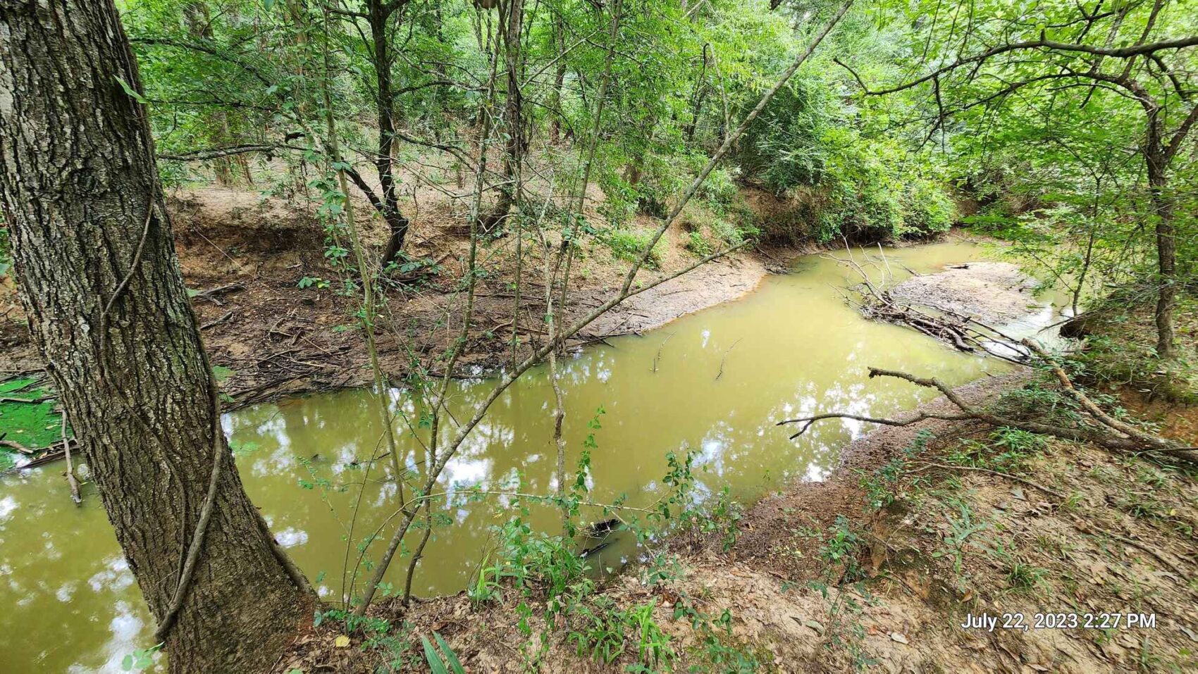
PROPERTY DETAILS
- Price:$578,380
- Type:Hunting Land, Recreational Property, Timberland
- Address:County Road 280
- Acres:156
- County:Nacogdoches
- City:Garrison
- Status:Sold
- State:Texas
- Zip:75946
PROPERY DESCRIPTION
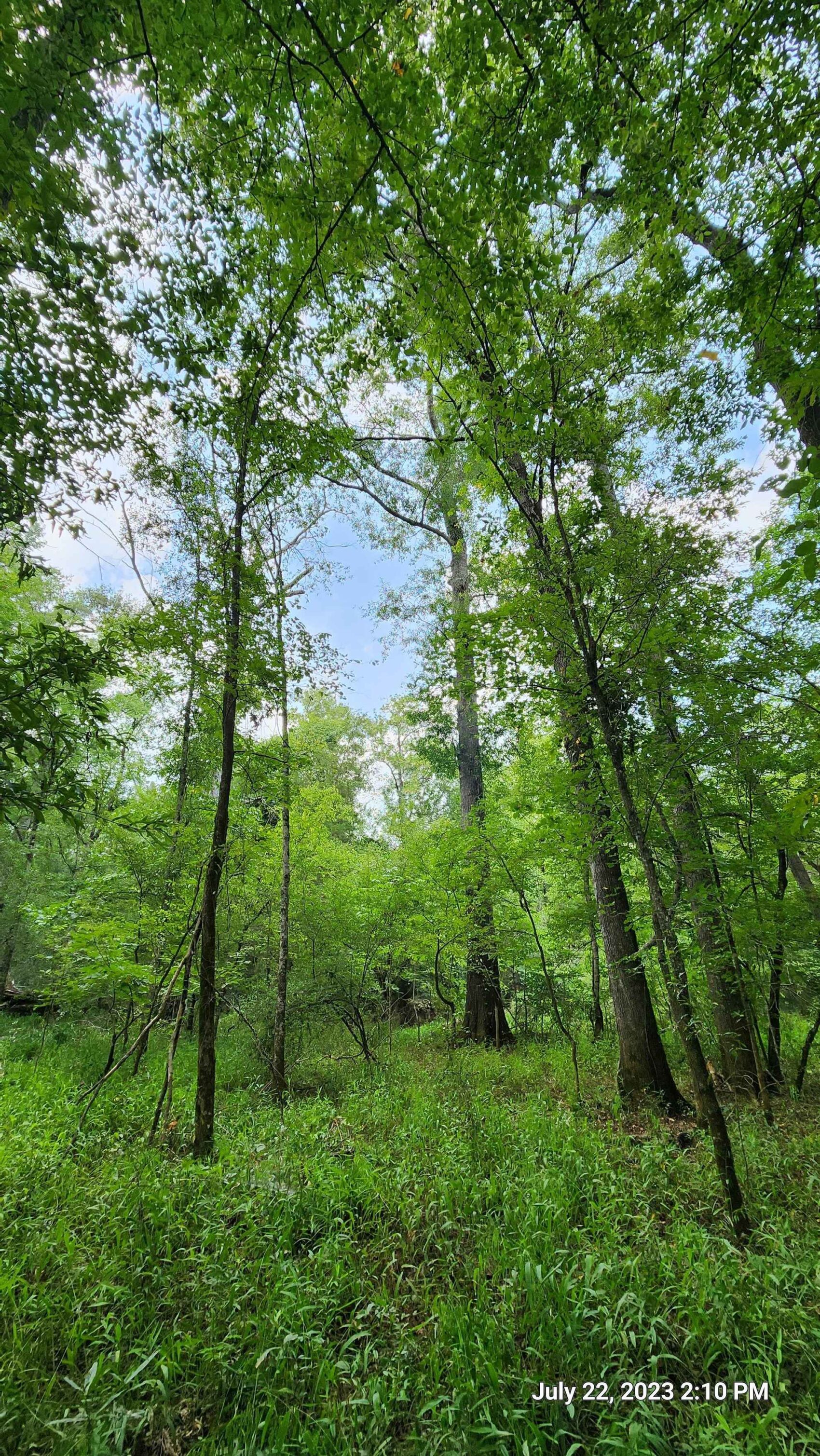
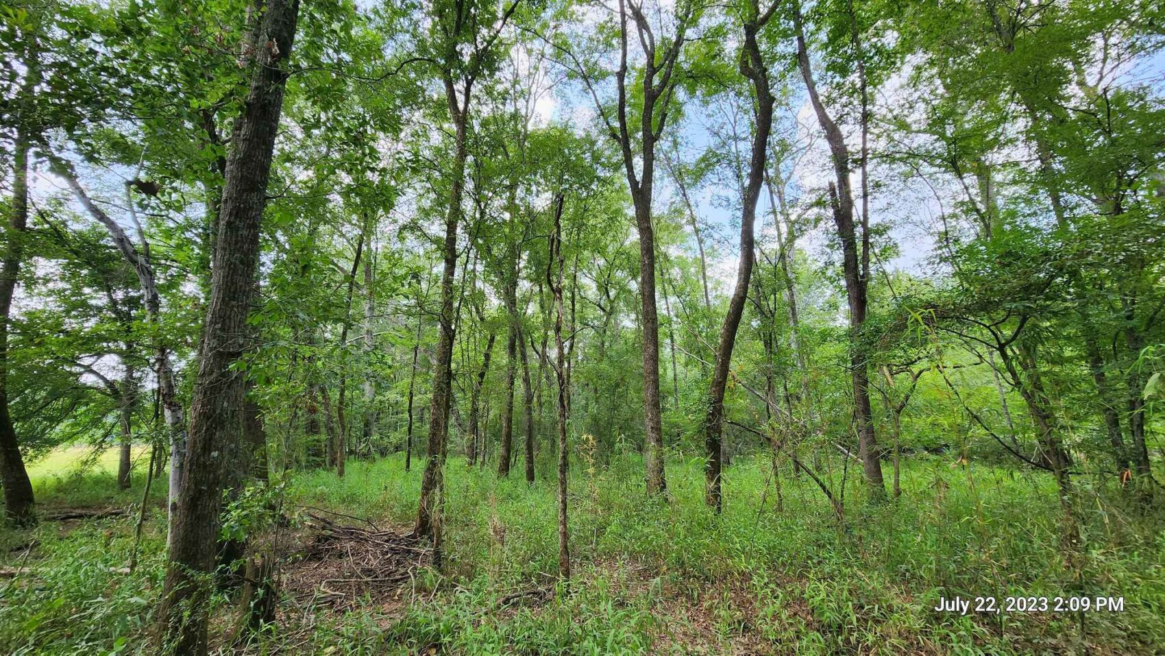
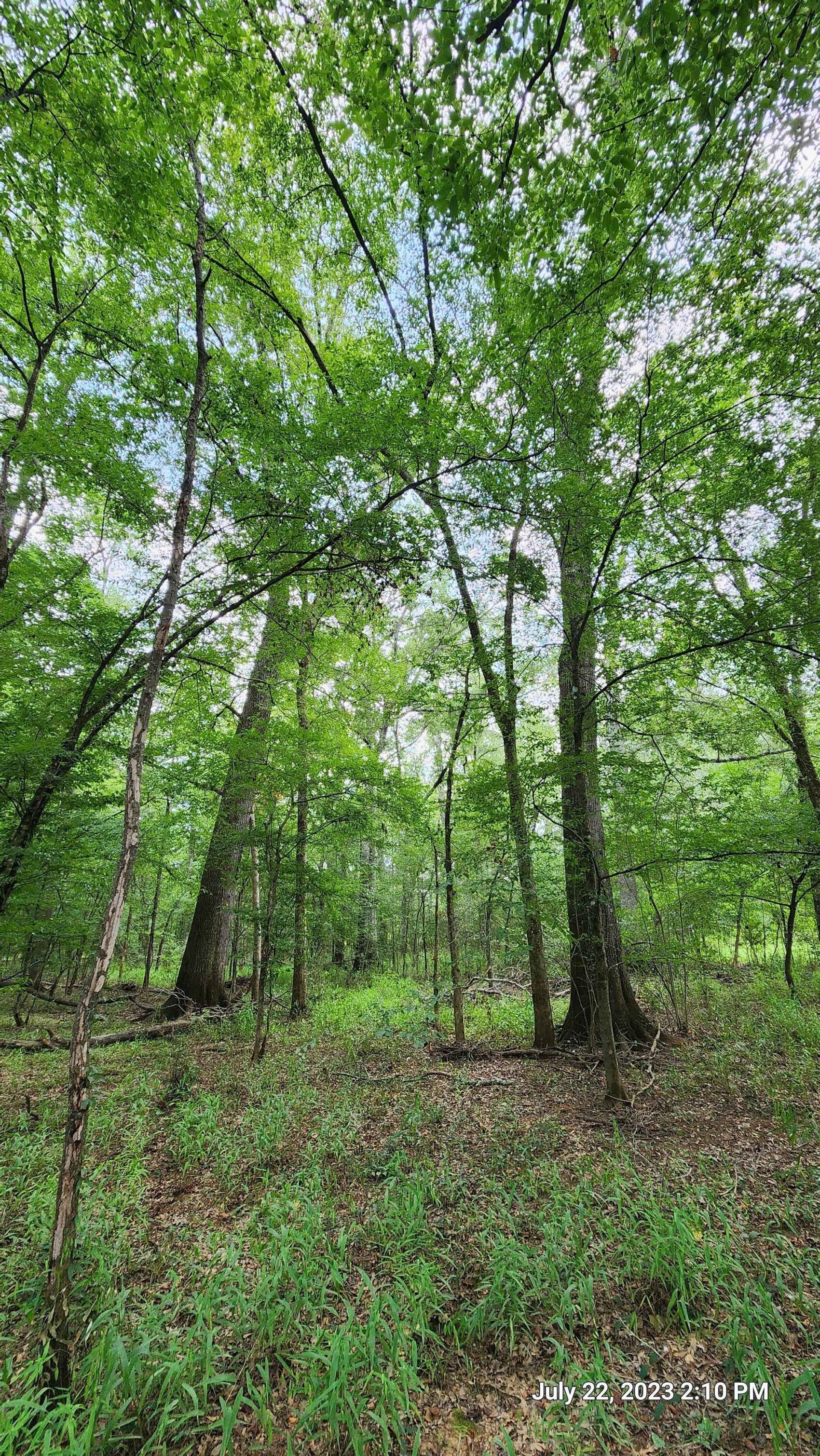
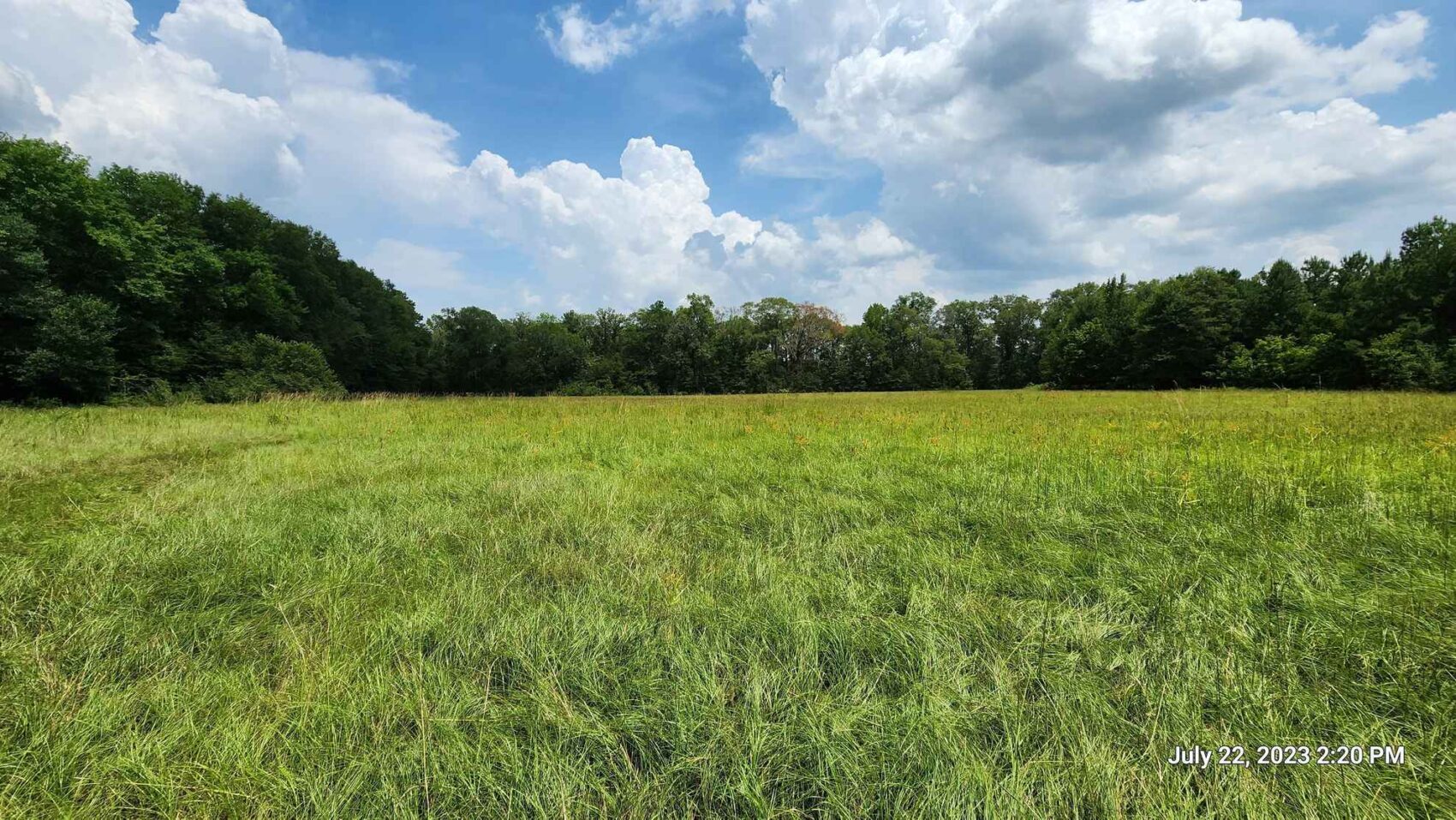
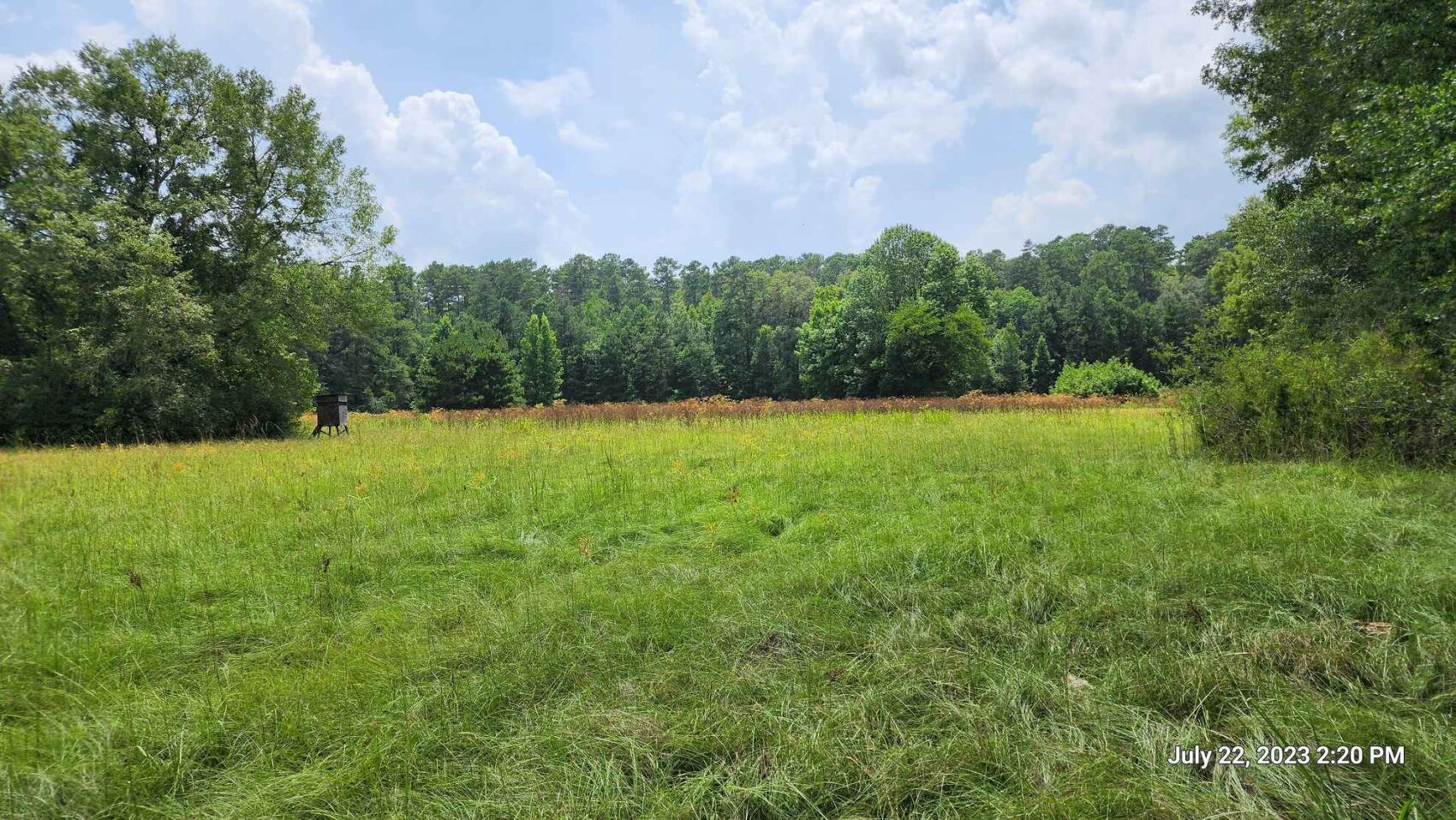
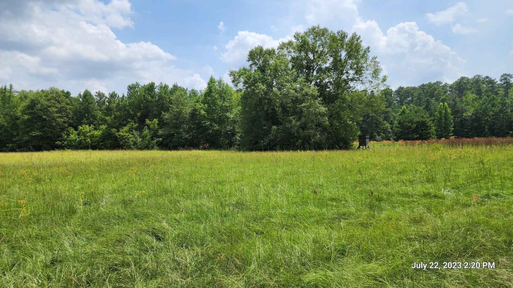
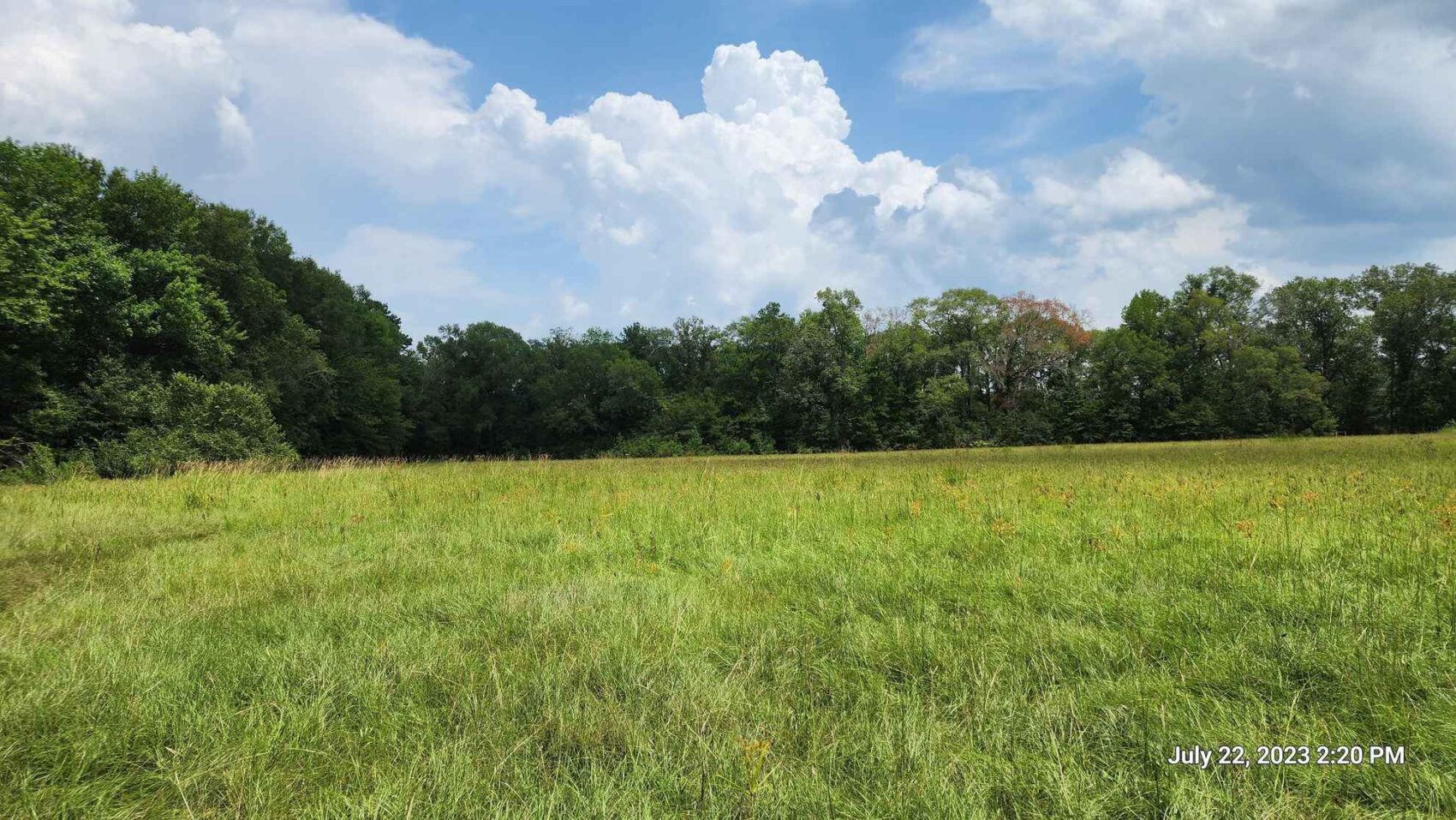
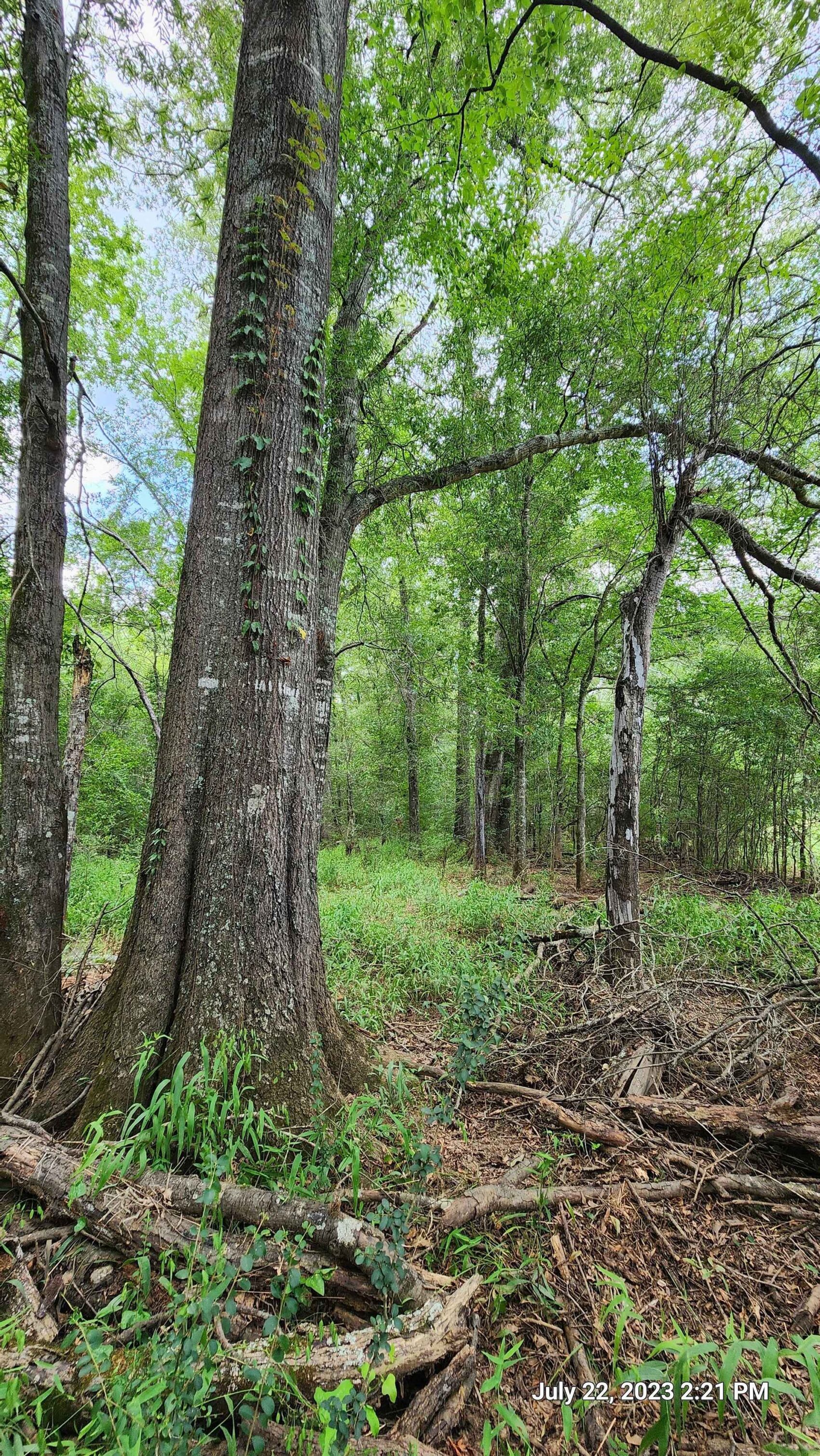
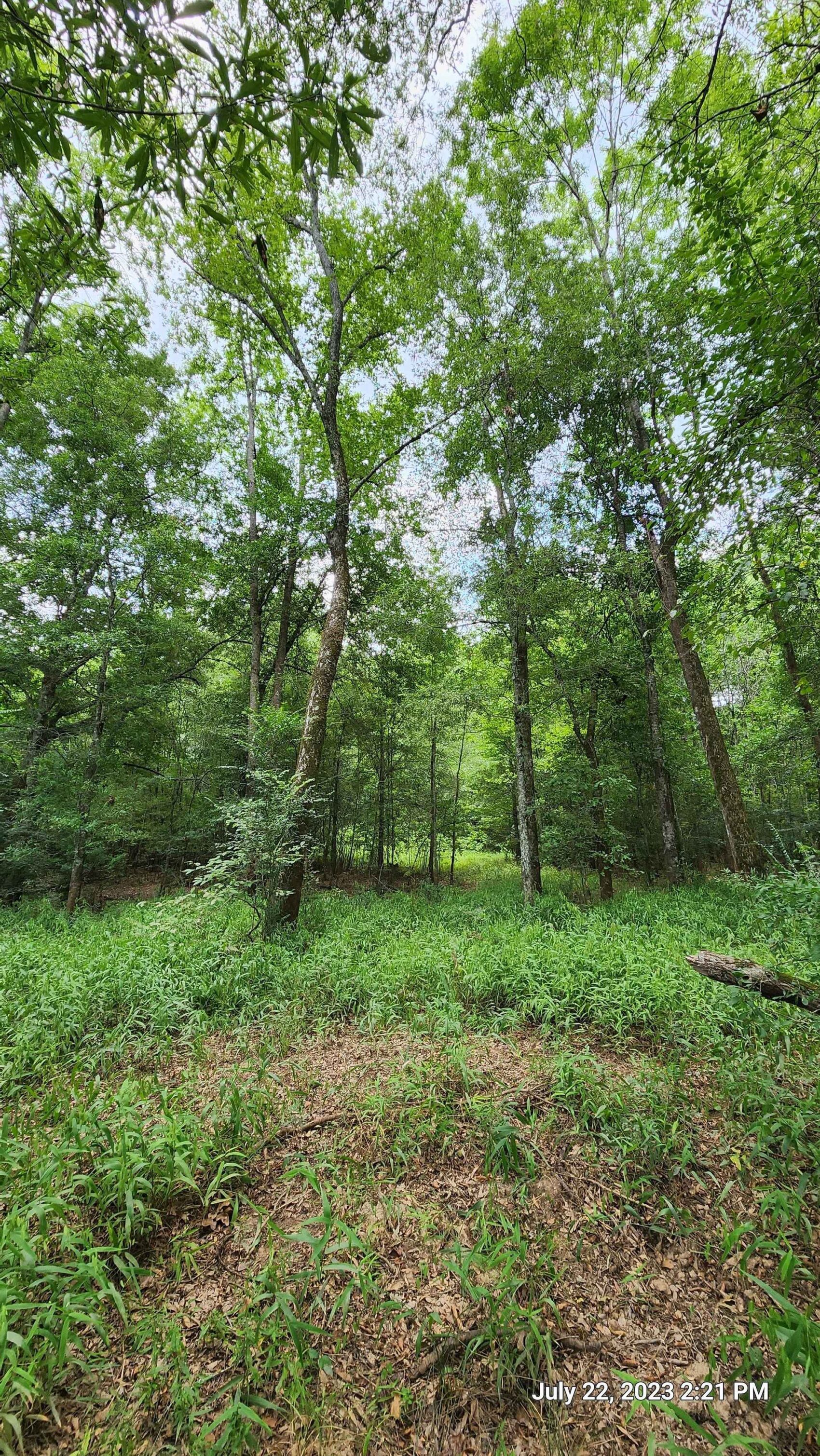
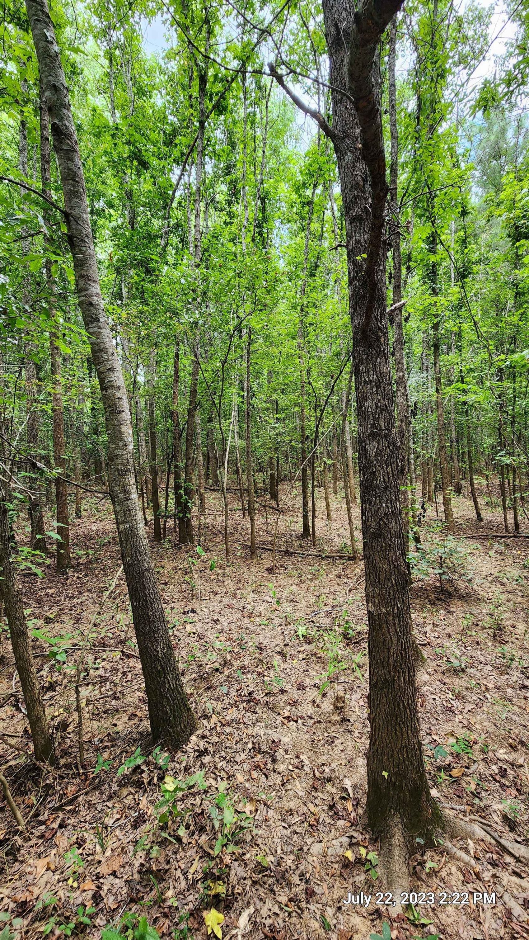
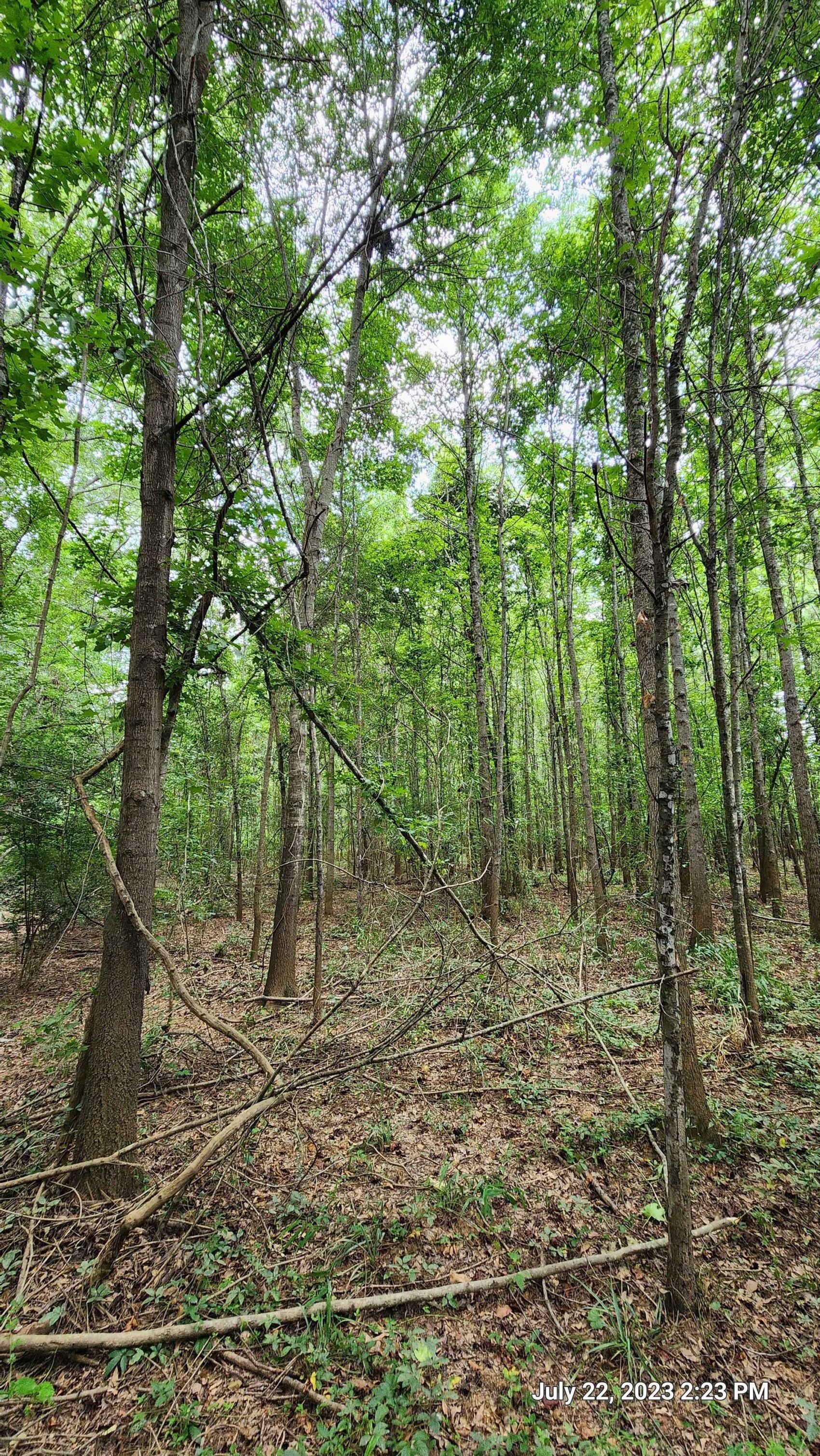
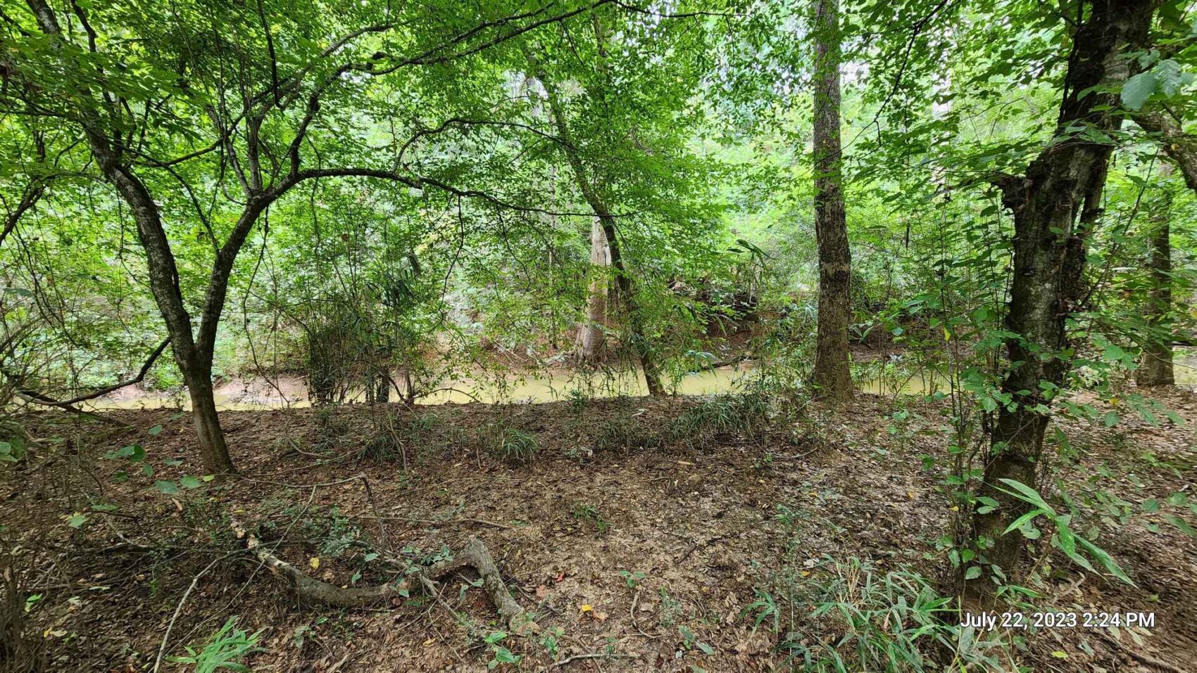
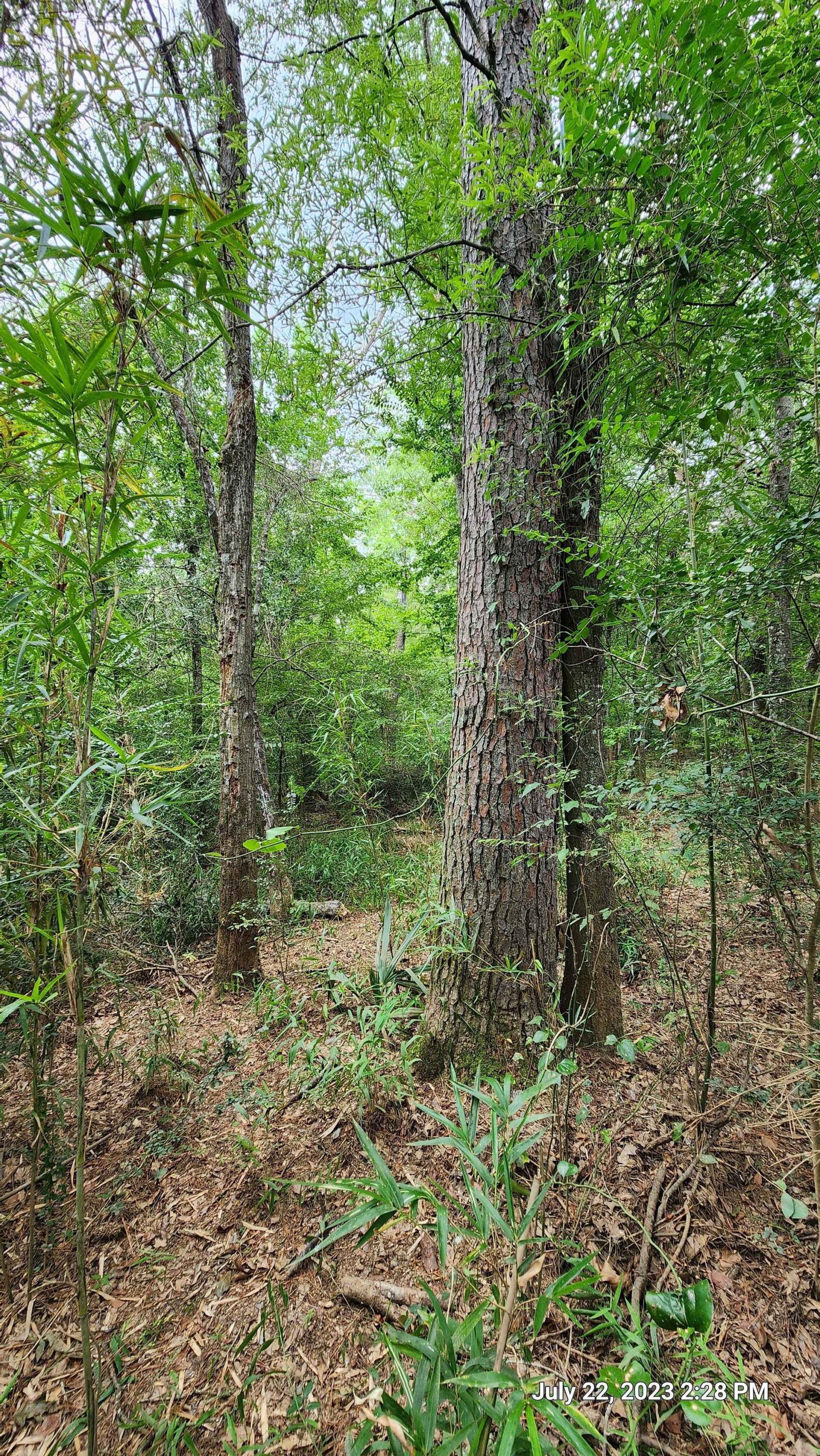
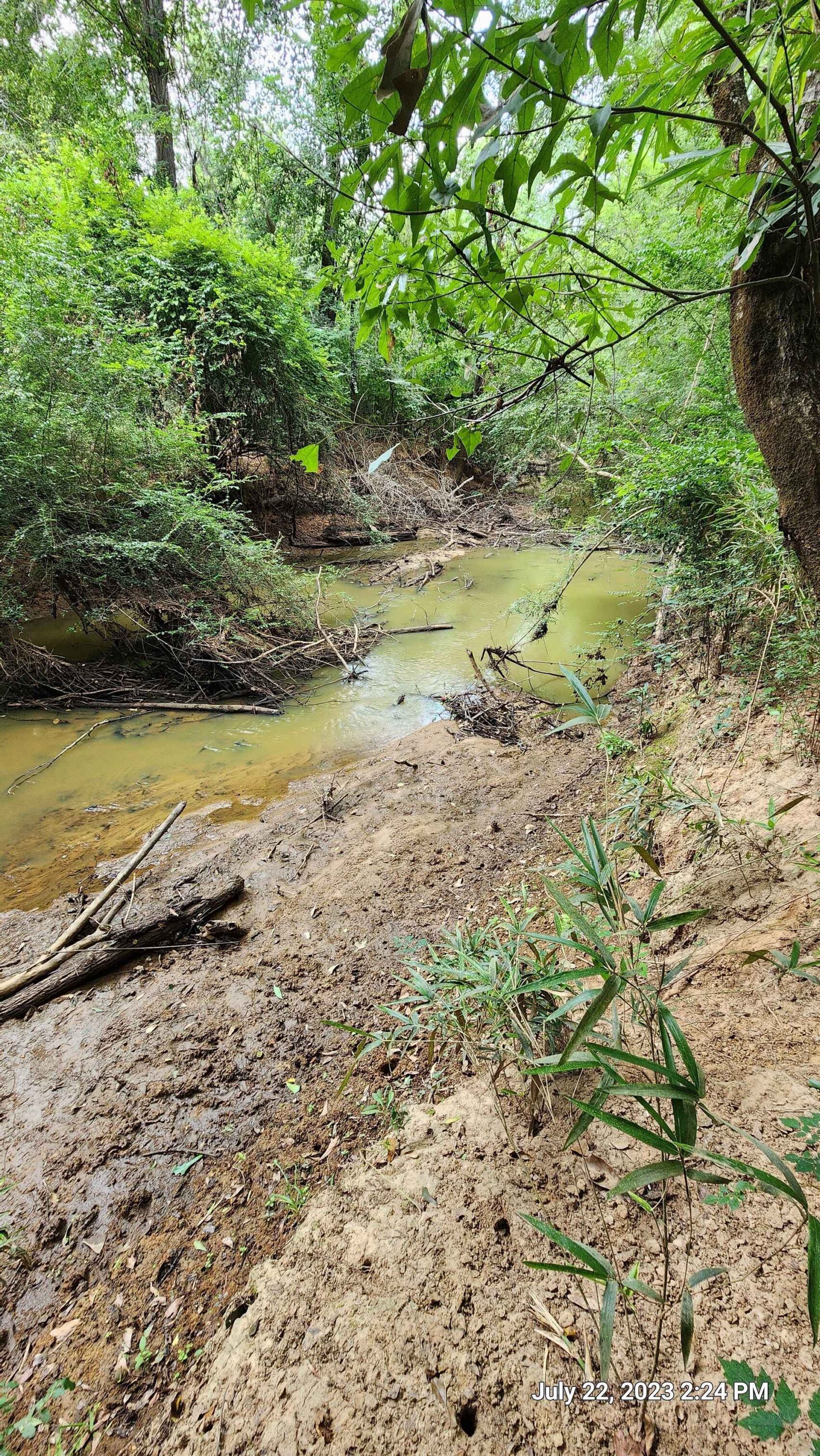
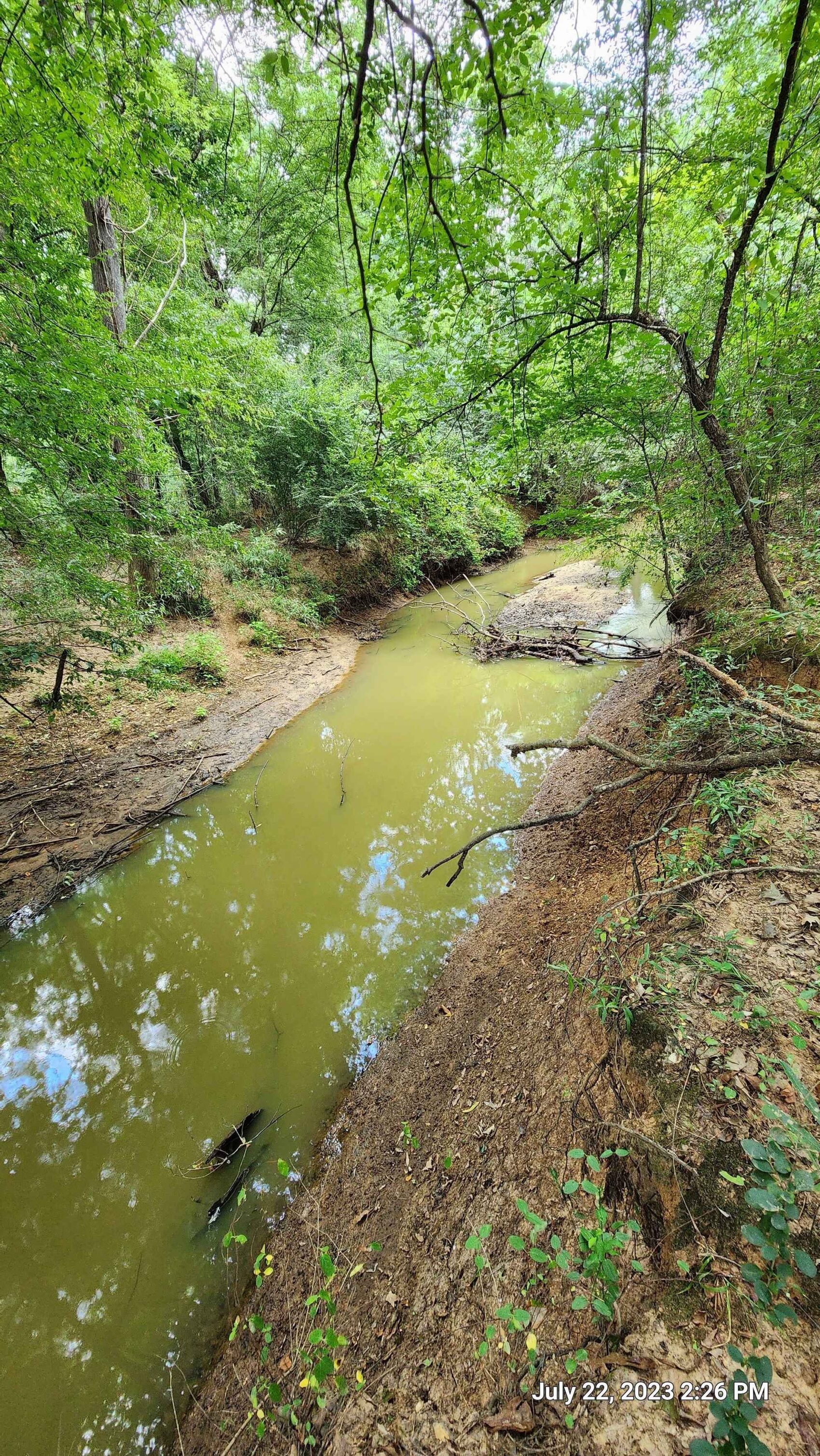
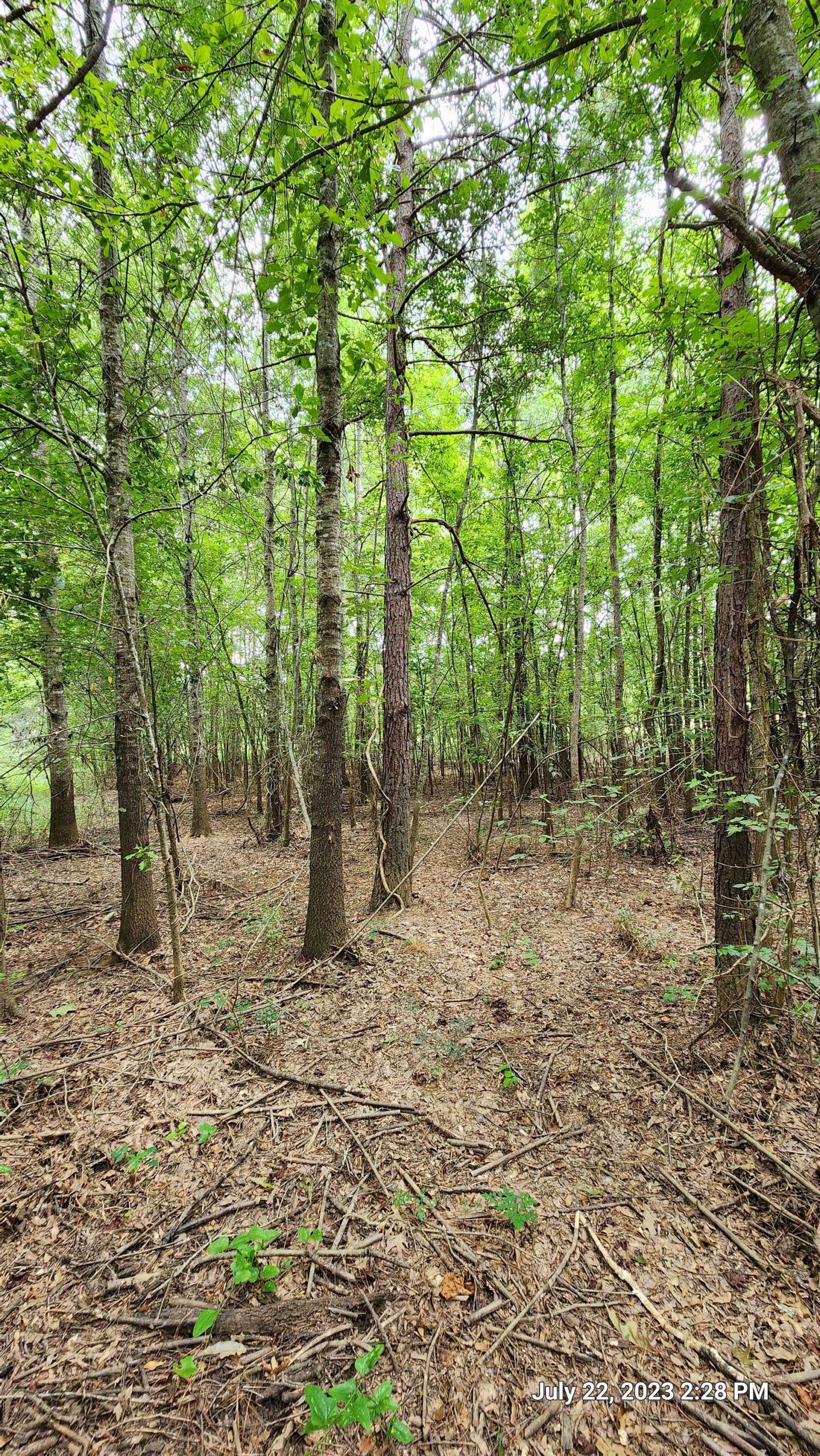
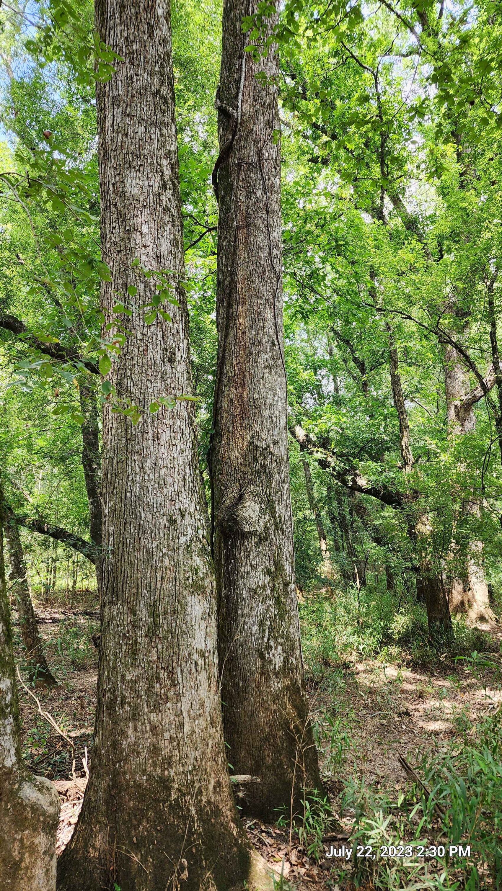
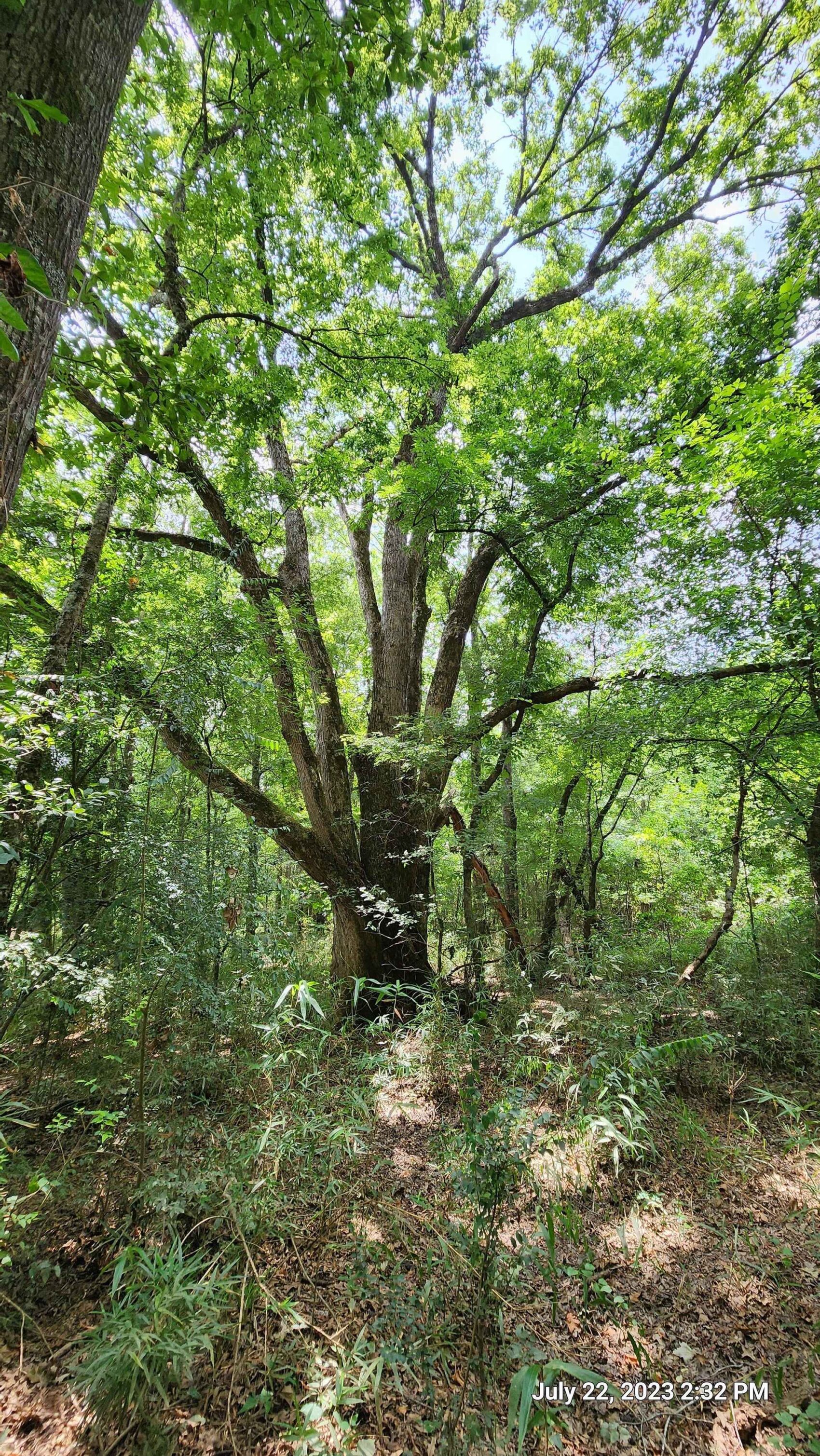
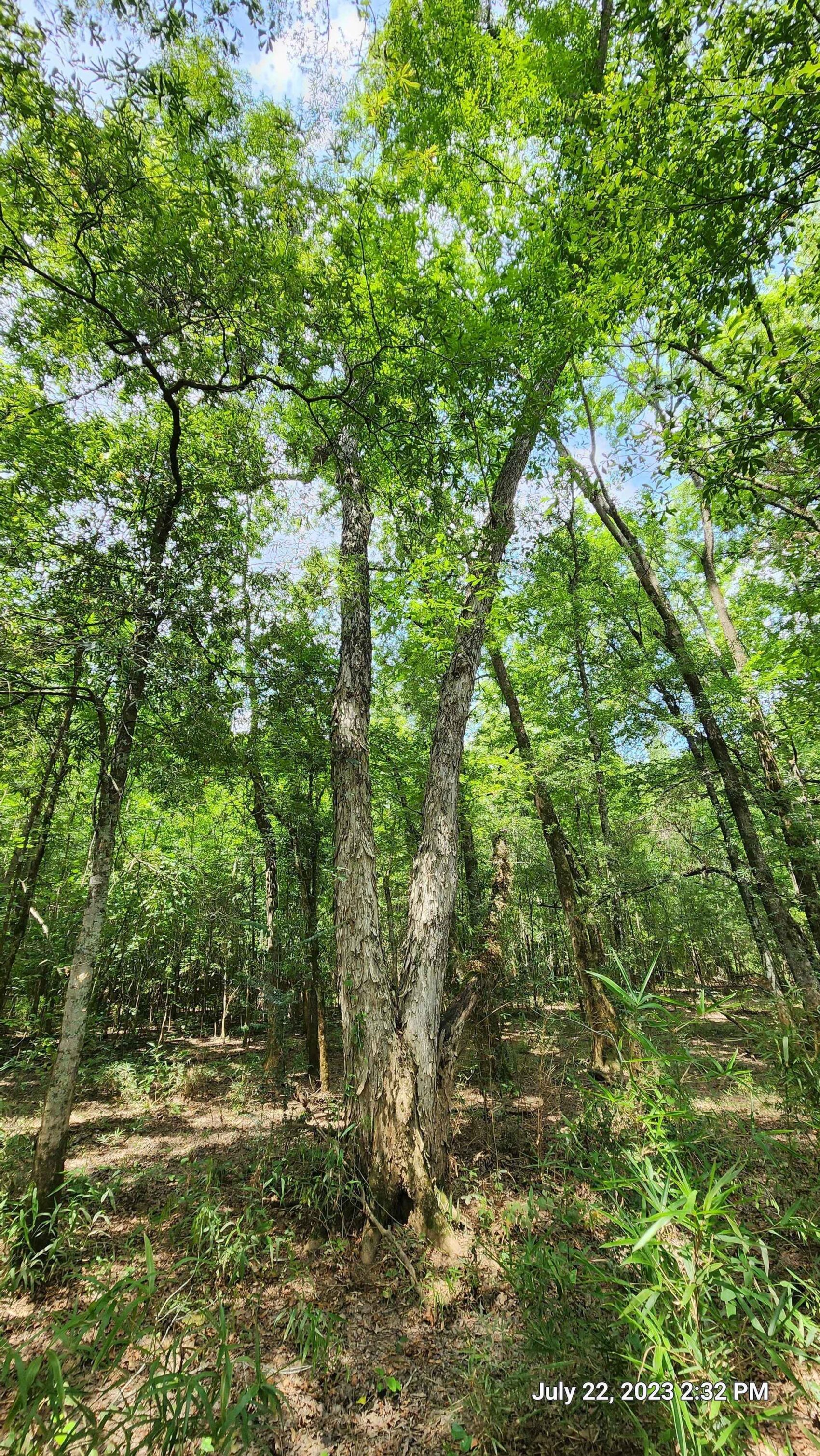
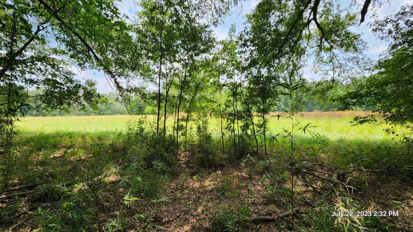
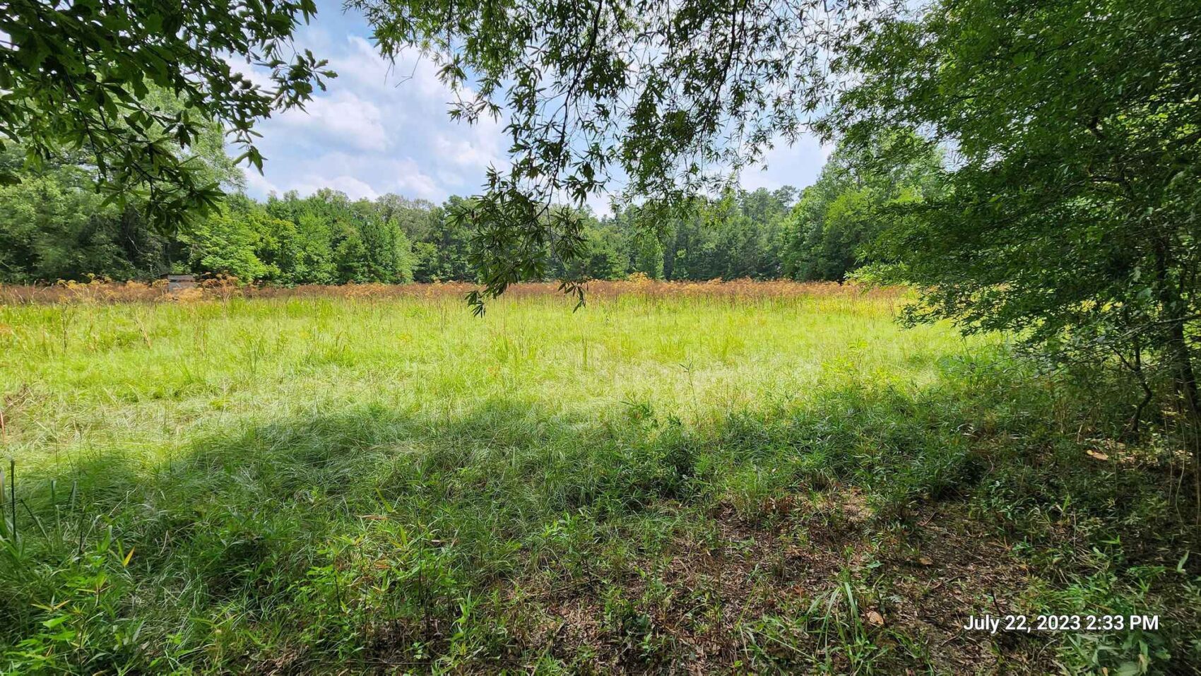
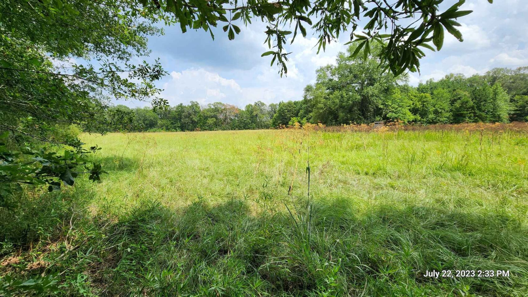
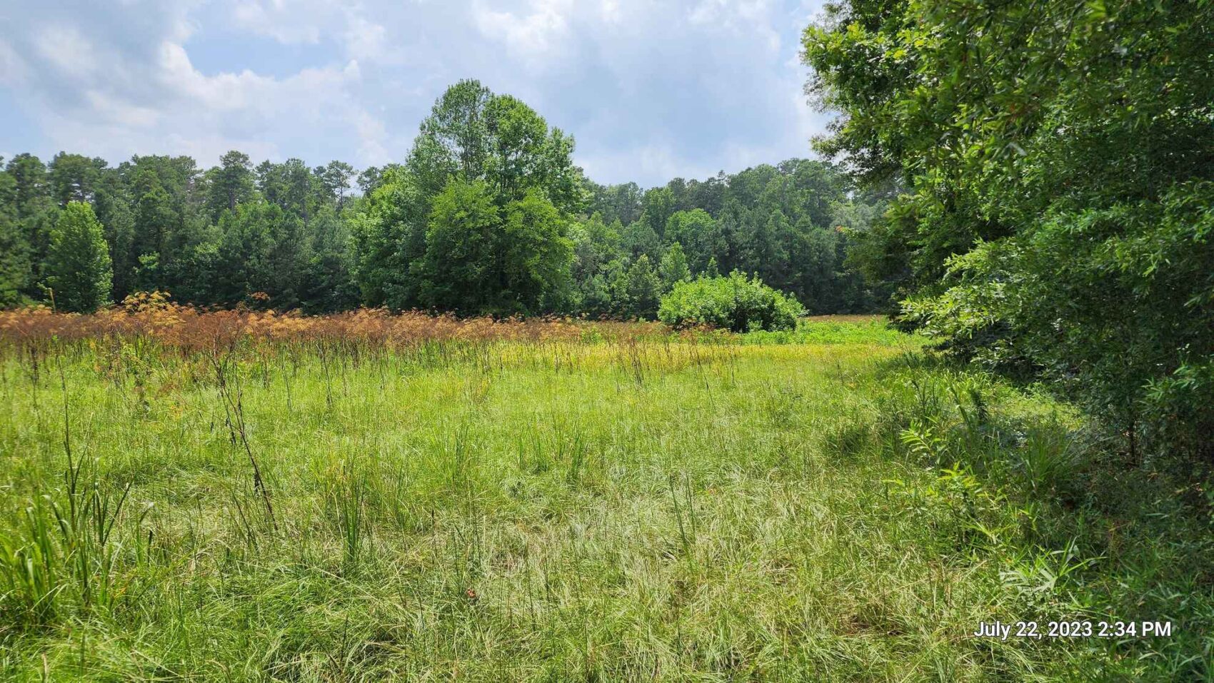
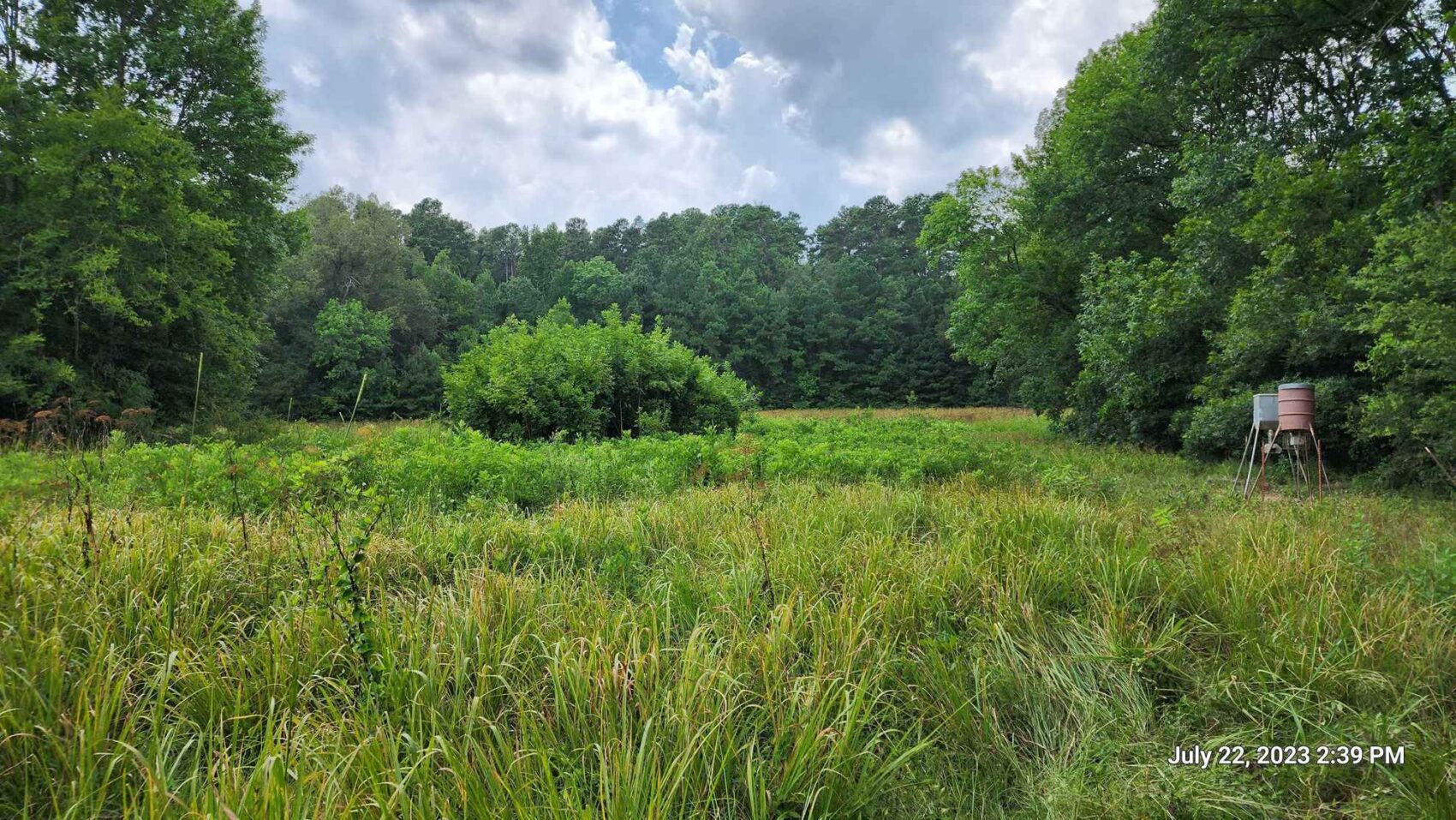
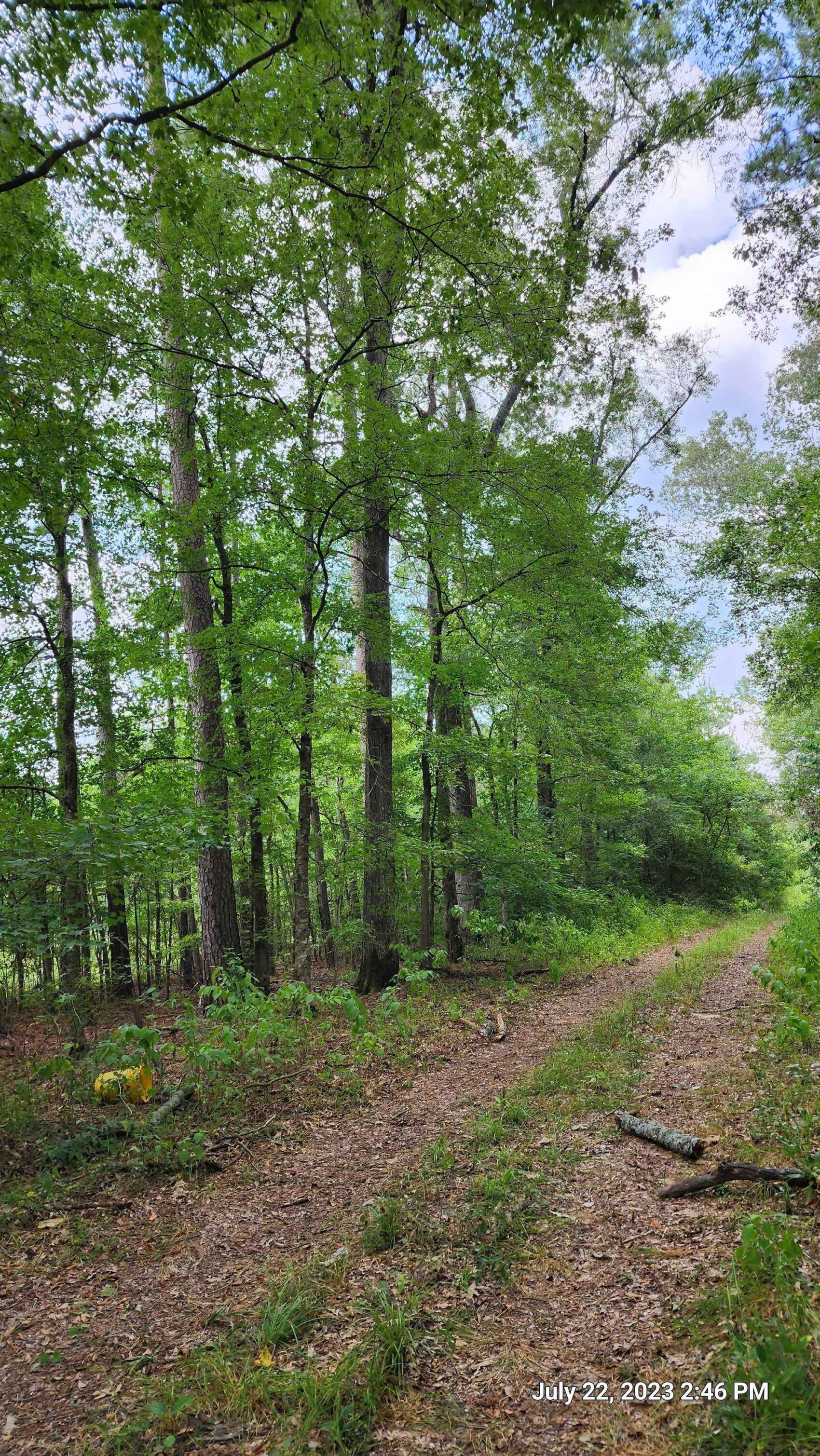
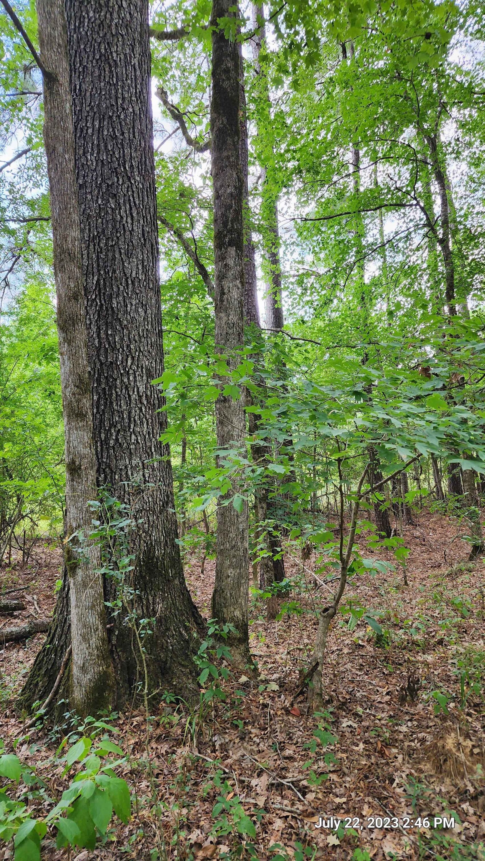
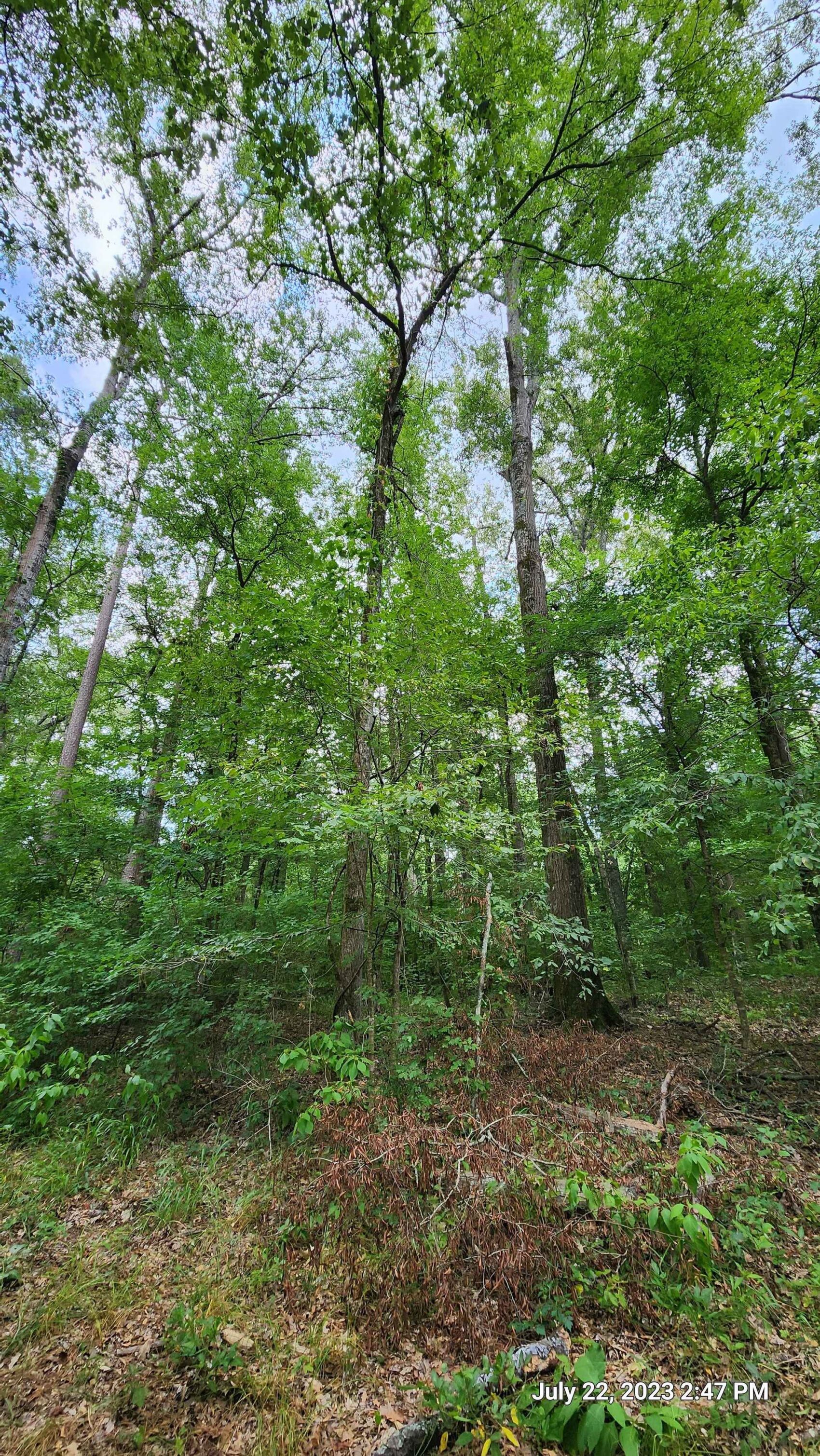
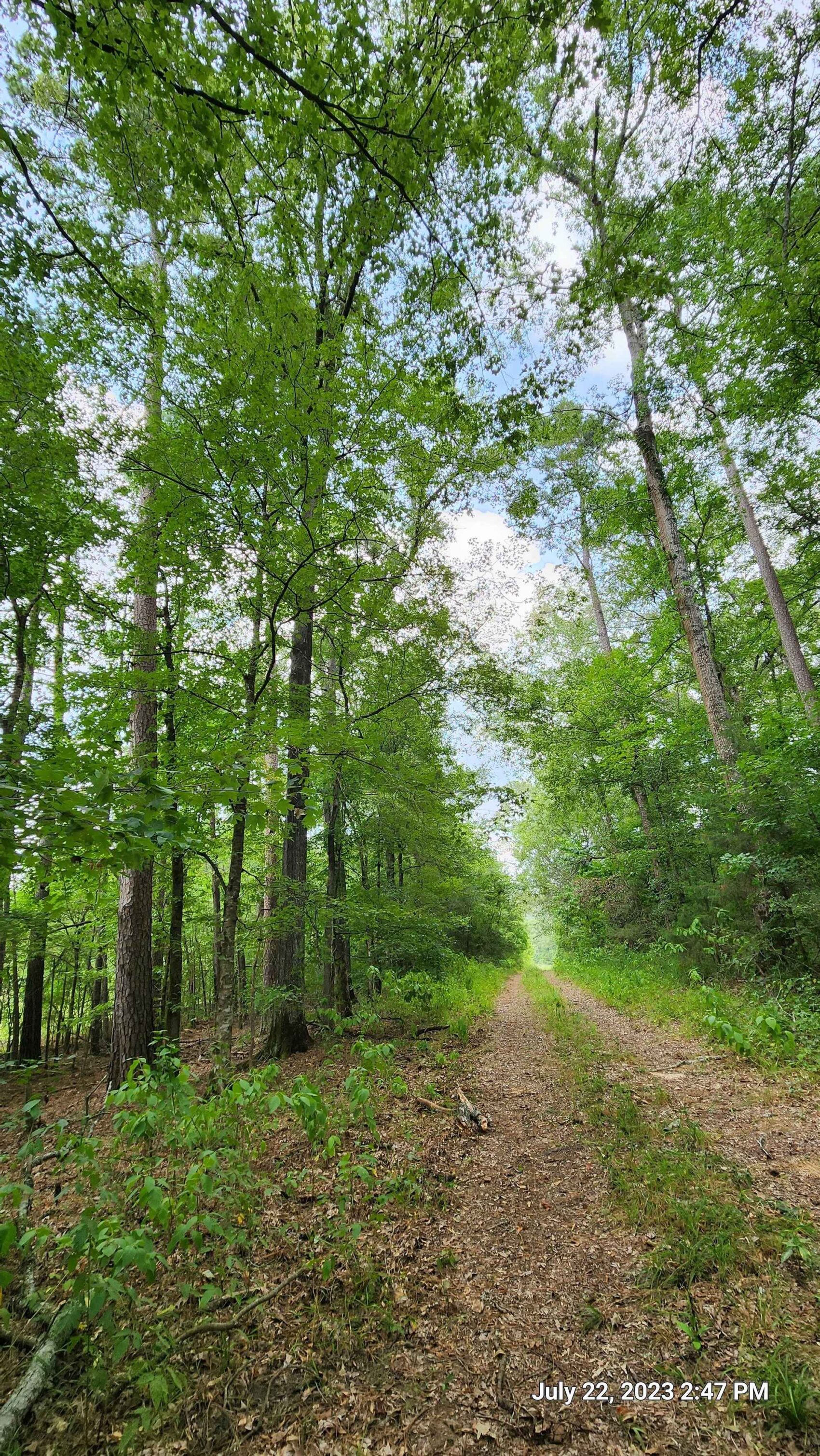
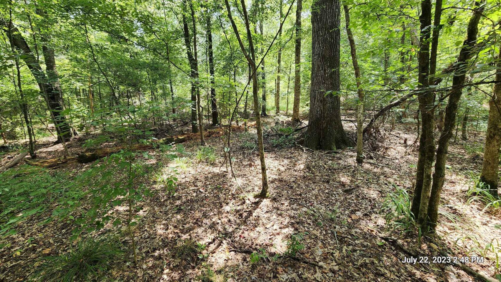
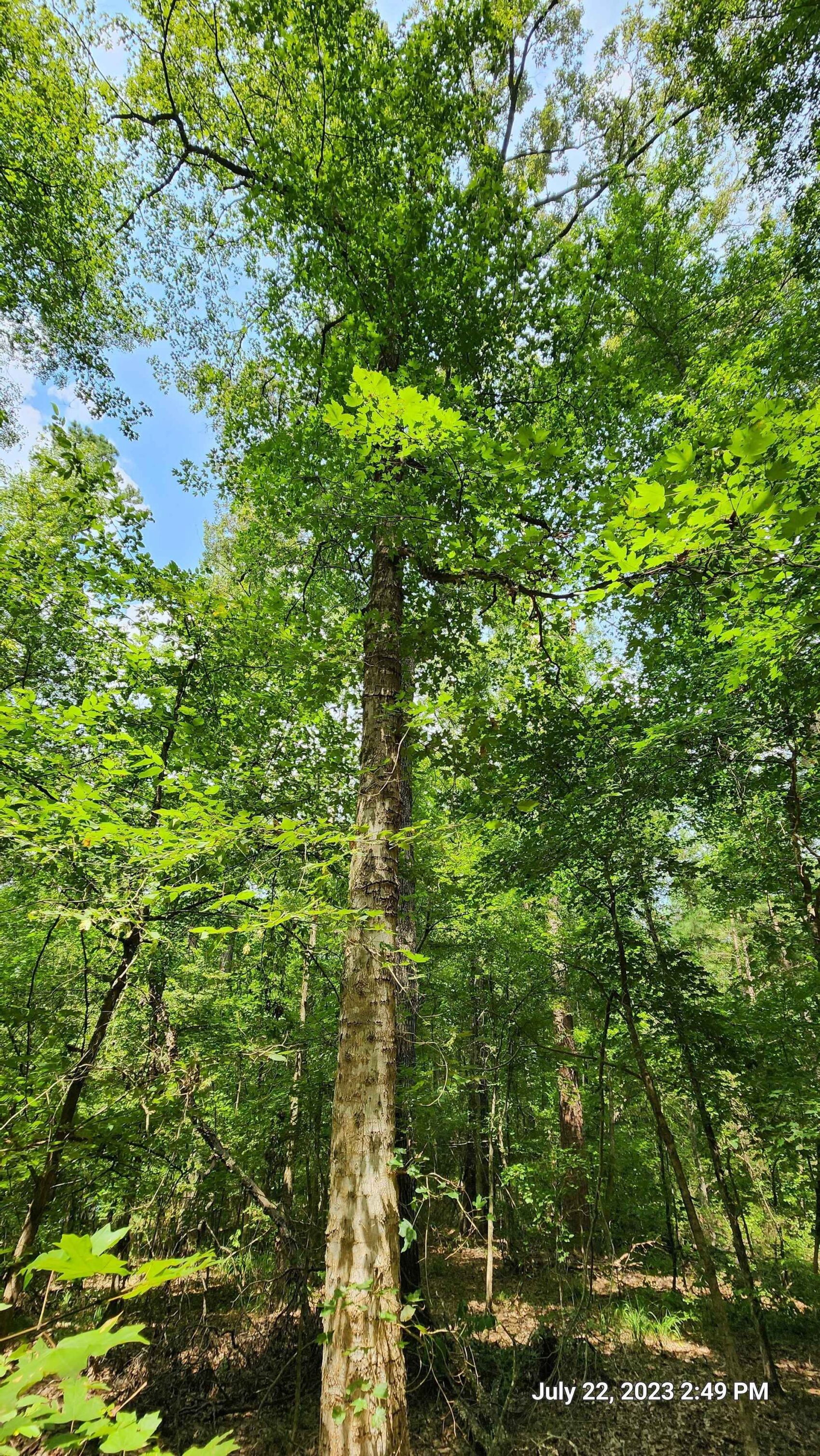
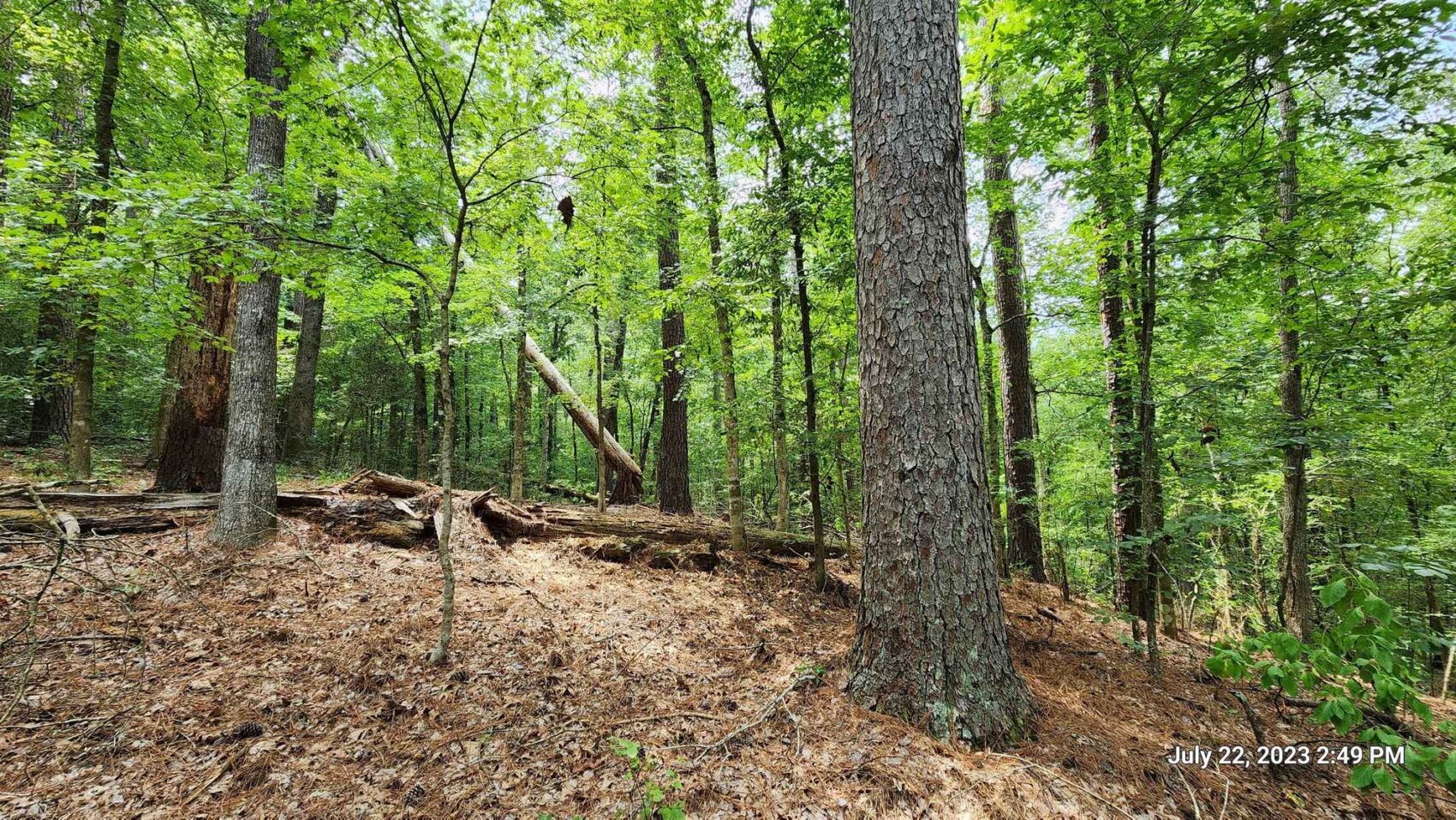
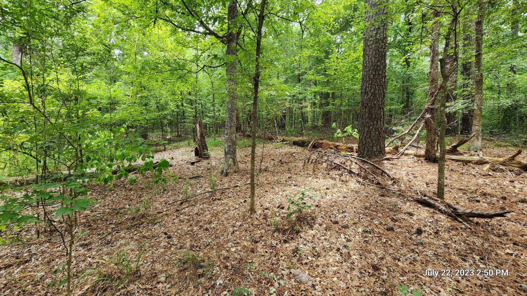
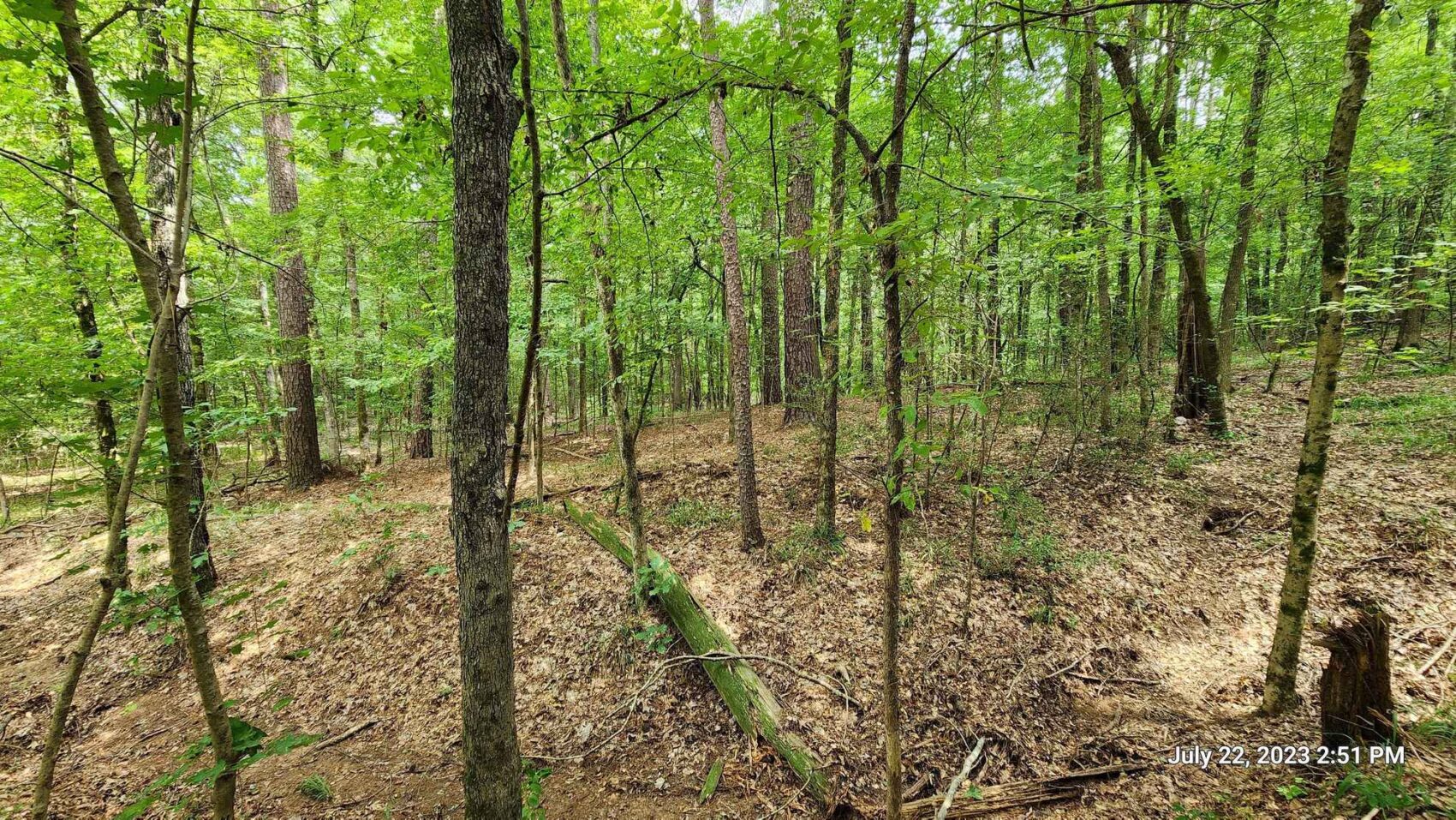
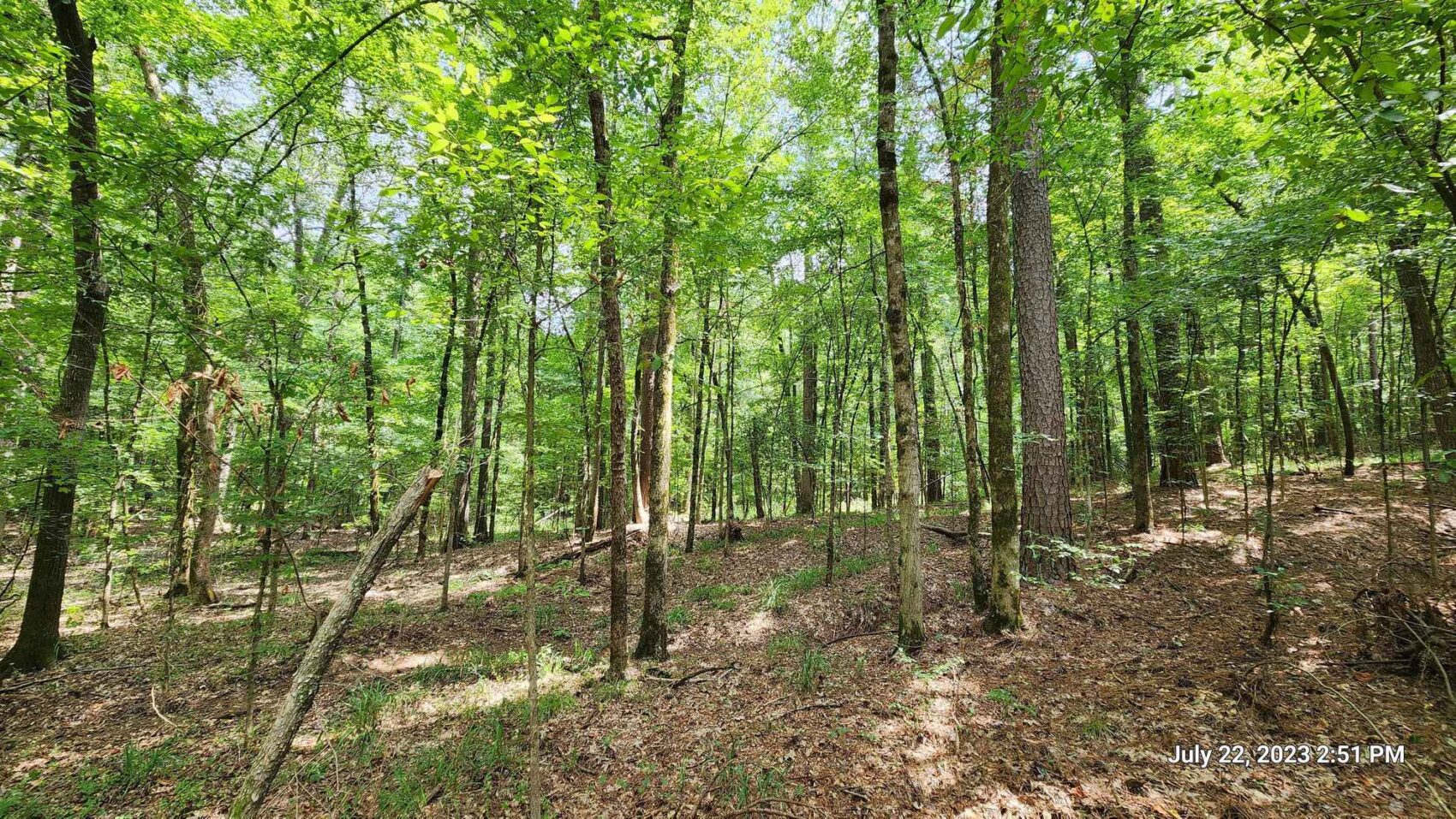
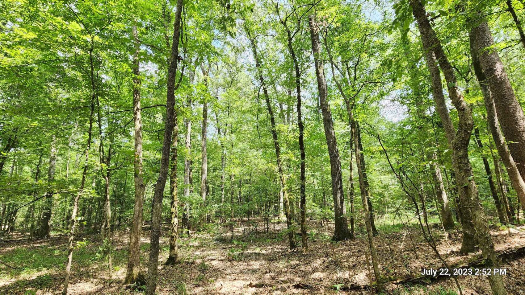
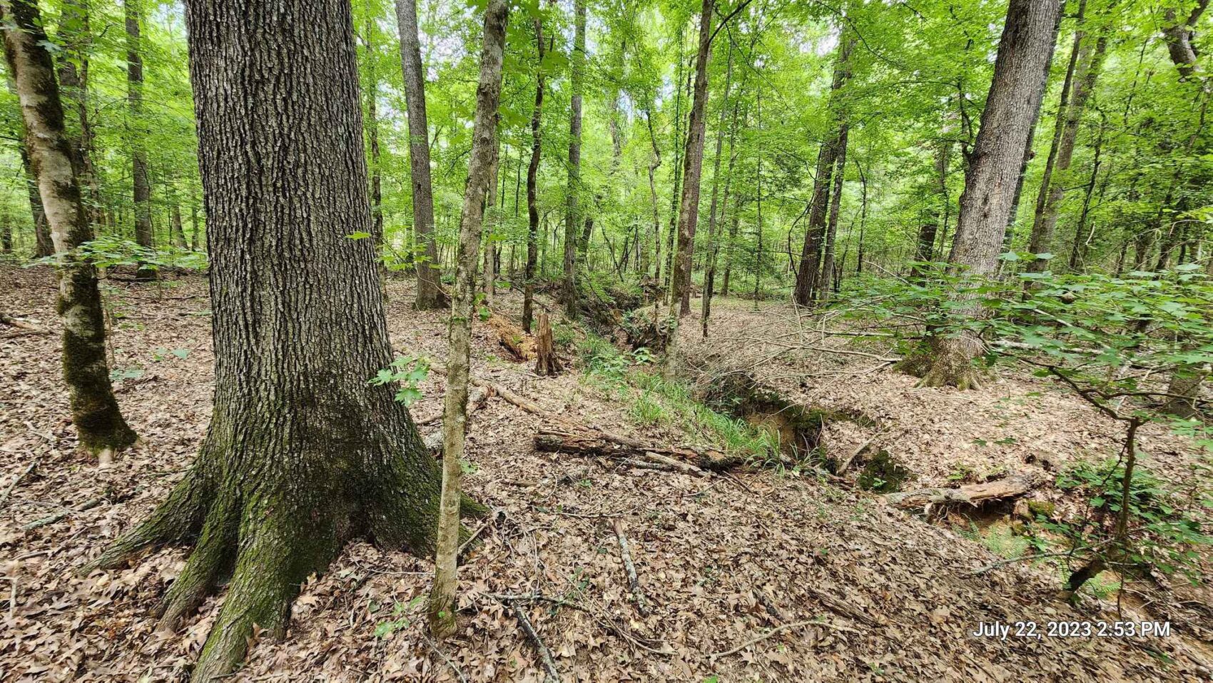
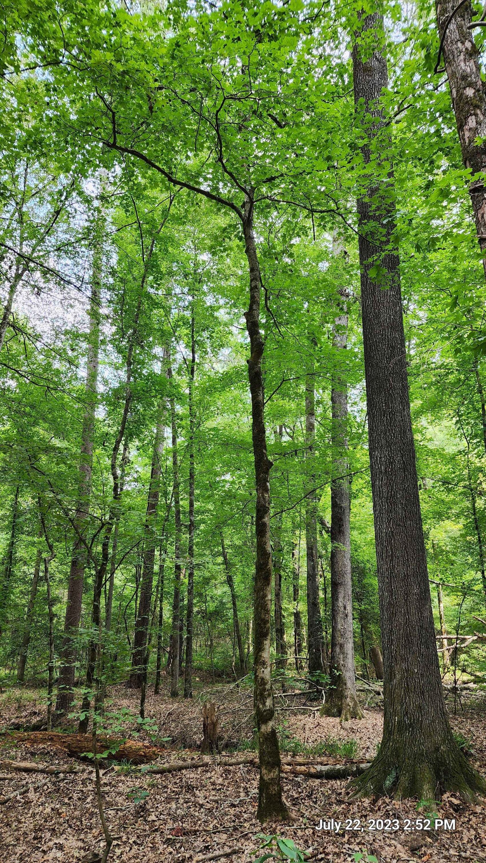
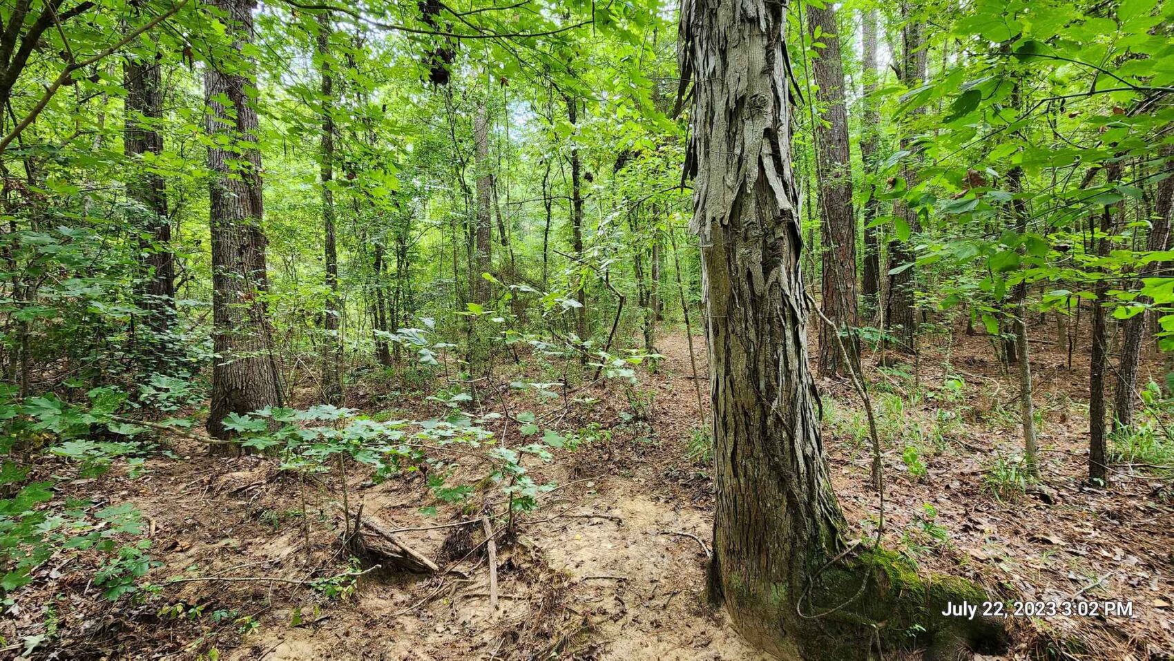
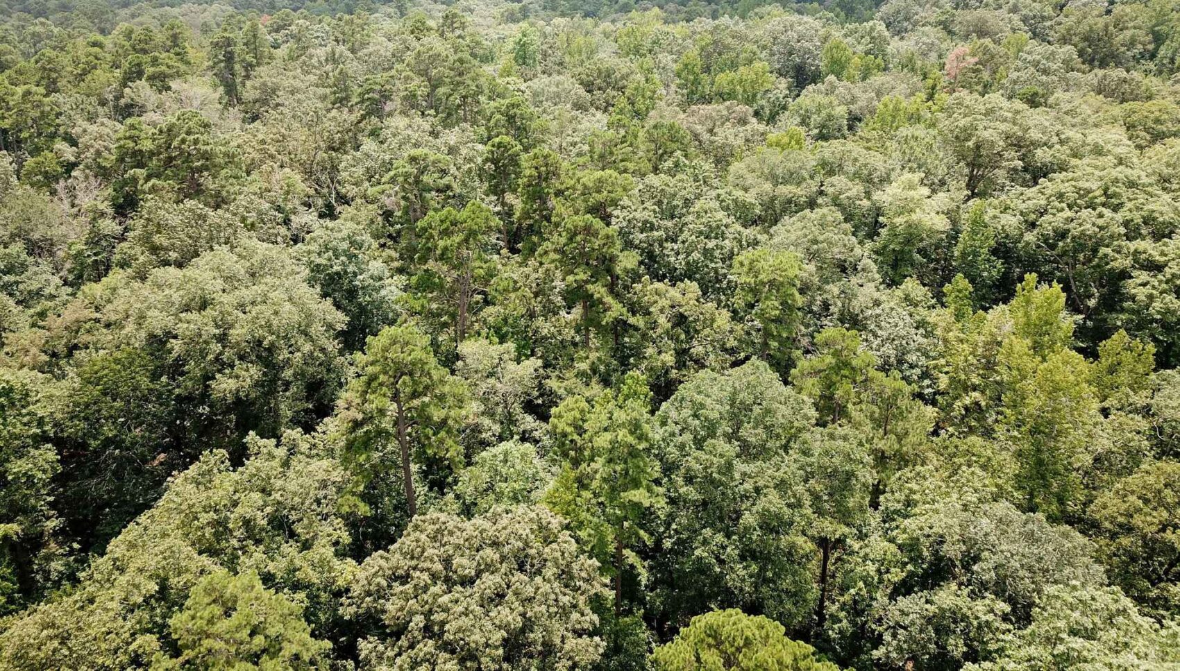
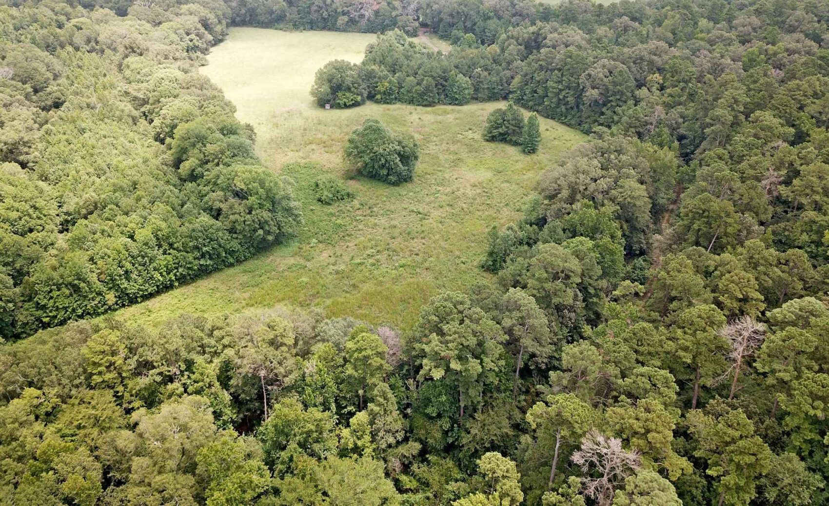
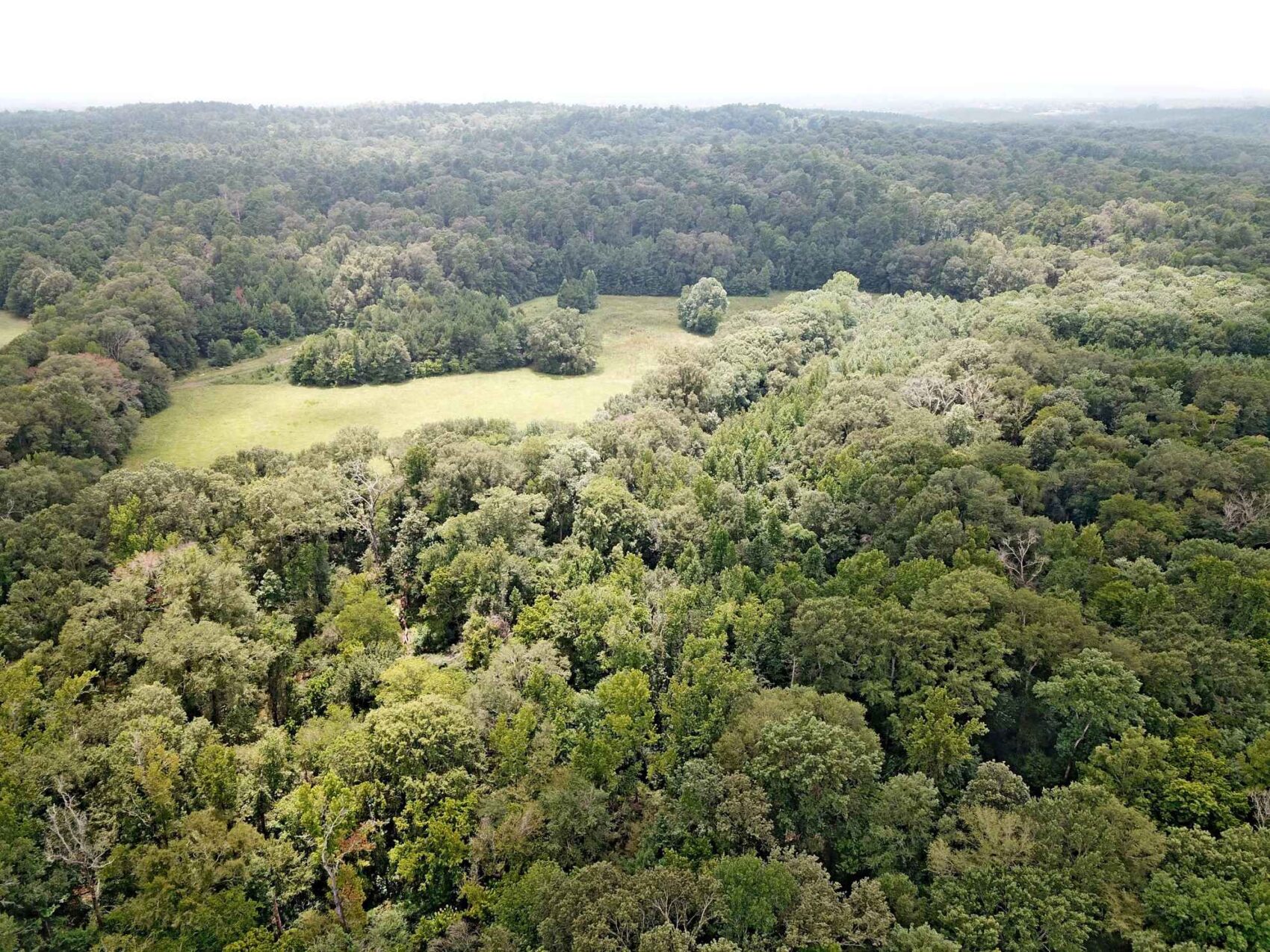
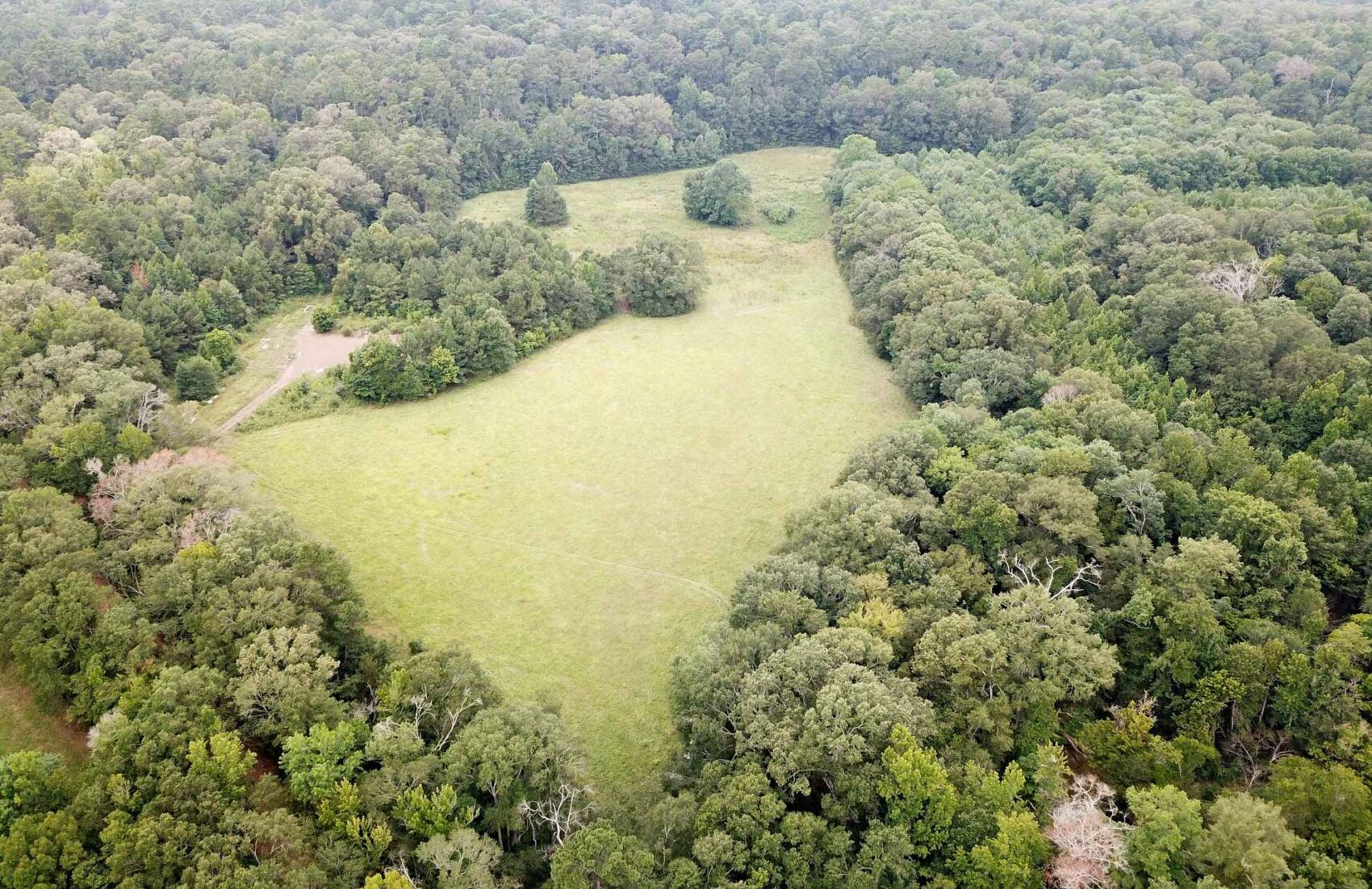
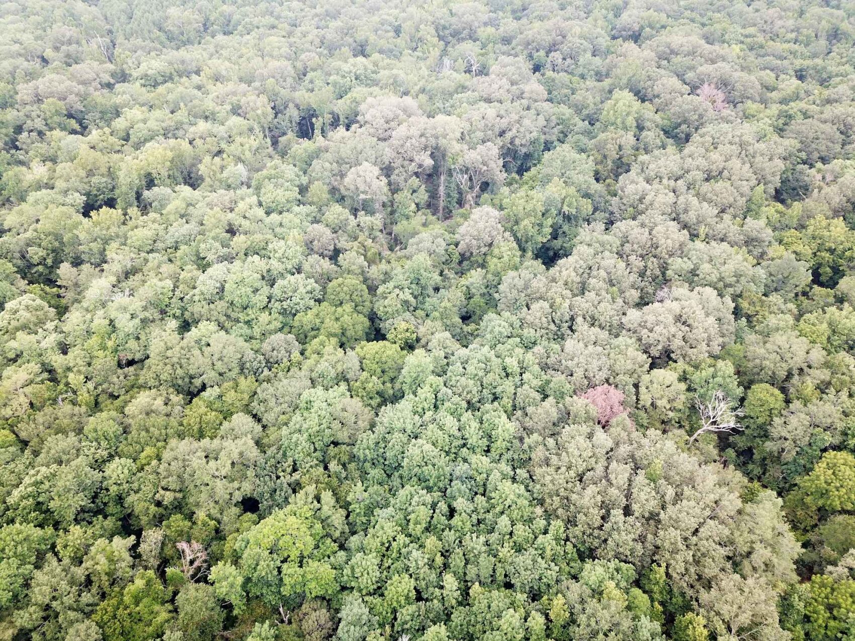
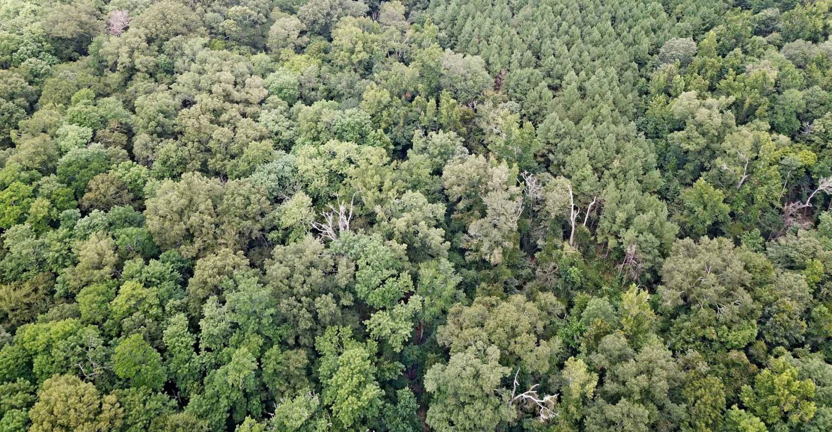
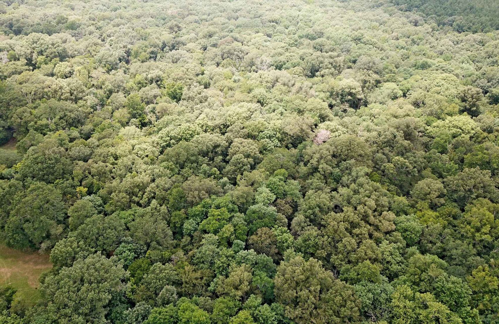
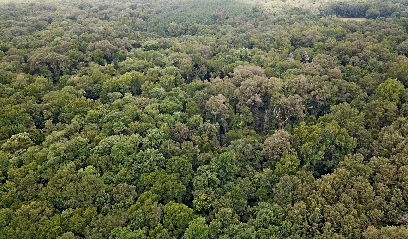
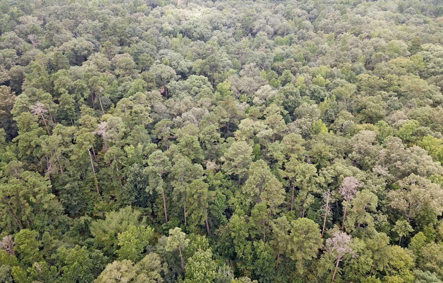
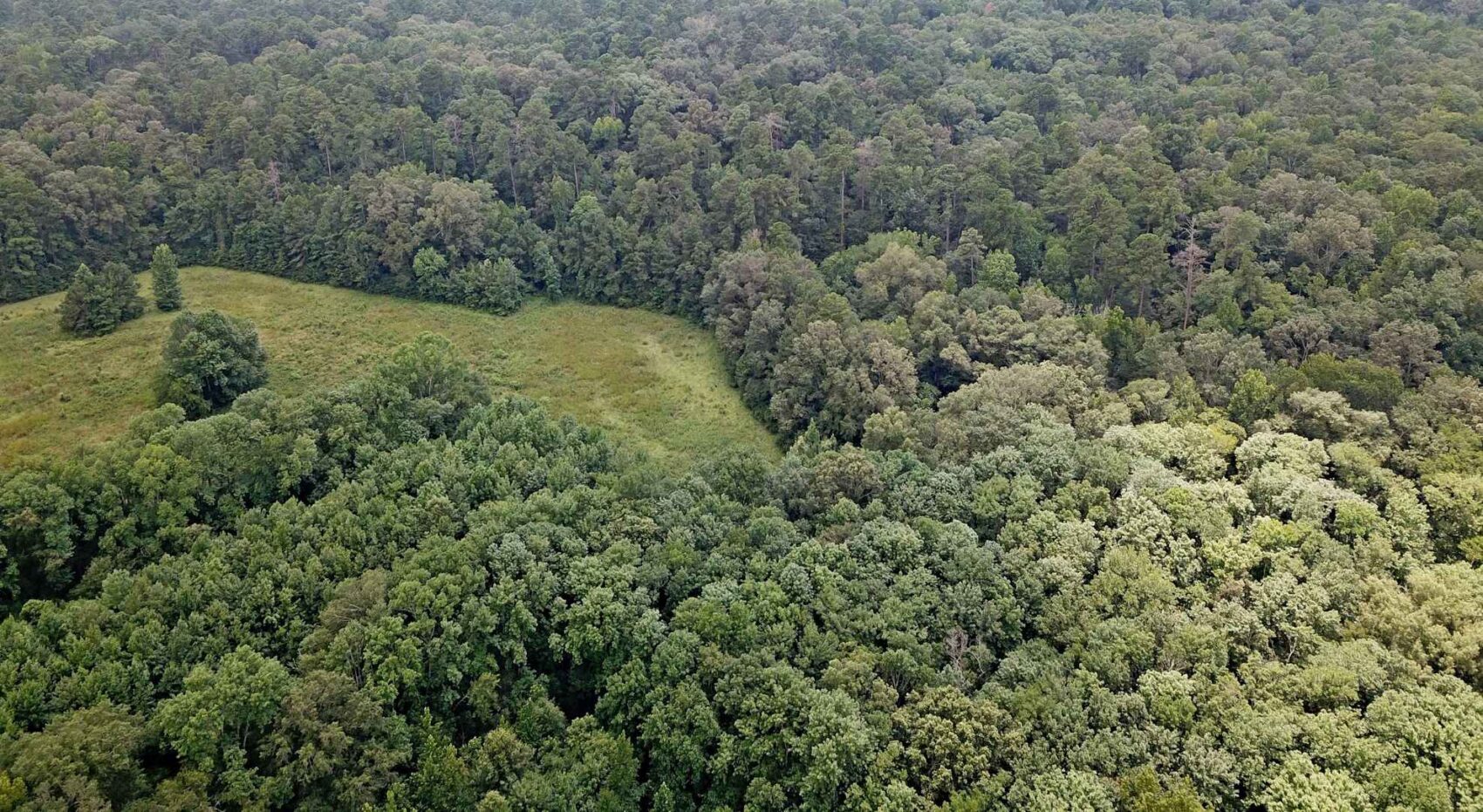
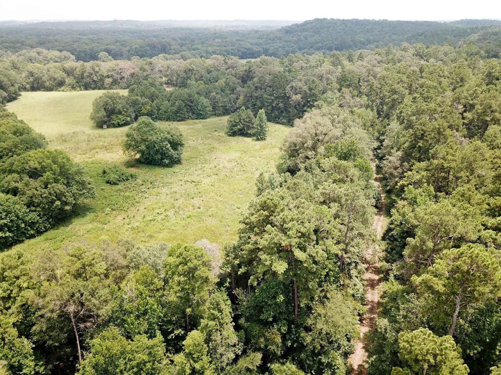
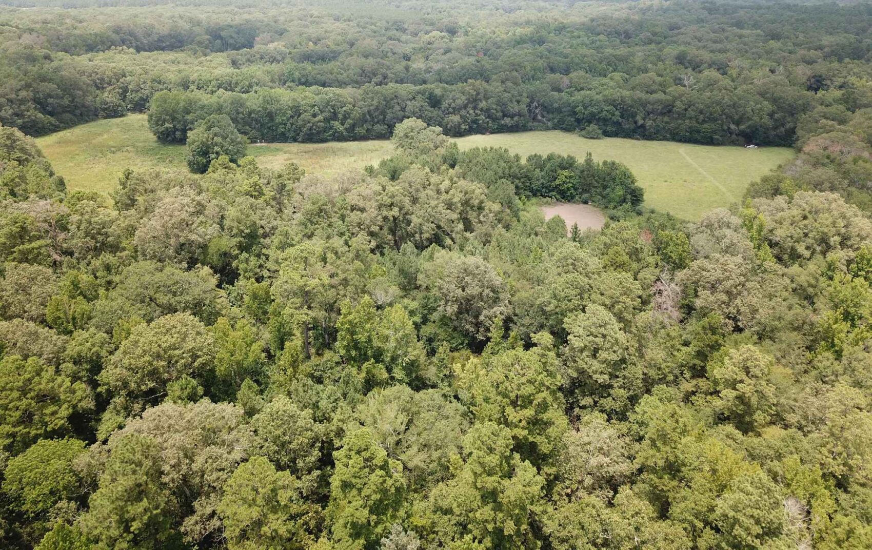
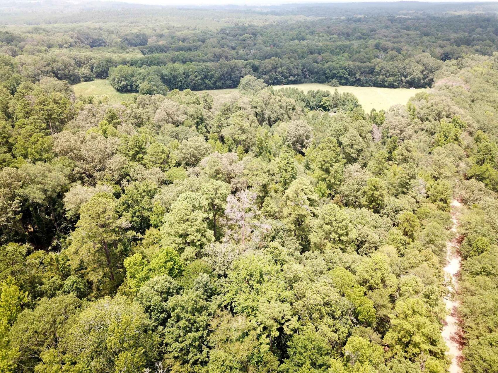
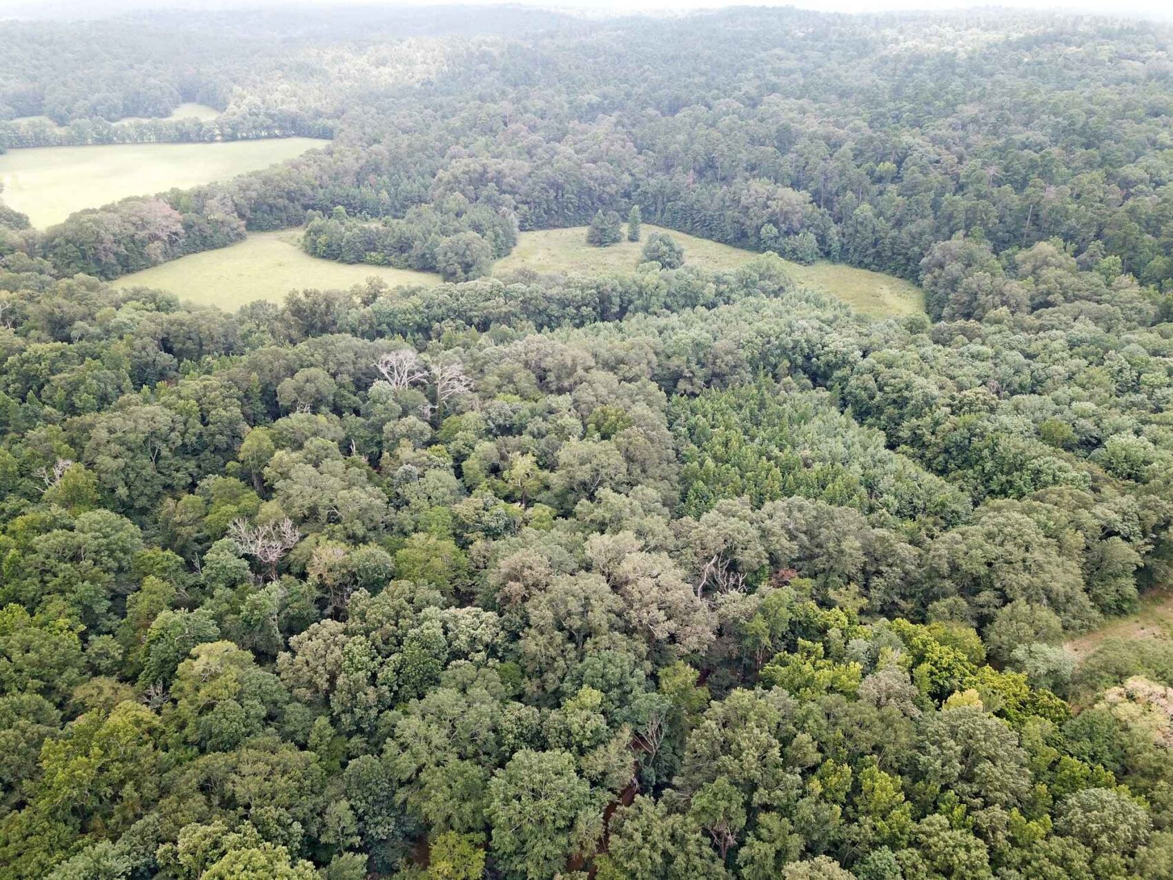
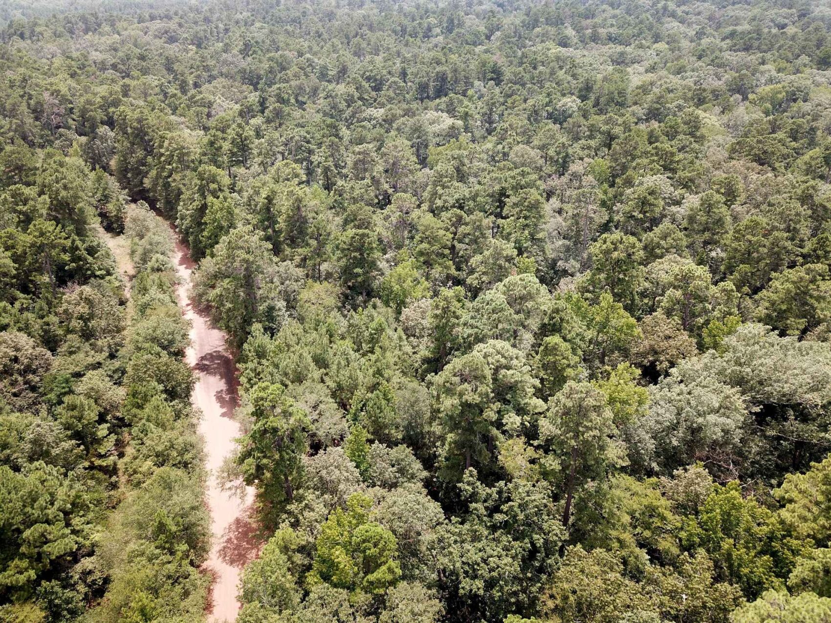
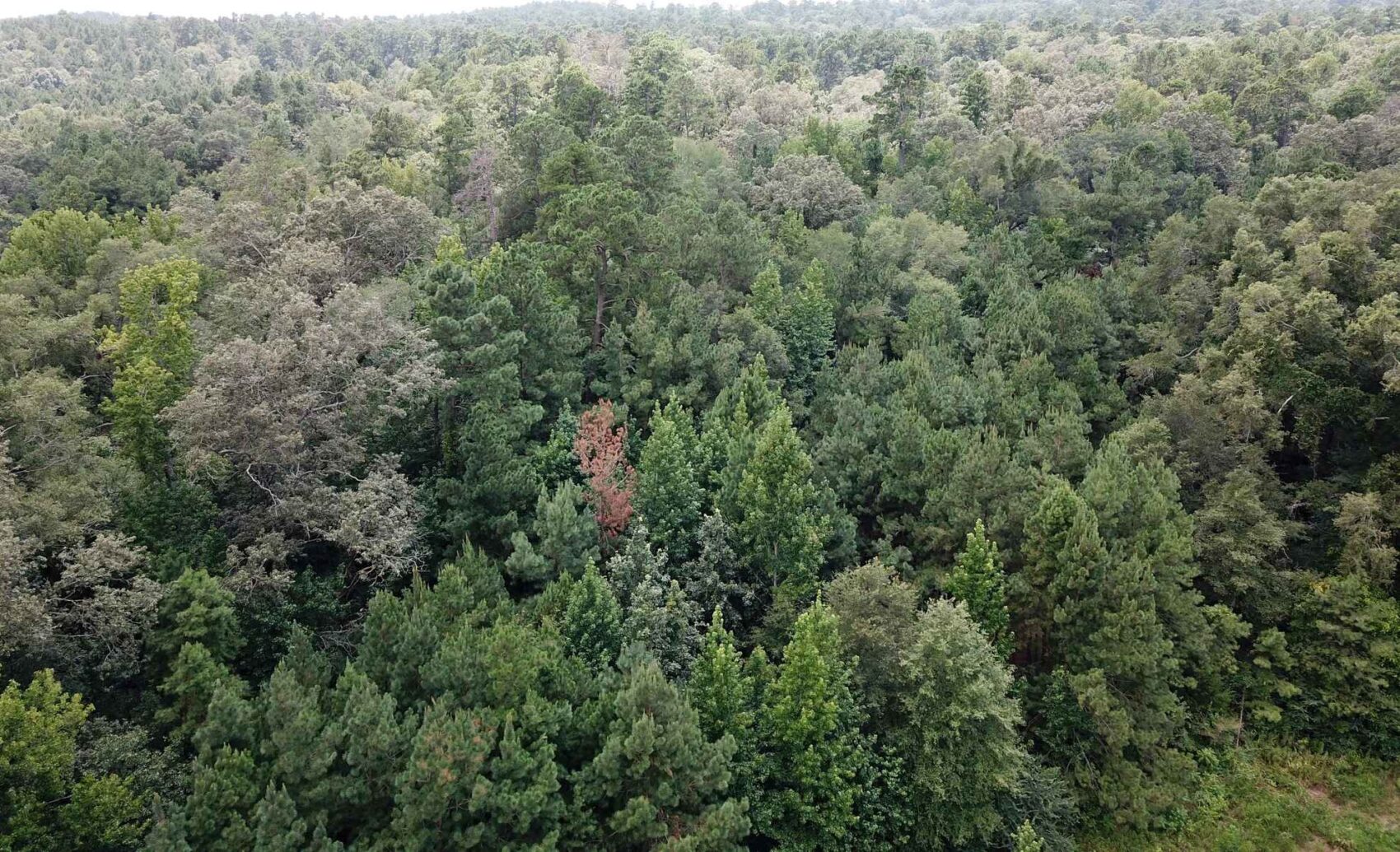
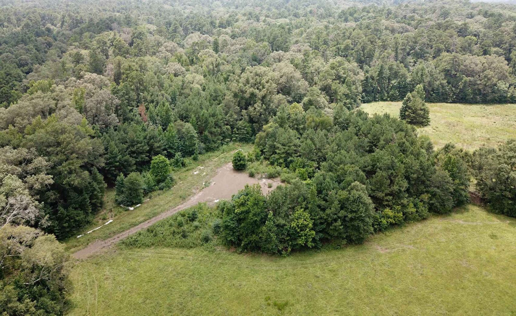
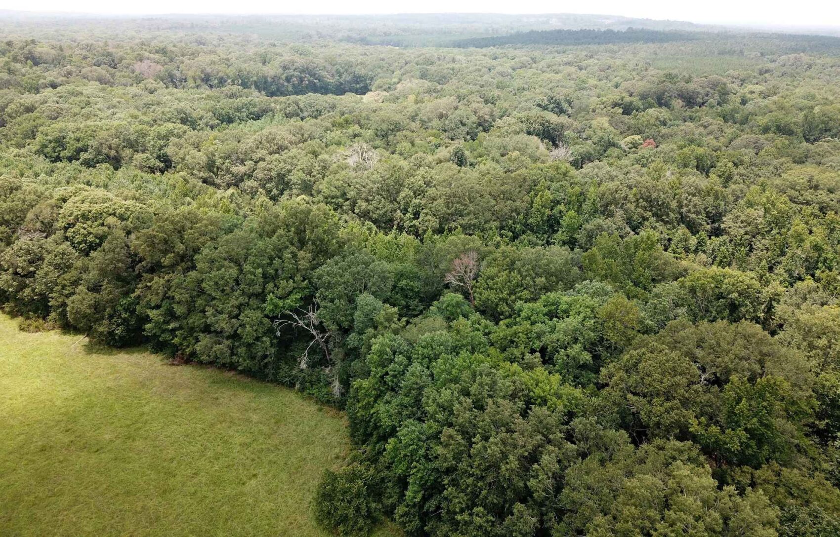
This land is unique in todays market, combining recreational opportunities, older native timber and a diverse ecology. This land has a mix of uplands and bottomlands with outstanding native forests, and has an 11-acre field. The timber assets present an immediate cash flow opportunity and future timber growth prospects. For hunters and nature lovers interested in native bottomland hardwoods, this is an outstanding hunting and recreational property with a combination of forest and field and excellent county road access. This land offers great opportunities for hunting, enjoyment of open woodlands, observing wildlife, and the enjoyment of an uncommonly mature native upland pine and bottomland hardwood forest. Over much of the property, the understory is semi- to fully open and is easy to traverse on foot. There are potential upland building locations in the uplands on ridges and high plateau areas that would appear to be suitable for building. This property is located a twenty-minute drive from supplies, shopping and health care in Nacogdoches.
The native forests on this property have a wide assortment of species including loblolly pine, white oak, beech, ash, shortleaf pine, water oak, black oak, sweetgum, southern red oak, American elm, Florida maple, American holly, cherrybark red oak, swamp chestnut oak, southern red oak, black cherry, mulberry and hornbeam. In addition to these, cedar elm, overcup oak, shagbark and pignut hickory, bitter pecan, river birch, black walnut, pawpaw and blackgum are several of the species found in the bottomland areas.
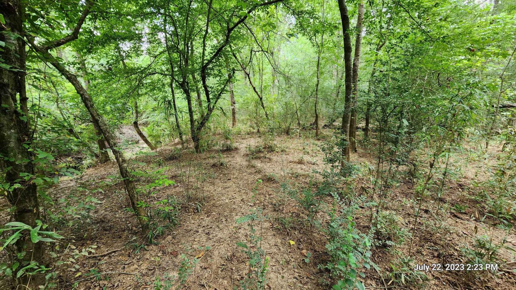
In addition to the older forests, the bottomlands north and west of the open field are young hardwoods that have naturally reforested about six acres of field. North of Naconiche Creek along Wanders Creek is another five acres of old field that is now populated with young, vigorously growing hardwoods. These young areas have sweetgum, water oak, willow oak, cherrybark oak, bitter pecan and ash as the primary species, with a small number of loblolly pines.
The timber asset is a combination of mature native upland pine and bottomland hardwood timber. An available timber inventory report was completed in October 2022. The merchantable timber value data based on the 71-acre area south and west of Naconiche Creek, to include the uplands, is estimated at around $1325 per acre on 58 merchantable forested acres. There are impressive stands of very tall, high-grade native pines on about 32 acres of the well-drained southwestern uplands. The roughly 85 acres north of Naconiche Creek is primarily made up of bottomland hardwood forest, with the timber inventory report indicating about $800 per acre in 2022 timber value. About 1.5 acres of an unthinned loblolly pine plantation is slated to be included in this parcel along the northern boundary line.
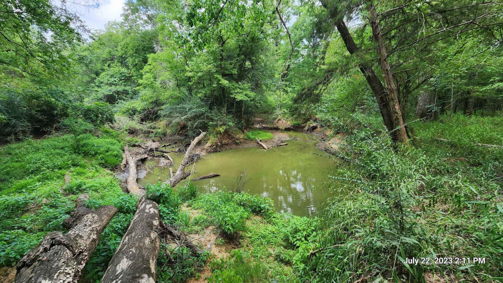
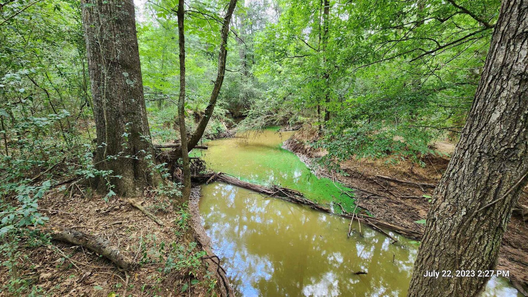
This Property has two major perennial streams, Naconiche and Wanders Creeks, with smaller Bohannon Branch in the northwestern portion. Approximately 124 acres are in the bottomland Marietta loam and Iulus fine sandy loam soils, which are some of the highest-producing soils in the southern U.S. for both pine and hardwood trees.
The balance of the Property has the upland Sacul, Cuthbert and Eastwood fine sandy loams, being good, well-drained upland soils for growing both hardwood and pine. The southwestern uplands have interesting topography, with a wet-weather stream channel running parallel to the county road through the area.
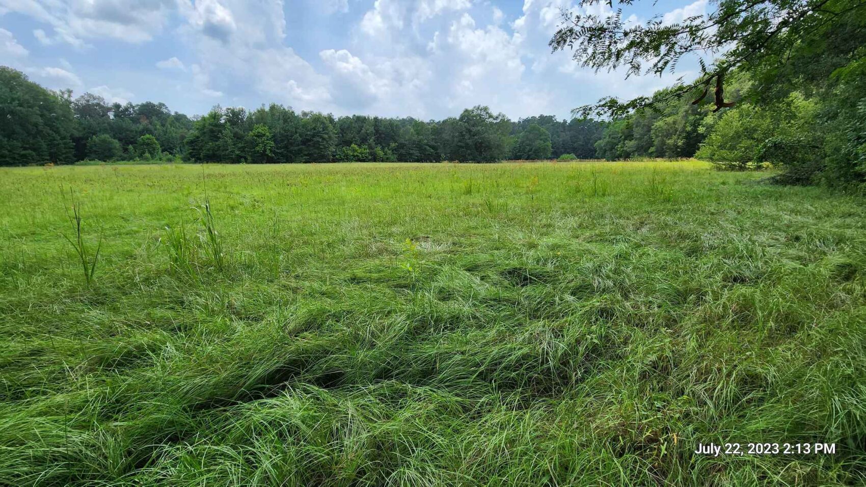
The approximately 11-acre open field has a roughly 5-acre hay pasture. This open ground could continue to be utilized, or could be readily converted into food plots and/or planted with pine or hardwood trees.
The mapping is offered as a general guide as to the location of the property, but no guarantee is made as to the exact location of these boundaries. This parcel is being divided out of a larger parcel, and is slated for boundary surveying. The 156-acre area is estimated only, based on Appraisal District information using GIS and aerial photo interpretation, deed call information and ground checks of a few assumed corner and line markers. It lies west of Wanders Creek and north of County Road 280, with road frontage on CR 280 beginning on west side of the Naconiche Creek Bridge.
This property of approximately 156 acres is offered at $3,708 per acre or $578,380.
The Sellers are retaining all owned oil & gas minerals. There may be additional prior reservations of oil & gas minerals and associated surface access rights.
No seller financing is available.
This property is currently under Ag/Timber Valuation on the taxes. Land taxes using the Nacogdoches Appraisal District 2023 Tax records are estimated at $459.71 on 156 acres with timber/ag exemptions, and are estimated at $9,491.48 without timber/ag exemptions on 156 acres. Buyers should be aware of roll-back provisions if land use is changed or the new owner fails to apply and/or qualify for ag/timber exemption.
These estimates are based on a per-acre rough calculation, as the 156-acre property is being divided out of a 515-acre tract that had $1519.29 in taxes with exemptions, and estimated taxes of $31,368.15 without exemptions. The current tax office mapping is incorrect, as this 156-acre parcel offered for sale does not front on FM 95 as currently shown.
Electric Power (Deep East Texas Electric Coop) is 8/10ths of a mile to the east of the Property along CR 280 at FM 95, and electric lines are present approximately 8/10ths of a mile to the west of the Property on CR 280.
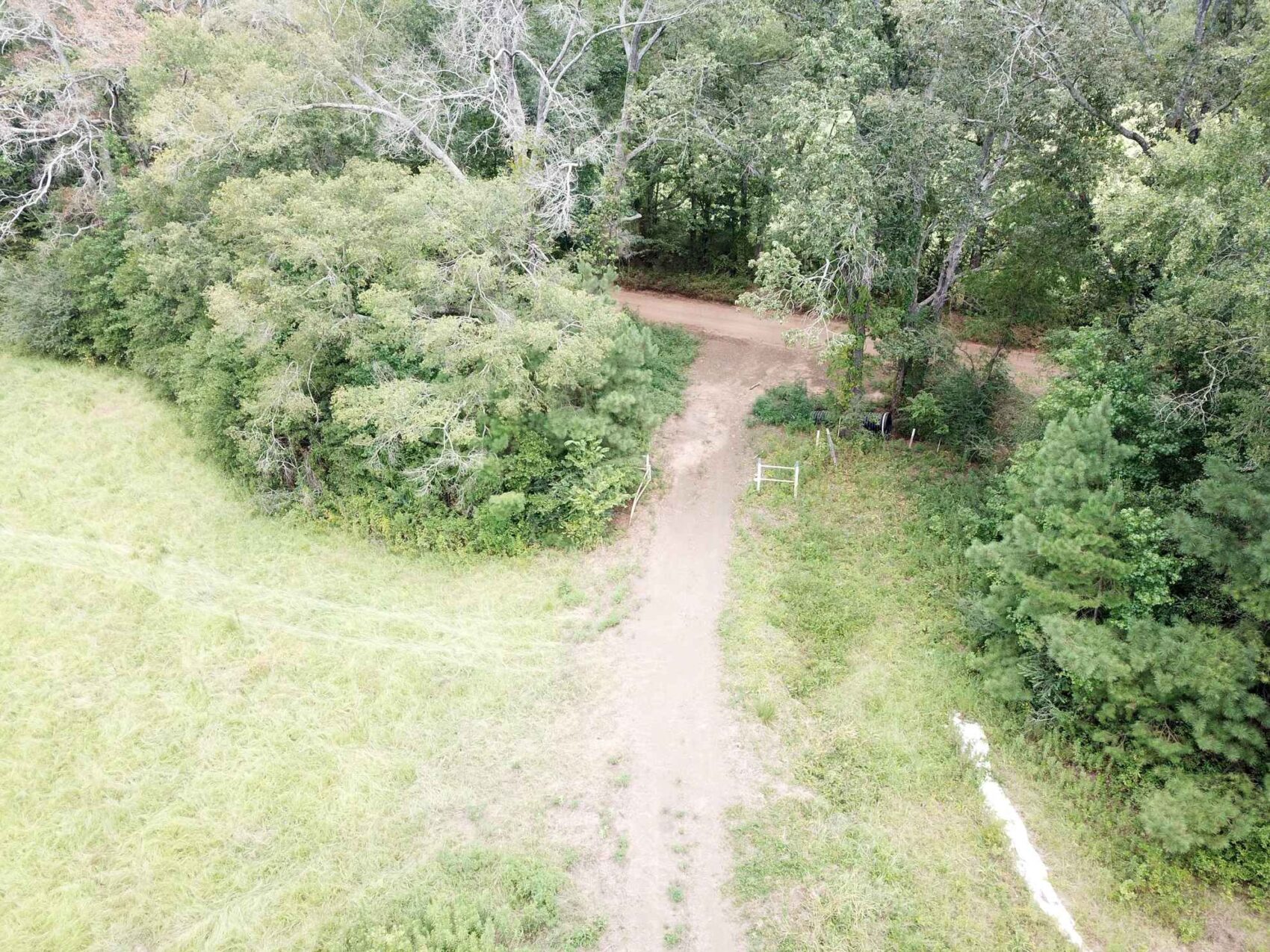
No improvements, buildings, or deer blinds are included in the offering other than the existing gate.
Approximately 1,950 feet of frontage along CR 280 along its southeastern boundary.
Most Residents in the area are on water wells and septic systems, and state website maps do not show a community water service area at this site. Community water is indicated about 8/10ths of a mile to the west on CR 280, and is shown to be Libbey Water Supply Corporation, PO Box 115, Martinsville, TX 75958 - 936-615-6168.
All of Nacogdoches County groundwater is subject to the rules of the Pineywoods Groundwater Conservation District. Information concerning water well drilling can be found at: pgcd.org
Garrison ISD School District.
The mapping shows the FEMA floodplain along the major creeks.
There are two known gas pipelines on this Property, belonging to MarkWest Pinnacle, as shown on the mapping.
There is one abandoned, shut-in gas well on the Property, as shown on the mapping.
To arrange site visits, please contact listing agent Mark Brian at 936-590-0986, or the TerraStone office at 936-590-4909. Buyers agents are required to contact listing agent to arrange site visits and are required to accompany potential buyers at the time of the first visit. Failure to disclose as a buyers agent or lack of presence upon first site visit will result in co-broker compensation being at discretion of listing agent. A 2% co-broker fee is offered on this property. The listing agent is willing to accompany Buyers Agents as a guide if requested and given sufficient notice.
TerraStone Land Company strives to gather good information concerning listed properties from reliable sources, but cannot guarantee the accuracy of said data, including but not limited to boundary line locations, acreages, fence lines, tree ages, timber volumes, timber value, legal title, environmental hazards, condition of improvements, legal access, utility services, or site suitability for agricultural or forestry use. All maps are provided for illustrative purposes only and are not survey plats. Unless specifically stated, no formal land surveying by a licensed surveyor has been used in determining acreages. Aerial and ground photography may include neighboring properties that are not included in this offering, and such photography is intended for general use only. TLC recommends that potential buyers examine the offered property to their own satisfaction, and are strongly urged to verify all pertinent facts for themselves. TLC is not responsible for errors, omissions, offering withdrawal or price modifications.
USEFUL DOCUMENTS
- locationmapgarrison156acres.pdf
- locationmapnacogdoches156acres.pdf
- AerialMap156Acres.pdf
- TopoMap156Acres.pdf
- SoilsMap156Acres.pdf
- FloodplainMap156Acres.pdf
- zoomedtopoMap156Acres.pdf
- WetlandGasWellPipelineContourMap156Acres.pdf
Property Map / Directions
From the north, from Garrison at Hwy 59 & FM 95 go south for 5 miles to County Road 280 (Logansport Road) then right (west) for 6/10ths of a mile over the Naconiche Creek Bridge to the property on the right (north side of CR 280). From the south, north on FM 95 from Martinsville at Hwy 7 for 8.6 miles to CR 280, or from Nacogdoches Loop northeast on FM 2112, then left (northeast) on FM 1878 to FM 95; turn left (north) on FM 95 for 3.7 miles to CR 280.
PROPERTY IMAGES

Other Listings
-
 $278,356
+-107.06 Acres - Harrison County, Texas
Acres107.06 CountyHarrison StateTexas -
$1,227,107
1,067 ACRES, McINTOSH COUNTY, OKLAHOMA
Acres1,067.05 CountyMcIntosh StateOklahoma -
$65,000
10.16 ACRES, NACOGDOCHES COUNTY, TEXAS
Acres10.00 CountyNacogdoches StateTexas -
$40,688
10.443 ACRES, SHELBY COUNTY, TEXAS
Acres10.44 CountyShelby StateTexas -
$36,575
10.45 ACRES, NACOGDOCHES COUNTY, TEXAS
Acres10.45 CountyNacogdoches StateTexas -
$30,000
10.928 ACRES, CHEROKEE COUNTY, TEXAS
Acres10.93 CountyCherokee StateTexas -
$429,250
101.0 ACRES, RUSK COUNTY, TEXAS
Acres101.00 CountyRusk StateTexas -
$303,450
101.15 ACRES, HARRISON - PANOLA COUNTY
Acres101.15 CountyPanola StateTexas -
106.0 ACRES, SABINE COUNTY, TEXAS
Acres0.00 County State -
$233,200
106.0 ACRES, SABINE COUNTY, TEXAS
Acres106.00 CountySabine StateTexas -
$231,575
107 ACRES, NACOGDOCHES COUNTY, TEXAS
Acres107.00 CountyNacogdoches StateTexas -
$305,424
113.12 ACRES, SABINE COUNTY, TEXAS
Acres113.12 CountySabine StateTexas -
$295,000
118.0 ACRES, NACOGDOCHES COUNTY, TEXAS
Acres118.00 CountyNacogdoches StateTexas -
$72,000
12.0 ACRES, RUSK COUNTY, TEXAS
Acres12.00 CountyRusk StateTexas -
$146,400
12.2 Acres Red River County, Texas
Acres12.20 CountyRed River StateTexas -
$133,350
12.7 Acres Red River County, Texas
Acres12.70 CountyRed River StateTexas -
$175,000
120 ACRES, CASS COUNTY, TEXAS
Acres120.00 CountyCass StateTexas -
$340,000
132.081 ACRES, SHELBY COUNTY, TEXAS
Acres132.08 CountyShelby StateTexas -
$343,000
133.47 ACRES, PANOLA COUNTY, TEXAS
Acres133.47 CountyPanola StateTexas -
$398,250
135 ACRES, NACOGDOCHES COUNTY, TEXAS
Acres135.00 CountyNacogdoches StateTexas -
$890,500
137.0 ACRES, ANDERSON COUNTY, TEXAS
Acres137.00 CountyAnderson StateTexas -
$148,050
14.1 Acres Red River County, Texas
Acres14.10 CountyRed River StateTexas -
$375,000
140.0 ACRES, SHELBY COUNTY, TEXAS
Acres140.00 CountyShelby StateTexas -
$455,008
154.24 ACRES, RUSK COUNTY, TEXAS
Acres154.24 CountyRusk StateTexas -
$578,380
156 ACRES, NACOGDOCHES COUNTY, TEXAS
Acres156.00 CountyNacogdoches StateTexas -
$99,900
16.0 ACRES NACOGDOCHES COUNTY, TX Lot 5
Acres16.00 CountyNacogdoches StateTexas -
$99,900
16.0 ACRES, NACOGDOCHES COUNTY, TEXAS
Acres16.00 CountyNacogdoches StateTexas -
$143,650
16.9 Acres Red River County, Texas
Acres16.90 CountyRed River StateTexas -
$420,605
162.71 ACRES, ANGELINA COUNTY, TEXAS
Acres162.70 CountyAngelina StateTexas -
$449,500
167.50 ACRES, SHELBY COUNTY, TEXAS
Acres167.50 CountyShelby StateTexas -
$380,250
169.0 ACRES, HARDIN COUNTY, TEXAS
Acres169.00 CountyHardin StateTexas -
$30,600
17.0 ACRES, RUSK COUNTY, TEXAS
Acres17.00 CountyRusk StateTexas -
$317,330
171.53 ACRES, PANOLA COUNTY, TEXAS
Acres171.53 CountyPanola StateTexas -
$689,936
172.7 Acres Nacogdoches County Texas
Acres172.70 CountyNacogdoches StateTexas -
$347,812
178.0 ACRES, SHELBY COUNTY, TX
Acres178.00 CountyShelby StateTexas -
$72,000
18.0 ACRES, TYLER COUNTY, TX
Acres18.00 CountyTyler StateTexas -
$729,000
183 ACRES, UPSHUR COUNTY, TX
Acres183.00 CountyUpshur StateTexas -
$294,006
184.33 ACRES, CADDO PARISH, LOUISIANA
Acres184.33 CountyCaddo StateLouisiana -
$482,250
196 ACRES, BIENVILLE PARISH, LOUISIANA
Acres196.00 CountyBienville StateLouisiana -
$179,000
20.4 ACRES, NACOGDOCHES COUNTY, TEXAS
Acres20.40 CountyNacogdoches StateTexas -
$217,350
20.7 Acres Red River County, Texas
Acres20.70 CountyRed River StateTexas -
$1,063,233
200.61 ACRES, SHELBY COUNTY, TEXAS
Acres200.61 CountyShelby StateTexas -
$155,000
21.4492 Acres, Trinity County, Texas
Acres21.45 CountyTrinity StateTexas -
218 ACRES, CADDO PARISH, LOUISIANA
Acres0.00 County State -
$520,000
218 ACRES, CADDO PARISH, LOUISIANA
Acres218.00 CountyCaddo StateLouisiana -
$135,660
22.61 acres in Rusk County, Texas
Acres22.61 CountyRusk StateTexas -
$314,580
226.6 ACRES, ALLEN PARISH, LOUISIANA
Acres226.60 CountyAllen StateLouisiana -
$599,500
231.87 ACRES, CASS COUNTY, TEXAS
Acres231.87 CountyCass StateTexas -
$120,000
24.86 Acres, Shelby County, TX
Acres24.86 CountyShelby StateTexas -
$1,116,000
248 acres in Nacogdoches County, Texas
Acres248.00 CountyNacogdoches StateTexas -
$91,505
25.070 ACRES, PANOLA COUNTY, TEXAS
Acres25.07 CountyPanola StateTexas -
$332,735
25.595 ACRES, ANGELINA COUNTY, TEXAS
Acres25.60 CountyAngelina StateTexas -
$179,000
26.13 Acres San Augustine County
Acres26.13 CountySan Augustine StateTexas -
$576,555
289.03 ACRES, CHEROKEE COUNTY, TEXAS
Acres289.03 CountyCherokee StateTexas -
$575,000
293.479 ACRES, PANOLA COUNTY, TEXAS
Acres293.47 CountyPanola StateTexas -
$7,900,000
3,160.58 ACRES, AR, LA, OK
Acres3,160.58 CountyUnion StateArkansas -
$55,500
3.48 ACRES, SMITH COUNTY, TX
Acres3.48 CountySmith StateTexas -
$195,000
30 Acres, Nacogdoches County, Texas
Acres30.00 CountyNacogdoches StateTexas -
$258,000
30.0 ACRES, SHELBY COUNTY, TEXAS
Acres30.00 CountyShelby StateTexas -
$102,204
30.06 ACRES, SABINE COUNTY, TEXAS
Acres30.06 CountySabine StateTexas -
$89,900
30.414 Acres, NACOGDOCHES COUNTY, TEXAS
Acres30.41 CountyNacogdoches StateTexas -
$795,000
315.0 ACRES, JEFFERSON COUNTY, TEXAS
Acres315.00 CountyJefferson StateTexas -
$137,600
32 ACRES, RUSK COUNTY, TEXAS
Acres32.00 CountyRusk StateTexas -
$246,000
32.8 Acres Red River County, Texas
Acres32.80 CountyRed River StateTexas -
$1,195,000
340.63 ACRES, PANOLA COUNTY, TEXAS
Acres340.63 CountyPanola StateTexas -
$122,500
35.0 ACRES CHEROKEE COUNTY, TX
Acres35.00 CountyCherokee StateTexas -
$180,025
37.9 ACRES NORTH PARCEL SHELBY COUNTY, TEXAS
Acres37.90 CountyShelby StateTexas -
$175,500
39 ACRES SOUTH PARCEL SHELBY COUNTY, TEXAS
Acres39.00 CountyShelby StateTexas -
$114,811
39.59ac HARRISON COUNTY, TX
Acres39.59 CountyHarrison StateTexas -
$1,160,000
392.68 Acres, Upshur County, Texas
Acres392.68 CountyUpshur StateTexas -
$75,885
40.35 ACRES, PANOLA COUNTY, TEXAS
Acres40.35 CountyPanola StateTexas -
$1,200,000
435 ACRES, BEXAR COUNTY, TEXAS
Acres435.00 CountyBexar StateTexas -
$127,861
44.09 ACRES, NACOGDOCHES COUNTY, TEXAS
Acres44.09 CountyNacogdoches StateTexas -
$291,200
44.8 Acres Red River County, Texas
Acres44.80 CountyRed River StateTexas -
$226,000
46 Acres, Nacogdoches County, Texas
Acres46.00 CountyNacogdoches StateTexas -
$225,500
46.0 ACRES, RUSK COUNTY, TEXAS
Acres46.00 CountyRusk StateTexas -
$117,500
47 ACRES, RUSK COUNTY, TEXAS
Acres47.00 CountyRusk StateTexas -
$289,100
49.0 ACRES, RUSK COUNTY, TEXAS
Acres49.00 CountyRusk StateTexas -
$2,972,730
495.455 Acres, Smith County, Texas
Acres495.45 CountyTexas StateTexas -
$30,000
5.62 ACRES, CHEROKEE COUNTY, TEXAS
Acres5.62 CountyCherokee StateTexas -
$640,000
507 ACRES, YELL COUNTY, ARKANSAS
Acres507.06 CountyYell StateArkansas -
$201,630
51.7 Acres, Rusk County, Texas
Acres51.70 CountyRusk StateTexas -
$1,754,695
527.758 ACRES, SMITH COUNTY, TEXAS
Acres527.75 CountySmith StateTexas -
$202,550
54 ACRES, RUSK COUNTY, TEXAS
Acres54.00 CountyRusk StateTexas -
$170,163
54.02 ACRES, SABINE COUNTY, TEXAS
Acres54.02 CountySabine StateTexas -
$178,230
54.84 ACRES, NACOGDOCHES COUNTY, TEXAS
Acres54.84 CountyNacogdoches StateTexas -
$156,790
55.5 ACRES, HOUSTON COUNTY, TEXAS
Acres55.50 CountyHouston StateTexas -
$156,800
56 ACRES, RUSK COUNTY, TEXAS
Acres56.00 CountyRusk StateTexas -
$131,600
56.0 ACRES, NACOGDOCHES COUNTY, TEXAS
Acres56.00 CountyNacogdoches StateTexas -
Contact for Price
56.889 ACRES, LAFAYETTE COUNTY, ARKANSAS
Acres56.89 CountyLafayette StateArkansas -
$1,562,000
568 ACRES, NACOGDOCHES COUNTY, TEXAS
Acres568.00 CountyNacogdoches StateTexas -
$165,528
58.08 ACRES, SABINE COUNTY, TEXAS
Acres58.08 CountySabine StateTexas -
$194,000
58.6 ACRES CAMP COUNTY, TEXAS
Acres58.60 CountyCamp StateTexas -
$218,230
59.06 ACRES (TR #10), NACOGDOCHES COUNTY, TEXAS
Acres59.06 CountyNacogdoches StateTexas -
$259,000
61.94 ACRES, HARDIN COUNTY, TEXAS
Acres61.94 CountyHardin StateTexas -
$180,648
62.4 Acres, Nacogdoches County, Texas
Acres62.40 CountyNacogdoches StateTexas -
$329,490
62.76 Acres Trawick, Nacogdoches County TX
Acres62.76 CountyNacogdoches StateTexas -
$185,075
67.3 ACRES, PANOLA COUNTY, TEXAS
Acres67.30 CountyPanola StateTexas -
$180,200
68 ACRES, NEWTON COUNTY, TEXAS
Acres68.00 CountyNewton StateTexas -
$239,900
69.358 ACRES PANOLA COUNTY, TX
Acres69.35 CountyPanola StateTexas -
$75,000
7.74 Acres Nacogdoches County, Texas
Acres7.74 CountyNacogdoches StateTexas -
$298,715
70.286 ACRES, PANOLA COUNTY, TEXAS
Acres70.28 CountyPanola StateTexas -
$308,975
72.7 ACRES. RUSK COUNTY, TEXAS
Acres72.70 CountyRusk StateTexas -
$215,000
74.0 ACRES, PANOLA COUNTY, TEXAS
Acres74.00 CountyPanola StateTexas -
$283,513
76.265 ACRES, SHELBY COUNTY, TEXAS
Acres76.27 CountyShelby StateTexas -
$3,995,000
803 ACRES, POLK COUNTY, TEXAS
Acres803.00 CountyPolk StateTexas -
$277,675
81.6 ACRES, DESOTO PARISH, LOUISIANA
Acres81.60 CountyDe Soto StateLouisiana -
$215,200
82.73 ACRES, CASS COUNTY, TEXAS
Acres82.73 CountyCass StateTexas -
$572,000
88.0 ACRES, GREGG COUNTY, TEXAS
Acres88.00 CountyGregg StateTexas -
$220,000
88.0 ACRES, RUSK COUNTY, TEXAS
Acres88.00 CountyRusk StateTexas -
$799,000
88.54 ACRES, BEAUREGARD PARISH, LOUISIANA
Acres88.54 CountyBeauregard StateLouisiana -
$459,000
88.54 ACRES, NACOGDOCHES COUNTY, TEXAS
Acres88.54 CountyNacogdoches StateTexas -
$220,500
90 ACRES, CLAIBORNE PARISH, LOUISIANA
Acres90.00 CountyClaiborne StateLouisiana -
$258,132
92.19 ACRES, RUSK COUNTY, TEXAS
Acres92.19 CountyRusk StateTexas -
$124,371
95.67 ACRES, ALLEN PARISH, LOUISIANA
Acres95.67 CountyAllen StateLouisiana -
$336,000
96.0 ACRES (Tract A&B) NACOGDOCHES COUNTY, TX
Acres96.00 CountyNacogdoches StateTexas -
$496,740
97.4 ACRES, SABINE COUNTY, TEXAS
Acres97.40 CountySabine StateTexas -
$178,200
99 ACRES, TYLER COUNTY, TEXAS
Acres99.00 CountyTyler StateTexas -
$800,000
99.49 ACRES, NACOGDOCHES COUNTY, TEXAS
Acres99.49 CountyNacogdoches StateTexas -
$297,505
99.5 Acres, Panola County, Texas
Acres99.50 CountyPanola StateTexas -
$174,635
CROSSROADS 53 ACRES, NACOGDOCHES COUNTY, TEXAS
Acres53.00 CountyNacogdoches StateTexas -
$535,920
GARRETT WEST 154 ACRES, NACOGDOCHES COUNTY, TEXAS
Acres154.00 CountyNacogdoches StateTexas -
$47,900
PRICE IMPROVEMENT - 6.39 ACRES, RUSK COUNTY, TEXAS
Acres6.39 CountyRusk StateTexas -
$163,845
UPDATED - 64.506 ACRES, CASS COUNTY, TEXAS
Acres64.51 CountyCass StateTexas
Contact Us About This Property
Call us at (936) 590-4909, email us at info@terrastonelandco.com or use the contact form below.