

1,067 ACRES, McINTOSH COUNTY, OKLAHOMA
Sold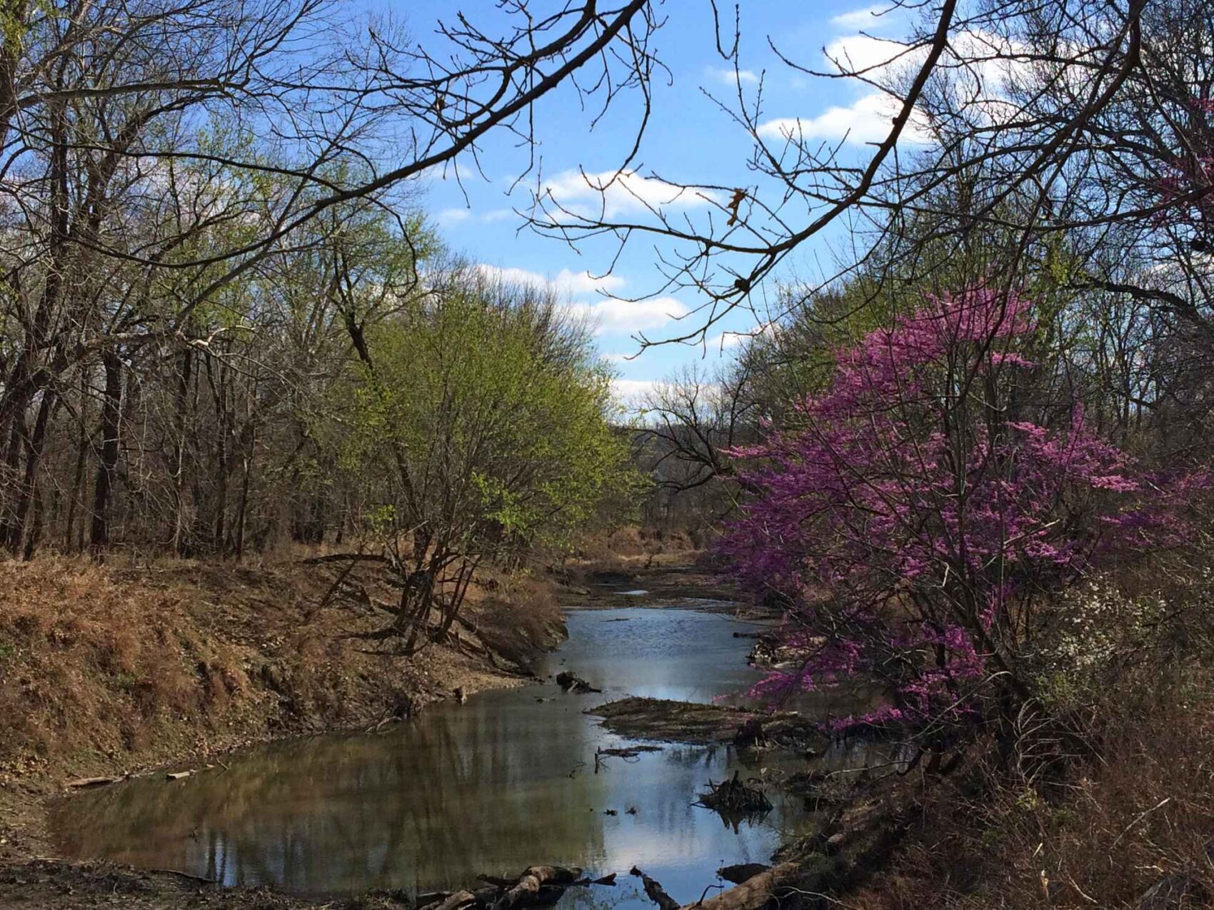
PROPERTY DETAILS
- Price:$1,227,107
- Type:Hunting Land, Recreational Property, Riverfront Property, Undeveloped Land
- Address:E1010 Road
- Acres:1,067
- County:McIntosh
- City:Warner
- Status:Sold
- State:Oklahoma
- Zip:74469
PROPERY DESCRIPTION
Imagine owning 1,067 contiguous acres of hunting and recreation rights located on a major perennial stream, with extensive hardwood bottomlands, substantial marshes, and upland fields interlaced with good game cover, being located within about an hours' drive of Tulsa or Ft. Smith, just a few miles north of Warner and 15 miles south of Muskogee in the northeast corner of McIntosh County, Oklahoma. This is a truly unique opportunity to acquire privately-owned land with outstanding hunting and recreational rights at $1,150 per acre, which is significantly lower than the average recreational property.
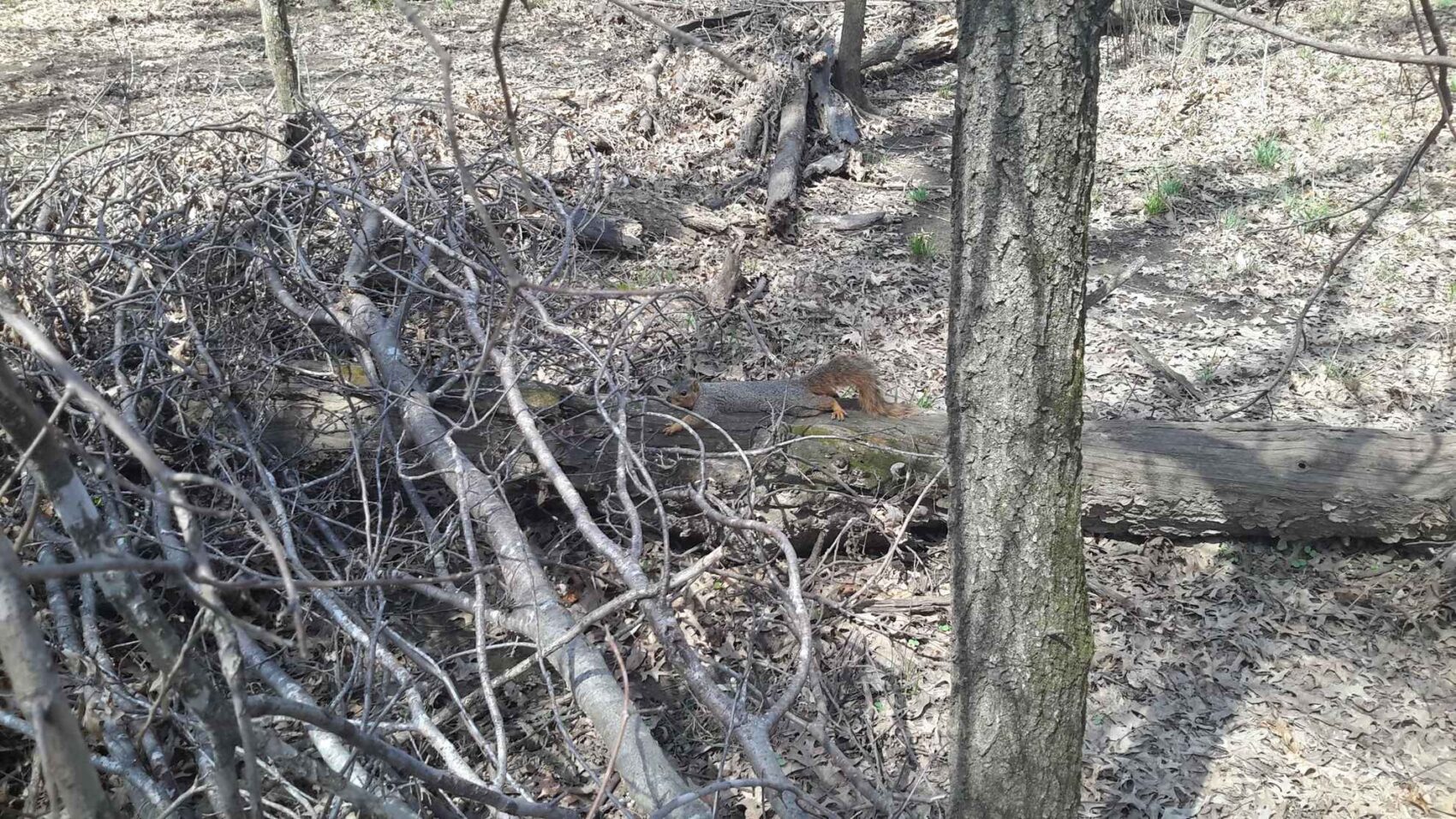
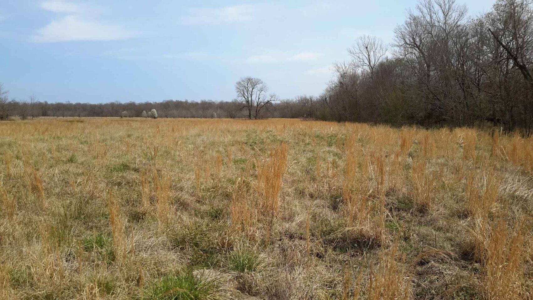
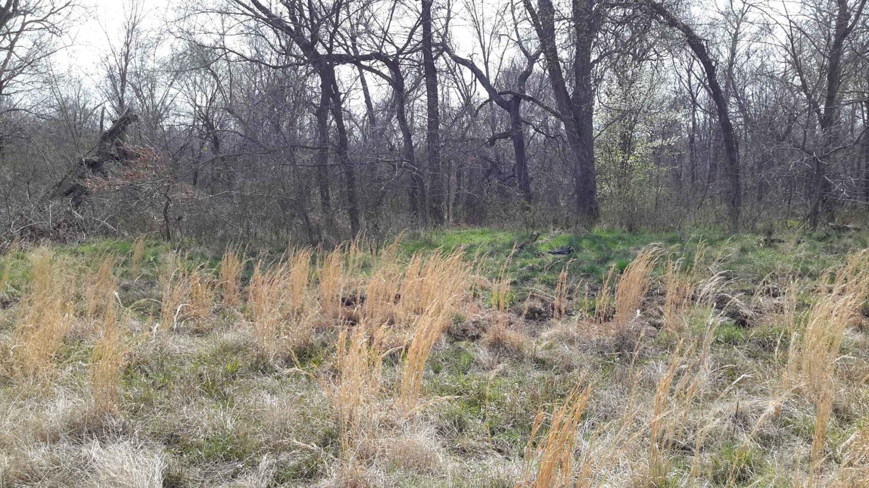
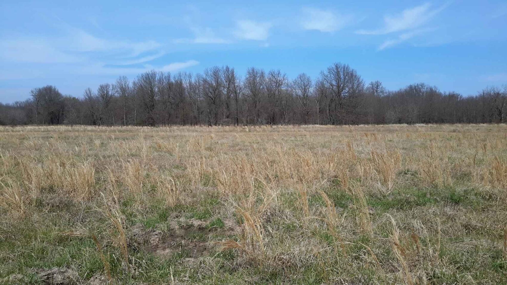
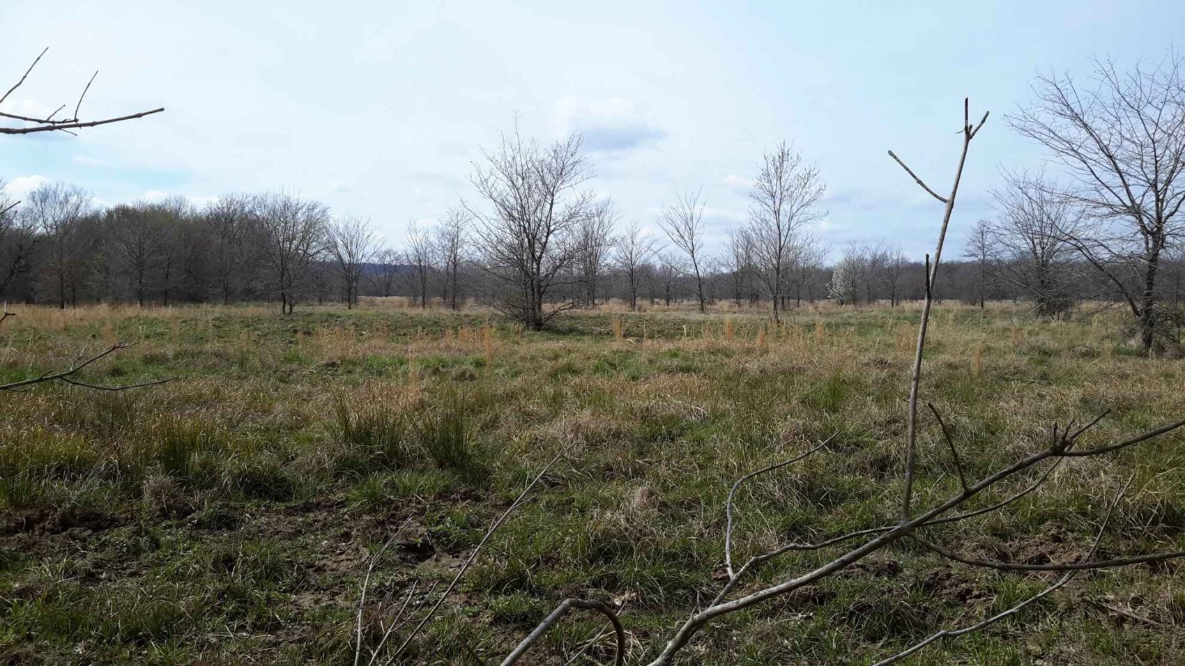
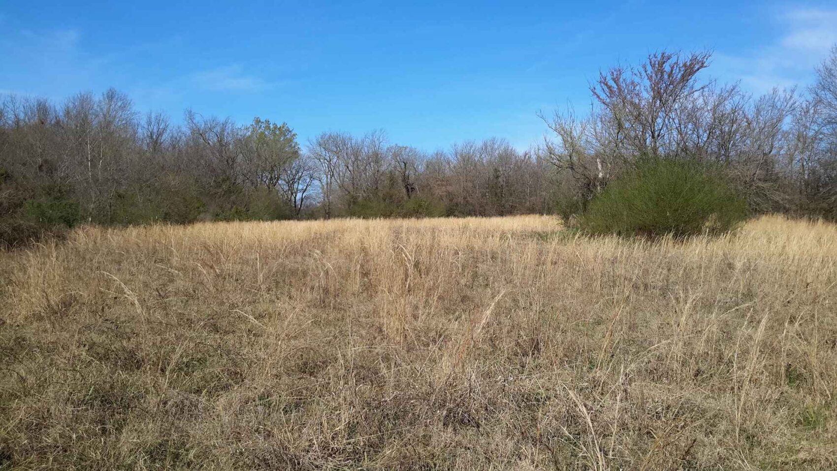
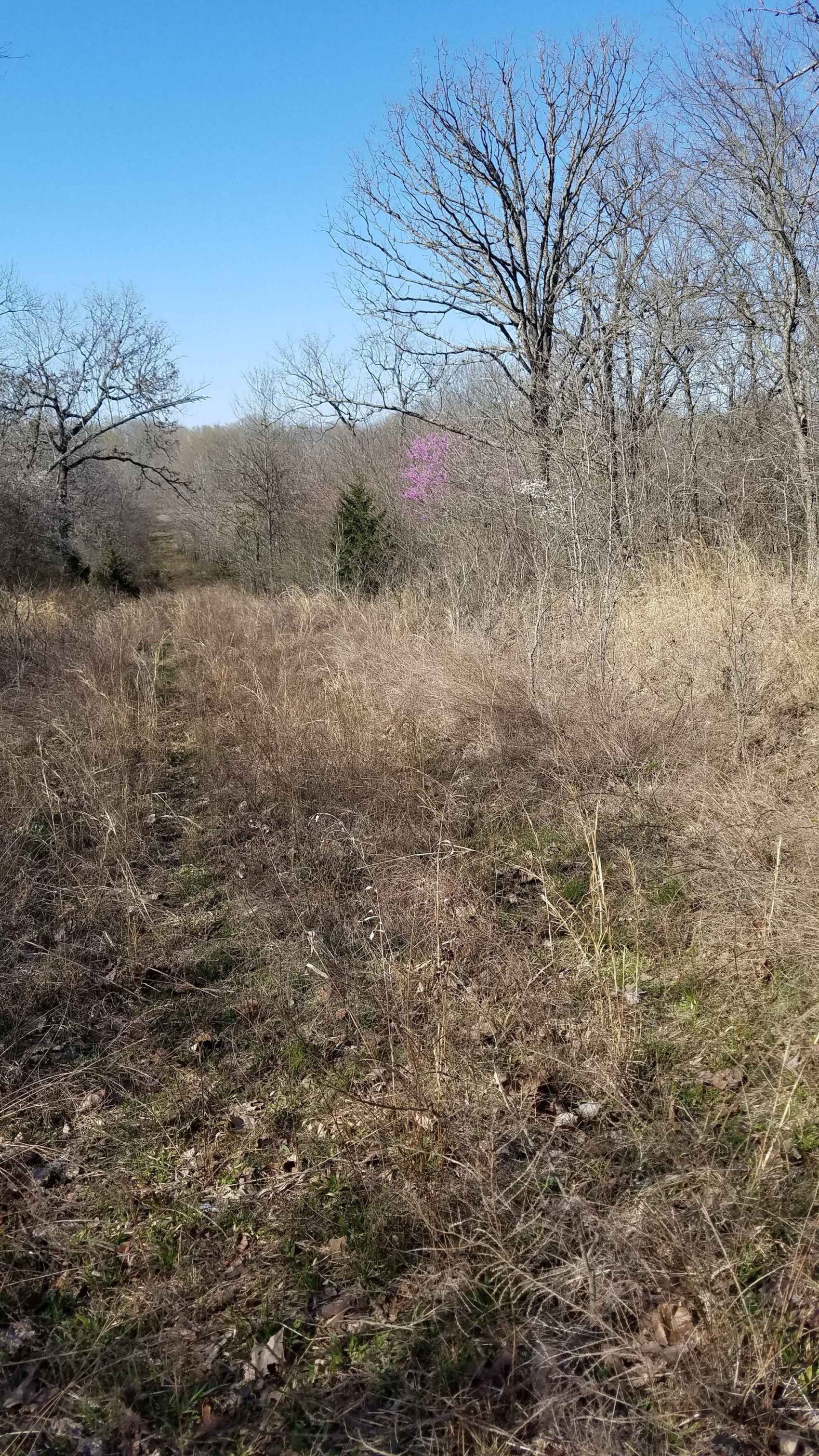
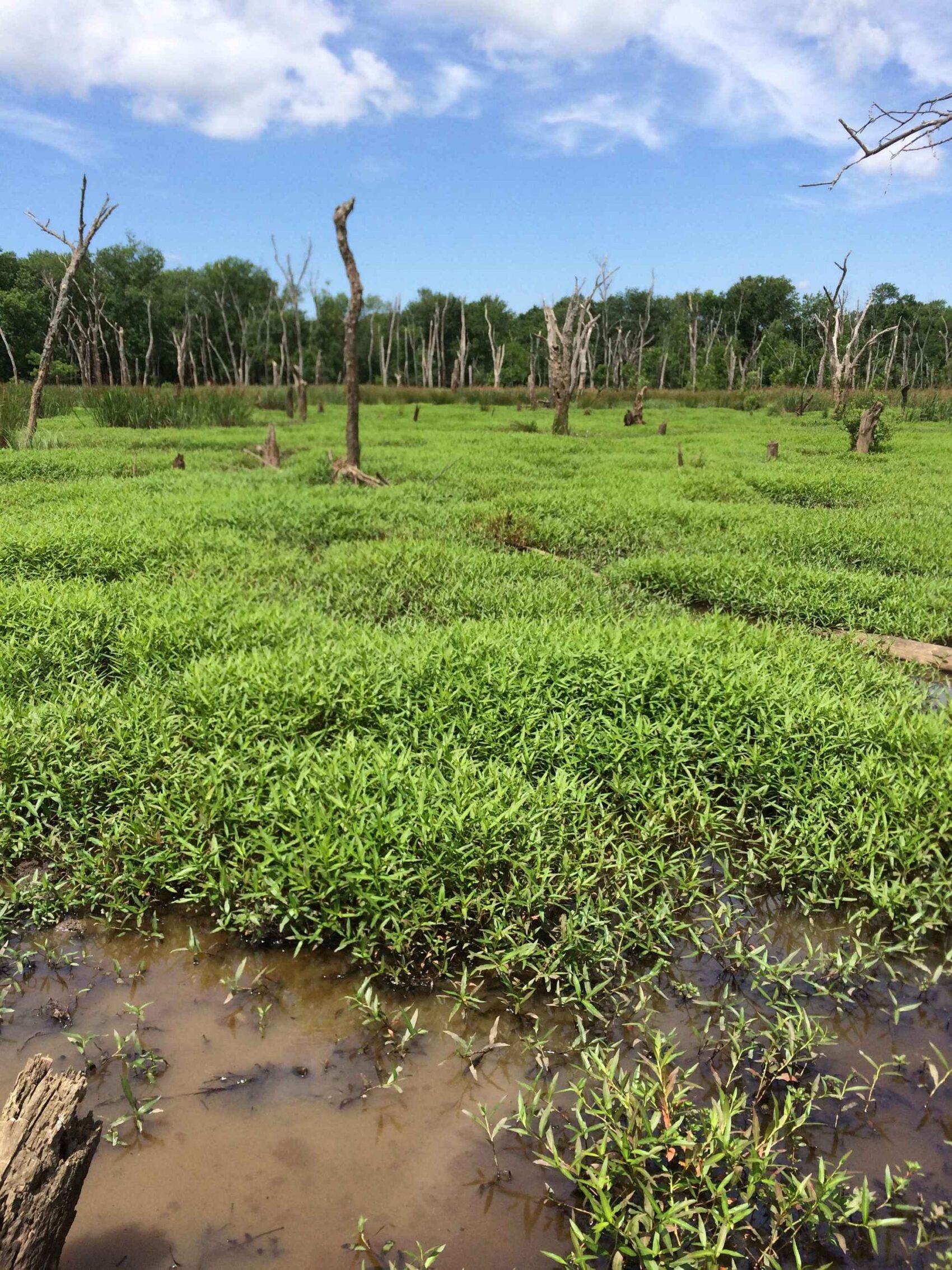
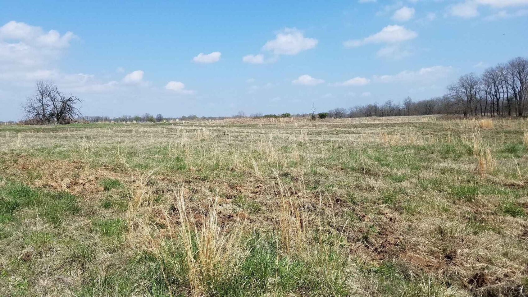
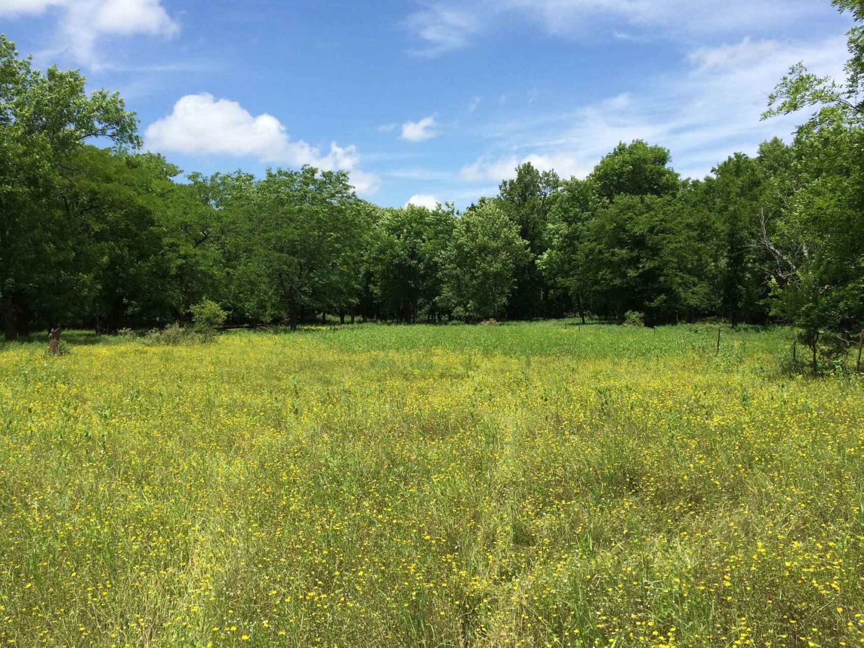
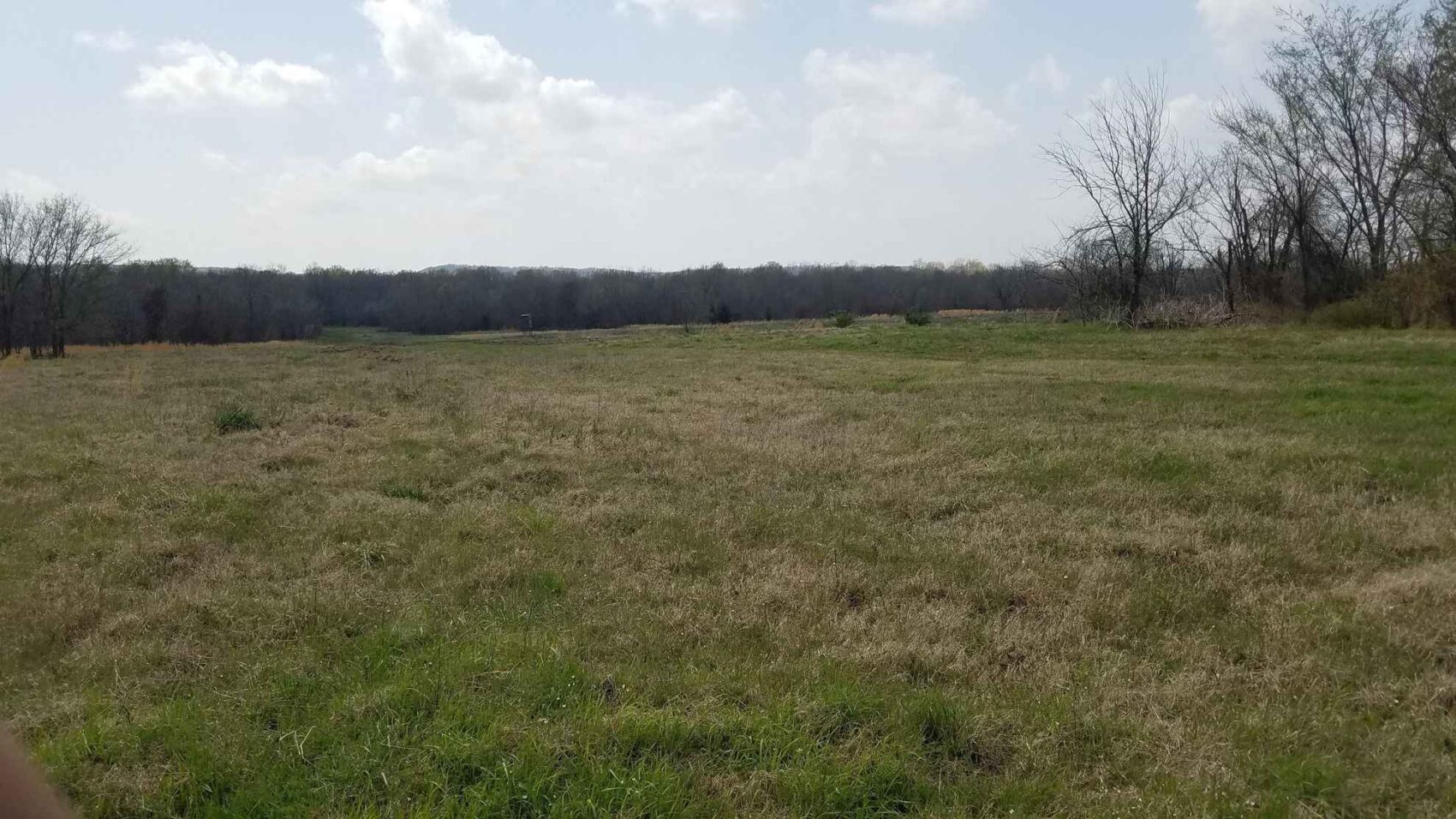
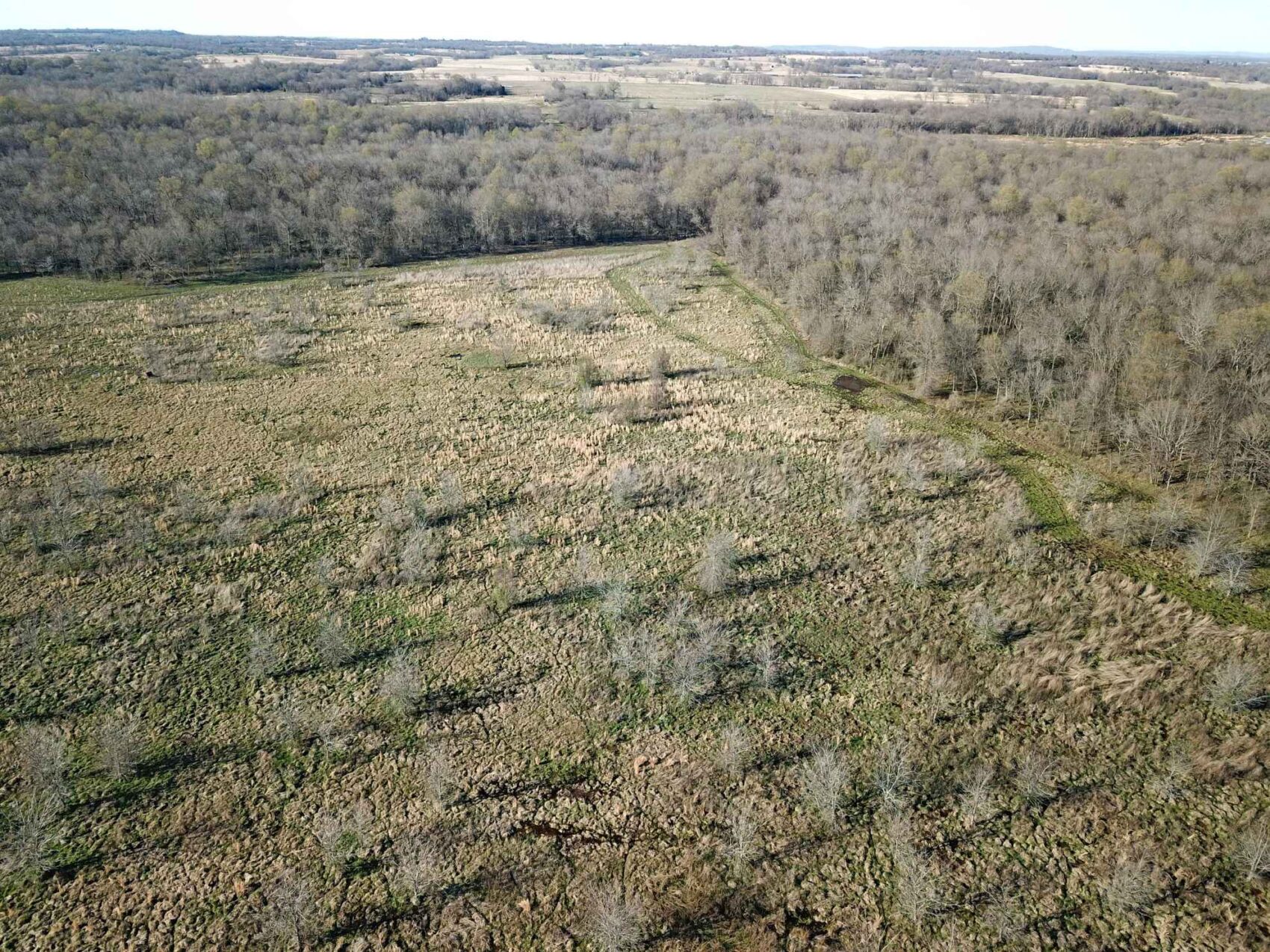
This land offers excellent hunting for deer, ducks, feral hogs and squirrel in upland and bottomland areas. The diversity of the habitat on this land is of the highest quality, with small openings, creeks, sloughs, old stock tanks, large fields, three major marshes and large areas of remarkably attractive bottomland forest with a clean understory providing excellent hunting conditions. This land offers a hunter the opportunity to traverse over seven hundred acres of forest something that most people can only dream of being able to do.
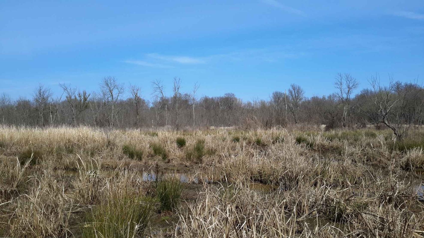
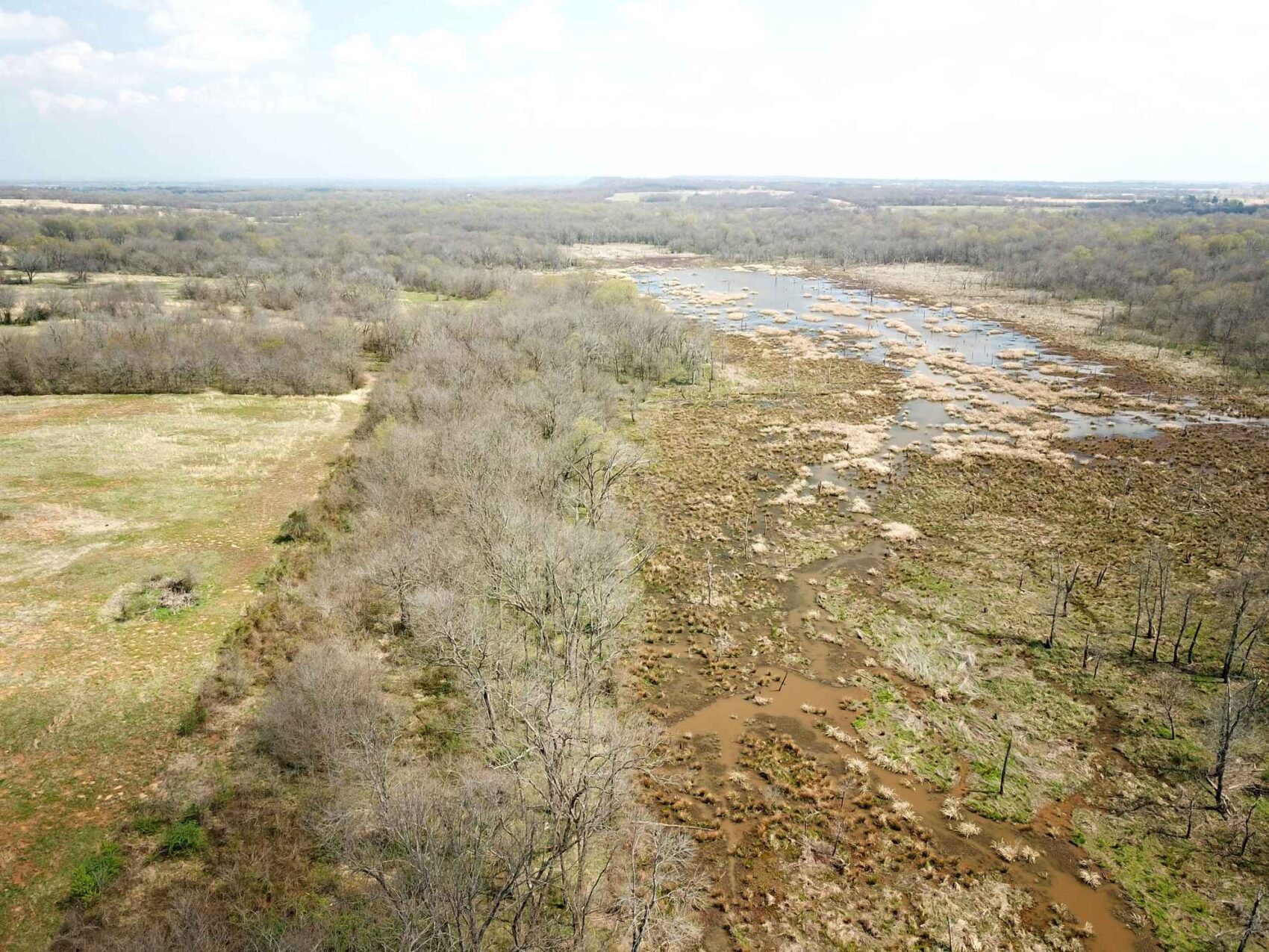
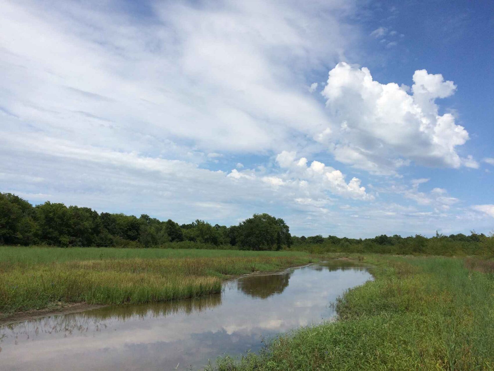
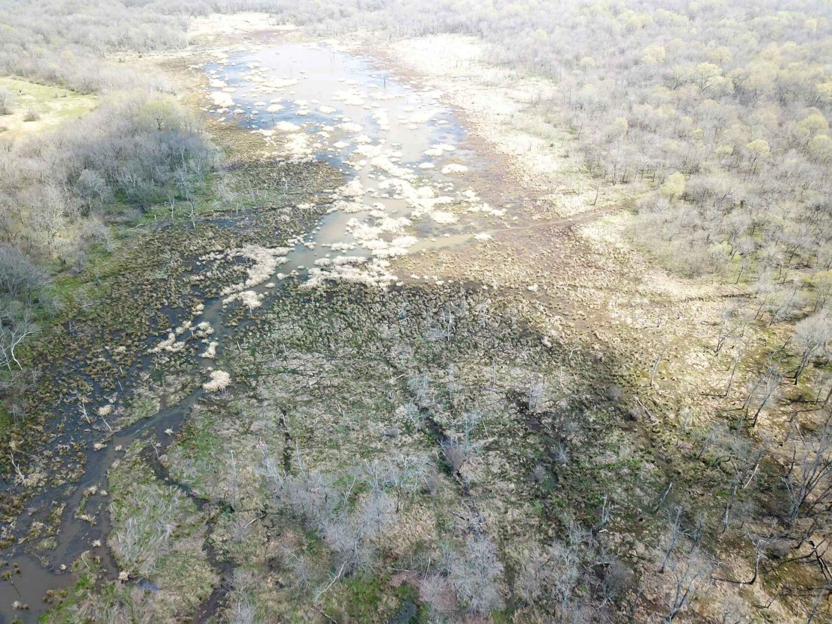
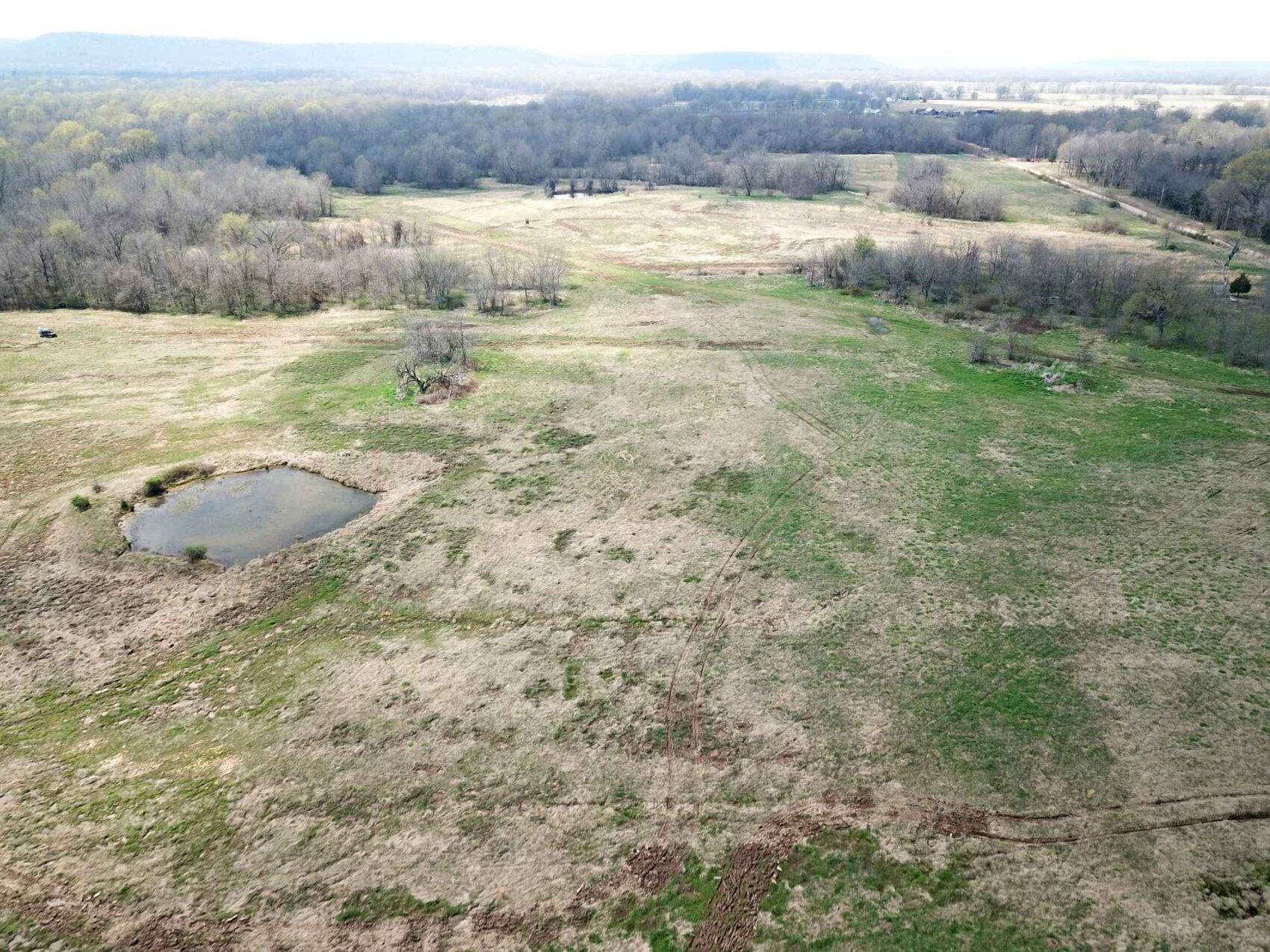
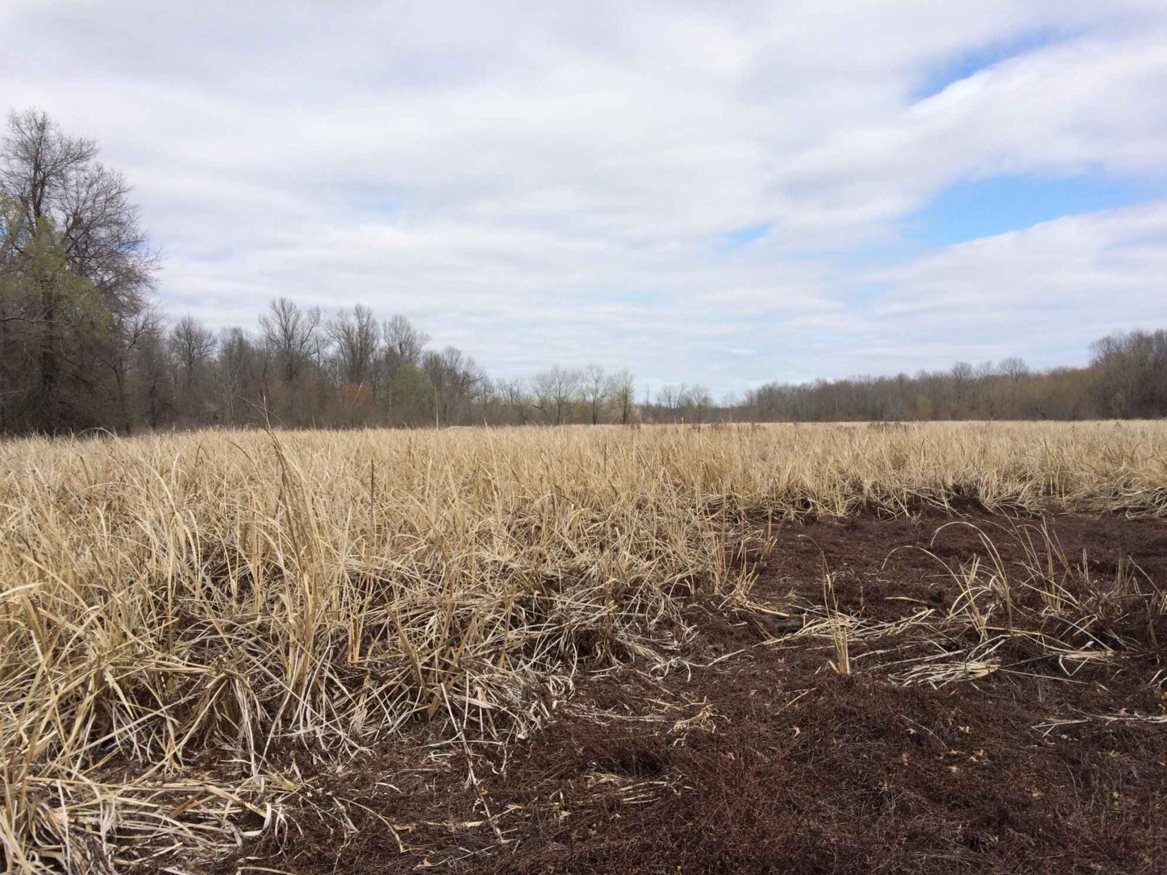
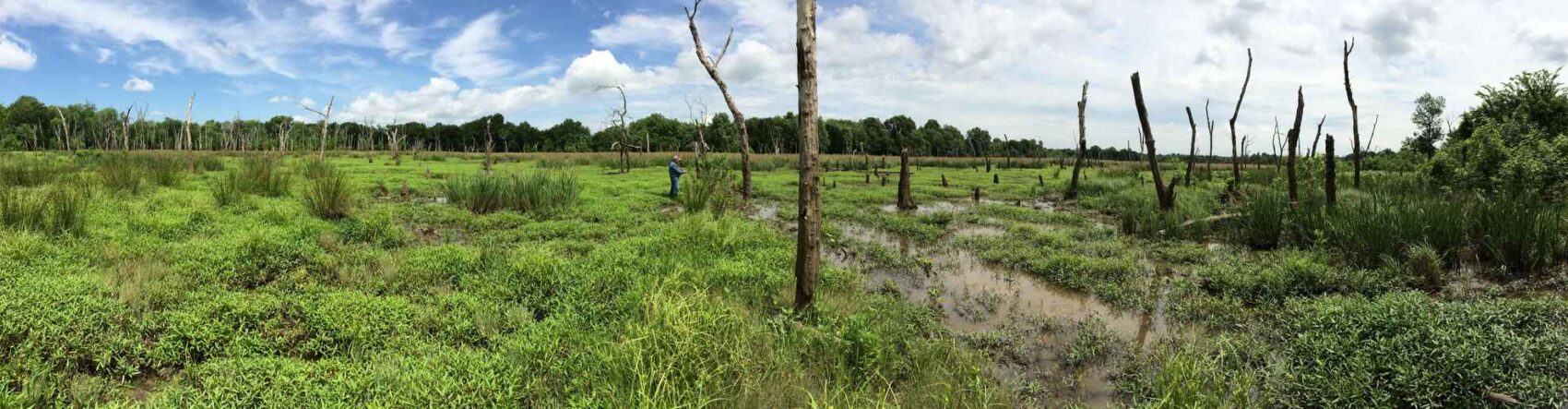
The three large marshes have provided excellent duck hunting opportunities according to previous leasees. The largest marsh, which covers about forty-five to fifty acres on average years, has unusually good access with open fields being located along the north margin. The smaller marsh complex is in the northwestern end of the property, and encompasses about thirty acres.
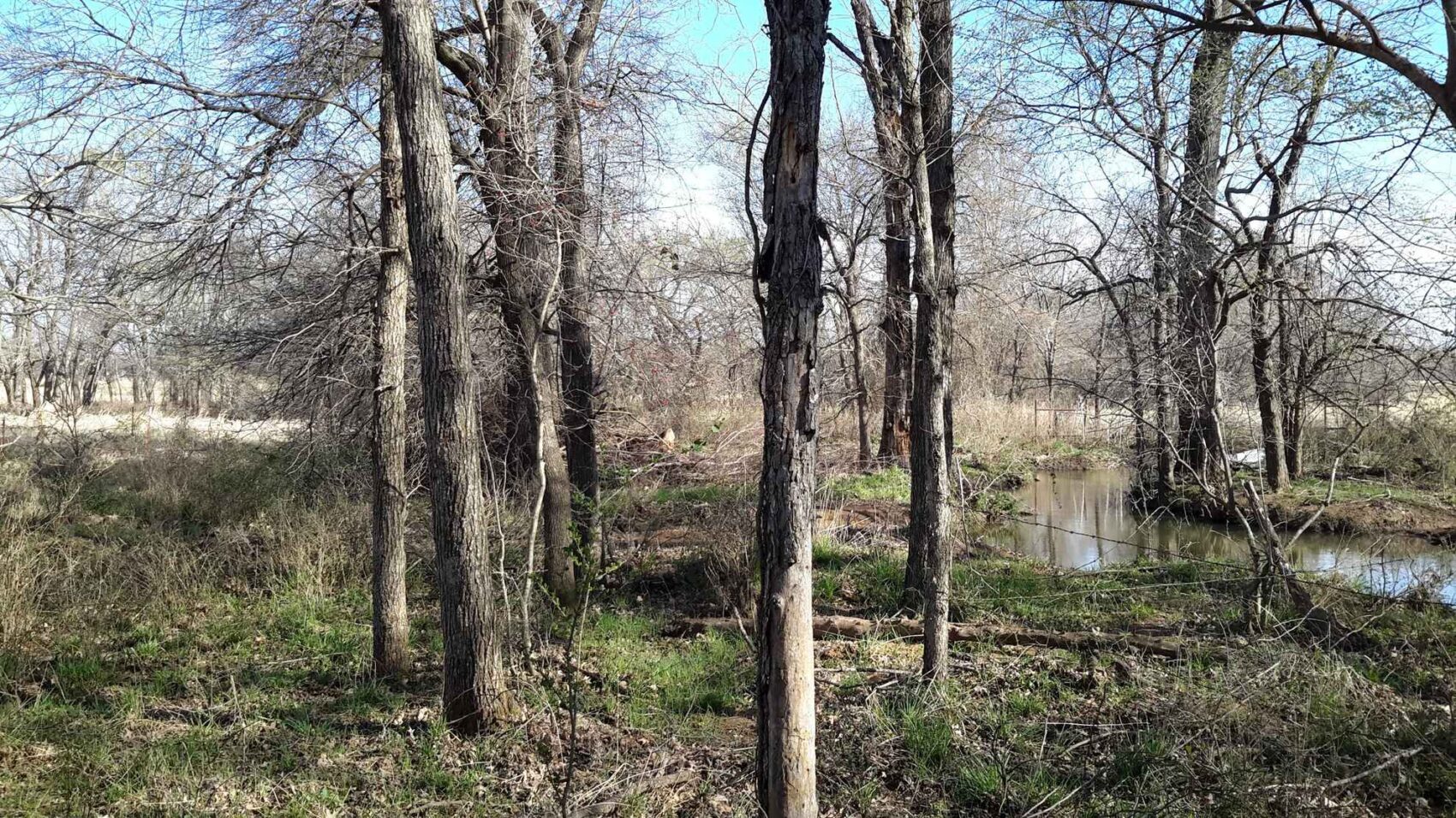
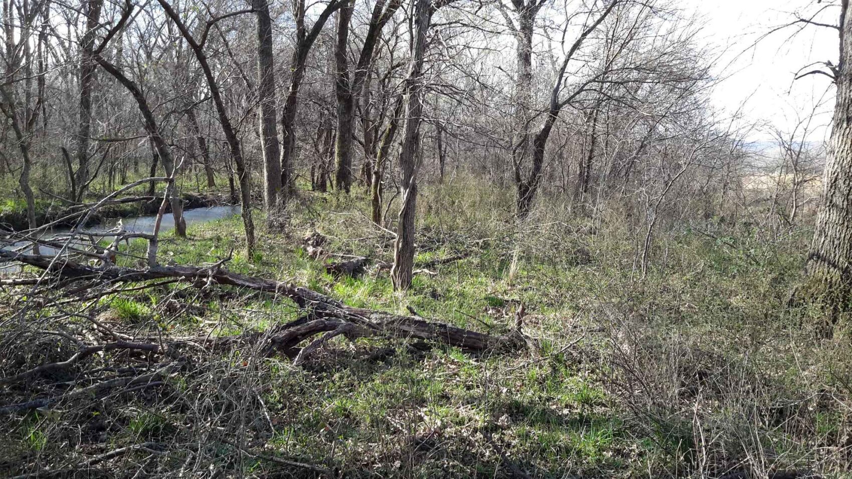
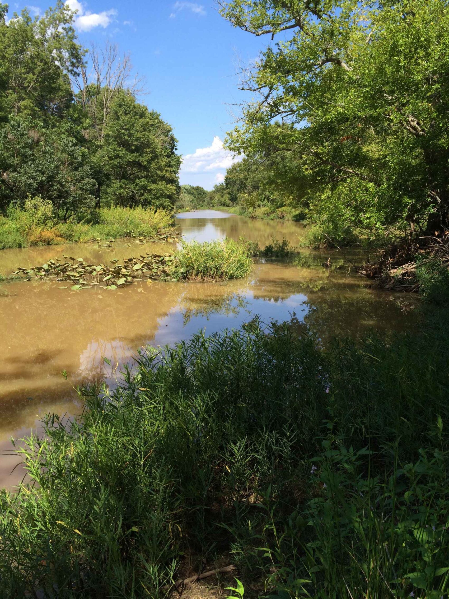
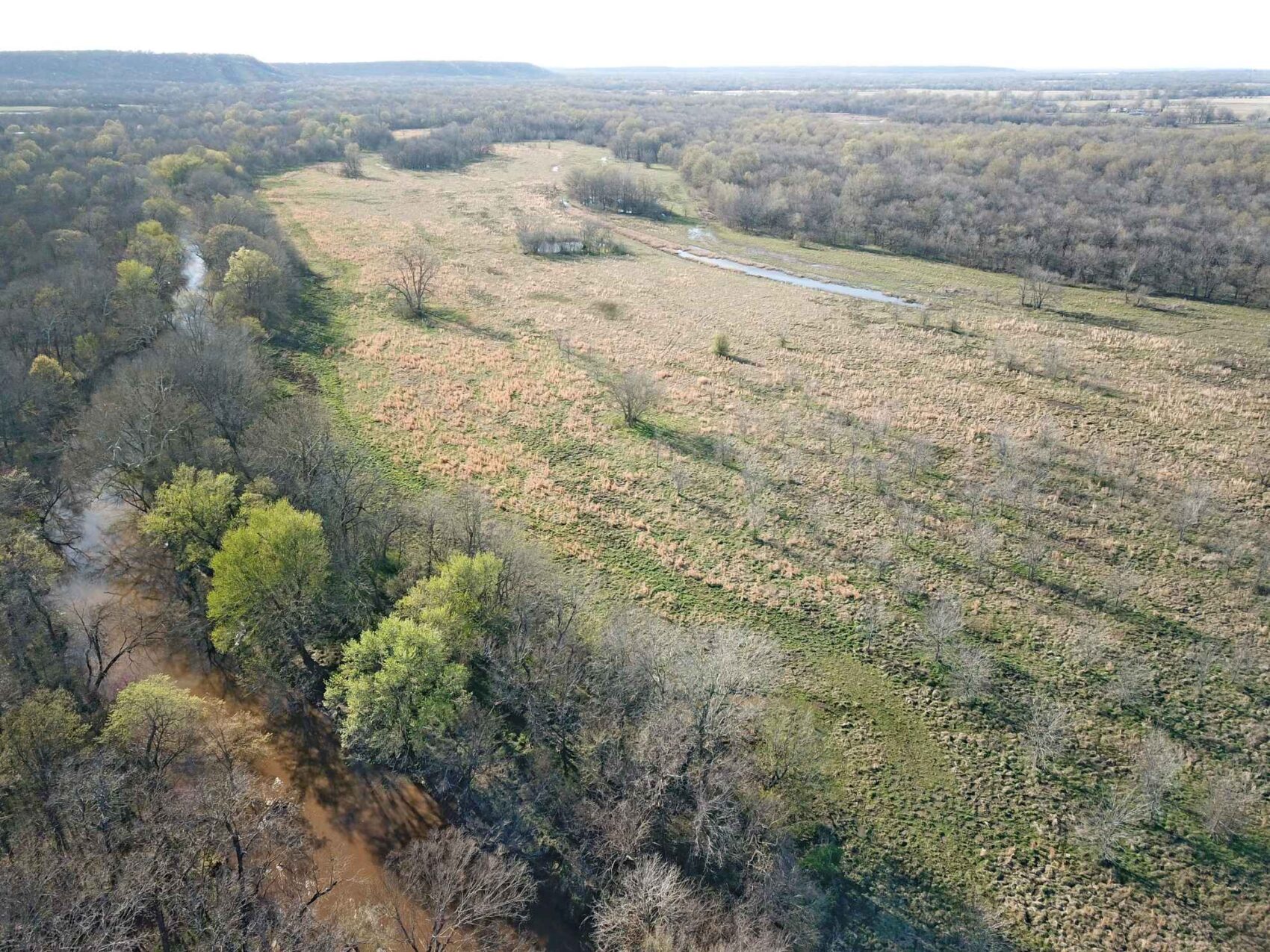
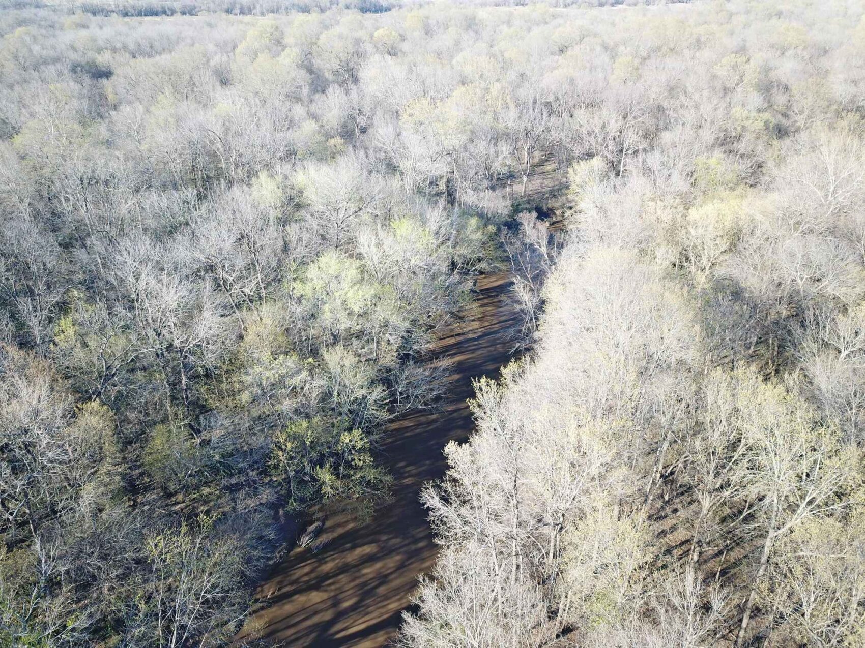
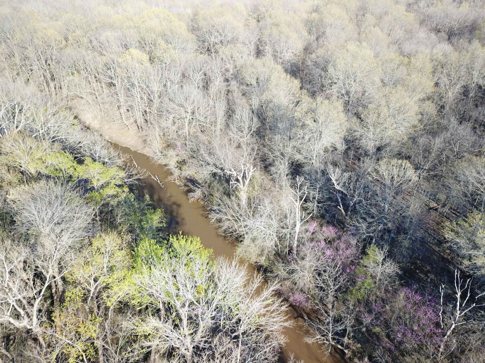
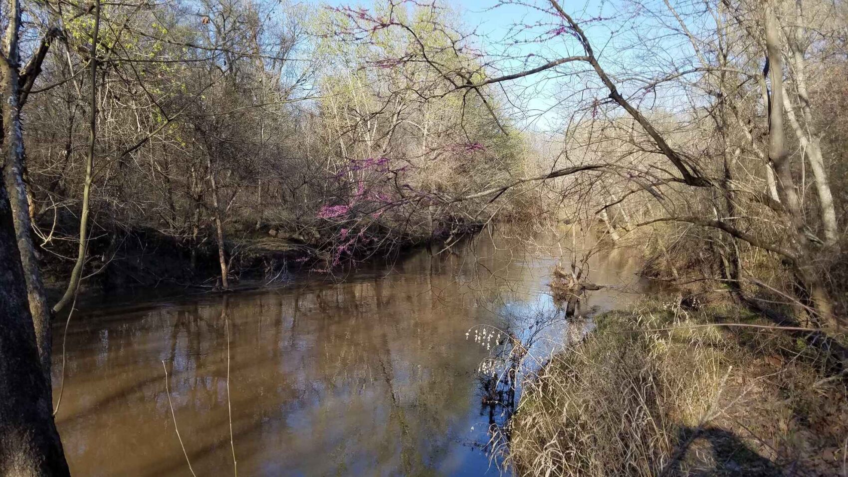
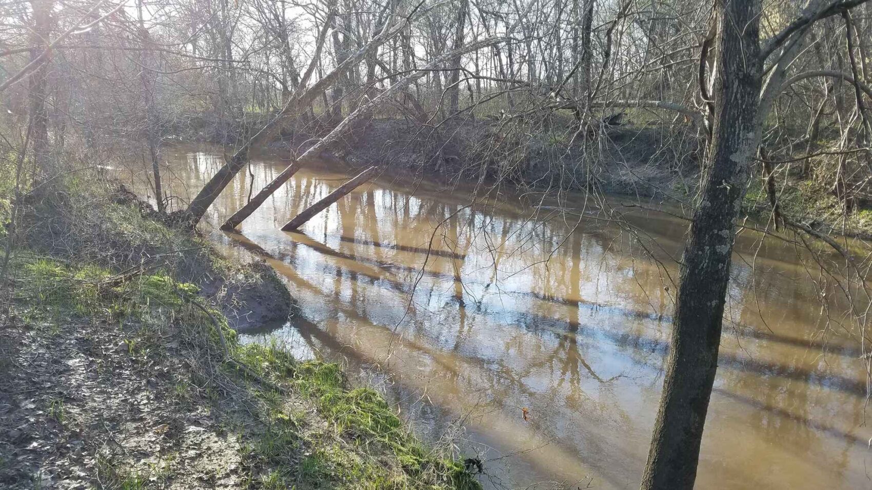
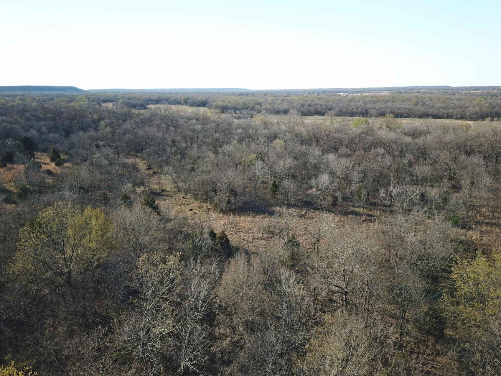
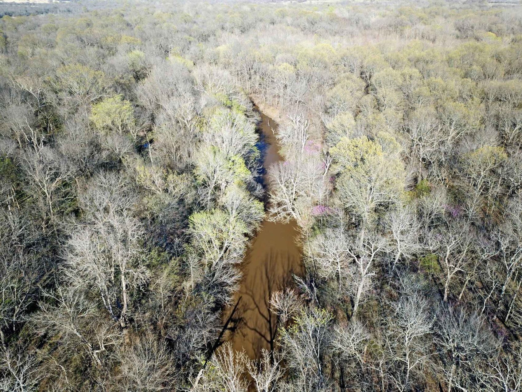
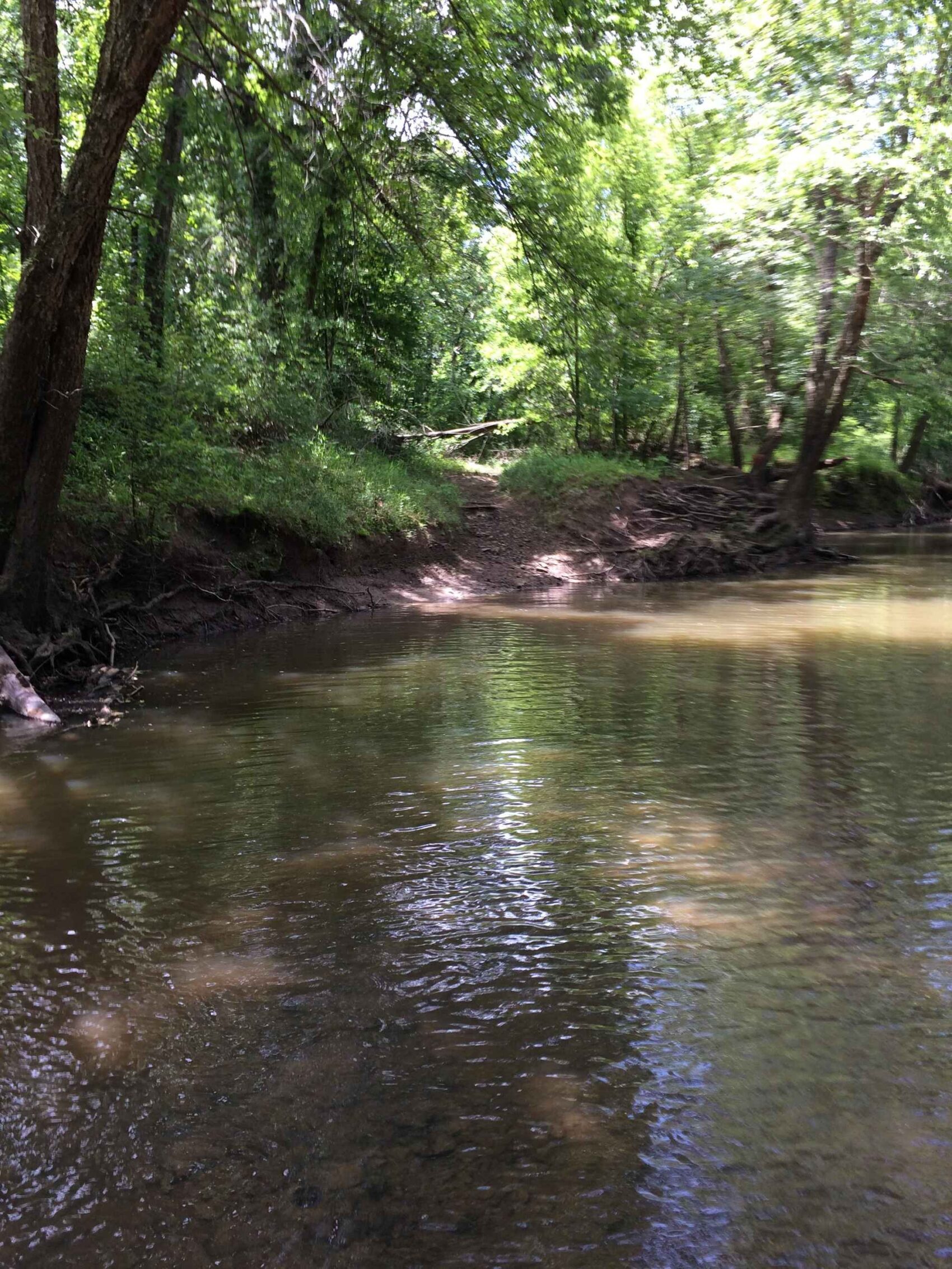
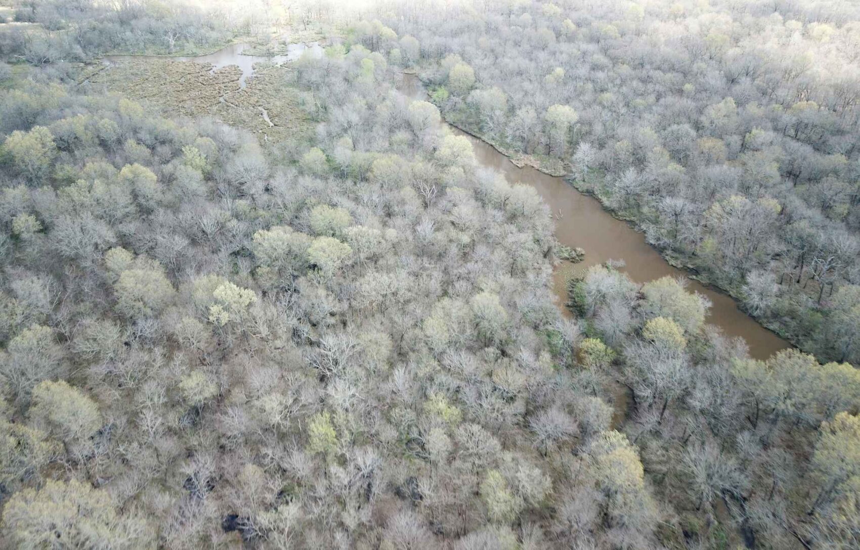
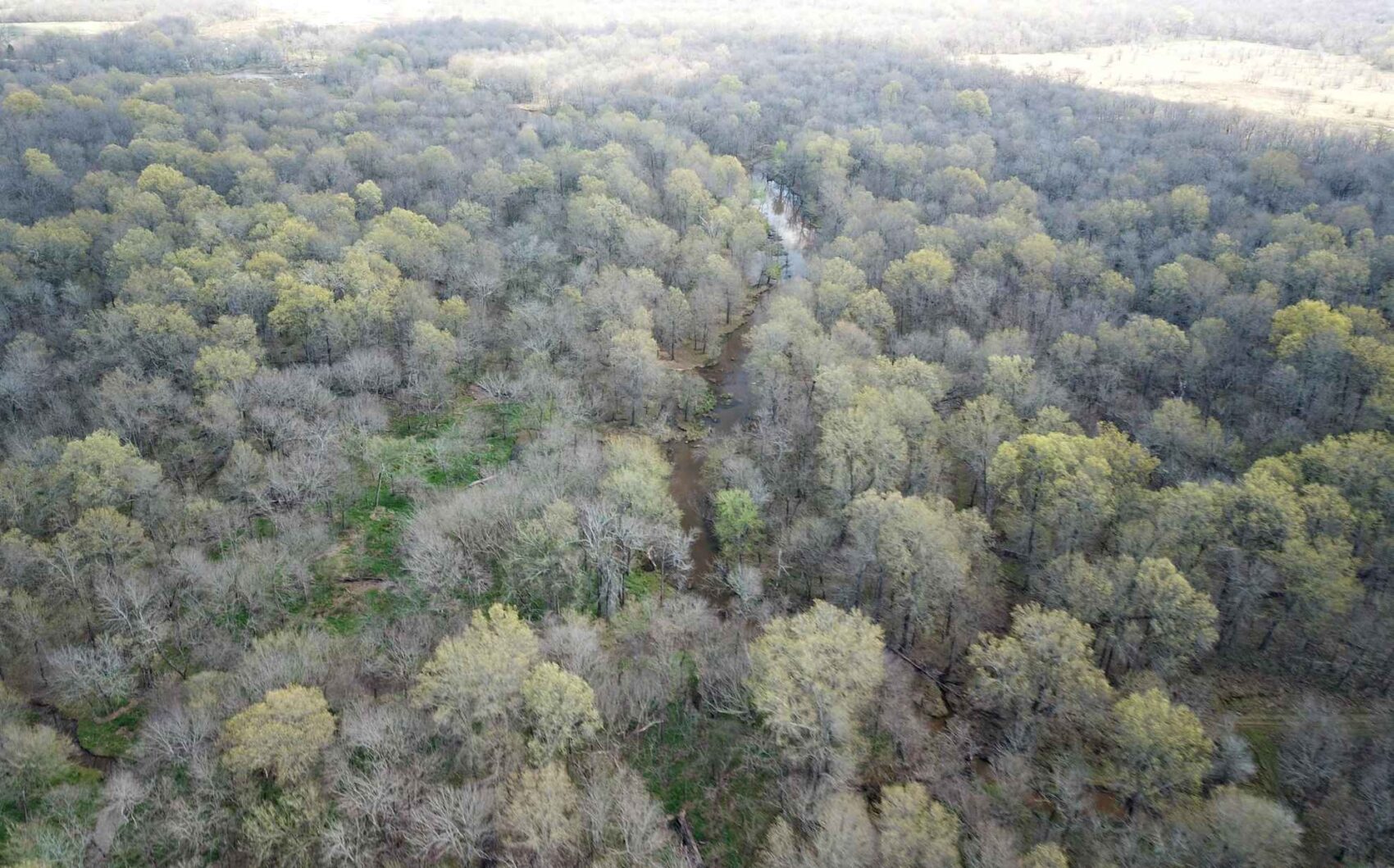
About three miles of the substantial stream Dirty Creek runs from west to east through the southern section, offering fishing and other recreational opportunities. There are miles of unimproved roads and trails leading through the forests and fields.
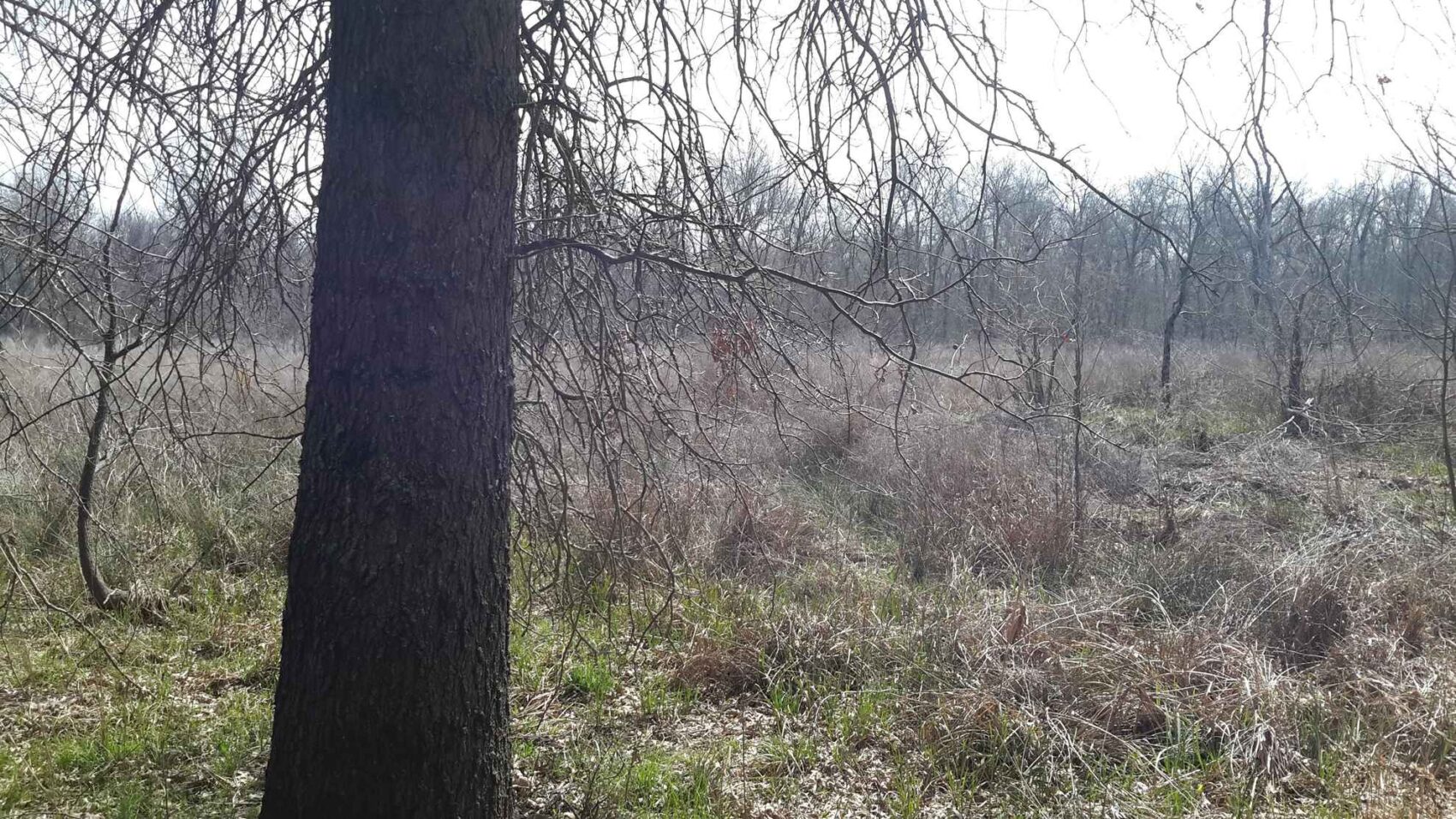
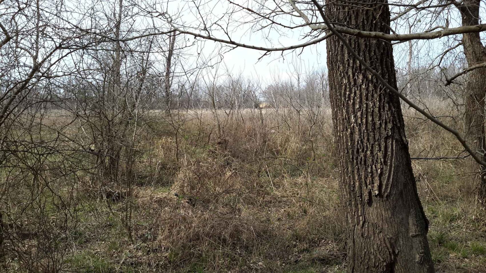
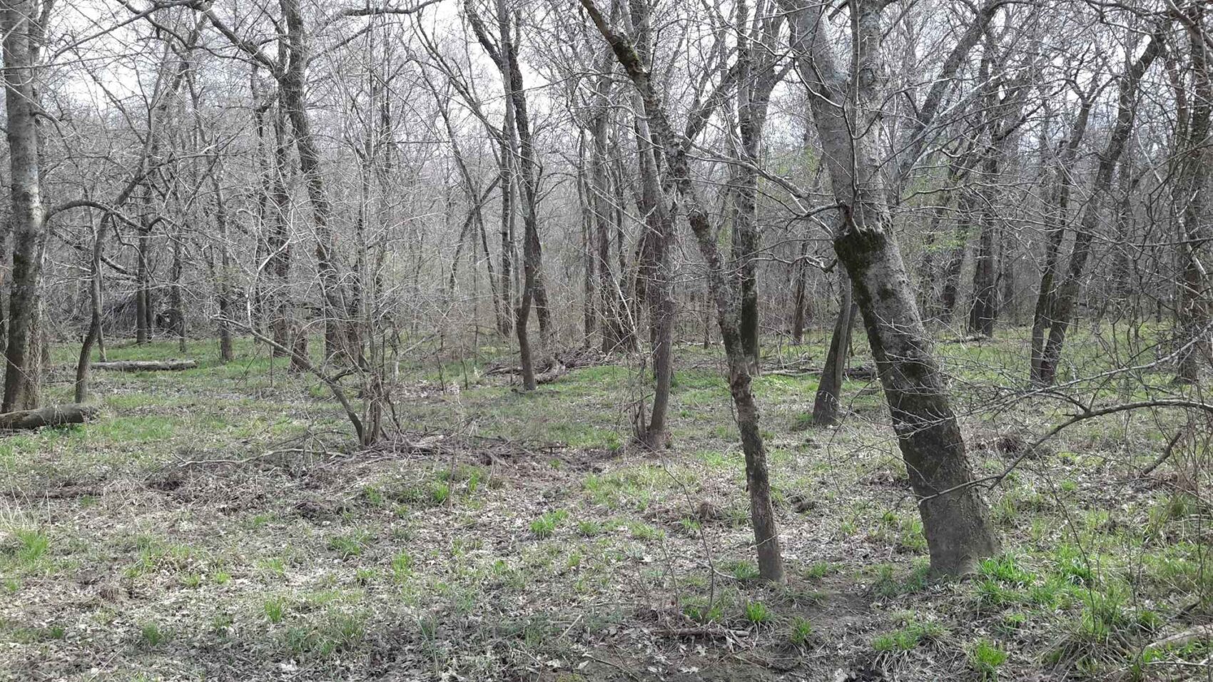
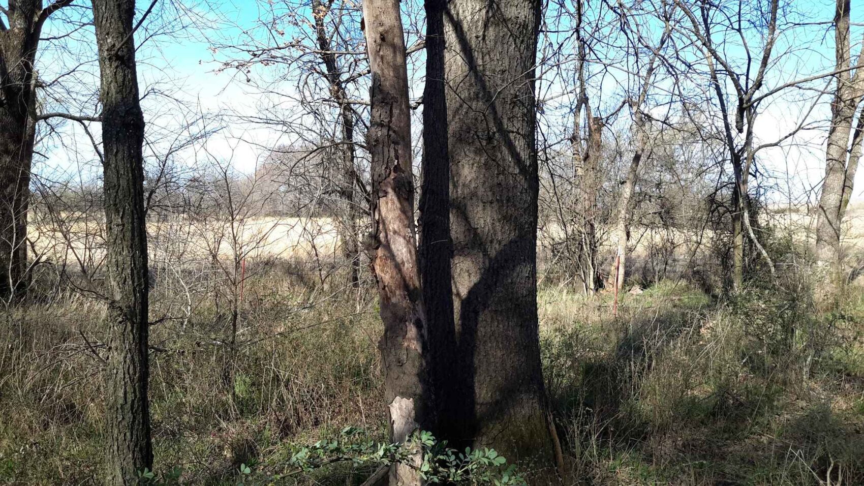
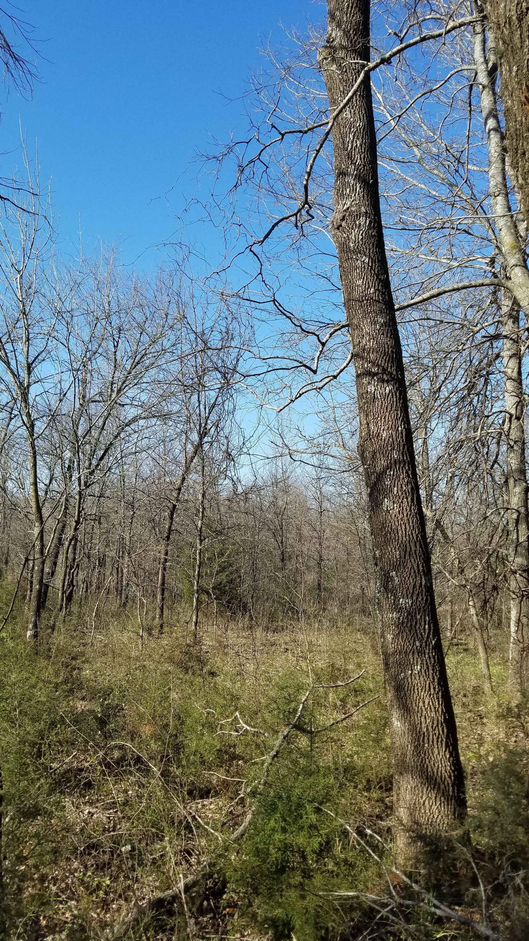
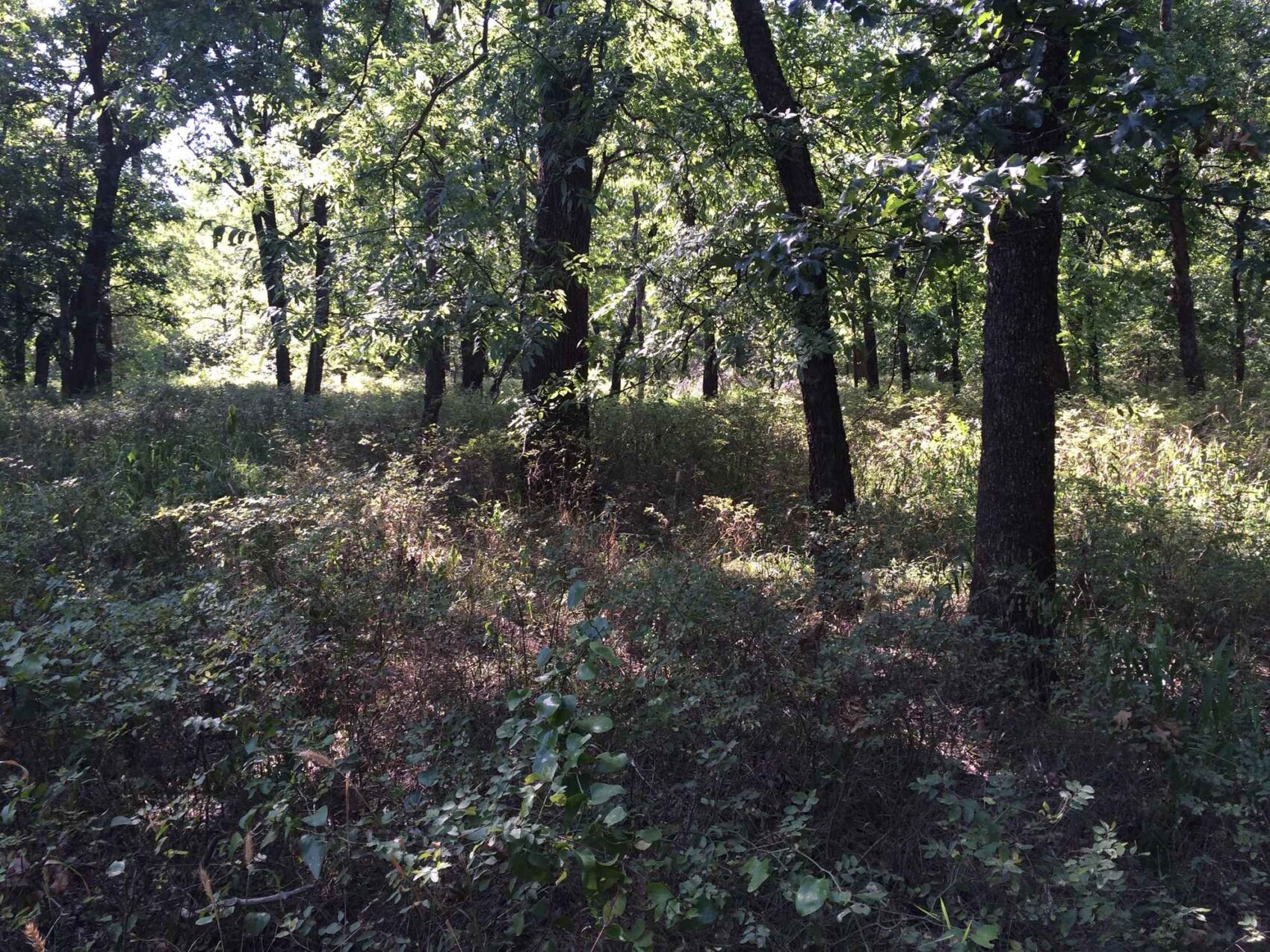
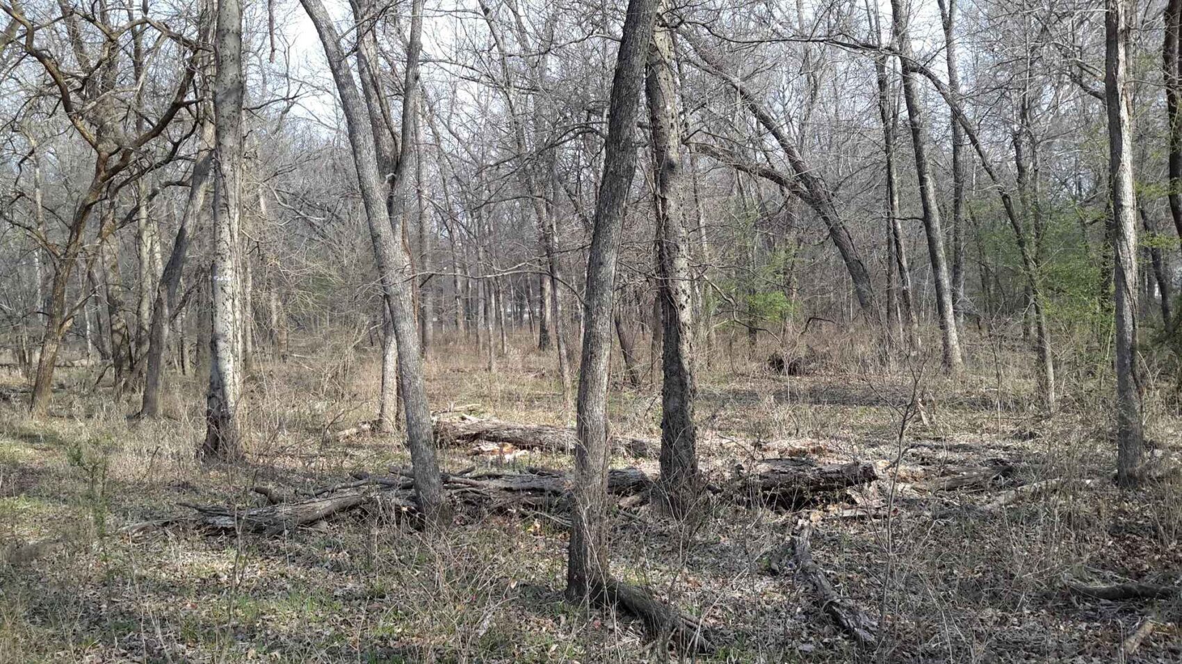
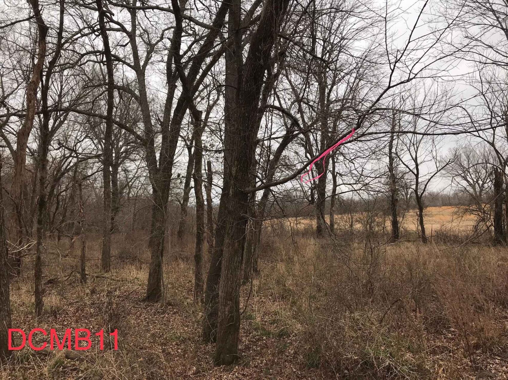
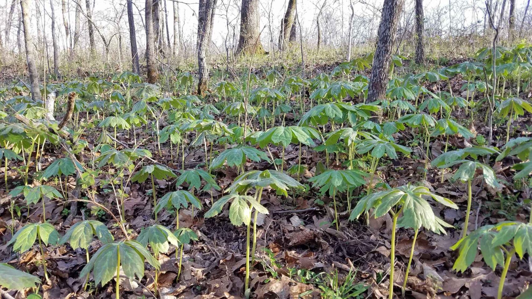
The native forests on this property are a combination of large older trees, medium-aged and younger trees, with a very wide assortment of species. It has been many years since any timber was cut, and the understory is semi- to fully open in most places. As with most Oklahoma land, this property was farmed in the past, with a long history of crop production and cattle grazing. It is now an undisturbed forest, a delight to walk through, and is ideal for hunting, hiking, or just exploring.
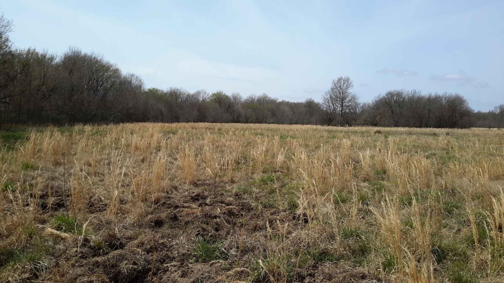
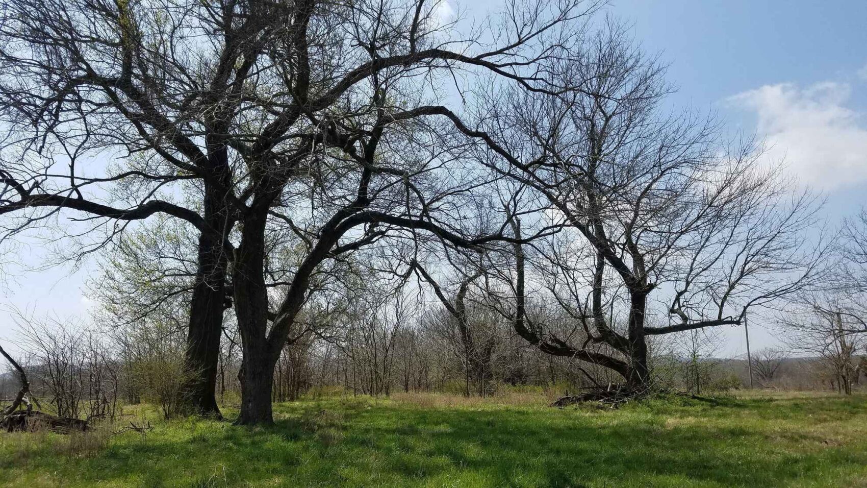
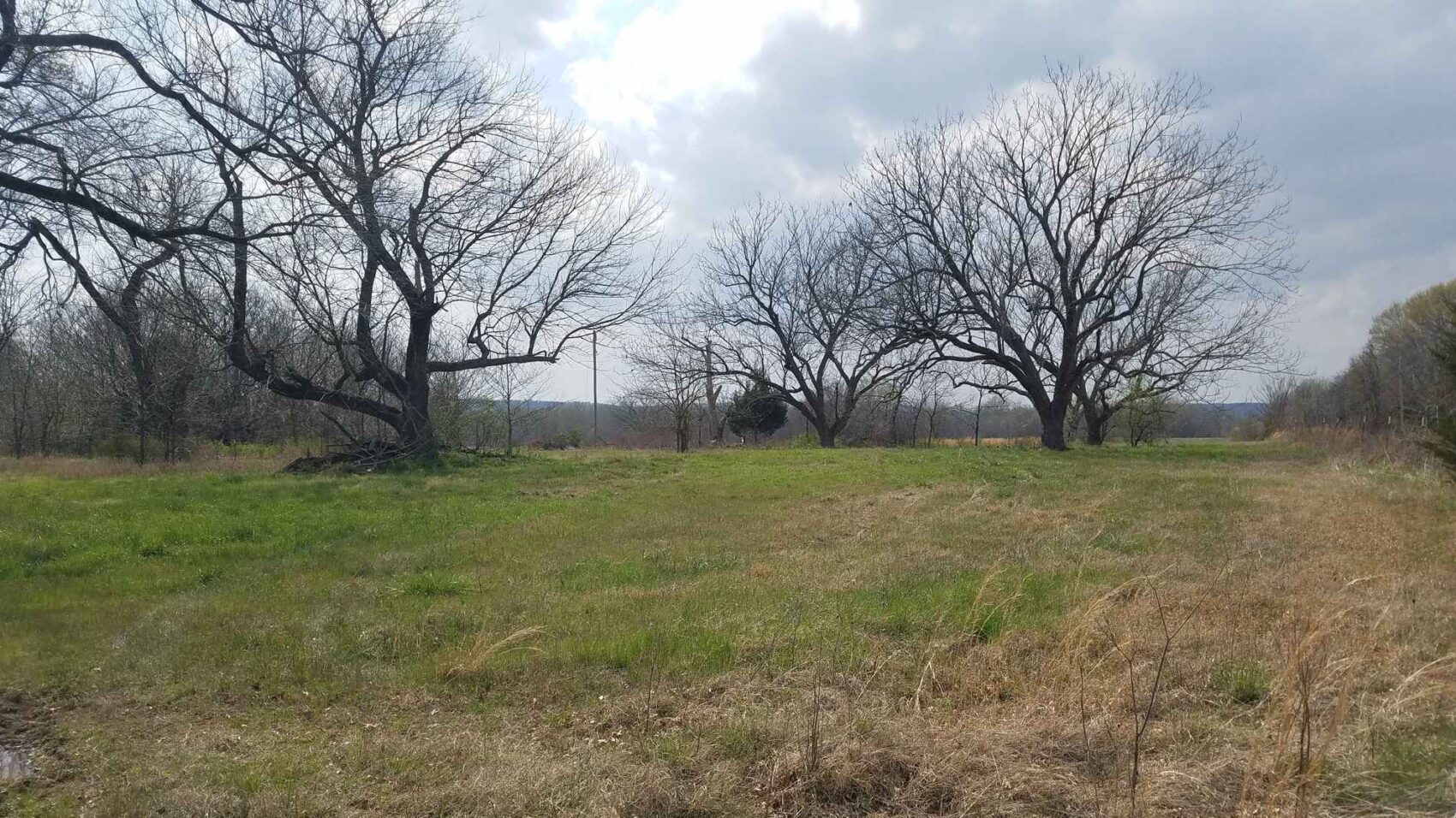
The property consists of a diverse matrix of forests, shrub lands, woodlands, and herbaceous areas, with herbaceous areas comprising about 30%, while forests in various stages of maturity from young regeneration to mature forest make up 70% of the tract. The upland areas are categorized as an assortment of open fields with native grasses and forbs interspersed with forests and semi-open areas containing scattered trees and shrubs. Upland forests include post oak, blackjack oak, winged elm, eastern redcedar, green ash, chinquapin oak, and burr oak. The bottomland forests include pin oak, burr oak, silver maple, green ash, hackberry, pecan, boxelder, persimmon, Osage orange, honeylocust and American sycamore. Shrub / midstory species include Possumhaw, huckleberry, eastern redbud and flowering dogwood.
Natural Resource Conservation Service soil survey data indicate that the soils are primarily silt loams, with some rockier soils on the southern areas south of Dirty Creek.
1,032 acres of the property is under a conservation easement agreement and is being actively managed for native habitat, with funding for the prescribed burning program, vegetation control, road and boundary maintenance being provided by an endowment and executed by a conservation bank manager. The key activity is prescribed burning, which provides for excellent all-around wildlife habitat as well as assisting in maintaining an open nature to the woods and fields. The goal is to burn every acre possible at least once every five years, with no more than 40% of the habitat burned each year.
There are 35.05 acres in three development areas that have public road access with utilities, and are available for building homes, cabins, camps or whatever the property owner would desire. Two of these Development Areas are located on the northern side of the land, which is the McIntosh-Muskogee County line on County Road E1010. The 15.5-acre Development Area 1 is located on an upland site and is primarily in an open field, with some large walnut and red oak trees, as well as the old original barn and farmyard site. The 5.9-acre Development Area 2 overlooks the largest natural marsh and is tucked into the corner of a field against the woods and the marsh. The 13.65-acre Development Area 3 is located on the southern boundary off of County Road E1020, on an upland forested site on the south bank of Dirty Creek.
The property owner will be under no obligation to accomplish any of these habitat management activities, but will be required to cooperate with the conservation bank manager, U.S. Fish & Wildlife Service, and the conservation easement holder. The property cannot be subdivided, no consumptive activities such as logging or mining are allowed, and land title transactions require the approval of the U.S. Fish & Wildlife Service.
The property owner will only be responsible for whatever improvements are desired on any of the three development areas, providing their own non-permanent hunting blinds and feeders, and if desired establishing and maintaining up to a total of 10 acres of food plots (for example, could be twenty half-acre plots) planted with native species or commonly-used non-invasive non-native species such as corn, wheat, rye, clover, cowpeas, soybeans, oats, sunflower, etc.
A summary of the conservation project, the complete land survey, and other information is provided in the document download section.
Oil & Gas minerals are not available.
Electric Power, cable television and telephone are located on both the north and side boundaries of the property along the county road frontages.
The south county road additionally has community water.
Warner Public School District.
One gas well site is on property, in the south section within the Development Area 3 footprint, with the access road off of county road E 1020. Several plugged/abandoned gas wells are located in the forested area north of Dirty Creek.
A pipeline right-of-way crosses the property in the eastern section, running northwest to southeast.
The abandoned Texas & Pacific Railroad line is located along the eastern side of Dirty Creek in the easternmost portion of this property.
Refer to the survey plat and other documents for a more complete description of the site.
Buyers agents are required to contact the listing agent to arrange site visits and are required to accompany potential buyers at the time of the first visit. Failure to disclose as a buyers agent or lack of presence upon first site visit will result in co-broker compensation being at discretion of listing agent.
TerraStone Land Company strives to gather good information concerning listed properties from reliable sources, but cannot guarantee the accuracy of said data, including but not limited to boundary line locations, acreages, fence lines, legal title, environmental hazards, condition of improvements, legal access, utility services, or site suitability for agricultural or forestry use. All maps are provided for illustrative purposes only and are not survey plats. TLC recommends that potential buyers examine the offered property to their own satisfaction. TLC is not responsible for errors, omissions, offering withdrawal or price modifications.
USEFUL DOCUMENTS
- DirtyCreek-ResrvdEsmts-Signed2018-8-13.pdf
- DirtyCreek-BoundarylessResrvdEsmts-forRvw2018-8-13.pdf
- DirtyCreek-ResrvdEsmtsMap-Signed2018-8-13.pdf
- DirtyCreekABBCBAPART1.pdf
- DirtyCreekABBCBAPART2.pdf
- DirtyCreekABBCBAPART3.pdf
- DirtyCreekConservationEasement_McIntoshCtyOK_FILED08172018.pdf
- DirtyCreek-TerrastoneTopoMap-AGW-4-22-21.pdf
- DirtyCreek-TerrastoneStandFeaturesMap-AGW-4-22-21.pdf
- DirtyCreek-TerrastoneBAnkandPropertyMap-AGW-4-22-21.pdf
- DirtyCreek-TerrastoneLocationMap-AGW-4-22-21.pdf
Property Map / Directions
Site visits can be arranged by contacting Bradley Wilson, Broker, through the TerraStone office at 936-590-4909.
PROPERTY IMAGES
Other Listings
-
 $278,356
+-107.06 Acres - Harrison County, Texas
Acres107.06 CountyHarrison StateTexas -
$1,227,107
1,067 ACRES, McINTOSH COUNTY, OKLAHOMA
Acres1,067.05 CountyMcIntosh StateOklahoma -
$65,000
10.16 ACRES, NACOGDOCHES COUNTY, TEXAS
Acres10.00 CountyNacogdoches StateTexas -
$40,688
10.443 ACRES, SHELBY COUNTY, TEXAS
Acres10.44 CountyShelby StateTexas -
$36,575
10.45 ACRES, NACOGDOCHES COUNTY, TEXAS
Acres10.45 CountyNacogdoches StateTexas -
$30,000
10.928 ACRES, CHEROKEE COUNTY, TEXAS
Acres10.93 CountyCherokee StateTexas -
$429,250
101.0 ACRES, RUSK COUNTY, TEXAS
Acres101.00 CountyRusk StateTexas -
$303,450
101.15 ACRES, HARRISON - PANOLA COUNTY
Acres101.15 CountyPanola StateTexas -
106.0 ACRES, SABINE COUNTY, TEXAS
Acres0.00 County State -
$233,200
106.0 ACRES, SABINE COUNTY, TEXAS
Acres106.00 CountySabine StateTexas -
$231,575
107 ACRES, NACOGDOCHES COUNTY, TEXAS
Acres107.00 CountyNacogdoches StateTexas -
$305,424
113.12 ACRES, SABINE COUNTY, TEXAS
Acres113.12 CountySabine StateTexas -
$295,000
118.0 ACRES, NACOGDOCHES COUNTY, TEXAS
Acres118.00 CountyNacogdoches StateTexas -
$72,000
12.0 ACRES, RUSK COUNTY, TEXAS
Acres12.00 CountyRusk StateTexas -
$146,400
12.2 Acres Red River County, Texas
Acres12.20 CountyRed River StateTexas -
$133,350
12.7 Acres Red River County, Texas
Acres12.70 CountyRed River StateTexas -
$175,000
120 ACRES, CASS COUNTY, TEXAS
Acres120.00 CountyCass StateTexas -
$340,000
132.081 ACRES, SHELBY COUNTY, TEXAS
Acres132.08 CountyShelby StateTexas -
$343,000
133.47 ACRES, PANOLA COUNTY, TEXAS
Acres133.47 CountyPanola StateTexas -
$398,250
135 ACRES, NACOGDOCHES COUNTY, TEXAS
Acres135.00 CountyNacogdoches StateTexas -
$890,500
137.0 ACRES, ANDERSON COUNTY, TEXAS
Acres137.00 CountyAnderson StateTexas -
$148,050
14.1 Acres Red River County, Texas
Acres14.10 CountyRed River StateTexas -
$375,000
140.0 ACRES, SHELBY COUNTY, TEXAS
Acres140.00 CountyShelby StateTexas -
$455,008
154.24 ACRES, RUSK COUNTY, TEXAS
Acres154.24 CountyRusk StateTexas -
$578,380
156 ACRES, NACOGDOCHES COUNTY, TEXAS
Acres156.00 CountyNacogdoches StateTexas -
$99,900
16.0 ACRES NACOGDOCHES COUNTY, TX Lot 5
Acres16.00 CountyNacogdoches StateTexas -
$99,900
16.0 ACRES, NACOGDOCHES COUNTY, TEXAS
Acres16.00 CountyNacogdoches StateTexas -
$143,650
16.9 Acres Red River County, Texas
Acres16.90 CountyRed River StateTexas -
$420,605
162.71 ACRES, ANGELINA COUNTY, TEXAS
Acres162.70 CountyAngelina StateTexas -
$449,500
167.50 ACRES, SHELBY COUNTY, TEXAS
Acres167.50 CountyShelby StateTexas -
$380,250
169.0 ACRES, HARDIN COUNTY, TEXAS
Acres169.00 CountyHardin StateTexas -
$30,600
17.0 ACRES, RUSK COUNTY, TEXAS
Acres17.00 CountyRusk StateTexas -
$317,330
171.53 ACRES, PANOLA COUNTY, TEXAS
Acres171.53 CountyPanola StateTexas -
$689,936
172.7 Acres Nacogdoches County Texas
Acres172.70 CountyNacogdoches StateTexas -
$347,812
178.0 ACRES, SHELBY COUNTY, TX
Acres178.00 CountyShelby StateTexas -
$72,000
18.0 ACRES, TYLER COUNTY, TX
Acres18.00 CountyTyler StateTexas -
$729,000
183 ACRES, UPSHUR COUNTY, TX
Acres183.00 CountyUpshur StateTexas -
$294,006
184.33 ACRES, CADDO PARISH, LOUISIANA
Acres184.33 CountyCaddo StateLouisiana -
$482,250
196 ACRES, BIENVILLE PARISH, LOUISIANA
Acres196.00 CountyBienville StateLouisiana -
$179,000
20.4 ACRES, NACOGDOCHES COUNTY, TEXAS
Acres20.40 CountyNacogdoches StateTexas -
$217,350
20.7 Acres Red River County, Texas
Acres20.70 CountyRed River StateTexas -
$1,063,233
200.61 ACRES, SHELBY COUNTY, TEXAS
Acres200.61 CountyShelby StateTexas -
$155,000
21.4492 Acres, Trinity County, Texas
Acres21.45 CountyTrinity StateTexas -
218 ACRES, CADDO PARISH, LOUISIANA
Acres0.00 County State -
$520,000
218 ACRES, CADDO PARISH, LOUISIANA
Acres218.00 CountyCaddo StateLouisiana -
$135,660
22.61 acres in Rusk County, Texas
Acres22.61 CountyRusk StateTexas -
$314,580
226.6 ACRES, ALLEN PARISH, LOUISIANA
Acres226.60 CountyAllen StateLouisiana -
$599,500
231.87 ACRES, CASS COUNTY, TEXAS
Acres231.87 CountyCass StateTexas -
$120,000
24.86 Acres, Shelby County, TX
Acres24.86 CountyShelby StateTexas -
$1,116,000
248 acres in Nacogdoches County, Texas
Acres248.00 CountyNacogdoches StateTexas -
$91,505
25.070 ACRES, PANOLA COUNTY, TEXAS
Acres25.07 CountyPanola StateTexas -
$332,735
25.595 ACRES, ANGELINA COUNTY, TEXAS
Acres25.60 CountyAngelina StateTexas -
$179,000
26.13 Acres San Augustine County
Acres26.13 CountySan Augustine StateTexas -
$576,555
289.03 ACRES, CHEROKEE COUNTY, TEXAS
Acres289.03 CountyCherokee StateTexas -
$575,000
293.479 ACRES, PANOLA COUNTY, TEXAS
Acres293.47 CountyPanola StateTexas -
$7,900,000
3,160.58 ACRES, AR, LA, OK
Acres3,160.58 CountyUnion StateArkansas -
$55,500
3.48 ACRES, SMITH COUNTY, TX
Acres3.48 CountySmith StateTexas -
$195,000
30 Acres, Nacogdoches County, Texas
Acres30.00 CountyNacogdoches StateTexas -
$258,000
30.0 ACRES, SHELBY COUNTY, TEXAS
Acres30.00 CountyShelby StateTexas -
$102,204
30.06 ACRES, SABINE COUNTY, TEXAS
Acres30.06 CountySabine StateTexas -
$89,900
30.414 Acres, NACOGDOCHES COUNTY, TEXAS
Acres30.41 CountyNacogdoches StateTexas -
$795,000
315.0 ACRES, JEFFERSON COUNTY, TEXAS
Acres315.00 CountyJefferson StateTexas -
$137,600
32 ACRES, RUSK COUNTY, TEXAS
Acres32.00 CountyRusk StateTexas -
$246,000
32.8 Acres Red River County, Texas
Acres32.80 CountyRed River StateTexas -
$1,195,000
340.63 ACRES, PANOLA COUNTY, TEXAS
Acres340.63 CountyPanola StateTexas -
$122,500
35.0 ACRES CHEROKEE COUNTY, TX
Acres35.00 CountyCherokee StateTexas -
$180,025
37.9 ACRES NORTH PARCEL SHELBY COUNTY, TEXAS
Acres37.90 CountyShelby StateTexas -
$175,500
39 ACRES SOUTH PARCEL SHELBY COUNTY, TEXAS
Acres39.00 CountyShelby StateTexas -
$114,811
39.59ac HARRISON COUNTY, TX
Acres39.59 CountyHarrison StateTexas -
$1,160,000
392.68 Acres, Upshur County, Texas
Acres392.68 CountyUpshur StateTexas -
$75,885
40.35 ACRES, PANOLA COUNTY, TEXAS
Acres40.35 CountyPanola StateTexas -
$1,200,000
435 ACRES, BEXAR COUNTY, TEXAS
Acres435.00 CountyBexar StateTexas -
$127,861
44.09 ACRES, NACOGDOCHES COUNTY, TEXAS
Acres44.09 CountyNacogdoches StateTexas -
$291,200
44.8 Acres Red River County, Texas
Acres44.80 CountyRed River StateTexas -
$226,000
46 Acres, Nacogdoches County, Texas
Acres46.00 CountyNacogdoches StateTexas -
$225,500
46.0 ACRES, RUSK COUNTY, TEXAS
Acres46.00 CountyRusk StateTexas -
$117,500
47 ACRES, RUSK COUNTY, TEXAS
Acres47.00 CountyRusk StateTexas -
$289,100
49.0 ACRES, RUSK COUNTY, TEXAS
Acres49.00 CountyRusk StateTexas -
$2,972,730
495.455 Acres, Smith County, Texas
Acres495.45 CountyTexas StateTexas -
$30,000
5.62 ACRES, CHEROKEE COUNTY, TEXAS
Acres5.62 CountyCherokee StateTexas -
$640,000
507 ACRES, YELL COUNTY, ARKANSAS
Acres507.06 CountyYell StateArkansas -
$201,630
51.7 Acres, Rusk County, Texas
Acres51.70 CountyRusk StateTexas -
$1,754,695
527.758 ACRES, SMITH COUNTY, TEXAS
Acres527.75 CountySmith StateTexas -
$202,550
54 ACRES, RUSK COUNTY, TEXAS
Acres54.00 CountyRusk StateTexas -
$170,163
54.02 ACRES, SABINE COUNTY, TEXAS
Acres54.02 CountySabine StateTexas -
$178,230
54.84 ACRES, NACOGDOCHES COUNTY, TEXAS
Acres54.84 CountyNacogdoches StateTexas -
$156,790
55.5 ACRES, HOUSTON COUNTY, TEXAS
Acres55.50 CountyHouston StateTexas -
$156,800
56 ACRES, RUSK COUNTY, TEXAS
Acres56.00 CountyRusk StateTexas -
$131,600
56.0 ACRES, NACOGDOCHES COUNTY, TEXAS
Acres56.00 CountyNacogdoches StateTexas -
Contact for Price
56.889 ACRES, LAFAYETTE COUNTY, ARKANSAS
Acres56.89 CountyLafayette StateArkansas -
$1,562,000
568 ACRES, NACOGDOCHES COUNTY, TEXAS
Acres568.00 CountyNacogdoches StateTexas -
$165,528
58.08 ACRES, SABINE COUNTY, TEXAS
Acres58.08 CountySabine StateTexas -
$194,000
58.6 ACRES CAMP COUNTY, TEXAS
Acres58.60 CountyCamp StateTexas -
$218,230
59.06 ACRES (TR #10), NACOGDOCHES COUNTY, TEXAS
Acres59.06 CountyNacogdoches StateTexas -
$259,000
61.94 ACRES, HARDIN COUNTY, TEXAS
Acres61.94 CountyHardin StateTexas -
$180,648
62.4 Acres, Nacogdoches County, Texas
Acres62.40 CountyNacogdoches StateTexas -
$329,490
62.76 Acres Trawick, Nacogdoches County TX
Acres62.76 CountyNacogdoches StateTexas -
$185,075
67.3 ACRES, PANOLA COUNTY, TEXAS
Acres67.30 CountyPanola StateTexas -
$180,200
68 ACRES, NEWTON COUNTY, TEXAS
Acres68.00 CountyNewton StateTexas -
$239,900
69.358 ACRES PANOLA COUNTY, TX
Acres69.35 CountyPanola StateTexas -
$75,000
7.74 Acres Nacogdoches County, Texas
Acres7.74 CountyNacogdoches StateTexas -
$298,715
70.286 ACRES, PANOLA COUNTY, TEXAS
Acres70.28 CountyPanola StateTexas -
$308,975
72.7 ACRES. RUSK COUNTY, TEXAS
Acres72.70 CountyRusk StateTexas -
$215,000
74.0 ACRES, PANOLA COUNTY, TEXAS
Acres74.00 CountyPanola StateTexas -
$283,513
76.265 ACRES, SHELBY COUNTY, TEXAS
Acres76.27 CountyShelby StateTexas -
$3,995,000
803 ACRES, POLK COUNTY, TEXAS
Acres803.00 CountyPolk StateTexas -
$277,675
81.6 ACRES, DESOTO PARISH, LOUISIANA
Acres81.60 CountyDe Soto StateLouisiana -
$215,200
82.73 ACRES, CASS COUNTY, TEXAS
Acres82.73 CountyCass StateTexas -
$572,000
88.0 ACRES, GREGG COUNTY, TEXAS
Acres88.00 CountyGregg StateTexas -
$220,000
88.0 ACRES, RUSK COUNTY, TEXAS
Acres88.00 CountyRusk StateTexas -
$799,000
88.54 ACRES, BEAUREGARD PARISH, LOUISIANA
Acres88.54 CountyBeauregard StateLouisiana -
$459,000
88.54 ACRES, NACOGDOCHES COUNTY, TEXAS
Acres88.54 CountyNacogdoches StateTexas -
$220,500
90 ACRES, CLAIBORNE PARISH, LOUISIANA
Acres90.00 CountyClaiborne StateLouisiana -
$258,132
92.19 ACRES, RUSK COUNTY, TEXAS
Acres92.19 CountyRusk StateTexas -
$124,371
95.67 ACRES, ALLEN PARISH, LOUISIANA
Acres95.67 CountyAllen StateLouisiana -
$336,000
96.0 ACRES (Tract A&B) NACOGDOCHES COUNTY, TX
Acres96.00 CountyNacogdoches StateTexas -
$496,740
97.4 ACRES, SABINE COUNTY, TEXAS
Acres97.40 CountySabine StateTexas -
$178,200
99 ACRES, TYLER COUNTY, TEXAS
Acres99.00 CountyTyler StateTexas -
$800,000
99.49 ACRES, NACOGDOCHES COUNTY, TEXAS
Acres99.49 CountyNacogdoches StateTexas -
$297,505
99.5 Acres, Panola County, Texas
Acres99.50 CountyPanola StateTexas -
$174,635
CROSSROADS 53 ACRES, NACOGDOCHES COUNTY, TEXAS
Acres53.00 CountyNacogdoches StateTexas -
$535,920
GARRETT WEST 154 ACRES, NACOGDOCHES COUNTY, TEXAS
Acres154.00 CountyNacogdoches StateTexas -
$47,900
PRICE IMPROVEMENT - 6.39 ACRES, RUSK COUNTY, TEXAS
Acres6.39 CountyRusk StateTexas -
$163,845
UPDATED - 64.506 ACRES, CASS COUNTY, TEXAS
Acres64.51 CountyCass StateTexas
Contact Us About This Property
Call us at (936) 590-4909, email us at info@terrastonelandco.com or use the contact form below.